Kibaha

Last updated
Kibaha
Jiji la Kibaha
Kibaha.GIF
District
Tanzania location map.svg
Red pog.svg
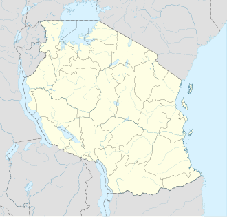
Kibaha
Location in Tanzania
Coordinates: 6°46′S38°55′E / 6.767°S 38.917°E / -6.767; 38.917
CountryFlag of Tanzania.svg  Tanzania
Region Pwani
District Kibaha
Government
  TypeTownship
Population
 (2022 census) [1]
   Urban
265,360
Time zone UTC+3 (East Africa Time)
Area code 023
Website Regional Website

Kibaha is a city, with a population of 265,360 (2022 census), [1] located in eastern Tanzania. It is the capital of Pwani Region. It is located in Kibaha District, one of the six districts of Pwani Region.

Contents

Kibaha Landscape. Kibaha panorama.jpg
Kibaha Landscape.


Education

Kibaha hosts the Kibaha Education Centre.

Transport

Road

Kibaha is served by the A7.

Related Research Articles

<span class="mw-page-title-main">Rufiji District, Pwani</span> District of Pwani Region, Tanzania

Rufiji is one of the six districts of the Pwani Region of Tanzania. It is bordered to the north by the Kisarawe and Mkuranga Districts, to the east by the Indian Ocean, to the south by the Kilwa District, Lindi Region and to the west by the Morogoro Region.

<span class="mw-page-title-main">Pwani Region</span> Region of Tanzania

Pwani Region is one of Tanzania's 31 administrative regions. The word "Pwani" in Swahili means the "coast". The regional capital is the town of Kibaha. The Region borders the Tanga Region to the north, Morogoro Region to the west, Lindi Region to the south, and surrounds Dar es Salaam Region to the east. The Indian Ocean also borders the region to its northeast and southeast. The region is home to Mafia Island, the Rufiji delta and Saadani National Park. The region is home to Bagamoyo town, a historical Swahili settlement, and the first colonial capital of German East Africa. According to the 2012 national census, the region had a population of 1,098,668, which was slightly lower than the pre-census projection of 1,110,917. From 2002 to 2012, the region's 2.2 percent average annual population growth rate was the seventeenth-highest in the country. It was also the 21st most densely populated region with 34 people per square kilometre., the region is slightly larger than Belgium.

<span class="mw-page-title-main">Dar es Salaam Region</span> Region of Tanzania

Dar es Salaam Region is one of Tanzania's 31 administrative regions and is located in the east coast of the country. The region covers an area of 1,393 km2 (538 sq mi). The region is comparable in size to the combined land and water areas of the nation state of Mauritius Dar es Salaam Region is bordered to the east by Indian Ocean and it is entirely surrounded by Pwani Region. The Pwani districts that border Dar es Salaam region are Bagamoyo District to the north, Kibaha Urban District to the west, Kisarawe District to the south west and Mkuranga District to the south of the region. The region's seat (capital) is located inside the ward of Ilala. The region is named after the city of Dar es Salaam itself. The region is home to Tanzania's major finance, administration and industries, thus the making it the country's richest region. According to the 2022 census, the region has a total population of 5,383,728 and national census of 2012 had 4,364,541. The region has the highest population in Tanzania followed by Mwanza Region.

<span class="mw-page-title-main">Ubungo District, Dar es Salaam</span> District of Dar es Salaam Region, Tanzania

Ubungo District, offcially the, Ubungo Municipal Council is one of five districts of the Dar es Salaam Region of Tanzania. The Kinondoni District and Kibaha of the Pwani Region border the district to the north; the Kisarawe District of Pwani Region borders it to the west; and the Ilala District borders the it to the south and east. The district covers an area of 269.4 km2 (104.0 sq mi). The district is comparable in size to the land area of St. Kitts and Nevis. The administrative seat is Kwembe. The district is home to the University of Dar es Salaam, The Magufuli Bus Terminal, the largest in the country, and Pande Game Reserve the largest protected land area in Dar es Salaam Region. In addition, the district is home to the largest natural gas powered power station, the Ubungo Thermal Power Station and the headquarters of the Tanzania Electric Supply Company Limited (TANESCO). The 2012 National Tanzania Census states the population of the district as 845,368.

<span class="mw-page-title-main">Bagamoyo District, Pwani</span> District in Pwani Region, Tanzania

Bagamoyo is one of the six districts of the Pwani Region of Tanzania. It is bordered to the north by the Tanga Region, to the west by the Morogoro Region, to the east by the Indian Ocean and to the south by the Kibaha District. The district capital is at Bagamoyo.

<span class="mw-page-title-main">Kisarawe District, Pwani</span> District of Pwani Region, Tanzania

Kisarawe is one of the six districts of the Pwani Region of Tanzania. It is bordered to the East by Dar es Salaam Region, to the north by the Kibaha District, to the east by the Mkuranga District, to the south by the Rufiji District and to the west by the Morogoro Region. The district is the historical homeland of the Ndengereko and Zaramo people.

<span class="mw-page-title-main">Liwale District, Lindi</span> District of Lindi Region, Tanzania

Liwale is one of the six districts of the Lindi Region of Tanzania. It is the largest district in Lindi and one of the largest in districts in Tanzania. It is bordered to the north by the Pwani Region, to the east by the Kilwa District, to the south by the Ruangwa District and to the west by the Morogoro Region. Most of Liwale district is within the Nyerere National Park.

<span class="mw-page-title-main">Kwere people</span> Ethnic group from Pwani Region of Tanzania

The Kwere also known as Ngh'wele are a matrilineal ethnic and linguistic group native to Bagamoyo District and Chalinze District in Pwani Region of coastal Tanzania. The primary language spoken is Ngh'wele, called Kikwere in Swahili. The most famous person of Kwere descent is former President of Tanzania Jakaya Kikwete.

Ruvu is a small town and ward (shehia) located in the Kibaha District of the Pwani Region in eastern Tanzania, west of Dar es Salaam. As of 2002, the ward population was 6,697.

Kibaha Secondary School is a Tanzanian all-boys secondary school located in Kibaha, Kibaha District, Pwani Region.

Kisarawe is a Tanzanian district that is the larger settlement of the Pugu Hills, southwest of Dar es Salaam. In the Kisarawe district there is an 8200-hectares cultivation of Jatropha shrubs that are processed to produce biodiesel.

<span class="mw-page-title-main">Kibaha District, Pwani</span> District of Pwani Region, Tanzania

Kibaha is one of nine administrative districts of Pwani Region in Tanzania. The name means '"it is here" in Zaramo. The District covers an area of 1,502 km2 (580 sq mi). Kibaha District is bordered to the northeast by Kibaha Urban District and the north by Chalinze District. The district is bordered to the southeast by the Kisarawe District, On the western side the district is borderd by Morogoro District of Morogoro Region. The district seat (capital) is the town and ward of Mlandizi. According to the 2012 census, the district has a total population of 70,209.

Sikonge is a town and ward in Sikonge District, Tabora Region, Tanzania, East Africa. It is the administrative seat of Sikonge District. As of 2002, the ward had a population of 24,917.

<span class="mw-page-title-main">Mafia District</span> District in Pwani Region, Tanzania

Mafia is one of the 6 districts of the Pwani Region of Tanzania. It covers Mafia Island and its associated archipelago.

Soga is a village and a ward in the Pwani Region of Tanzania. It is located in Kibaha District.

<span class="mw-page-title-main">Chalinze District</span> District of Pwani Region, Tanzania

Chalinze is one of nine administrative districts of Pwani Region in Tanzania. The district covers an area of 8,042 km2 (3,105 sq mi). The district is comparable in size to the land area of Puerto Rico. Chalinze District is bordered to the northeast by Pangani District, the north by Handeni District and in Kilindi District of Tanga Region. The district is bordered to the east by the Indian Ocean. Chalinze is also borders Bagamoyo District, Kibaha Urban District and to the South by Kibaha District. On the western part, the district is borderd by Mvomero District and Morogoro Rural District of Morogoro Region.

<span class="mw-page-title-main">Mlandizi</span> Ward in Kibaha District, Pwani Region

Mchinga is an administrative ward and capital of Kibaha District in Pwani Region of Tanzania. The ward covers an area of 84.6 km2 (32.7 sq mi), and has an average elevation of 60 m (200 ft). According to the 2012 census, the ward has a total population of 17,318.

Mabwepande is an administrative ward in Kinondoni District of the Dar es Salaam Region in Tanzania. Bunju and Wazo wards form the ward's eastern boundary. The Mbezi ward of Ilala District borders the ward to the south. Pangani ward of Kibaha Town Council and Kerege ward of Bagamoyo District in Pwani Region border the wards to the west and north, respectively. According to the 2012 census, the ward has a total population of 25,460.

References

  1. 1 2 Citypopulation.de Population of cities & urban localities in Tanzania

6°46′S38°55′E / 6.767°S 38.917°E / -6.767; 38.917