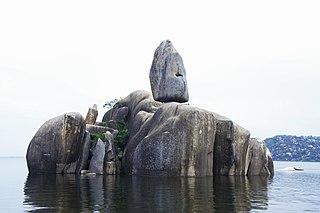
Mwanza City, also known as Rock City to the residents, is a port city and capital of Mwanza Region on the southern shore of Lake Victoria in north-western Tanzania. With an urban population of 1,311,000 in 2023, it is Tanzania's second largest city, after Dar es Salaam. It is also the second largest city in the Lake Victoria basin after Kampala, Uganda and ahead of Kisumu, Kenya at least in population size. Within the East African community, Mwanza city is the fifth largest city after Dar, Nairobi, Mombasa, and Kampala. It is slightly ahead of Kigali, Kisumu, and Bujumbura in the population of city proper limits. However, in terms of infrastructure, Kigali and Kisumu cities are way ahead of Mwanza. Mwanza city is also the capital city of Mwanza Region, and is administratively divided into two municipal districts within that Region - Ilemela and Nyamagana.

Lira is a city in the Northern Region of Uganda. It is the main municipal, administrative, and commercial centre of Lira District.
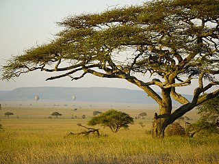
Mara Region is one of Tanzania's 31 administrative regions. The region covers an area of 21,760 km2 (8,400 sq mi). The region is comparable in size to the combined land area of the nation state of El Salvador. The neighboring regions are Mwanza Region and Simiyu Region, Arusha Region, and Kagera Region. The Mara Region borders Kenya .The regional capital is the municipality of Musoma. Mara Region is known for being the home of Serengeti National Park, a UNESCO World Heritage site and also the birth place of Tanzania's founding father Julius Nyerere. Under British colonial occupation, the Mara Region was a district called the Lake Province, which became the Lake Region after independence in 1961.
Shinyanga, also known as Mji wa Shinyanga in the national language, is a city in northern Tanzania. The city is the location of the regional headquarters of Shinyanga Region as well as the district headquarters of Shinyanga Urban District. The region and district are named after the town.
Masaka is a city in the Buganda Region of Uganda, west of Lake Victoria. The city is the headquarters of Masaka District.

Mwanza Region is one of Tanzania's 31 administrative regions The region covers a land area of 25,233 km2 (9,743 sq mi). The region is comparable in size to the combined land area of the nation state of North Macedonia. Mwanza Region is bordered to the north through Lake Victoria by the Kagera Region and Mara Region, to the east by Simiyu Region, to the south by the Shinyanga Region and to the west by Geita Region. The regional capital is the city of Mwanza. According to the 2022 national census, the region had a population of 3,699,872 and national census of 2012 had 2,772,509. Mwanza Region is the second region with high population in Tanzania after Dar es Salaam Region

Shinyanga Region is one of Tanzania's 31 administrative regions. The region covers a land area of 18,555 km2 (7,164 sq mi). The region is comparable in size to the combined land area of the nation state of Fiji. The region is bordered to the north by the Mwanza, Mara, and Kagera Regions and to the south by the Tabora Region. In addition, the Kigoma Region borders the region to the west, and the Simiyu Region and a sliver of Singida Region to the east. The regional capital is the municipality of Shinyanga. According to the 2012 national census, the region had a population of 1,534,808.
Yumbe is a town in the Northern Region of Uganda. It is the district headquarters of Yumbe District.
Kayunga is a town in the Central Region of Uganda. It is the main municipal, administrative, and commercial center of Kayunga District.
Moyo, is the main municipal, administrative, and commercial center of Moyo District in the Northern Region of Uganda. The district headquarters are located here.
Mlimba is a town in central Tanzania on the plains.

The following outline is provided as an overview of and topical guide to Tanzania:
Mwanza is a town in Malawi on the border with Mozambique. It is the administrative headquarters for Mwanza District.

Simiyu Region is one of Tanzania's 31 administrative regions. The region covers a land area of 25,212 km2 (9,734 sq mi). The region is comparable in size to the combined land area of the nation state of North Macedonia. The region is bordered to the north by the Mara Region, to the south by the Shinyanga Region and Singida Region. Mwanza Region borders the region to the west through Lake Victoria, and Arusha Region to the east. The region is home to the Serengeti National Park, a UNESCO World Heritage Site, shared with Mara Region. The regional capital is the town of Bariadi. According to the 2012 national census, the region had a population of 1,534,808.
Katunguru, is a settlement in Rubirizi District, Ankole sub-region, in the Western Region of Uganda. The name also applies to Katunguru Sub-county and Katunguru Parish, where the settlement is located.

Busega District is one of the five districts of Simiyu Region of Tanzania, East Africa. Its administrative centre is the town of Nyashimo. It is bordered to the north by Lake Victoria and Bunda District, to the east by Bariadi District, and to the south by Magu District.
Lamadi is a town and a ward in Busega District of Simiyu Region, Tanzania. It is located on the shore of Lake Victoria. On 'dala dala' mini-busses in the area, the town's name is sometimes misspelled as 'Ramadi' the town have street (mitaa) that are Itongo, Makanisani, Majengo, Msekula Road, Mwalukonge and three village that are Lukungu, Mwabayanda and Kalago The main tribes in Lamadi Town are Sukuma, Jita,Kurya,Zanaki,Luo and Waha from Kigoma. The people like to visit Lamadi Town because is fevered by many attraction.
Isebania, also Isibania, is a town in Tarime District, Mara Region, in northern Tanzania, at the border with Kenya.

Kijereshi Game Reserve is a protected area located in Simiyu Region of Tanzania.

Msalala District is a district council in the Shinyanga Region of Tanzania's lake zone established in 2012. The district lies in the middle of the region just north-east of the town of Kahama.
