Mogadishu, locally known as Xamar or Hamar, is the capital and most populous city of Somalia. The city has served as an important port connecting traders across the Indian Ocean for millennia and has an estimated urban population of 2,610,483.
Mudug is an administrative region (gobol) in north-central Somalia. The population of Mudug is 131,455 as of 2005.

Galguduud is an administrative region (gobol) of Galmudug state in central Somalia. Its administrative capital is Dusmareb. The largest town in the region is El Buur, which lies at the centre of the region.

Bakool is a region (gobol) in southwestern Somalia.

Lower Shabelle is an administrative region (gobol) in southern Somalia.

Banaadir is an administrative region (gobol) in southeastern Somalia. It covers the same area as the city of Mogadishu, which serves as the capital. It is the only region in the country not belonging to any of the six states. It is bordered to the northwest by the Shabelle river, and to the southeast by the Indian Ocean. Although by far the smallest administrative region in Somalia, it has the largest population, estimated at 1,650,227 in 2014.

Bay is an administrative region (gobol) in southern Somalia.
Gedo is an administrative region (gobol) in Jubaland, southern Somalia. Its regional capital is Garbahaarreey. The region was formed during 1974 and is bordered by the Ogaden in Ethiopia, the North Eastern Province in Kenya, and the Somali regions of Bakool, Bay, Jubbada Dhexe, and Jubbada Hoose further down east. The southern parts of Gedo, west of the Jubba River, used to be part of the old British Trans-Juba region during half of the seventy years of colonial era in Africa from 1890 to 1960. The British and Italians fought twice over this area.

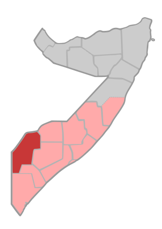
Somalia is a federal republic consisting of 6 federal member states. They are Somaliland, Puntland, Galmudug, Hirshaabelle, South West, and Jubaland. There is an interim administration Khatumo, and a regional administration Banaadir. Somalia is further subdivided into 18 administrative regions, which are in turn subdivided into districts.

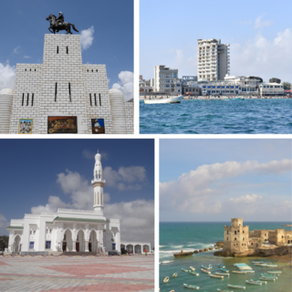
Jowhar is the capital city of Hirshabelle state of Somalia. Jowhar is also the administrative capital of Middle Shabelle region of Somalia.

Baidoa is the largest city of the South West State of Somalia.
The Hawadle are a Somali clan who trace descent to Meyle, one of the sons of Irir Samaale. The Hawadle, as well as many other Somali clans stem from Samaale.
The timeline of events in the War in Somalia during 2006 is set out below.
Warsheikh is an administration center and coastal town of Warsheikh district. Warsheikh is located in the southeastern Middle Shabelle region of Hirshabelle State of Somalia. On the south, Warsheikh is bordered by the Banadir region, and on the north Adale District.

The Hiraab clan, is a prominent Somali clan belonging to the larger Hawiye clan. Renowned for its influential role, the Hiraab clan has produced numerous significant leaders within Somalia, including six presidents, the first president and prime minister of Somalia, and various other prominent figures. The clan's historical contributions include pioneering military leadership roles, and establishing a foundational influence in Somalia.

Bal'ad District is one of the districts of Middle Shabelle region of Somalia. It is located about 36 kilometers northeast of the capital city of Mogadishu. The district is an area of 4,400 square kilometres with an estimated population of 643,000 and 82 villages.
Adale, also known as Cadaley, is a coastal town in the southern Middle Shabelle region of Somalia.

This is a 2014 timeline of events in the Somali Civil War (2009–present).

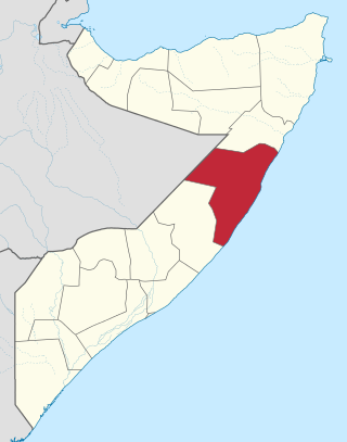
Hirshabelle, officially Hirshabelle State of Somalia, is a Federal Member State in south-central Somalia. It is bordered by Galmudug state of Somalia to the north, South West State of Somalia and Banadir region to the south, Ethiopia to the west and the Indian Ocean to the east. Jowhar is the capital state.
This is a 2024 timeline of events in the Somali Civil War (2009–present).

