 |
|---|
The Republic of Togo is divided into five regions which are subdivided into 39 prefectures. These various prefectures of Togo are shown according to their respective regions below.
| |
|---|
The Republic of Togo is divided into five regions which are subdivided into 39 prefectures. These various prefectures of Togo are shown according to their respective regions below.


Togo is a small Sub-Saharan state, comprising a long strip of land in West Africa. Togo's geographic coordinates are a latitude of 8° north and a longitude of 1°10′ east. It is bordered by three countries: Benin to the east, with 644 km (400 mi) of border; Burkina Faso to the north, with 126 km (78 mi) of border; and Ghana, with 877 km (545 mi) of border. To the south Togo has 56 km (35 mi) of coastline along the Bight of Benin of the Gulf of Guinea in the North Atlantic Ocean. Togo stretches 579 km (360 mi) north from the Gulf and is only 160 km (99 mi) wide at the broadest point. In total, Togo has an area of 56,785 km2 (21,925 sq mi), of which 54,385 km2 (20,998 sq mi) is land and 2,400 km2 (927 sq mi) is water.
Dapaong is a city in northern Togo and prefecture seat of Tône in the Savanes Region, of which it is also the capital. It had a population of 58,071 at the 2010 Census. It is situated 638 km north of the capital Lomé, near the border with Burkina Faso. It is a market town and has a small museum.

Regions are the first-level administrative divisions of Togo. They are subdivided into prefectures, which can be further broken down into communes. Each region has an elected regional government and a capital city that acts as its administrative seat. The regional governments have jurisdiction over some local affairs, but most powers are shared with the national government.

Maritime Region is the southernmost of Togo's five regions, with the country's only shoreline on the Bight of Benin. Tsévié serves as the regional capital. It is the smallest region in terms of area, but it has the largest population, with 3.5 million people.

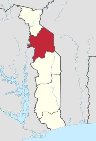
Savanes Region is the northernmost of the five Regions of Togo. Dapaong is the regional capital and largest city. Another major town in the region is Mango.

Plateaux Region is one of Togo's five regions.

Centrale Region is one of Togo's five regions. Sokodé is the regional capital. Centrale is the least populated region in Togo with a total of 795,529 people according to a census done in 2022.
Kara Region is one of Togo's five regions. Kara is the regional capital.

Mono is one of the twelve departments of Benin, with its capital at Lokossa. It is named for the Mono River which forms much of the border with Togo. The northern areas of the department were split off to create the newly formed Kouffo Department in 1999. Mono is subdivided into six communes, each centred at one of the principal towns, namely, Athiémè, Bopa, Comè, Grand-Popo, Houéyogbé and Lokossa. It has an area of 1,396 square kilometres (539 sq mi).

Kouffo or Couffo is one of the twelve departments of Benin. Kouffo borders the country of Togo and the departments of Mono, Zou and Atlantique. Since 2008, the department's capital has been Aplahoué. The department of Kouffo was created in 1999 when it was split off from Mono Department.

Lacs is a prefecture located in the Maritime Region of Togo. The prefecture covers 388 km2, with a population in 2022 of 241,247. The prefecture seat is located in Aného. It contains Togo's easternmost point.

Est-Mono is a prefecture located in the Plateaux Region of Togo. The prefecture covers 2,599 km2, with a population in 2022 of 164,460. The prefecture seat is located in Elavagnon.
Moyen-Mono is a prefecture located in the Plateaux Region of Togo. The prefecture covers 594.7 km2, with a population in 2022 of 90,505. The prefecture seat is located in Tohoun.
Ogou is a prefecture located in the Plateaux Region of Togo. The prefecture covers 1,928 km2, with a population in 2022 of 253,467. The prefecture seat is located in Atakpamé.

Kpendjal is a prefecture located in the Savanes Region of Togo. The prefecture seat is located in Mandouri. The cantons of Kpendjal include Mandouri, Namondjoga, Pogno, Koundjoaré, Naki-Est, Borgou, Ogaro, Tambigou, Nayéga, Papri, and Tambonga.
Haho is a prefecture located in the Plateaux Region of Togo. The prefecture covers 3,051 km2, with a population in 2022 of 305,096. The prefecture seat is located in Notsé.
Oti is a prefecture located in the Savanes Region of Togo. The prefecture seat is located in Sansanné-Mango. The prefecture covers 1,524 km2 (588 sq mi), with a population in 2022 of 124,848.

The Cantonsof Togo are the third-level administrative units of the country, after regions and prefectures; which in turn they are subdivided into villages. They are similar to communes or sub-districts or sub-prefectures of other French African nations.
The Togo Baptist Convention is an association of Baptist Christian churches in Togo. It is affiliated with the Baptist World Alliance. The headquarters is in Lomé.
Bas-Mono is a prefecture located in the Maritime Region of Togo. The prefecture covers 327 km2, with a population in 2022 of 94,860.
| | This Togo location article is a stub. You can help Wikipedia by expanding it. |
