Danish Meteorological Institute

Last updated
Danish Meteorological Institute
Danmarks Meteorologiske Institut
DMI - Danmarks Meteorologiske Institut - The National Danish Meteorological Institute (Copenhagen).JPG
Headquarters of the DMI, Copenhagen.
Weather monitoring and forecasting agency overview
Formed1872 (1872)
Preceding agencies
  • Meteorological Institute
  • Meteorological Service for Civil Aviation
  • Meteorological Service for Defence
JurisdictionMinistry of Energy, Utilities and Climate
Headquarters Copenhagen
55°42′55″N12°33′40″E / 55.715390°N 12.560998°E / 55.715390; 12.560998
MottoVi klæder dig på til fremtidens vejr.
Employees380-400
Annual budget285 million DKK (2020)
Website www.dmi.dk

The Danish Meteorological Institute (DMI; Danish : Danmarks Meteorologiske Institut) is the official Danish meteorological institute, administrated by the Ministry of Climate, Energy and Utilities. It makes weather forecasts and observations for Denmark, Greenland, and the Faroe Islands.

Contents

History

The Danish Meteorological Institute (DMI) was founded in 1872, primarily through the efforts of Ludwig A. Colding. DMI integrates the expertise of three predecessor organizations: the former Meteorological Institute, the Meteorological Service for Civil Aviation, and the Meteorological Service for Defence.

The current DMI was formed in 1990 through the merger of these three institutions. It operates under the Ministry of Transport and employs approximately 380 staff members, in addition to around 450 voluntary weather and climate observers.

The institute was originally established to "make observations, communicate them to the general public, and develop scientific meteorology." These objectives remain central to DMI's mission, despite significant advancements in communication technology and an increased demand for qualified meteorological advice. Today, DMI is recognized for its comprehensive and internationally acclaimed expertise in all aspects of weather and climate.

DMI is responsible for meeting the meteorological needs of society across the Kingdom of Denmark, which includes Denmark, the Faroe Islands, and Greenland, as well as their territorial waters and airspace. This responsibility involves monitoring atmospheric, terrestrial, and marine weather, climate, and environmental conditions. The primary goals of these activities are to protect human life and property while providing a basis for economic and environmental planning—particularly in sectors such as the armed forces, aviation, shipping, and road traffic.

While DMI is well-known for its media weather forecasts, it also plays a vital role in assisting businesses, institutions, and the public in making informed decisions related to economic, environmental, and safety considerations. Its services are extensively used by the fisheries and agricultural sectors, as well as by sports associations and other organizations.

DMI's capabilities and services are supported by advanced technologies, including supercomputers, satellites, radar systems, and automatic measuring equipment. Ongoing research and development ensure that DMI operates efficiently and effectively, meeting modern quality standards for its products and services.

Weather Models

In 1985, the Danish Meteorological Institute (DMI) collaborated with national weather services from the Nordic countries, as well as those from the Netherlands, Ireland, and Spain, to establish a research partnership focused on the High Resolution Limited Area Model (HIRLAM) for weather forecasting. This cross-country research initiative marked the first collaboration of its kind in the world, leading to the successful operational implementation of a state-of-the-art short-range regional weather forecast model in Denmark and other member countries of HIRLAM.

Since 2004, HIRLAM has expanded its research efforts through a partnership with the ALADIN consortium, led by Météo-France. This collaboration aims to advance the mesoscale, non-hydrostatic forecasting system known as AROME. As a result of this joint effort, the HIRLAM consortium developed the new generation cloud-resolving numerical weather prediction (NWP) system called Harmonie-AROME. This system focuses on operational applications of kilometer-scale ensemble forecasting, specifically designed to predict and issue warnings for high-impact weather events such as flash flooding, thunderstorms, heavy summer rain, gusty winds, and winter snowstorms.

At DMI, the Harmonie-based kilometer-scale forecasting system has been progressively operationalized since 2013 for routine forecasts covering Greenland, the Faroe Islands, and Denmark. In 2017, DMI introduced an innovative ensemble forecasting system called COMEPS (COntinuous Mesoscale Ensemble Prediction System). This 25-member system operates at a resolution of 2.5 kilometers and employs hourly data assimilation with an overlapping observation window, allowing for an hourly refresh of probabilistic forecasts.

In 2018, DMI operationalized the first hectometric-scale NWP system, specifically designed for predicting strong coastal winds in southern Greenland.

Additionally, DMI operates an ice patrol service based in Narsarsuaq, southern Greenland. This service monitors sea ice and icebergs along Greenland's coasts, creates ice charts, and addresses other safety-related tasks crucial for navigation in Greenlandic marine waters. [1] [2]

DMI weather station in Kangerlussuaq, Greenland. DMI weather station Kangerlussuaq.jpg
DMI weather station in Kangerlussuaq, Greenland.

Equipment

Computer

In 1984, DMI acquired a Sperry 1100 from University of Copenhagen, and upgraded it with vector processors in 1985. It was replaced with a Convex 3880 in 1992. A NEC SX 4 was used from 1996, and a NEC SX-6 from 2002. A dual Cray XT5 [3] marked the switch from vector to scalar in 2007. From 2016, the Icelandic Meteorological Office (Veðurstofa) manages a 192 teraFLOPS dual Cray XC30 system for DMI as weather forecast, due to cheaper electricity and cooling. [4] One is used for development, the other for daily operations. Data traffic between Iceland and Denmark uses two 10 Gbit/s cables [5] (Danice/FARICE-1). The XC30s are scheduled to be upgraded to 700 Tflops in 2018. [6]

Radar

DMI operates five dual-polarization C-band weather radars from US-based Enterprise Electronics Corporation and Finnish-based Vaisala. These radars have a Doppler and full-range of 240 km. DMI's first precipitation radar was installed in Karup in 1957, but due to its limited technological capabilities, it was decommissioned in the early 1990s. Starting in 1992, DMI began upgrading its radar network with single-polarization radars, and by 2017-2023, these radars underwent further modernization to dual-polarization. During this process, the Sindal (1994) radar was replaced with a newer Vaisala dual-polarization radar, and the Virring (2008) radar was gradually phased out in favor of a new radar on Samsø, also made by Vaisala. [7] [8] [9] [10]

Meteorological and hydrological observation stations

DMI has a large catalog of weather and ocean observation stations across the kingdom. [11]

See also

Related Research Articles

<span class="mw-page-title-main">Met Office</span> United Kingdoms national weather service

The Meteorological Office, abbreviated as the Met Office, is the United Kingdom's national weather and climate service. It is an executive agency and trading fund of the Department for Science, Innovation and Technology and is led by CEO Penelope Endersby, who took on the role as Chief Executive in December 2018 and is the first woman to do so. The Met Office makes meteorological predictions across all timescales from weather forecasts to climate change.

<span class="mw-page-title-main">Weather radar</span> Radar used to locate and monitor meteorological conditions

Weather radar, also called weather surveillance radar (WSR) and Doppler weather radar, is a type of radar used to locate precipitation, calculate its motion, and estimate its type. Modern weather radars are mostly pulse-Doppler radars, capable of detecting the motion of rain droplets in addition to the intensity of the precipitation. Both types of data can be analyzed to determine the structure of storms and their potential to cause severe weather.
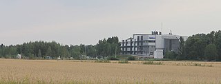
<span class="mw-page-title-main">Vaisala</span> Finnish technology company making measuring instruments

Vaisala Oyj is a Finnish company that produces products and services for environmental and industrial measurement.

HIRLAM, the High Resolution Limited Area Model, is a Numerical Weather Prediction (NWP) forecast system developed by the international HIRLAM programme.

<span class="mw-page-title-main">Deutscher Wetterdienst</span> German weather service

The Deutscher Wetterdienst or DWD for short, is the German Meteorological Service, based in Offenbach am Main, Germany, which monitors weather and meteorological conditions over Germany and provides weather services for the general public and for nautical, aviational, hydrometeorological or agricultural purposes. It is attached to the Federal Ministry for Digital and Transport. The DWDs principal tasks include warning against weather-related dangers and monitoring and rating climate changes affecting Germany. The organisation runs atmospheric models on their supercomputer for precise weather forecasting. The DWD also manages the national climate archive and one of the largest specialised libraries on weather and climate worldwide.
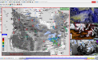
<span class="mw-page-title-main">NinJo</span>

NinJo is a meteorological software system. It is a community project of the German Weather Service, the Meteorological Service of Canada, the Danish Meteorological Institute, MeteoSwiss, and the German Bundeswehr. It consists of modules for monitoring weather events, editing point forecasts and viewing meteorological data. An additional batch component is able to render graphical products off-line, these may, for example, be visualized by a web service. Essentially it is a client—server system an implemented fully with the programming language Java.

The King City weather radar station is a weather radar located in King City, Ontario, Canada. It is operated by Environment Canada and is part of the Canadian weather radar network, for which it is the primary research station.

<span class="mw-page-title-main">Atmospheric model</span> Mathematical model of atmospheric motions

In atmospheric science, an atmospheric model is a mathematical model constructed around the full set of primitive, dynamical equations which govern atmospheric motions. It can supplement these equations with parameterizations for turbulent diffusion, radiation, moist processes, heat exchange, soil, vegetation, surface water, the kinematic effects of terrain, and convection. Most atmospheric models are numerical, i.e. they discretize equations of motion. They can predict microscale phenomena such as tornadoes and boundary layer eddies, sub-microscale turbulent flow over buildings, as well as synoptic and global flows. The horizontal domain of a model is either global, covering the entire Earth, or regional (limited-area), covering only part of the Earth. Atmospheric models also differ in how they compute vertical fluid motions; some types of models are thermotropic, barotropic, hydrostatic, and non-hydrostatic. These model types are differentiated by their assumptions about the atmosphere, which must balance computational speed with the model's fidelity to the atmosphere it is simulating.

<span class="mw-page-title-main">Canadian weather radar network</span> Weather radars used by the Environment and Climate Change Canada

The Canadian weather radar network consists of 33 weather radars spanning Canada's most populated regions. Their primary purpose is the early detection of precipitation, its motion and the threat it poses to life and property.

<span class="mw-page-title-main">Weather Research and Forecasting Model</span> Numerical weather prediction system

The Weather Research and Forecasting (WRF) Model is a numerical weather prediction (NWP) system designed to serve both atmospheric research and operational forecasting needs. NWP refers to the simulation and prediction of the atmosphere with a computer model, and WRF is a set of software for this. WRF features two dynamical (computational) cores, a data assimilation system, and a software architecture allowing for parallel computation and system extensibility. The model serves a wide range of meteorological applications across scales ranging from meters to thousands of kilometers.

Met Éireann is the state meteorological service of Ireland, part of the Department of Housing, Local Government and Heritage.

<span class="mw-page-title-main">Norwegian Meteorological Institute</span> National meteorological service of Norway

The Norwegian Meteorological Institute, also known internationally as MET Norway, is Norway's national meteorological institute. It provides weather forecasts for civilian and military uses and conducts research in meteorology, oceanography and climatology. It is headquartered in Oslo and has offices and stations in other cities and places. It has around 500 full-time staff and was founded in 1866.

The Unified Model is a numerical weather prediction and climate modeling software suite originally developed by the United Kingdom Met Office from 1990, and now both used and further developed by many weather-forecasting agencies around the world. The Unified Model gets its name because a single model is used across a range of both timescales and spatial scales. The models are grid-point based, rather than wave based, and are run on a variety of supercomputers around the world. The Unified Model atmosphere can be coupled to a number of ocean models. At the Met Office it is used for the main suite of Global Model, North Atlantic and Europe model (NAE) and a high-resolution UK model (UKV), in addition to a variety of Crisis Area Models and other models that can be run on demand. Similar Unified Model suites with global and regional domains are used by many other national or military weather agencies around the world for operational forecasting.

<span class="mw-page-title-main">Climate of Greenland</span>

Greenland's climate is a tundra climate on and near the coasts and an ice cap climate in inland areas. It typically has short, cool summers and long, moderately cold winters.
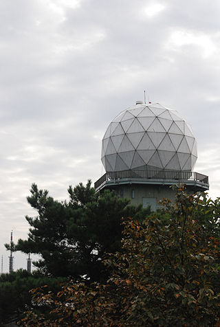
<span class="mw-page-title-main">Korea Meteorological Administration</span> Meteorological service of South Korea

The Korea Meteorological Administration is the national meteorological service of the Republic of Korea. The service started in 1904 joining the WMO in 1956. Numerical Weather Prediction is performed using the Unified Model software suite.

<span class="mw-page-title-main">Nowcasting (meteorology)</span>

Nowcasting is weather forecasting on a very short term mesoscale period of up to 2 hours, according to the World Meteorological Organization, and up to six hours, according to other authors in the field. This forecast is an extrapolation in time of known weather parameters, including those obtained by means of remote sensing, using techniques that take into account a possible evolution of the air mass. This type of forecast therefore includes details that cannot be solved by numerical weather prediction (NWP) models running over longer forecast periods.
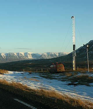
<span class="mw-page-title-main">Icelandic Meteorological Office</span> Icelandic national meteorological service

Icelandic Meteorological Office is Iceland's national weather service and as such a government agency under the Ministry of Environment and Natural Resources. It is also active in volcano monitoring, esp. volcano seismology, and, together with other institutions, responsible for civil protection in Iceland

<span class="mw-page-title-main">Solar power forecasting</span> Power forecasting

Solar power forecasting is the process of gathering and analyzing data in order to predict solar power generation on various time horizons with the goal to mitigate the impact of solar intermittency. Solar power forecasts are used for efficient management of the electric grid and for power trading.

The Cray XC30 is a massively parallel multiprocessor supercomputer manufactured by Cray. It consists of Intel Xeon processors, with optional Nvidia Tesla or Xeon Phi accelerators, connected together by Cray's proprietary "Aries" interconnect, stored in air-cooled or liquid-cooled cabinets. Each liquid-cooled cabinet can contain up to 48 blades, each with eight CPU sockets, and uses 90 kW of power. The XC series supercomputers are available with the Cray DataWarp applications I/O accelerator technology.

<span class="mw-page-title-main">Joint Polarization Experiment</span>

The Joint Polarization Experiment (JPOLE) was a test for evaluating the performance of the WSR-88D in order to modify it to include dual polarization. This program was a joint project of the National Weather Service (NWS), the Federal Aviation Administration (FAA), and the US Air Force Meteorological Agency (AFWA), which took place from 2000-2004. It has resulted in the upgrading of the entire meteorological radar network in the United States by adding dual polarization to better determine the type of hydrometeor, and quantities that have fallen.

References

  1. Ramskov, Jens; Sandal, Jesper Stein (2015-09-11). "Ny vejrmodel skal give bedre varsel af skybrud | Ingeniøren". ing.dk (in Danish). Retrieved 2024-10-28.
  2. Ramskov, Jens (2015-09-12). "Vejrudsigten: Større nøjagtighed og præcis usikkerhed | Ingeniøren". ing.dk (in Danish). Retrieved 2024-10-28.
  3. "DMI's supercomputer: 2048 kerner og 110 terabyte til 42 mio". Version2 . 4 June 2009. Retrieved 26 March 2016. (in Danish)
  4. "Efter 31 år er supercomputeren blevet tavs i DMI's maskinstue". Version2 . 14 March 2016. Retrieved 26 March 2016.(in Danish)
  5. "DMI's it-folk står klar til at løse problemer med ny supercomputer". Version2 . 9 March 2016. Retrieved 26 March 2016. (in Danish)
  6. "Oppetid og ydelse vigtigere end specifik hardware". Version2 . 8 August 2015. Retrieved 26 March 2016.(in Danish)
  7. "To nye radarer på vej". www.dmi.dk (in Danish). Retrieved 2024-10-13.
  8. "Release Notes". DMI Open Data. Retrieved 2024-10-13.
  9. "The Danish weather radar network" (PDF). The Danish Weather Radar Network.
  10. "Radarens styrker og svagheder". www.dmi.dk (in Danish). Retrieved 2024-10-13.
  11. "Catalogue of Meteorological Stations in Denmark: Overview of Observation Sites and Parameters by January 2013" (PDF). Danish Meteorological Institute.{{cite journal}}: |first= missing |last= (help)