The European Centre for Medium-Range Weather Forecasts (ECMWF) is an independent intergovernmental organisation supported by most of the nations of Europe. It is based at three sites: Shinfield Park, Reading, United Kingdom; Bologna, Italy; and Bonn, Germany. It operates one of the largest supercomputer complexes in Europe and the world's largest archive of numerical weather prediction data.[1]
ECMWF was established in 1975, in recognition of the need to pool the scientific and technical resources of Europe's meteorological services and institutions for the production of weather forecasts for medium-range timescales (up to approximately two weeks) and of the economic and social benefits expected from it. The Centre employs about 350 staff, mostly appointed from across the member states and co-operating states.[1]
Aerial view of the data centre in Bologna, Italy.
In 2017, the centre's member states accepted an offer from the Italian Government to move ECMWF's data centre to Bologna, Italy. The new site, a former tobacco factory, would be redesigned by the architecture firm gmp.[2]
During 2020, the Centre arranged to move its Copernicus operations away from Reading and into European Union territory.[3] Following bids from Toulouse,[3] Italy,[4] Austria,[5] Germany,[6] Spain[7] and Ireland,[8] eventually Bonn (Germany) was chosen.[9] The move has been directly attributed to Brexit.[9][10]
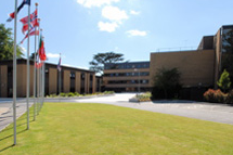
In early 2024, it was announced that the ECMWF's headquarters, currently at Shinfield Road in the English town of Reading, would be relocated to a new complex to be constructed on the Whiteknights Park campus of the University of Reading. Construction of this complex started in early 2025, with completion expected in early 2027.[11][12]
Objectives
ECMWF aims to provide accurate medium-range global weather forecasts out to 15 days and seasonal forecasts out to 12 months.[13] Its products are provided to the national weather services of its member states and co-operating states as a complement to their national short-range and climatological activities, and those national states use ECMWF's products for their own national duties, in particular to give early warning of potentially damaging severe weather.
Produce numerical weather forecasts and monitor planetary systems that influence weather
Carry out scientific and technical research to improve forecast skill
Maintain an archive of meteorological data
To deliver this core mission, the Centre provides:
Twice-daily global numerical weather forecasts
Air quality analysis
Atmospheric composition monitoring
Climate monitoring
Ocean circulation analysis
Hydrological prediction
The Centre develops and operates global atmospheric models and data assimilation systems for the dynamics, thermodynamics and composition of the Earth's atmosphere and for interacting parts of the Earth-system. It uses numerical weather prediction methods to prepare forecasts and their initial conditions, and it contributes to monitoring the relevant parts of the Earth system.
The Centre arranged to move its Copernicus operations away from Reading and into Bonn (Germany) in 2020.[3][9] The move has been directly attributed to Brexit.[9][10]
medium-range forecasts, predicting the weather up to 15 days ahead
monthly forecasts, predicting the weather on a weekly basis 30 days ahead
seasonal forecasts up to 12 months ahead.
Over the past three decades ECMWF's wide-ranging programme of research has played a major role in developing such assimilation and modelling systems. This improves the accuracy and reliability of weather forecasting by about a day per decade, so that a seven-day forecast now (2015) is as accurate as a three-day forecast was four decades ago (1975).[18]
Monthly and seasonal forecasts
ECMWF's monthly and seasonal forecasts provide early predictions of events such as heat waves, cold spells and droughts, as well as their impacts on sectors such as agriculture, energy and health. Since ECMWF runs a wave model, there are also predictions of coastal waves and storm surges in European waters which can be used to provide warnings.
Early warning of severe weather events
Forecasts of severe weather events allow appropriate mitigating action to be taken and contingency plans to be put into place by the authorities and the public. The increased time gained by issuing accurate warnings can save lives, for instance by evacuating people from a storm surge area. Authorities and businesses can plan to maintain services around threats such as high winds, floods or snow.
ECMWF's Extreme Forecast Index (EFI) was developed as a tool to identify where the EPS (Ensemble Prediction System) forecast distribution differs substantially from that of the model climate[clarification needed]. It contains information regarding variability of weather parameters, in location and time and can highlight an abnormality of a weather situation without having to define specific space- and time-dependent thresholds.
Satellite data
ECMWF, through its partnerships with EUMETSAT, ESA, the EU and others, exploits satellite data for operational numerical weather prediction and operational seasonal forecasting with coupled atmosphere–ocean–land models. The increasing amount of satellite data and the development of more sophisticated ways of extracting information from that data have made a major contribution to improving the accuracy and utility of NWP forecasts.[21]
ECMWF supports research on climate variability using an approach known as reanalysis. This involves feeding weather observations collected over decades into a NWP system to recreate past atmospheric, sea- and land-surface conditions over specific time periods to obtain a clearer picture of how the climate has changed. Reanalysis provides a four-dimensional picture of the atmosphere and effectively allows monitoring of the variability and change of global climate, thereby contributing also to the understanding and attribution of climate change.
To date, and with support from Europe's National Meteorological Services and the European Commission, ECMWF has conducted several major reanalyses of the global atmosphere: the first ECMWF re-analysis (ERA-15) project generated reanalyses from December 1978 to February 1994; the ERA-40 project generated reanalyses from September 1957 to August 2002. The ERA-Interim reanalysis[22] covered the period from 1979 onwards. A reanalysis product (ERA5)[23] with higher spatial resolution (31km) was released by ECMWF in 2019 as part of the Copernicus Climate Change Service.[24]
ECMWF's operational forecasts are produced from its "Integrated Forecast System" (sometimes informally known in the United States as the "European model") which is run every twelve hours and forecasts out to ten days.
It includes both a "deterministic forecast" mode and an ensemble. The deterministic forecast is a single model run that is relatively high in resolution as well as in computational expense. The ensemble is relatively low (about half that of the deterministic) in resolution (and in computational expense), so less accurate. But it is run 51 times in parallel, from slightly different initial conditions to give a spread of likelihood over the range of the forecast.[25]
As of 2021, the ECMWF's weather model is generally considered to be the most accurate weather forecasting model.[26]
↑Deutscher Wetterdienst. "ECMWF - European Centre for Medium-Range Weather Forecasts". Berlin, Germany: Federal Ministry of Transport and Digital Infrastructure. Retrieved 29 April 2014. Established in 1975, ECMWF is renowned worldwide for providing the most accurate medium-range global weather forecasts up to 10 days ahead, monthly forecasts and seasonal outlooks to six months ahead.
↑ECMWF (30 December 2013), What we do, retrieved 11 June 2019
↑Dee, D. P.; Uppala, S. M.; Simmons, A. J.; Berrisford, P.; Poli, P.; etal. (2011). "The ERA-Interim reanalysis: Configuration and performance of the data assimilation system". Quarterly Journal of the Royal Meteorological Society. 137 (656): 553–597. Bibcode:2011QJRMS.137..553D. doi:10.1002/qj.828. hdl:20.500.11824/1106.
This page is based on this Wikipedia article Text is available under the CC BY-SA 4.0 license; additional terms may apply. Images, videos and audio are available under their respective licenses.