Related Research Articles
Atmospheric dispersion modeling is the mathematical simulation of how air pollutants disperse in the ambient atmosphere. It is performed with computer programs that include algorithms to solve the mathematical equations that govern the pollutant dispersion. The dispersion models are used to estimate the downwind ambient concentration of air pollutants or toxins emitted from sources such as industrial plants, vehicular traffic or accidental chemical releases. They can also be used to predict future concentrations under specific scenarios. Therefore, they are the dominant type of model used in air quality policy making. They are most useful for pollutants that are dispersed over large distances and that may react in the atmosphere. For pollutants that have a very high spatio-temporal variability and for epidemiological studies statistical land-use regression models are also used.

The Royal Dutch Meteorological Institute is the Dutch national weather forecasting service, which has its headquarters in De Bilt, in the province of Utrecht, Netherlands.

Roadway air dispersion modeling is the study of air pollutant transport from a roadway or other linear emitter. Computer models are required to conduct this analysis, because of the complex variables involved, including vehicle emissions, vehicle speed, meteorology, and terrain geometry. Line source dispersion has been studied since at least the 1960s, when the regulatory framework in the United States began requiring quantitative analysis of the air pollution consequences of major roadway and airport projects. By the early 1970s this subset of atmospheric dispersion models were being applied to real world cases of highway planning, even including some controversial court cases.
The Atmospheric Dispersion Modelling Liaison Committee (ADMLC) is composed of representatives from government departments, agencies and private consultancies. The ADMLC's main aim is to review current understanding of atmospheric dispersion and related phenomena for application primarily in the authorization or licensing of pollutant emissions to the atmosphere from industrial, commercial or institutional sites.
Germany has an air pollution control regulation titled "Technical Instructions on Air Quality Control" and commonly referred to as the TA Luft.
The National Atmospheric Release Advisory Center (NARAC) is located at the University of California's Lawrence Livermore National Laboratory. It is a national support and resource center for planning, real-time assessment, emergency response, and detailed studies of incidents involving a wide variety of hazards, including nuclear, radiological, chemical, biological, and natural emissions.
CALPUFF is an advanced, integrated Lagrangian puff modeling system for the simulation of atmospheric pollution dispersion distributed by the Atmospheric Studies Group at TRC Solutions.
PUFF-PLUME is a model used to help predict how air pollution disperses in the atmosphere. It is a Gaussian atmospheric transport chemical/radionuclide dispersion model that includes wet and dry deposition, real-time input of meteorological observations and forecasts, dose estimates from inhalation and gamma shine, and puff or continuous plume dispersion modes. It was first developed by the Pacific Northwest National Laboratory (PNNL) in the 1970s.
The ADMS 3 is an advanced atmospheric pollution dispersion model for calculating concentrations of atmospheric pollutants emitted both continuously from point, line, volume and area sources, or intermittently from point sources. It was developed by Cambridge Environmental Research Consultants (CERC) of the UK in collaboration with the UK Meteorological Office, National Power plc and the University of Surrey. The first version of ADMS was released in 1993. The version of the ADMS model discussed on this page is version 3 and was released in February 1999. It runs on Microsoft Windows. The current release, ADMS 5 Service Pack 1, was released in April 2013 with a number of additional features.

The AERMOD atmospheric dispersion modeling system is an integrated system that includes three modules:
NAME atmospheric pollution dispersion model was first developed by the UK's Met Office in 1986 after the nuclear accident at Chernobyl, which demonstrated the need for a method that could predict the spread and deposition of radioactive gases or material released into the atmosphere.
DISPERSION21 is a local scale atmospheric pollution dispersion model developed by the air quality research unit at Swedish Meteorological and Hydrological Institute (SMHI), located in Norrköping.
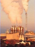
Air pollution dispersion – distribution of air pollution into the atmosphere. Air pollution is the introduction of particulates, biological molecules, or other harmful materials into Earth's atmosphere, causing disease, death to humans, damage to other living organisms such as food crops, or the natural or built environment. Air pollution may come from anthropogenic or natural sources. Dispersion refers to what happens to the pollution during and after its introduction; understanding this may help in identifying and controlling it. Air pollution dispersion has become the focus of environmental conservationists and governmental environmental protection agencies of many countries regarding air pollution control.
The Czech Hydrometeorological Institute (CHMI) is within the Environmental Ministry of the Czech Republic. The head office and centralized workplaces of the CHMI, including the data processing, telecommunication and technical services, are located at the Institute's own campus in Prague.
MERCURE is an atmospheric dispersion modeling CFD code developed by Électricité de France (EDF) and distributed by ARIA Technologies, a French company.
ISC3 model is a popular steady-state Gaussian plume model which can be used to assess pollutant concentrations from a wide variety of sources associated with an industrial complex.
Austal2000 is an atmospheric dispersion model for simulating the dispersion of air pollutants in the ambient atmosphere. It was developed by Ingenieurbüro Janicke in Dunum, Germany under contract to the Federal Ministry for Environment, Nature Conservation and Nuclear Safety.
The Operational Street Pollution Model (OSPM) is an atmospheric dispersion model for simulating the dispersion of air pollutants in so-called street canyons. It was developed by the National Environmental Research Institute of Denmark, Department of Atmospheric Environment, Aarhus University. As a result of reorganisation at Aarhus University the model has been maintained by the Department of Environmental Science at Aarhus University since 2011. For about 20 years, OSPM has been used in many countries for studying traffic pollution, performing analyses of field campaign measurements, studying efficiency of pollution abatement strategies, carrying out exposure assessments and as reference in comparisons to other models. OSPM is generally considered as state-of-the-art in practical street pollution modelling.
The Hybrid Single-Particle Lagrangian Integrated Trajectory model (HYSPLIT) is a computer model that is used to compute air parcel trajectories to determine how far and in what direction a parcel of air, and subsequently air pollutants, will travel. HYSPLIT is also capable of calculating air pollutant dispersion, chemical transformation, and deposition. The HYSPLIT model was developed by the National Oceanic and Atmospheric Administration (NOAA) Air Resources Laboratory and the Australian Bureau of Meteorology Research Centere in 1998. The model derives its name from the usage of both Lagrangian and Eulerian approaches.
References
- E. Canepa, F. Modesti, and C.F. Ratto (2000) Evaluation of the SAFE_AIR code against air pollution field and laboratory experiments. Atmos. Environ., 34, 4805-4818.
- E. Canepa, L. Dallorto, and C.F. Ratto (2000) About the plume rise description in the dispersion code SAFE_AIR. Int. J. Environ. Pollut., 14, 235-245.
- E. Canepa and P.J.H. Builtjes (2001) Methodology of model testing and application to dispersion simulation above complex terrain. Int. J. Environ. Pollut., 16, 101-115.
- E. Canepa and C.F. Ratto (2003) SAFE_AIR algorithms to simulate the transport of pollutant elements: a model validation exercise and sensitivity analysis. Environ. Model. Software, 18, 365-372.
- E. Canepa, F. D’Alberti, F. D’Amati, and G. Triacchini (2007) The GIS-based SafeAirView software for the concentration assessment of radioactive pollutants after an accidental releases. Science Total Environ., 373, 32-42.
- M. Cavallaro, E. Canepa, and E. Georgieva (2007) The SAFE_AIR II dispersion model: description and statistical evaluation of its dispersion module against wind tunnel data from area sources. Ecolog. Model., 202, 547-558.