The Jihad of Usman dan Fodio was a religio-military conflict in present-day Nigeria and Cameroon. The war began when Usman dan Fodio, a prominent Islamic scholar and teacher, was exiled from Gobir by King Yunfa, one of his former students.

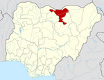
Kano State is one of the 36 states of Nigeria, located in the northern region of the country. According to the national census done in 2006, Kano State is the most populous state in Nigeria. The recent official estimates taken in 2016 by the National Bureau of Statistics found that Kano State was still the largest state by population in Nigeria. Created in 1967 out of the former Northern Region, Kano State borders on Katsina State to the northwest for about 210 km, Jigawa State to the northeast for 355 km, Bauchi State to the southeast for 131 km, and Kaduna State to the southwest for 255 km. The state's capital and largest city is the city of Kano, the second most populous city in Nigeria after Lagos. The incumbent governor of the state is Abba Kabir Yusuf. He was sworn in on 29 May 2023.
Jigawa State is one of the 36 states of Nigeria, located in the northern region of the country. Jigawa was created on 27 August 1991, under the General Ibrahim Babangida military administration. Jigawa State was formerly part of Kano State and was located in the northeastern-most region of Kano State, and it forms part of Nigeria's national border with the Republic of Niger. The state capital and largest city is Dutse. Jigawa state has 27 local governments.

Northern Nigeria was an autonomous division within Nigeria, distinctly different from the southern part of the country, with independent customs, foreign relations and security structures. In 1962, it acquired the territory of the British Northern Cameroons, which voted to become a province within Northern Nigeria.

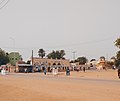
Gumel or Gumal is a city and traditional emirate in Jigawa State, Nigeria.

Katagum is a town, a local government area and a traditional emirate in Bauchi State of north eastern Nigeria. The town is located on the northern bank of the Jama'are River, which is a tributary of the Hadejia. Most of the inhabitants are peoples from the Fulani, Kanuri, Karai-karai and Hausa tribes. The chief agricultural products include peanuts (groundnuts), sorghum, millet, rice, cowpeas, cotton, indigo, and gum arabic. Livestock include horses, cattle, goats, sheep, donkeys and a lot of poultry.
Dutse is the capital city of Jigawa State in northern Nigeria, and also the capital of Dutse Emirate. It is a home to Federal University, Dutse established in November 2011. In addition to the Federal University Dutse, there is also a Research Institute for Date Palm (Sub-Station) and state polytechnic in Dutse. The Jigawa State Polytechnic has its College of Business and Management Studies at Dutse.
Suleja is a city in Niger State, Nigeria, just north of Abuja, capital of the Nigeria. It is sometimes confused with the nearby city of Abuja, due to its proximity, and the fact that it was originally called Abuja before the Nigerian government adopted the name from the then Emir Sulayman Bal for its new federal capital in 1976.

Hausa Kingdoms, also known as Hausa Kingdom or Hausaland, was a collection of states ruled by the Hausa people, before the Fulani jihad. It was situated between the Niger River and Lake Chad. Hausaland lay between the Western Sudanic kingdoms of Ancient Ghana, Mali and Songhai and the Eastern Sudanic kingdoms of Kanem-Bornu. Hausaland took shape as a political and cultural region during the first millennium CE as a result of the westward expansion of Hausa peoples. They arrived in Hausaland when the terrain was converting from woodlands to savannah. They started cultivating grains, which led to a denser peasant population. They had a common language, laws and customs. The Hausa were known for fishing, hunting, agriculture, salt-mining, and blacksmithing.
Bayajidda was, according to the legends surrounding most West African states before the 19th century, the founder of the Hausa states.

The Zazzau, also known as the Zaria Emirate, is a traditional state with headquarters in the city of Zaria, Kaduna State, Nigeria. The current emir of Zazzau is Ahmed Nuhu Bamalli CFR, who succeeded the former emir, late Alhaji Shehu Idris.
Daura is a town and local government area in Katsina State, northern Nigeria. It is the spiritual home of the Hausa people. The emirate is referred to as one of the "seven true Hausa states" because it was,, ruled by the descendants of Bayajidda's sons with Daurama and Magira . The University of California's African American Studies Department refers to Daura, as well as Katsina, as having been "ancient seats of Islamic culture and learning."

Azare is a town in Bauchi State, Nigeria. It was founded by Mallam Zaki, who was put into office by Shehu Usman Danfodio in early 1814. Azare is the headquarters of the Katagum division in Bauchi State. It is bordered to the east by Damban LGA and Potiskum Yobe State, to the south by Misau Local Government, to the west by Jama'are Local Government, and to the north by Itas/Gadau Local Government Area of Bauchi State.
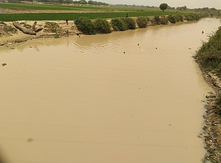
The Hadejia River is a river in Northern Nigeria and is a tributary of the Yobe River. Among the cities and towns that lie on or near its banks are Hadejia and Nguru. Damming of the river for the purposes of irrigation has led to a decrease in the amount of water in the Hadejia-Nguru wetlands, which the river forms along with Nguru Lake.
Jama'are is a Local Government Area of Bauchi State, Nigeria. Its headquarters are in the town of Jama'are. It has an area of 493 km2 and a population of 176,883 at the 2006 census. The postal code of the area is 751. It is populated by a Fulani tribe that migrated from Dulare in the Lake Chad basin in the Republic of Chad.

Kafin Hausa is a Local Government Area of Jigawa State, Nigeria. Its headquarters are in the town of Kafin Hausa.
Ringim is a Local Government Area (LGA) of Jigawa State, Nigeria. Its headquarters are in the town of Ringim, the LGA has an area of 1,057 km² and a population of 192,024 at the 2006 census.
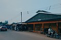
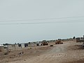
Maigatari is a border town located in the Sahel along the Niger-Nigeria border. The town is known for its large market founded in 1870 and trading in horses, camels, cattle and other livestock between Niger, Mali, Chad and Cameroon.
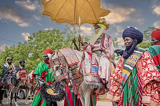
The Daura Emirate is a religious and traditional state in Northern Nigeria, the Emir of Daura still rules as a ceremonial hereditary monarch, and maintains a palace. Muhammad Bashar became the emir in 1966, reigning for 41 years until his death in 2007, On 28 February 2007, Umar Faruk Umar became Emir of Daura succeeding Muhammad Bashar.
Kwasarawa is an ancient place where some Fulani Rulers migrated to from Daura after the British and French had divided the three Daura polities, the British installed Zango's king, Malam Musa, as the new emir of Daura. Kwasarawa once part of Daura, It became part of the newly created Sandamu Local Government in Daura Emirate, Katsina State, Nigeria.