Kainji Lake

Last updated
Kainji Lake
Kainji Lake within Nigeria.jpg
Kainji Lake highlighted within Nigeria
Nigeria relief location map.jpg
Red pog.svg
Kainji Lake
LocationWestern Nigeria
Coordinates 10°22′N4°33′E / 10.367°N 4.550°E / 10.367; 4.550
Primary inflows Niger River
Primary outflows Niger River
Basin  countriesNigeria
Surface areamax. 1,243 km2 (480 sq mi)
Max. depth12.1 m (40 ft)
Water volume15 km3 (12,000,000 acre⋅ft)
Kainji Lake By Kainji Lake (4894130372).jpg
Kainji Lake
Kainji Lake within Nigeria Kainji Lake within Nigeria.jpg
Kainji Lake within Nigeria

Kainji Lake, in North Central Nigeria, is a reservoir on the Niger River, formed by the Kainji Dam. [1] It was formed in 1968 and is a part of Niger State and Kebbi State. [2] Kainji Lake National Park (KNLP), situated around the lake, is Nigeria's oldest National Park, established in 1976. [3]

Contents

Kanji Dam

Kainji Lake Kainji Dam 10.jpg
Kainji Lake

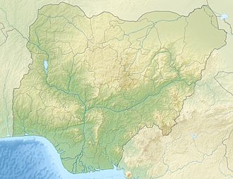
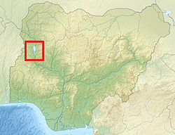
The Kainji Dam is situated in the Northern region of Niger State and generates power for most towns in Nigeria. [4] [5] It was built from 1964 to 1968 and cost about 209 million dollars, a quarter of which was used to relocate the original population. [6] Together with a smaller dam for a minor stream, it is 10 kilometres (6.2 mi) long and 65 metres (213 ft) high in the middle. It has a capacity of 12 turbines producing a total of 960 MW, but only 8 were installed, producing 760 MW. [7] Part of the production is sold to the neighbouring country of Niger. [8]

According to reports in 2023, the Kanji Dam was affected by flood due to the opening of the Lagdo Reservoir dam in Cameroon. [9]

Construction of the Kainji Dam and Lake

Before the construction, over 192 small settlements were situated in the area that is now Kainji Lake; 121 of them were rebuilt on higher ground (e.g., the city of New Bussa further south). In the dam’s wake, several environmental concerns have arisen: the lake is overfished, and major species of Nigerian fauna—e.g., crocodiles, sea cows, and hippos—have gone extinct. The formerly fertile flood plains have disappeared as well. Without these natural inundation areas, recurring flood events have frequently had catastrophic consequences for the local population. [10]


National Park

Kob antelope in the National Park Kob - Kainji Lake National Park (4894084728).jpg
Kob antelope in the National Park
Kainji Lake Kainji Lake.png
Kainji Lake

Kainji Lake National Park (KNLP) (headquarters Wawa) is situated 560 kilometres (350 mi) north of Lagos, close to the border with the Republic of Benin. [11] It comprises two sectors, Borgu Game Reserve and Zugurma Game Reserve, which are separated by Kainji Lake. [12] The abundant wildlife in the game preserves include baboons, duikers, hippopotami, hyenas, kobs, roan antelopes, and warthogs. [13]

Only the Borgu (western) sector is currently used for tourism; the Zugurma (eastern) sector lacks infrastructure, including access roads. [14] The topography of the park is gently undulating with a general decrease in elevation from west to east. The Borgu sector is drained mainly by the Oli, Timo and Doro rivers and their tributaries, while the Zugurma sector is drained by the Maingyara and Nuwa Tizururu rivers. The vegetation of the park is typical of the Guinean forest-savanna mosaic, although in some areas it appears more Sahelian. Riparian forests occur on the banks of the larger watercourses. [15] [16]

Climate

It has a dry and wet seasons that last from the month of April to November. A typical year that has 1100 to 1200mm of rain, or over 195 days. [17]

Conservation issues

Although the area around the park has a relatively low population density, numerous human activities adversely affect the park. These include deforestation, uncontrolled burning and illegal grazing and are particularly prevalent in the Zugurma sector. Wild mammals occur at relatively low densities due to illegal hunting. Lake Kainji has suffered a dramatic decline as a fishery due to the high numbers of artisanal and subsistence fisherfolk using the lake. [18] It has been suggested that a period of closure, together with controlled fishing rights may help improve fish stocks.[ citation needed ]

Related Research Articles

<span class="mw-page-title-main">Niger River</span> Major river in West Africa

The Niger River is the main river of West Africa, extending about 4,180 kilometres. Its drainage basin is 2,117,700 km2 (817,600 sq mi) in area. Its source is in the Guinea Highlands in south-eastern Guinea near the Sierra Leone border. It runs in a crescent shape through Mali, Niger, on the border with Benin and then through Nigeria, discharging through a massive delta, known as the Niger Delta, into the Gulf of Guinea in the Atlantic Ocean. The Niger is the third-longest river in Africa, exceeded by the Nile and the Congo River. Its main tributary is the Benue River.

<span class="mw-page-title-main">Niger State</span> State of Nigeria

Niger is a state in the North Central region of Nigeria. It is the largest state in the country by area. The state capital is Minna. Other major cities are Bida, Kontagora and Suleja. Niger state was formed in 1976 when the then North-Western State was divided into Niger State and Sokoto State. It is home state of two former Nigerian military heads of state— Ibrahim Babangida and Abdulsalami Abubakar. The Nupe,Adara, Gbagyi, Kamuku, Kambari, Gungawa, Hun-Saare, Hausa and Koro form the majority of numerous indigenous tribes of Niger State.

<span class="mw-page-title-main">Kwara State</span> State of Nigeria

Kwara State is a state in Western Nigeria, bordered to the east by Kogi State, to the north by Niger State, and to the south by Ekiti, Osun, and Oyo states, while its western border makes up part of the international border with Benin Republic. Its capital is the city of Ilorin and the state has 16 local government areas.

<span class="mw-page-title-main">Kainji National Park</span> National park in Nigeria

Kainji National Park is a national park in Niger State and Kwara State, Nigeria. Established in 1978, it covers an area of about 5,341 km2 (2,062 sq mi). The park includes three distinct sectors: a part of the Kainji Lake in which fishing is restricted, the Borgu Game Reserve to the west of the lake, and the Zugurma Game Reserve to the southeast.

New Bussa is a town in Niger State, Nigeria. It is the new site of Bussa after the Kainji Lake dam set the previous location underwater. As of 2007 New Bussa had an estimated population of 24,449. New Bussa is the headquarters of the Borgu Emirate and the Borgu Local Government Area.

<span class="mw-page-title-main">Bussa, Nigeria</span>

Bussa, also known as Boussa in older texts, was the capital of northern Borgu, in northern Nigeria. It was the farthest navigable point on the Niger River, just above the rapids. The town site is now covered by Lake Kainji, which was created in 1968 with the construction of the Lake Kainji dam. The town was re-located to what is now called New Bussa.

<span class="mw-page-title-main">Kainji Dam</span> Dam in Niger, Nigeria

Kainji Dam is a dam across the Niger River in Niger State of Central Nigeria. Construction of the dam by Impregilo began in 1964 and was completed in 1968. Its total cost was estimated at US$209 million, with one-quarter of this amount used to resettle people displaced by the construction of the dam and its reservoir, the Kainji Lake.

Articles related to Nigeria include:

<span class="mw-page-title-main">Wildlife of Nigeria</span>

The wildlife of Nigeria consists of the flora and fauna of this country in West Africa. Nigeria has a wide variety of habitats, ranging from mangrove swamps and tropical rainforest to savanna with scattered clumps of trees. About 290 mammal species and 940 bird species have been recorded in the country.

<span class="mw-page-title-main">Lagdo Reservoir</span> Reservoir in North Province

Lagdo Reservoir is a reservoir located in the Northern Province of Cameroon, on the Benue River, in the Niger basin. The lake covers an area of 586 km2.

Mariga is a Local Government Area in Niger State, Nigeria. Its headquarters are in the town of Bangi in the north of the area. Other towns in the LGA are Igwama and Inkwai. Various endangered Kamuku languages are spoken in Mariga LGA.

The Borgu Local Government Area is an administrative region in Niger State, Nigeria, It is one of the 25 Local Government Areas (LGAs) in the state, with the headquarter situated in the town of New Bussa. The postal code is 913. The Borgu LGA was formerly part of Kwara State, but on 27 August 1991 it was transferred to Niger State.

The Borgu Game Reserve is a section of the Kainji National Park, in the Borgu Local Government Area of Niger State and Baruten Local Government Area of Kwara State, Nigeria. It is bordered on the east by Kainji Lake and reaches almost to the border with Benin to the west, covering 397,002 hectares. It was amalgamated with the Zugurma Game Reserve in 1975 to form the Kainji Lake National Park.

The Zugurma Game Reserve is a section of the Kainji National Park, in the Mariga Local Government Area of Niger State, Nigeria. It is bordered by the Kontagora River to the northwest and the Manyara River to the north, and covers an area of 138,500 hectares. It was amalgamated with the Borgu Game Reserve in 1975 to form the Kainji Lake National Park.

The Chad Basin National Park is a national park in northeastern Nigeria, in the Chad Basin, with a total area of about 2,258 km2. The park is fragmented, with three sectors. The Chingurmi-Duguma sector is in Borno State, in a Sudanian savanna ecological zone. The Bade-Nguru Wetlands and Bulatura sectors are in Yobe State in the Sahel ecological zone.

Reshe is the most divergent of the Kainji languages of Nigeria. It is spoken on the northern and southern sides of Kainji Lake. It is spoken in Yauri LGA, Kebbi State, and in Borgu LGA, Niger State.

The electricity sector in Nigeria generates, transmits and distributes megawatts(MW) of electric power that is significantly less than what is needed to meet basic household and industrial needs. Nigeria has twenty-three (23) power-generating plants connected to the national grid with the capacity to generate 11,165.4 MW of electricity. These plants are managed by generation companies (GenCos), independent power providers, and Niger Delta Holding Company. In 2012, the industry labored to distribute 5,000 MW, very much less than the 40,000 MW needed to sustain the basic needs of the population. This deficit is also exacerbated by unannounced load shedding, partial and total system collapse and power failure. To meet demand, many households and businesses resort to purchasing generating sets to power their properties; this source of energy provided 6,000 MW in 2008. Nigeria has a chronic electricity shortage that has affected the country for many years. In 2022, its power grid collapsed twice in one week.

Natural areas in Nigeria include:

<span class="mw-page-title-main">2022 Nigeria floods</span> Major floods in Nigeria in 2022

The 2022 Nigeria floods affected many parts of the country. From the Federal Government Data, the floods had displaced over 1.4 million people, killed over 603 people, and injured more than 2,400 people. About 82,035 houses had been damaged, and 332,327 hectares of land had also been affected.

References

  1. "Kainji Lake". Encyclopædia Britannica. Retrieved July 21, 2012.
  2. "Earth from Space: Kainji Lake". www.esa.int. Retrieved 2023-07-20.
  3. "Kainji Lake National Park". Bird Life International. Retrieved July 18, 2012.
  4. "Flood: As River Niger overflows, fear grips plain settlers - Daily Trust". dailytrust.com. Retrieved 2023-09-22.
  5. "Construction of the Kainji Dam and Lake". Environment & Society Portal. Retrieved 2023-07-20.
  6. "Earth from Space: Kainji Lake". www.esa.int. Retrieved 2023-07-20.
  7. "An inside look at Kainji Dam". Daily Trust Online. Archived from the original on October 14, 2012. Retrieved July 21, 2012.
  8. "Kainji Lake in north central Nigeria". Earth.com. Retrieved 2023-07-20.
  9. Nnodim, Okechukwu (2022-09-20). "Flood displaces Nigerians as Cameroon opens dams". Punch Newspapers. Retrieved 2023-09-22.
  10. "Construction of the Kainji Dam and Lake". Environment & Society Portal. Retrieved 2024-07-15.
  11. Apoola, Tope (2021-12-08). "Kainji National Park". LitCaf. Retrieved 2023-07-20.
  12. "Kainji Lake National Park (national park, Nigeria)". Encyclopedia Britannica. Retrieved July 18, 2012.
  13. "Kainji Lake National Park, Niger - Photos & Reviews". Hotels.ng Places. Retrieved 2023-07-20.
  14. "Kainji Lake National Park". Bird Life International. Retrieved July 18, 2012.
  15. "Kainji Lake National Park, Nigeria - KeyBiodiversityAreas.org". www.keybiodiversityareas.org. Retrieved 2023-09-15.
  16. "BirdLife Data Zone". datazone.birdlife.org. Retrieved 2023-09-15.
  17. "Kainji Lake National Park" . Retrieved 2023-08-21.
  18. "Inland fishery resources of nigeria". www.fao.org. Retrieved 2023-08-17.