Commune IV | |
|---|---|
Commune | |
| Country | |
| Region | Bamako Capital District |
| Cercle | Bamako |
| Time zone | UTC (Coordinated Universal Time) |
Commune IV | |
|---|---|
Commune | |
| Country | |
| Region | Bamako Capital District |
| Cercle | Bamako |
| Time zone | UTC (Coordinated Universal Time) |

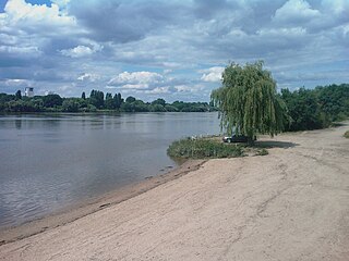
Bamako is the capital and largest city of Mali, with a population of 2,009,109. In 2006, it was estimated to be the fastest-growing city in Africa and sixth-fastest in the world. It is located on the Niger River, near the rapids that divide the upper and middle Niger valleys in the southwestern part of the country.
Since 2016, Mali has been divided into ten regions and one capital district. A reorganization of the country from eight to nineteen regions was passed into law in 2012, but of the new regions, only Taoudénit and Ménaka have begun to be implemented. Each of the regions bears the name of its capital. The regions are divided into 56 cercles. The cercles and the capital district are divided into 703 communes.

The 2002 Africa Cup of Nations was the 23rd edition of the Africa Cup of Nations, the association football championship of Africa (CAF). It was hosted by Mali. Just like in 2000, the field of sixteen teams was split into four groups of four. Cameroon won its fourth championship, beating Senegal on penalty kicks 3−2 after a goalless draw.

Koulikoro Region is a region in western Mali. It is the second administrative area of Mali and covers an area of 90,120 km2. Its capital is the city of Koulikoro.

Ibrahim Boubacar Keïta, or as he is often known, IBK, is a Malian politician who has been President of Mali since 2013. Previously he was Prime Minister of Mali from 1994 to 2000 and President of the National Assembly of Mali from 2002 to 2007. He founded a political party, Rally for Mali (RPM), in 2001. He was elected as President in the July–August 2013 presidential election and sworn in on 4 September 2013.

Koulikoro is a town and urban commune in Mali. The capital of the Koulikoro Region, Koulikoro is located on banks of the Niger River, 59 kilometres (37 mi) downstream from Mali's capital Bamako.
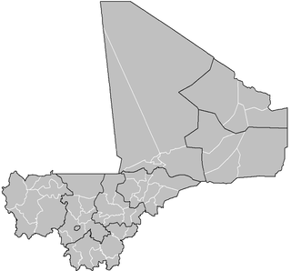
A cercle is the second level administrative unit in Mali. Mali is divided into eight régions and one capital district (Bamako); the régions are subdivided into 49 cercles. These subdivisions bear the name of their principal city.
Saint-Sébastien-sur-Loire is a commune in the Loire-Atlantique department in western France.

A Commune is the third level administrative unit in Mali. Mali is divided into eight regions and one capital district (Bamako). These subdivisions bear the name of their principal city. The regions are divided into 49 Cercles. The Cercles and the district are divided into 703 Communes, with 36 Urban Communes and 667 Rural Communes, while some larger Cercles still contain Arrondissements above the Commune level, these are organisational areas with no independent power or office. Rural Communes are subdivided in Villages, while Urban Communes are subdivided into Quartier. Communes usually bear the name of their principal town. The capital, Bamako, consists of six Urban Communes. There were initially 701 communes until the Law No. 01-043 of 7 June 2001 created two new Rural Communes in the desert region in the north east of the country: Alata, Ménaka Cercle in the Gao Region and Intadjedite, Tin-Essako Cercle in the Kidal Region.

Tienfala is a small town and commune on the Niger River in the Cercle of Koulikoro in the Koulikoro Region of south-western Mali. As of 1998 the commune had a population of 4128. It is located 30 kilometres from Bamako.
Kalabancoro or Kalaban Koro is a rural commune and town in the cercle of Kati within the Koulikoro Region of south-western Mali. The commune has become part of the suburbs of Bamako, the Malian capital. It lies on the south side of the Niger River, to the south and west of the urban communes V and VI of Bamako. The commune is growing very rapidly. In 1998 it had a population of 35,582 but by 2009 this had grown to 166,722. It is now Mali's third most populous commune, and by far the most populous rural commune.
Mountougoula is a village and rural commune in the Cercle of Kati in the Koulikoro Region of south-western Mali. The commune covers an area of 369 square kilometers and includes 16 villages. In the 2009 census the commune had a population of 11,814. The village of Mountougoula lies 30 km southeast of Bamako, the Malian capital.
Wateni is a rural commune in the Cercle of Sikasso in the Sikasso Region of southern Mali. The commune covers an area of 211 square kilometers and includes ten villages. In the 2009 census it had a population of 6,701. The village of N'Tjila, the administrative center (chef-lieu) of the commune, is 94 km west-northwest of Sikasso.
The following is a timeline of the history of the city of Bamako, Mali.
Commune I is a commune of Bamako, Mali.
Commune II is a commune of Bamako, Mali.
Commune III is a commune of Bamako, Mali.
Commune V is a commune of Bamako, Mali.
Commune VI is a commune of Bamako, Mali.
| This Mali location article is a stub. You can help Wikipedia by expanding it. |