This article needs additional citations for verification .(January 2024) |
Kolokani | |
|---|---|
Commune and town | |
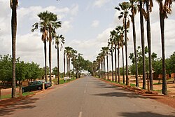 National Route 1 in Kolokani | |
 Kolokani Location in Mali | |
| Coordinates: 13°35′27″N8°02′03″W / 13.59083°N 8.03417°W | |
| Country | |
| Region | Koulikoro Region |
| Cercle | Kolokani Cercle |
| Population (2009) | |
• Total | 57,307 |
| Time zone | UTC+0 (GMT) |
Kolokani is a town of approximately 57,307 inhabitants in Mali's Koulikoro Region.
