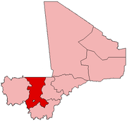
A Commune is the third-level administrative unit in Mali. Mali is divided into eight regions and one capital district (Bamako). These subdivisions bear the name of their principal city. The regions are divided into 49 Cercles. The Cercles and the district are divided into 703 Communes, with 36 Urban Communes and 667 Rural Communes, while some larger Cercles still contain Arrondissements above the Commune level, these are organisational areas with no independent power or office. Rural Communes are subdivided in Villages, while Urban Communes are subdivided into Quartier. Communes usually bear the name of their principal town. The capital, Bamako, consists of six Urban Communes. There were initially 701 communes until the Law No. 01-043 of 7 June 2001 created two new Rural Communes in the desert region in the north east of the country: Alata, Ménaka Cercle in the Gao Region and Intadjedite, Tin-Essako Cercle in the Kidal Region.

Nioro Cercle is an administrative subdivision of the Kayes Region of Mali. Its administrative center (chef-lieu) is the town of Nioro du Sahel. The commune is on the Mauritanian border and has long been a major stop on the trans-Saharan trade.

Guidimakan Keri Kafo is a commune in the Cercle of Kayes in the Kayes Region of south-western Mali. The main town (chef-lieu) of the commune is Gakoura which lies on the north bank of the Senegal River. In 2009 the commune had a population of 13,647.

Gongasso is a village and rural commune in the Cercle of Sikasso in the Sikasso Region of southern Mali. The commune covers an area of 378 square kilometers and includes ten villages. In the 2009 census it had a population of 8465. The village of Gongasso lies 29 km northwest of Sikasso on the main road, the RN11, linking Sikasso and Koutiala.

Wassoulou-Ballé is a rural commune in the Cercle of Yanfolila in the Sikasso Region of southern Mali. The administrative center (chef-lieu) of the commune is the town of Yanfolila. The town is also the administrative center of the cercle. It lies 272 km west of Sikasso, 164 km south of Bamako and 23 km from the border with Guinea. The commune covers an area of 1,594 square kilometers and includes the town of Yanfolila and 29 villages. In the 2009 census it had a population of 51,727.

Gouandiaka is a rural commune in the Cercle of Yanfolila in the Sikasso Region of southern Mali. The commune covers an area of 1,169 square kilometers and includes 29 villages. In the 2009 census it had a population of 26,287. The village of Kalana, the administrative center (chef-lieu) of the commune, is 44 km south of Yanfolila.

Dioro is a town and rural commune in the Cercle of Ségou in the Ségou Region of southern-central Mali. The commune extends over an area of approximately 586 square kilometers on the right bank of the Niger River and includes the town and 29 of the surrounding villages. In the 2009 census the commune had a population of 47,876. The town of Dioro is located 57 km northeast of Ségou on the bank of the river.

Dougabougou is a small town and rural commune in the Cercle of Ségou in the Ségou Region of southern-central Mali. The commune covers an area of approximately 180 square kilometers and includes the town and 6 villages. In the 2009 census the population was 29,208. The town lies 20 km north of the Markala dam. Many of the inhabitants are employed in the production of sugar on land irrigated by the Office du Niger scheme. A Chinese-Malian company produces sugar in the town.

Kolongo or Kolongo Tomo is a village and rural commune in the Cercle of Macina in the Ségou Region of southern-central Mali. The commune covers an area of approximately 484 square kilometers and includes 37 villages. In the 2009 census the commune had a population of 37,648. The village lies on the Fala de Boky-Wéré, an ancient branch of the Niger River that now forms part of the irrigation system of the Office du Niger.

Boky Wéré is a village and rural commune in the Cercle of Macina in the Ségou Region of southern-central Mali. The commune covers an area of approximately 220 square kilometers and includes 14 villages. The commune is bordered to the north by the commune of Monimpébougou, to the east by the commune of Kokry, to the west by the commune of Pogo and to the south by the commune of Kolongo. In the 2009 census the commune had a population of 16,934. The village lies to the north of the Fala de Boky-Wéré, an ancient riverbed that forms part of the Office du Niger irrigation system, and to the south of a large irrigation canal dug in 2009 as part of the Libyan financed Malibya project.

Folomana is a village and rural commune in the Cercle of Macina in the Ségou Region of southern-central Mali. The commune covers an area of approximately 146 square kilometers and includes 17 villages. In the 2009 census the commune had a population of 10,478.

Monimpébougou is a village and rural commune in the Cercle of Macina in the Ségou Region of southern-central Mali. The commune covers an area of approximately 2,249 square kilometers and includes 33 villages. In the 2009 census the commune had a population of 32,899.

Fatiné is a rural commune in the Cercle of Ségou in the Ségou Region of Mali. The commune includes 29 villages in an area of approximately 1006 square kilometers. In the 2009 census it had a population of 25,161. The Bani River runs along the southern boundary of the commune. The administrative center (chef-lieu) is the village of Fatiné Marka.

Timniri is a rural commune in the Cercle of Bandigara of the Mopti Region of Mali. The commune contains 29 villages and in the 2009 census had a population of 20,637. The administrative centre (chef-lieu) is the village of Diangassagou.

Farimaké is a commune of the Cercle of Youwarou in the Mopti Region of Mali. The local government is based in the village of Gathi-Loumbo. The commune covers an area of 3,148 km2. It is bounded to the west by the commune of Youwarou, to the north by the communes of Dianké, Léré and Alzounoub, to the east by the commune of Nampalari and to the south by the communes of Kareri, Toguéré Coumbé and Bimbere Tama. The commune lies to the west of the Issa-Ber, the larger of the two branches of the Niger River that flow out of Lake Débo. The commume contains 29 small villages and in 2009 had a population of 11,869. The largest ethnic group are the Fulani who make up more than 40 percent of the population.

Néma-Badenyakafo is a rural commune of the Cercle of Djenné in the Mopti Region of Mali. The commune contains 29 villages. The principal village (chef-lieu) is Mougna.

Ouro Ardo is a commune of the Cercle of Ténenkou in the Mopti Region of Mali. The local government is based in the village of Kondo. The commune includes 29 small villages and in 2009 had a population of 9,114.

Diangounté Camara is a rural commune and small town in the Cercle of Diéma in the Kayes Region of western Mali. The commune contains 13 villages and hamlets. In the 2009 census the commune had a population of 28,213.

Madiga Sacko is a rural commune and village in the Cercle of Diéma in the Kayes Region of western Mali. The commune includes the villages of Guédéguilé, Souranguédou and Bagamabougou as well as the main village (chef-lieu) of Madiga Sacko. In the 2009 census the commune had a population of 12,690.

Gomitradougou is a rural commune in the Cercle of Diéma in the Kayes Region of western Mali. The commune includes the villages of Gomitra, Wattaye, Kouloudienguè, Missira, Bassibougou, Sébabougou, Niamakoro and N’Tallabougou. The main village (chef-lieu) is Kouloudiengué. In the 2009 census the commune had a population of 7,287.


