The National Library of Mali is located in Bamako, Mali.

Kéniéba Cercle is a subdivision of the Kayes Region of Mali. The administrative center (chef-lieu) is the town of Kéniéba.
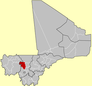
Kolokani Cercle is an administrative subdivision of the Koulikoro Region of Mali. Its seat is the town of Kolokani, which is also its largest settlement. It lies directly to the north of Kati Cercle. Also to the south, is the District of Bamako, which after independence was carved out of the middle of the Region. The cercle is further divided into communes.

Kati Cercle is an administrative subdivision of the Koulikoro Region of Mali. Its seat is the town of Kati, which is also its largest town. It lies at the southwest corner of the region, and completely surrounds the Bamako Capital District. Until the capital was hived off in 1977, the combined Cercle was called Bamako Cercle, with the capital city as its seat.

Dioïla Cercle is an administrative subdivision of the Koulikoro Region of Mali. Its seat is the town of Dioïla. It lies at the southeast corner of the region, and prior to 1977, it was combined with what is now Kati Cercle and the District of Bamako in the "Bamako Cercle", with the capital city as its seat.

Yanfolila Cercle is an administrative subdivision of the Sikasso Region of southern Mali. The administrative center (chef-lieu) is the town of Yanfolila.

Yorosso Cercle is an administrative subdivision of the Sikasso Region of southern Mali. The main town (chef-lieu) is Yorosso.

Bla Cercle is an administrative subdivision of the Ségou Region of Mali. The administrative center (chef-lieu) is the town of Bla.
Niantjila is a small town and commune in the Cercle of Dioila in the Koulikoro Region of southern Mali. As of 1998 the commune had a population of 12,845.
N'Golobougou is a small town and commune in the Cercle of Dioila in the Koulikoro Region of southern Mali. As of 1998 the commune had a population of 14,880.
Wacoro is a small town and commune in the Cercle of Dioila in the Koulikoro Region of southern Mali. As of 1998 the commune had a population of 9706.
Jèkafo is a small town and commune in the Cercle of Dioila in the Koulikoro Region of southern Mali. As of 1998 the commune had a population of 5,138.
Kaniogo is a small town and commune in the Cercle of Kangaba in the Koulikoro Region of south-western Mali. As of 1998 the commune had a population of 11415.
Meridiela is a small town and commune in the Cercle of Bougouni in the Sikasso Region of south-western Mali. In 1998 the commune had a population of 9,037.
Syen Toula is a small town and commune in the Cercle of Bougouni in the Sikasso Region of southern Mali. In 1998 the commune had a population of 5,825.
Kadiana is a small town and commune in the Cercle of Kolondieba in the Sikasso Region of southern Mali. In 1998 the commune had a population of 12,404.
Danou is a commune in the Cercle of Bougouni in the Sikasso Region of southern Mali. The principal town lies at Torakoro. In 1998 the commune had a population of 8,869.
Gouendo is a small town and commune in the Cercle of Barouéli in the Ségou Region of southern-central Mali. In 1998 the commune had a population of 8,724.
Kava is a commune in the Cercle of San in the Ségou Region of Mali. The principal town lies at Heremakono. As of 1998 the commune had a population of 10,699.
Kassorola is a commune in the Cercle of San in the Ségou Region of Mali. The administrative center is the town of Nianasso. In a 2009 census, this regions total population was 16,275.


