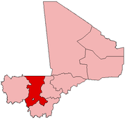
Bafoulabé is a town and rural commune in south-western Mali. It is located in the Region of Kayes at the confluence of the Bafing and Bakoy rivers which join to become the Sénégal River. Bafoulabé is the capital of the Cercle of Bafoulabé, which in 1887 was the first Cercle to be created in Mali.
An administrative centre is a seat of regional administration or local government, or a county town, or the place where the central administration of a commune is located.

Tamanrasset, also known as Tamanghasset or Tamenghest, is an oasis city and capital of Tamanrasset Province in southern Algeria, in the Ahaggar Mountains. It is the chief city of the Algerian Tuareg. It is located an altitude of 1,320 metres (4,330 ft). As of the 2008 census, it has a population of 92,635, up from 72,741 in 1998, with an annual growth rate of 2.5%.

Tinzaouaten is a Saharan rural commune in the far northeast of Mali on the Algerian border. The commune is in the Abeïbara Cercle of the Kidal Region. It included a stop on a trans-Saharan trade route and a military post on the frontier under the French colonial regime. In 2009 the 8,000 square kilometer commune had a population of 2,300, most of whom are nomadic Tuareg. The Algerian settlement of Tinzaouten is on the Algerian side of the border.

A Commune is the third level administrative unit in Mali. Mali is divided into eight regions and one capital district (Bamako). These subdivisions bear the name of their principal city. The regions are divided into 49 Cercles. The Cercles and the district are divided into 703 Communes, with 36 Urban Communes and 667 Rural Communes, while some larger Cercles still contain Arrondissements above the Commune level, these are organisational areas with no independent power or office. Rural Communes are subdivided in Villages, while Urban Communes are subdivided into Quartier. Communes usually bear the name of their principal town. The capital, Bamako, consists of six Urban Communes. There were initially 701 communes until the Law No. 01-043 of 7 June 2001 created two new Rural Communes in the desert region in the north east of the country: Alata, Ménaka Cercle in the Gao Region and Intadjedite, Tin-Essako Cercle in the Kidal Region.

Diédougou is a rural commune in the Cercle of Dioïla in the Koulikoro Region of south-western Mali. The commune contains 34 villages. The administrative center (chef-lieu) is at the village of Béléko Soba which lies 205 km east of Bamako. In the 2009 census the commune had a population of 39,021.

Dioumaténé is a village and rural commune in the Cercle of Kadiolo in the Sikasso Region of southern Mali. The commune covers an area of 225 square kilometers and includes 5 villages. In the 2009 census it had a population of 4,274. The village of Dioumaténé, the administrative center (chef-lieu) of the commune, is 16 km west of Kadiolo.

Kouniana is a village and commune in the Cercle of Koutiala in the Sikasso Region of southern Mali. The commune covers an area of 79 square kilometers and includes 2 settlements. In the 2009 census it had a population of 3,294. The village of Kouniana, the administrative centre (chef-lieu) of the commune, is 45 km northeast of Koutiala.

Miniko is a village and rural commune in the Cercle of Sikasso in the Sikasso Region of southern Mali. The commune covers an area of 128 square kilometers and includes six villages. In the 2009 census it had a population of 3,288. The village of Miniko-Soba, the administrative center (chef-lieu) of the commune, is 33 km southwest of Sikasso.

Kourouma is a village and rural commune in the Cercle of Sikasso in the Sikasso Region of southern Mali. The commune covers an area of 293 square kilometers and includes 10 villages. In the 2009 census it had a population of 11,234. The village of Kourouma, the chef-lieu of the commune, is 81 km northwest of Sikasso.

Tella is a village and rural commune in the Cercle of Sikasso in the Sikasso Region of southern Mali. The commune covers an area of 511 square kilometers and includes six villages. In the 2009 census it had a population of 4,372. The village of Tella, the administrative center (chef-lieu) of the commune, is 82 km northwest of Sikasso.

Dialakoro is a village and rural commune in the Cercle of Sikasso in the Sikasso Region of southern Mali. The commune covers an area of 83 square kilometers and includes four villages. In the 2009 census it had a population of 6,893. The village of Dialakoro, the chef-lieu of the commune, is 98 km northwest of Sikasso.

Dembela is a small town and rural commune in the Cercle of Sikasso in the Sikasso Region of southern Mali. The commune covers an area of 426 square kilometers and includes 11 villages. In the 2009 census it had a population of 13,061. The village of Dembela, the chef-lieu of the commune, is 88 km northwest of Sikasso.

Sokourani-Missirikoro is a village and rural commune in the Cercle of Sikasso in the Sikasso Region of southern Mali. The commune covers an area of 88 square kilometers and includes five villages. In the 2009 census it had a population of 4,478. The village of Sokourani-Missirikoro, the administrative center (chef-lieu) of the commune, is 13 km southwest of Sikasso. The main language spoken in the commune is Senufo.

Koury is a small town and rural commune in the Cercle of Yorosso in the Sikasso Region of southern Mali. The commune covers an area of 712 square kilometers and includes the town and 16 villages. In the 2009 census it had a population of 54,435. The town, the administrative center (chef-lieu) of the commune, is 19 km south of Yorosso on the main road linking Koutiala in Mali with the town of Bobo-Dioulasso in Burkina Faso.

Fakolo is a commune in the Cercle of Koutiala in the Sikasso Region of southern Mali. The commune covers an area of 201 square kilometers and includes 6 villages. In the 2009 census it had a population of 13,130. The village of Zansoni, the administrative centre (chef-lieu) of the commune, is 35 km northwest of Koutiala.

Tiankadi is a commune in the Cercle of Sikasso in the Sikasso Region of southern Mali. The commune covers an area of 70 square kilometers and includes three villages. In the 2009 census it had a population of 4,674. The village of Zibangolola, the administrative center (chef-lieu) of the commune, is 60 km northwest of Sikasso.

Tagandougou is a rural commune in the Cercle of Yanfolila in the Sikasso Region of southern Mali. The commune covers an area of 614 square kilometers and includes 7 villages. In the 2009 census it had a population of 5,775. The village of Binko, the administrative center (chef-lieu) of the commune, is 52 km north of Yanfolila on the western side of the Sélingué Dam.

Sandougou-Soba is a town in western Ivory Coast. It is a sub-prefecture of Man Department in Tonkpi Region, Montagnes District.
The following is a timeline of the history of the city of Bamako, Mali.


