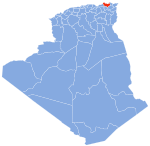
Algeria comprises 2,381,740 square kilometres (919,590 sq mi) of land, more than 80% of which is desert, in North Africa, between Morocco and Tunisia. It is the largest country in Africa. Its Arabic name, Al Jazair, is believed to derive from the rocky islands along the coastline of the Mediterranean Sea. The northern portion, an area of mountains, valleys, and plateaus between the Mediterranean and the Sahara Desert, forms an integral part of the section of North Africa known as the Maghreb. This area includes Morocco, Tunisia, and the northwestern portion of Libya known historically as Tripolitania.

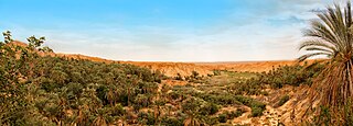
Tozeur is a city in southwest Tunisia. The city is located northwest of Chott el Djerid, in between this Chott and the smaller Chott el Gharsa. It is the capital of Tozeur Governorate. It was the site of the ancient city and former bishopric Tusuros, which remains a Latin Catholic titular see.
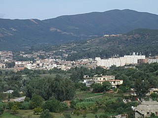
Cirta, also known by various other names in antiquity, was the ancient Berber, Punic and Roman settlement which later became Constantine, Algeria.
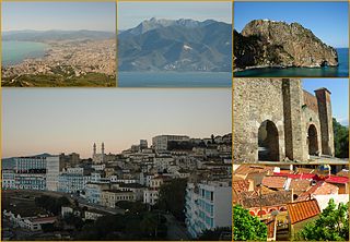
Béjaïa formerly Bougie and Bugia, is a Mediterranean port city and commune on the Gulf of Béjaïa in Algeria; it is the capital of Béjaïa Province.

Djémila, formerly Cuicul, is a small mountain village in Algeria, near the northern coast east of Algiers, where some of the best preserved Roman ruins in North Africa are found. It is situated in the region bordering the Constantinois and Petite Kabylie.

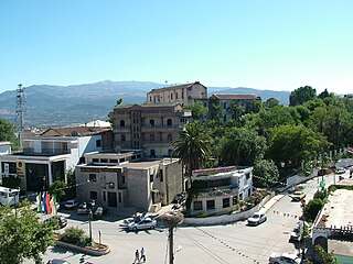
Mila is a city in the northeast of Algeria and the capital of Mila Province. In antiquity, it was known as Milevum or Miraeon, Μιραίον and was situated in the Roman province of Numidia.

Milevum was a Roman–Berber city in the Roman province of Numidia. It was located in present-day Mila in eastern Algeria.

Téboursouk is a town and commune in the Béja Governorate, Tunisia. It is located at 36° 27′ 26″N, 009° 14′ 54″E.
El Milia ( الميلية) is a town and commune in Jijel Province, Algeria.
Beniane is a town and commune in Mascara Province, Algeria at the site of ancient Ala Miliaria, a former bishopric which earns a Latin Catholic titular see.

Aïn Charchar is a town and commune in Skikda Province in north-eastern Algeria.
Tamalous is a town and commune in Skikda Province in north-eastern Algeria. According to the 2008 census it has a population of 23,728.
Negrine is a town and commune in Tébessa Province in north-eastern Algeria. It was the site of ancient Casae Nigrae, a settlement of Roman North Africa with an attached bishopric that remains a Latin Catholic titular see.

Honaine is a town and commune in Tlemcen Province in northwestern Algeria.
Igilgili was a [Algerian] town and a Phoenician, Carthaginian, and Roman colony in located in present-day Jijel, Algeria.

Tiddis was a Roman city that depended on Cirta and a bishopric as "Tiddi", which remains a Latin Catholic titular see.
El-Kentour (الكنتور) is a town and mountain in Algeria. It is located in the Constantine Mountains. El-Kentour is also the site of the El-Ouahch to El-Kentour tunnel, which is part of the National Road 3.

Bagai was a Roman–Berber city in the province of Africa Proconsularis. It must have been of some reasonable size, as it was also the seat of an ancient Catholic bishopric. The ancient city has been identified with ruins at Ksar-Bagaï outside of Baghai, in the Aurès Mountains of the El Hamma District in Khenchela Province, Algeria.

Grimidi was an ancient Roman town of the Roman province of Mauretania Caesariensis, located at 3.73031 35.87687 in North Africa. It flourished from about 30BC to about 640AD. Numerous ruins litter the site.
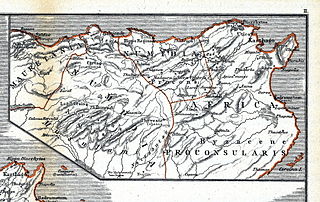
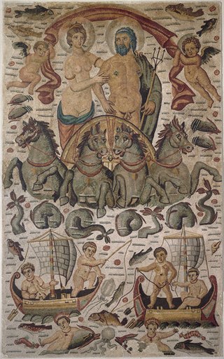
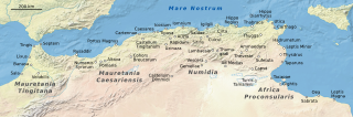
Numidia was a Roman province on the North African coast, comprising roughly the territory of north-east Algeria.