National Register of Historic Places listings in Washington County, Tennessee

Last updated

Location of Washington County in Tennessee Map of Tennessee highlighting Washington County.svg
Location of Washington County in Tennessee

This is a list of the National Register of Historic Places listings in Washington County, Tennessee.

Contents

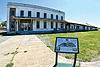
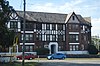
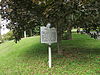
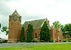
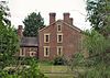
This is intended to be a complete list of the properties and districts on the National Register of Historic Places in Washington County, Tennessee, United States. Latitude and longitude coordinates are provided for many National Register properties and districts; these locations may be seen together in a map. [1]

There are 37 properties and districts listed on the National Register in the county. One site has been further designated a National Historic Landmark. Three other sites were once listed, but have since been removed.

See also National Register of Historic Places listings in Carter County, Tennessee for additional properties in Johnson City, a city that spans the county line.

Map all coordinates using: OpenStreetMap  
Download coordinates as: KML
Contents: Counties in Tennessee
Anderson  Bedford  Benton  Bledsoe  Blount  Bradley  Campbell  Cannon  Carroll  Carter  Cheatham  Chester  Claiborne  Clay  Cocke  Coffee  Crockett  Cumberland  Davidson  Decatur  DeKalb  Dickson  Dyer  Fayette  Fentress  Franklin  Gibson  Giles  Grainger  Greene  Grundy  Hamblen  Hamilton  Hancock  Hardeman  Hardin  Hawkins  Haywood  Henderson  Henry  Hickman  Houston  Humphreys  Jackson  Jefferson  Johnson  Knox  Lake  Lauderdale  Lawrence  Lewis  Lincoln  Loudon  Macon  Madison  Marion  Marshall  Maury  McMinn  McNairy  Meigs  Monroe  Montgomery  Moore  Morgan  Obion  Overton  Perry  Pickett  Polk  Putnam  Rhea  Roane  Robertson  Rutherford  Scott  Sequatchie  Sevier  Shelby  Smith  Stewart  Sullivan  Sumner  Tipton  Trousdale  Unicoi  Union  Van Buren  Warren  Washington  Wayne  Weakley  White  Williamson  Wilson


    This National Park Service list is complete through NPS recent listings posted November 3, 2022. [2]

Current listings

[3] Name on the Register [4] ImageDate listed [5] Location City or townDescription
1 Aquone
Aquone AquoneHouse.jpg
Aquone
November 4, 1993
(#93001199)
110 Barberry Rd.
36°19′37″N82°22′03″W / 36.3269°N 82.3675°W / 36.3269; -82.3675 (Aquone)
Johnson City
2 Bashor Mill
Bashor Mill Bashor Mill.jpg
Bashor Mill
July 8, 1980
(#80003878)
248 Denny Mill Rd
36°20′51″N82°24′17″W / 36.3475°N 82.4047°W / 36.3475; -82.4047 (Bashor Mill)
Johnson City
3 Boone Hydroelectric Project
Boone Hydroelectric Project Boone Dam.jpg
Boone Hydroelectric Project
October 26, 2017
(#100001476)
301 Boone Dam Rd.
36°26′25″N82°26′19″W / 36.4403°N 82.4386°W / 36.4403; -82.4386 (Boone Hydroelectric Project)
Kingsport Extends into Sullivan County
4 Brown Farm December 29, 2014
(#14001107)
359 Taylor Bridge Rd.
36°12′22″N82°29′13″W / 36.2061°N 82.487°W / 36.2061; -82.487 (Brown Farm)
Jonesborough
5 Adam Alexander Broyles House March 21, 2011
(#11000099)
3118 Old State Route 34
36°13′19″N82°35′54″W / 36.2219°N 82.5983°W / 36.2219; -82.5983 (Adam Alexander Broyles House)
Limestone
6 Broylesville Historic District
Broylesville Historic District Broyles-Mercantile-building-tn1.jpg
Broylesville Historic District
March 28, 1985
(#85000677)
Roughly bounded by Old State Route 34, Taylor Mill and Gravel Hill Rds. along Little Limestone Creek
36°12′44″N82°36′16″W / 36.2122°N 82.6044°W / 36.2122; -82.6044 (Broylesville Historic District)
Washington College Late-18th and early-19th century community initially developed by Adam Broyles, Jr., and his children. Inventory form.
7 Carolina, Clinchfield & Ohio Railroad Station and Depot
Carolina, Clinchfield & Ohio Railroad Station and Depot Depot041312.jpg
Carolina, Clinchfield & Ohio Railroad Station and Depot
March 27, 2008
(#08000238)
300 Buffalo St.
36°18′51″N82°21′10″W / 36.3142°N 82.3528°W / 36.3142; -82.3528 (Carolina, Clinchfield & Ohio Railroad Station and Depot)
Johnson City
8 Isaac Cooper House
Isaac Cooper House Issac Cooper House.jpg
Isaac Cooper House
September 7, 1984
(#84003723)
Glendale Rd.
36°19′21″N82°37′06″W / 36.3225°N 82.6183°W / 36.3225; -82.6183 (Isaac Cooper House)
Limestone
9 DeVault Tavern
DeVault Tavern DeVault-Tavern.jpg
DeVault Tavern
June 4, 1973
(#73001855)
West of Jonesborough on Leesburg Rd.
36°17′33″N82°32′32″W / 36.2925°N 82.5422°W / 36.2925; -82.5422 (DeVault Tavern)
Jonesborough
10 Valentine DeVault House July 29, 1977
(#77001298)
5 miles north of Johnson City off DeVault Lane
36°23′20″N82°21′12″W / 36.3889°N 82.3533°W / 36.3889; -82.3533 (Valentine DeVault House)
Johnson City
11 Dungan's Mill and Stone House
Dungan's Mill and Stone House Dungan's Mill and Stone House.jpg
Dungan's Mill and Stone House
July 2, 1973
(#73001854)
3190 Watauga Rd
36°22′08″N82°18′15″W / 36.3689°N 82.3042°W / 36.3689; -82.3042 (Dungan's Mill and Stone House)
Johnson City
12 Embree House
Embree House Embree House.jpg
Embree House
February 14, 1978
(#78002647)
Southwest of Telford on Walker's Mill Rd.
36°14′44″N82°33′16″W / 36.2456°N 82.5544°W / 36.2456; -82.5544 (Embree House)
Telford
13 Col. George Gillespie House
Col. George Gillespie House Col. George Gillespie House.jpg
Col. George Gillespie House
August 22, 1977
(#77001299)
Old State Route 34 near Davy Crockett Park Rd.
36°13′23″N82°37′58″W / 36.2231°N 82.6328°W / 36.2231; -82.6328 (Col. George Gillespie House)
Limestone
14 Isaac Hammer House
Isaac Hammer House Issac Hammer House.jpg
Isaac Hammer House
March 19, 1976
(#76001805)
North of Johnson City off U.S. Route 11
36°22′10″N82°22′56″W / 36.3694°N 82.3822°W / 36.3694; -82.3822 (Isaac Hammer House)
Johnson City
15 Henry Hoss House
Henry Hoss House The Henry Hoss House.jpg
Henry Hoss House
December 16, 1982
(#82001734)
Blountville Rd.
36°18′20″N82°27′49″W / 36.3056°N 82.4636°W / 36.3056; -82.4636 (Henry Hoss House)
Jonesborough
16 Johnson City Commercial Historic District
Johnson City Commercial Historic District Johnsoncitydowntown.jpg
Johnson City Commercial Historic District
July 17, 2003
(#03000666)
E. Market St., E. Main St., Tipton St., Buffalo St., Spring St., S. Roan St., and Colonial Way
36°19′01″N82°21′04″W / 36.3169°N 82.3511°W / 36.3169; -82.3511 (Johnson City Commercial Historic District)
Johnson City
17 Johnson City Country Club
Johnson City Country Club Johnson City Country Club.jpg
Johnson City Country Club
November 15, 2011
(#11000809)
1901 E. Unaka Ave.
36°20′36″N82°20′27″W / 36.3434°N 82.3408°W / 36.3434; -82.3408 (Johnson City Country Club)
Johnson City
18 Johnson City Postal Savings Bank and Post Office
Johnson City Postal Savings Bank and Post Office Johnson City Postal Savings Bank.jpg
Johnson City Postal Savings Bank and Post Office
November 17, 2020
(#100005792)
401 Ashe St.
36°18′47″N82°21′12″W / 36.3131°N 82.3534°W / 36.3131; -82.3534 (Johnson City Postal Savings Bank and Post Office)
Johnson City
19 Johnson City Warehouse and Commerce Historic District
Johnson City Warehouse and Commerce Historic District Market from Buffalo, Johnson City.jpg
Johnson City Warehouse and Commerce Historic District
July 17, 2003
(#03000667)
Commerce St., W. Market St., McClure St., and Boone St.; also 107 N. Boone, 100-102, 104, 200, 204, 210, and 214 Montgomery Sts.
36°19′02″N82°21′15″W / 36.3172°N 82.3542°W / 36.3172; -82.3542 (Johnson City Warehouse and Commerce Historic District)
Johnson City Second set of addresses represents a boundary decrease of December 2, 2014
20 Jonesborough Historic District
Jonesborough Historic District Jonesborough-chester-inn1.jpg
Jonesborough Historic District
December 23, 1969
(#69000183)
Roughly bounded by Depot and College Sts., 3rd Ave., and the junction of Main St. and Franklin Ave.; also roughly along E. Main St. from Franklin Ave. and 624 E. Main St.; also roughly along S. Cherokee St. from Depot St. to 504 S. Cherokee St., and Locust St.
36°17′35″N82°28′24″W / 36.2931°N 82.4733°W / 36.2931; -82.4733 (Jonesborough Historic District)
Jonesborough Second set of addresses represent a boundary increase of November 27, 2019
21 Martin Kitzmiller House
Martin Kitzmiller House Martin Kitzmiller House.jpg
Martin Kitzmiller House
July 25, 1985
(#85001609)
U.S. Route 23, Boone's Creek
36°23′47″N82°24′53″W / 36.3964°N 82.4147°W / 36.3964; -82.4147 (Martin Kitzmiller House)
Gray
22 Knob Creek Historic District July 10, 1986
(#86001543)
Gray Station, Knob Creek, and Fair Ridge Rds.
36°20′30″N82°24′35″W / 36.341667°N 82.409722°W / 36.341667; -82.409722 (Knob Creek Historic District)
Johnson City
23 Montrose Court Apartments
Montrose Court Apartments Montrose Court Apartments.jpg
Montrose Court Apartments
April 21, 1980
(#80003879)
Montrose Ct.
36°18′24″N82°21′26″W / 36.306667°N 82.357222°W / 36.306667; -82.357222 (Montrose Court Apartments)
Johnson City
24 Mountain Branch, National Home for Disabled Volunteer Soldiers
Mountain Branch, National Home for Disabled Volunteer Soldiers Brownlow Monument.jpg
Mountain Branch, National Home for Disabled Volunteer Soldiers
June 17, 2011
(#11000560)
Corner of Lamont and Sidney Sts.
36°18′38″N82°22′24″W / 36.310556°N 82.373333°W / 36.310556; -82.373333 (Mountain Branch, National Home for Disabled Volunteer Soldiers)
Johnson City
25 Plum Grove Archaeological Site September 5, 1985
(#85002353)
Address Restricted
Jonesborough
26 Peter Range Stone House
Peter Range Stone House 1804 Peter Range house.jpg
Peter Range Stone House
December 15, 1983
(#83004312)
2833 E Oakland Ave
36°21′31″N82°22′42″W / 36.358611°N 82.378333°W / 36.358611; -82.378333 (Peter Range Stone House)
Johnson City
27 Robin's Roost
Robin's Roost Historical Marker at Robin's Roost, Johnson City, TN.JPG
Robin's Roost
January 20, 1976
(#76001806)
S. Roane St.
36°18′38″N82°20′41″W / 36.310556°N 82.344722°W / 36.310556; -82.344722 (Robin's Roost)
Johnson City
28 St. Paul AME Zion Church
St. Paul AME Zion Church St. Paul AMEZ, Johnson City.jpg
St. Paul AME Zion Church
April 12, 2001
(#01000382)
201 Welbourne St.
36°19′15″N82°21′08″W / 36.320833°N 82.352222°W / 36.320833; -82.352222 (St. Paul AME Zion Church)
Johnson City
29 Salem Presbyterian Church
Salem Presbyterian Church Salem-Presbyterian-Church-tn1.jpg
Salem Presbyterian Church
September 22, 1992
(#92001255)
147 Washington College Rd.
36°13′08″N82°34′20″W / 36.218889°N 82.572222°W / 36.218889; -82.572222 (Salem Presbyterian Church)
Limestone Listed both individually and as a contributing property in the Washington College Historic District; designed by architect A. Page Brown.
30 Shelbridge
Shelbridge Shellbridge.jpg
Shelbridge
December 14, 1995
(#95001477)
101 E 11th Ave
36°19′38″N82°21′52″W / 36.327222°N 82.364444°W / 36.327222; -82.364444 (Shelbridge)
Johnson City
31 Sulphur Springs Methodist Campground
Sulphur Springs Methodist Campground Sulphur-Springs.jpg
Sulphur Springs Methodist Campground
May 12, 1975
(#75001796)
North of Jonesborough off State Route 81 in Sulphur Springs Community
36°20′53″N82°32′29″W / 36.348056°N 82.541389°W / 36.348056; -82.541389 (Sulphur Springs Methodist Campground)
Jonesborough
32 Thomas Telford House
Thomas Telford House Thomas-Telford-House-tn1.jpg
Thomas Telford House
February 10, 1982
(#82004064)
145 Jonesborough Waterplnt Rd
36°12′30″N82°36′17″W / 36.208333°N 82.604722°W / 36.208333; -82.604722 (Thomas Telford House)
Limestone Constructed c. 1815 by Thomas Telford (17661816); also a contributing property in the Broylesville Historic District.
33 Thankful Baptist Church
Thankful Baptist Church Thankful Baptist Church 2013-09-21 23-29-02.jpg
Thankful Baptist Church
August 8, 2001
(#01000852)
104 Water St.
36°19′10″N82°21′04″W / 36.319444°N 82.351111°W / 36.319444; -82.351111 (Thankful Baptist Church)
Johnson City
34 Tipton-Haynes House
Tipton-Haynes House Tipton-Haynes House, U.S. Highway 19, Johnson City vicinity (Washington County, Tennessee).jpg
Tipton-Haynes House
February 26, 1970
(#70000620)
Southeast of Johnson City on U.S. Route 19W
36°17′37″N82°20′06″W / 36.293611°N 82.335°W / 36.293611; -82.335 (Tipton-Haynes House)
Johnson City
35 Tree Streets Historic District
Tree Streets Historic District Tree Streets Historic District Marker.jpg
Tree Streets Historic District
March 12, 1996
(#96000232)
Roughly bounded by S. Roan, W. Chestnut, Franklin, and Virginia Sts. and University Parkway
36°18′29″N82°21′18″W / 36.308056°N 82.355°W / 36.308056; -82.355 (Tree Streets Historic District)
Johnson City
36 Washington College Historic District
Washington College Historic District Carnegie-Temple-Hall-Washington-College-tn1.jpg
Washington College Historic District
July 17, 2002
(#02000812)
116 Doak Ln.
36°13′04″N82°34′19″W / 36.217778°N 82.571944°W / 36.217778; -82.571944 (Washington College Historic District)
Washington College Early college established in 1780; most extant buildings constructed in the mid-19th and early-20th centuries. Inventory form.
37 Wassom Farm
Wassom Farm Wassom Farm.jpg
Wassom Farm
May 2, 2018
(#100002265)
276 Matthews Mill Rd.
36°14′49″N82°33′52″W / 36.2469°N 82.5645°W / 36.2469; -82.5645 (Wassom Farm)
Telford

Former listings

[3] Name on the RegisterImageDate listedDate removedLocationCity or townDescription
1 Bowers–Kirkpatrick Farmstead March 12, 1998
(#97001108)
March 20, 20173033 Boone's Creek Rd.
36°23′08″N82°25′00″W / 36.385556°N 82.416667°W / 36.385556; -82.416667 (Bowers–Kirkpatrick Farmstead)
Gray
2 Memorial Stadium July 19, 2010
(#10000472)
April 20, 2011Intersection of E Main Street and Lonnie Lowe Lane
36°19′17″N82°20′26″W / 36.3214°N 82.3406°W / 36.3214; -82.3406 (Memorial Stadium)
Johnson City
3 Christopher Taylor House
Christopher Taylor House Jonesborough-chris-taylor1.jpg
Christopher Taylor House
December 9, 1971
(#71000839)
April 30, 2009Main St.
36°16′35″N82°29′47″W / 36.2764°N 82.4964°W / 36.2764; -82.4964 (Christopher Taylor House)
Jonesborough Relocated to downtown Jonesborough in 1974.

See also

Related Research Articles

<span class="mw-page-title-main">National Register of Historic Places listings in Bristol, Virginia</span>

This is a list of the National Register of Historic Places listings in Bristol, Virginia.

<span class="mw-page-title-main">National Register of Historic Places listings in Stafford County, Virginia</span>

This is a list of the National Register of Historic Places listings in Stafford County, Virginia.

This is a list of the National Register of Historic Places listings in Obion County, Tennessee.

This is a list of the National Register of Historic Places listings in Bedford County, Tennessee.

This is a list of the National Register of Historic Places listings in Bradley County, Tennessee.

This is a list of the National Register of Historic Places listings in Maury County, Tennessee.

This is a list of the National Register of Historic Places listings in Carter County, Tennessee.

This is a list of the National Register of Historic Places listings in Coffee County, Tennessee.

This is a list of the National Register of Historic Places listings in White County, Tennessee.

This is a list of the National Register of Historic Places listings in Weakley County, Tennessee.

This is a list of the National Register of Historic Places listings in Robertson County, Tennessee.

This is a list of the National Register of Historic Places listings in Greene County, Tennessee.

This is a list of the National Register of Historic Places listings in Fentress County, Tennessee.

This is a list of the National Register of Historic Places listings in Franklin County, Tennessee.

This is a list of the National Register of Historic Places listings in Jefferson County, Tennessee.

This is a list of the National Register of Historic Places listings in Hardeman County, Tennessee.

This is a list of the National Register of Historic Places listings in Lawrence County, Tennessee.

This is a list of the National Register of Historic Places listings in Haywood County, Tennessee.

This is a list of the National Register of Historic Places listings in Lincoln County, Tennessee.

This is a list of the National Register of Historic Places listings in Meigs County, Tennessee.

References

  1. The latitude and longitude information provided in this table was derived originally from the National Register Information System, which has been found to be fairly accurate for about 99% of listings. Some locations in this table may have been corrected to current GPS standards.
  2. National Park Service, United States Department of the Interior, "National Register of Historic Places: Weekly List Actions", retrieved November 3, 2022.
  3. 1 2 Numbers represent an alphabetical ordering by significant words. Various colorings, defined here, differentiate National Historic Landmarks and historic districts from other NRHP buildings, structures, sites or objects.
  4. "National Register Information System". National Register of Historic Places . National Park Service. April 24, 2008.
  5. The eight-digit number below each date is the number assigned to each location in the National Register Information System database, which can be viewed by clicking the number.