Fall Branch, Tennessee

Last updated

Fall Branch
CDP
Fall-Branch-Hwy93-tn1.jpg
State Route 93 in the downtown district of Fall Branch
TNMap-doton-FallBranch.PNG
Location of Fall Branch, Tennessee
Coordinates: 36°25′11″N82°37′36″W / 36.41972°N 82.62667°W / 36.41972; -82.62667
Country United States
State Tennessee
Counties Washington, Greene
Settled1780s [1]
Area
[2]
  Total4.52 sq mi (11.70 km2)
  Land4.52 sq mi (11.70 km2)
  Water0.00 sq mi (0.00 km2)
Elevation
[3]
1,545 ft (457 m)
Population
 (2020) [4]
  Total1,248
  Density276.29/sq mi (106.67/km2)
Time zone UTC-5 (Eastern (EST))
  Summer (DST) UTC-4 (EDT)
ZIP code
37656
Area code 423
FIPS code 47-25540 [5]
GNIS feature ID2402475 [3]

Fall Branch is a census-designated place (CDP) in Washington and Greene counties in the U.S. state of Tennessee. [3] [6] The population was 1,291 at the 2010 census. [6] Some areas in Sullivan also use the Fall Branch ZIP code.

Contents

Fall Branch is part of the Johnson City Metropolitan Statistical Area, which is a component of the Johnson City Kingsport Bristol, TN-VA Combined Statistical Area commonly known as the "Tri-Cities" region.

History

One of the earliest settlers at Fall Branch was Isaac White, a Revolutionary War veteran who arrived in the area in 1781. He eventually established a farm at what is now the intersection of Interstate 81 and State Highway 93. Another early settler, Gabriel Morgan, built a grist mill at Fall Branch in the early 1800s. The mill stood until the 1930s, when it was torn down. [1]

By the early 1800s, Fall Branch was known as "Crouch Town", after a family of early settlers. The name had changed to "James' Cross Roads" by 1830, when a post office was established. The name "Falls Branch" had been adopted by 1854, and the "s" was dropped from "Falls" in 1883, giving the community its current name. The name was inspired by the waterfall the community's main creek, also called Fall Branch, spills over just before it empties into Horse Creek. [1]

In 1836, Fall Branch was designated as the county seat of the proposed "Powell County", which would have consisted of parts of Washington, Greene, Sullivan, and Hawkins counties. While voters approved of the new county, it was rejected by the Tennessee Supreme Court on the grounds that it failed to meet the minimum size required by the state constitution for new counties. [7] [8] [9] [10]

A school, Fall Branch Seminary, was established at Fall Branch in 1842. Fall Branch High School, initially a two-year school, was established before 1900. The high school was consolidated with several other smaller schools to form Daniel Boone High School in nearby Gray in 1971. [1]

A number of buildings dating to the 19th century still stand in Fall Branch. The Masonic Lodge, home to Johnson Lodge No. 274, was completed in 1869. The Joseph Sheppard House, constructed in the late 1850s, was believed to have been used to hide Confederate soldiers during the Civil War. The Bud White Home was constructed by a local physician, Jonathan Blair White, in 1869. The Hopper House, used as a boarding home for early Fall Branch Seminary students, was constructed in the first half of the 19th century. [1]

Geography

View across Fall Branch, with Chimneytop Mountain in the distance on the left Fall-Branch-FBC-Cemetery-tn1.jpg
View across Fall Branch, with Chimneytop Mountain in the distance on the left

Fall Branch is located at 36°25′11″N82°37′36″W / 36.419684°N 82.626760°W / 36.419684; -82.626760 (36.419684, -82.626760). [11] The community is situated along a creek of the same name that flows northward for several miles before emptying into Horse Creek (Horse Creek is a tributary of the South Fork Holston River). Just before reaching Horse Creek, Fall Branch flows over the 40-foot (12 m) Fall Branch Falls. [12] Many of Fall Branch's houses and public buildings lie along the base of the 1,962-foot (598 m) Fulwiler Hill. [13] Chimneytop Mountain, part of the greater Ridge-and-Valley Appalachians, rises prominently several miles to the west.

According to the United States Census Bureau, the CDP has a total area of 4.5 square miles (11.7 km2), all of it land. [6]

Demographics

Historical population
CensusPop.Note
2020 1,248
U.S. Decennial Census [14]

As of the census [5] of 2000, there were 1,313 people, 547 households, and 404 families residing in the CDP. The population density was 281.3 inhabitants per square mile (108.6/km2). There were 585 housing units at an average density of 125.3 per square mile (48.4/km2). The racial makeup of the CDP was 99.16% White, 0.38% Native American, and 0.46% from two or more races.

View west from the Fall Branch Post Office; the Ruritan Club is on the left Fall-Branch-Ruritan-Club-tn1.jpg
View west from the Fall Branch Post Office; the Ruritan Club is on the left

There were 547 households, out of which 27.4% had children under the age of 18 living with them, 63.1% were married couples living together, 7.3% had a female householder with no husband present, and 26.0% were non-families. 23.6% of all households were made up of individuals, and 9.0% had someone living alone who was 65 years of age or older. The average household size was 2.40 and the average family size was 2.84.

In the CDP, the population was spread out, with 21.5% under the age of 18, 5.0% from 18 to 24, 30.2% from 25 to 44, 27.3% from 45 to 64, and 16.1% who were 65 years of age or older. The median age was 41 years. For every 100 females, there were 101.1 males. For every 100 females age 18 and over, there were 95.3 males.

The median income for a household in the CDP was $37,083, and the median income for a family was $42,802. Males had a median income of $30,776 versus $20,568 for females. The per capita income for the CDP was $19,605. About 1.1% of families and 3.0% of the population were below the poverty line, including none of those under age 18 and 9.5% of those age 65 or over.

Postal service

Fall Branch has a post office and a zip code (37656).

The post office is located at 134 Ruritan Road, Fall Branch, Tennessee 37656.

Education

One school is located in Fall Branch; Fall Branch School, which serves grades PreK–8 in the Washington County portion of the community. West Pines Elementary School (grades PreK–8) previously served the Greene County portion until its closure in 2019. Grades PreK-5 now attend Baileyton Elementary in Baileyton and grades 6-8 now attend North Greene Middle School in Ottway. High school students attend North Greene High School (Greene County portion) and Daniel Boone High School (Washington County portion).

Transportation

Fall Branch is located off Interstate 81 exit 50, on State Route 93 near where Tennessee State Route 93 and Tennessee State Route 81 intersect South of Kingsport, north of Jonesborough and northeast of Greeneville.

Notable people

Related Research Articles

<span class="mw-page-title-main">Washington County, Tennessee</span> County in Tennessee, United States

Washington County is a county located in the U.S. state of Tennessee. As of the 2020 census, the population was 133,001. Its county seat is Jonesborough. The county's largest city and a regional educational, medical and commercial center is Johnson City. Washington County is Tennessee's oldest county, having been established in 1777 when the state was still part of North Carolina. Washington County is part of the Johnson City, TN Metropolitan Statistical Area, which is a component of the Johnson City–Kingsport–Bristol, TN-VA Combined Statistical Area, commonly known as the "Tri-Cities" region.

<span class="mw-page-title-main">Van Buren County, Tennessee</span> County in Tennessee, United States

Van Buren County is a county located in the U.S. state of Tennessee. As of the 2020 census, the population was 6,168, making it the second-least populous county in Tennessee. Its county seat is Spencer.

<span class="mw-page-title-main">Greene County, Tennessee</span> County in Tennessee, United States

Greene County is a county located on the eastern border of the U.S. state of Tennessee. As of the 2020 census, the population was 70,152. Its county seat is Greeneville. Greene County comprises the Greeneville, TN Micropolitan Statistical Area.

<span class="mw-page-title-main">Carter County, Tennessee</span> County in Tennessee, United States

Carter County is a county located in the U.S. state of Tennessee. As of the 2020 census, the population was 56,356. Its county seat is Elizabethton. The county is named in honor of Landon Carter (1760-1800), an early settler active in the "Lost State of Franklin" 1784-1788 secession from the State of North Carolina. Carter County is part of the Johnson City, TN Metropolitan Statistical Area, which is a component of the Johnson City–Kingsport–Bristol, TN-VA Combined Statistical Area, located in northeastern Tennessee.

<span class="mw-page-title-main">Fruit Cove, Florida</span> CDP in Florida, United States

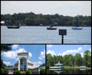
Fruit Cove is a census-designated place (CDP) in St. Johns County, Florida, United States. It is located in the community of St. Johns. The population was 32,143 at the 2020 census.

<span class="mw-page-title-main">Spring Creek, Nevada</span> CDP in Nevada, United States

Spring Creek is a census-designated place (CDP) in central Elko County, in northeastern Nevada in the western United States. It mainly serves as a bedroom community for the businesses and industries in and around the nearby city of Elko. It is part of the Elko Micropolitan Statistical Area. The population was 12,361 at the 2010 census.

<span class="mw-page-title-main">Hunter, Tennessee</span> CDP in Tennessee, United States

Hunter is a census-designated place (CDP) and unincorporated community located northeast of Elizabethton in Carter County, Tennessee, along Tennessee State Route 91 and the Watauga River. Its population was 1,854 as of the 2010 census. It is part of the Johnson City Metropolitan Statistical Area, which is a component of the Johnson City-Kingsport-Bristol, TN-VA Combined Statistical Area – commonly known as the "Tri-Cities" region. Hunter is a suburb of Elizabethton.

<span class="mw-page-title-main">Baileyton, Tennessee</span> Town in Tennessee, United States

Baileyton is a town in northern Greene County, Tennessee, United States. The population was 431 at the 2010 census, down from 504 at the 2000 census. Baileyton is located 13 miles (21 km) north of Greeneville and 18 miles (29 km) southeast of Rogersville.

<span class="mw-page-title-main">Mosheim, Tennessee</span> Town in Tennessee, United States

Mosheim is a town in Greene County, Tennessee, United States. The population was 2,479 at the 2020 census.

<span class="mw-page-title-main">Tusculum, Tennessee</span> City in Tennessee, United States

Tusculum is a city in Greene County, Tennessee, United States. The population was 3,298 at the 2020 census. It is the site of Tusculum University, the oldest university in Tennessee and the 28th oldest in the United States. Tusculum is a suburb of nearby Greeneville. The population of both Greeneville and Tusculum combined was approximately 18,777 at the 2020 census.

<span class="mw-page-title-main">Blountville, Tennessee</span> CDP in Tennessee, United States

Blountville is a census-designated place (CDP) in and the county seat of Sullivan County, Tennessee. The population was 3,074 at the 2010 census and 3,120 at the 2020 census. It is the only Tennessee county seat not to be an incorporated city or town.

Colonial Heights is a census-designated place (CDP) in Sullivan County, Tennessee, United States. It is located within the city of Kingsport.

Gray is a census-designated place (CDP) in Washington County, Tennessee, United States and a suburb of Johnson City. It is part of the Johnson City Metropolitan Statistical Area, which is a component of the Johnson City–Kingsport–Bristol, TN-VA Combined Statistical Area – commonly known as the "Tri-Cities" region. The population was 1,222 at the 2010 census.
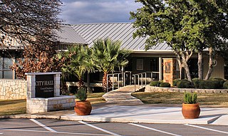
<span class="mw-page-title-main">Brushy Creek, Williamson County, Texas</span> CDP in Texas, United States

Brushy Creek is a census-designated place (CDP) in Williamson County, Texas, United States. The population was 22,519 at the 2020 census.

<span class="mw-page-title-main">Parkland, Washington</span> Census-designated place in Washington, United States

Parkland is a census-designated place (CDP) in Pierce County, Washington. The population was 35,803 at the time of the 2010 census and had grown to 38,623 as of the 2020 census. It is an unincorporated suburb of the city of Tacoma and is home to Pacific Lutheran University.

<span class="mw-page-title-main">Harts, West Virginia</span> Census-designated place in West Virginia, United States

Harts is a census-designated place (CDP) at the mouth of Big Harts Creek in Lincoln County, West Virginia, United States, situated along the Guyandotte River. As of the 2010 census, its population was 656. Harts is a part of the Huntington-Ashland, WV-KY-OH, Metropolitan Statistical Area (MSA). The Harts CDP includes the unincorporated communities of Harts, Atenville, Ferrellsburg, and Sand Creek.

<span class="mw-page-title-main">Seymour, Tennessee</span> CDP in Tennessee, United States

Seymour is a census-designated place (CDP) and unincorporated community in Blount and Sevier counties in the U.S. state of Tennessee. The CDP population was 14,705 at the 2020 U.S. census. It is included in the Knoxville, Tennessee Metropolitan Statistical Area.

<span class="mw-page-title-main">Horseshoe Bay, Texas</span> City in Texas, United States

Horseshoe Bay is a city in Llano and Burnet counties in the U.S. state of Texas.

<span class="mw-page-title-main">Tri-Cities, Tennessee</span> Region in East Tennessee

The Tri-Cities is the region comprising the cities of Kingsport, Johnson City, and Bristol and the surrounding smaller towns and communities in Northeast Tennessee and Southwest Virginia. They are commonly included in what is known as the Mountain Empire, which spans a portion of southwest Virginia and the mountainous counties in northeastern Tennessee. All three cities are located in Northeast Tennessee, while Bristol has a twin city of the same name in Virginia.
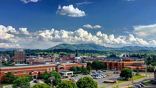
<span class="mw-page-title-main">Spring Arbor, Michigan</span> Census-designated place & unincorporated community in Michigan, United States

Spring Arbor is an unincorporated community and census-designated place (CDP) in Jackson County in the U.S. state of Michigan. The population of the CDP was 2,881 at the 2010 census, up from 2,188 at the 2000 census. The CDP is located within Spring Arbor Township.

References

  1. 1 2 3 4 5 "History of Fall Branch," Fall Branch Historical Society website. Retrieved: July 25, 2015.
  2. "ArcGIS REST Services Directory". United States Census Bureau. Retrieved October 15, 2022.
  3. 1 2 3 "Fall Branch Census Designated Place". Geographic Names Information System . United States Geological Survey . Retrieved November 6, 2020.
  4. "Census Population API". United States Census Bureau. Retrieved October 15, 2022.
  5. 1 2 "U.S. Census website". United States Census Bureau . Retrieved January 31, 2008.
  6. 1 2 3 "Geographic Identifiers: 2010 Demographic Profile Data (G001): Fall Branch CDP, Tennessee". American Factfinder. U.S. Census Bureau. Retrieved February 23, 2017.[ dead link ]
  7. Bob Cox, "A History Mystery: What Happened to Powell County? Archived 2017-02-24 at the Wayback Machine ," Johnson City Press, August 19, 2013.
  8. Bob Cox, "History Mystery: More Specifics about What Happened to Powell County Archived 2021-05-11 at the Wayback Machine ," Bob Cox's Yesteryear, September 23, 2013.
  9. Andrew Johnson, LeRoy P. Graf (ed.), Ralph Haskins (ed.), "Letter to John Young, March 10, 1840," Letters of Andrew Johnson, Vol. 1 (University of Tennessee Press, 1967), p. 26.
  10. John Moore, Reports of Cases At Law and In Equity Argued and Determined in the Supreme Court of the State of Arkansas , Volumes 28 and 29 (Pilot Printing, 1894), no. 384.
  11. "US Gazetteer files: 2010, 2000, and 1990". United States Census Bureau. February 12, 2011. Retrieved April 23, 2011.
  12. Tom Dunigan, "Fall Branch Falls," Tennessee Landforms. Accessed: July 25, 2015.
  13. U.S. Geological Survey Geographic Names Information System: Fulwiler Hill
  14. "Census of Population and Housing". Census.gov. Retrieved June 4, 2016.
  15. "Freshman Sensation: East Tennessee native Lawrence leads Clemson to playoff". Johnson City Press. December 4, 2018. Retrieved November 6, 2020.