Mosheim, Tennessee

Last updated

Mosheim
Mosheim-Town-Hall-tn1.jpg
Mosheim Town Hall
Greene County Tennessee Incorporated and Unincorporated areas Mosheim Highlighted 4750320.svg
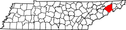
Location of Mosheim in Greene County, Tennessee.
Coordinates: 36°11′44″N82°57′57″W / 36.19556°N 82.96583°W / 36.19556; -82.96583
Country United States
State Tennessee
County Greene
Settledca. 1800
Incorporated1974 [1]
Named for Johann Lorenz von Mosheim
Government
  MayorDavid Myers
  Aldermen [2]
List of Aldermen
Area
[3]
  Total6.27 sq mi (16.24 km2)
  Land6.27 sq mi (16.24 km2)
  Water0.00 sq mi (0.00 km2)
Elevation
[4]
1,378 ft (420 m)
Population
 (2020) [5]
  Total2,479
  Density395.37/sq mi (152.65/km2)
Time zone UTC-5 (Eastern (EST))
  Summer (DST) UTC-4 (EDT)
ZIP code
37571, 37743 and 37818
Area code 423
FIPS code 47-50320 [6]
GNIS feature ID2406200 [4]
Website http://www.mosheim-tn.org

Mosheim (pronounced Moss-hime) is a town in Greene County, Tennessee, United States. The population was 2,479 at the 2020 census. [7]

Contents

History

Mosheim (also pronounced "MOSS-eyem" without the "h" sound) originally called "Blue Springs" after a spring that flows through the town, was settled circa 1800. Many of its initial settlers were German Lutherans. [8] In 1872, the Lutherans established a local college at Blue Springs known as Mosheim Institute, after the German theologian, Johann Lorenz von Mosheim (16931755). That same year, the name of the town was officially changed to "Mosheim", after the college. [8]

The Civil War Battle of Blue Springs was fought near Mosheim on October 10, 1863. The town of Mosheim held reenactments of this battle every year from 1991 until 2008, but ceased performing the reenactment due to financial obligations. [9] Several participants of the East Tennessee bridge-burning conspiracy, including noted potter Alex Haun, hailed from a community known as "Pottertown," which was located just outside Mosheim.

The original Mosheim Volunteer Fire Department station 2700 is the oldest fire department in Greene County being chartered in 1961.[ citation needed ] In 1998, the Mosheim Volunteer Fire Department station 2700 split into two separate departments. With this major split happening the birth of the Town of Mosheim Volunteer Fire Department station 1100 was on the rise. The new department has a total of five fire apparatuses which are used to serve and protect inside the city limits of the Town Of Mosheim.

Geography

Mosheim is situated along the base and southern slopes of Big Ridge, an elongate ridge that runs roughly parallel to U.S. Route 11E. This area lies within the headwaters of Mosheim Branch, a tributary of Little Chucky Creek. U.S. Route 11E, known locally as Andrew Johnson Highway, connects Mosheim with Interstate 81 and Bulls Gap to the northwest, and Greeneville to the southeast. Tennessee State Route 348 connects Mosheim with Midway and the rural parts of western Greene County.

According to the United States Census Bureau, the town has a total area of 6.1 square miles (15.9 km2), all land. [10]

Demographics

Historical population
CensusPop.Note
1980 1,539
1990 1,451−5.7%
2000 1,74920.5%
2010 2,36235.0%
2020 2,4795.0%
Sources: [11] [12] [5]

2020 census

Mosheim racial composition [13]
RaceNumberPercentage
White (non-Hispanic)2,25290.84%
Black or African American (non-Hispanic)281.13%
Native American 70.28%
Asian 70.28%
Pacific Islander 10.04%
Other/Mixed 1084.36%
Hispanic or Latino 763.07%

As of the 2020 United States census, there were 2,479 people, 949 households, and 607 families residing in the town.

2000 census

As of the census [6] of 2000, there were 1,749 people, 742 households, and 532 families residing in the town. The population density was 413.0 inhabitants per square mile (159.5/km2). There were 805 housing units at an average density of 190.1 per square mile (73.4/km2). The racial makeup of the town was 98.80% White, 0.46% African American, 0.11% Asian, and 0.63% from two or more races. Hispanic or Latino of any race were 0.11% of the population.

There were 742 households, out of which 28.8% had children under the age of 18 living with them, 57.8% were married couples living together, 10.1% had a female householder with no husband present, and 28.3% were non-families. 25.1% of all households were made up of individuals, and 10.0% had someone living alone who was 65 years of age or older. The average household size was 2.36 and the average family size was 2.78.

In the town, the population was spread out, with 20.8% under the age of 18, 6.9% from 18 to 24, 28.8% from 25 to 44, 28.3% from 45 to 64, and 15.2% who were 65 years of age or older. The median age was 41 years. For every 100 females, there were 92.8 males. For every 100 females age 18 and over, there were 90.2 males.

The median income for a household in the town was $29,194, and the median income for a family was $36,118. Males had a median income of $26,211 versus $19,479 for females. The per capita income for the town was $16,243. About 5.7% of families and 8.8% of the population were below the poverty line, including 6.5% of those under age 18 and 19.0% of those age 65 or over.

Postal service

Mosheim shares a post office with nearby community, Midway. The post office is located at 9280 West Andrew Johnson Highway in the Mosheim town limits at the corner of Main Street and US Route 11E.

Mosheim's zip code is 37818, although portions of the town limits are located in zip codes 37711 (areas around I-81, exit 23), 37743 (Eastern portions of the town), and Midway's zip code 37809.

Utilities

Water and sewage in Mosheim is provided by the Town of Mosheim Water Department and Old Knoxville Highway Utility District. Electricity is provided by Greeneville Light and Power System (GLPS).

Economy

Several factories are located in and near Mosheim, including a Walmart distribution center, Brenntag Mid-South. Minco Fused Silica Solutions of the World was located in nearby Midway, until 3M purchased the plant and now operates as 3M. Mosheim has one grocery store, Food Country USA. Several restaurants, gas stations and hotels are located at the Mosheim exit of Interstate 81, Exit 23.

Since 1986, Mosheim has hosted an annual festival in early June known as "Mosheim FunDays." The festival includes pageants, food and crafts booths, music, games, and a car show. [14]

Volunteer Speedway is located in the western portion of the town at Interstate 81, exit 23.

Education

There are three public schools in Mosheim, operated by Greene County Schools:

Western portions of Mosheim city limits are zoned to McDonald Elementary School in nearby Mohawk.

Recreation

Public Parks in Mosheim:

Related Research Articles

<span class="mw-page-title-main">Washington County, Tennessee</span> County in Tennessee, United States

Washington County is a county located in the U.S. state of Tennessee. As of the 2020 census, the population was 133,001. Its county seat is Jonesborough. The county's largest city and a regional educational, medical and commercial center is Johnson City. Washington County is Tennessee's oldest county, having been established in 1777 when the state was still part of North Carolina. Washington County is part of the Johnson City, TN Metropolitan Statistical Area, which is a component of the Johnson City–Kingsport–Bristol, TN-VA Combined Statistical Area, commonly known as the "Tri-Cities" region.

<span class="mw-page-title-main">Johnson County, Tennessee</span> County in Tennessee, United States

Johnson County is a county located in the U.S. state of Tennessee. As of the 2020 census, the population was 17,948. Its county seat is Mountain City. It is the state's northeasternmost county, sharing borders with Virginia and North Carolina.

<span class="mw-page-title-main">Hawkins County, Tennessee</span> County in Tennessee, United States

Hawkins County is a county located in the U.S. state of Tennessee. As of the 2020 census, the population was 56,721. Its county seat is Rogersville, Hawkins County is part of the Metropolitan Statistical Area, which is a component of the Johnson City-Kingsport-Bristol, TN-VA Combined Statistical Area, commonly known as the "Tri-Cities" region.

<span class="mw-page-title-main">Greene County, Tennessee</span> County in Tennessee, United States

Greene County is a county located on the eastern border of the U.S. state of Tennessee. As of the 2020 census, the population was 70,152. Its county seat is Greeneville. Greene County comprises the Greeneville, TN Micropolitan Statistical Area.

<span class="mw-page-title-main">Murray County, Georgia</span> County in Georgia, United States

Murray County is a county located in the northwestern part of the U.S. state of Georgia. As of the 2020 census, the population was 39,973. The county seat is Chatsworth.

<span class="mw-page-title-main">Crescent Township, Pennsylvania</span> Township in Pennsylvania, United States

Crescent Township is a township in Allegheny County, Pennsylvania, United States, and is part of the Pittsburgh Metro Area. The population was 2,479 at the 2020 census.

<span class="mw-page-title-main">Parrottsville, Tennessee</span> Town in Tennessee, United States

Parrottsville is a town in Cocke County, Tennessee, United States. The population was 263 at the 2010 census.

<span class="mw-page-title-main">Dickson, Tennessee</span> City in Tennessee, United States

Dickson is a city in the U.S. state of Tennessee. Located in Dickson County. It is part of the Nashville metropolitan area. As of the 2020 census, Dickson's population was 16,058.

<span class="mw-page-title-main">Baileyton, Tennessee</span> Town in Tennessee, United States

Baileyton is a town in northern Greene County, Tennessee, United States. The population was 431 at the 2010 census, down from 504 at the 2000 census. Baileyton is located 13 miles (21 km) north of Greeneville and 18 miles (29 km) southeast of Rogersville.

<span class="mw-page-title-main">Greeneville, Tennessee</span> County seat of Greene County, Tennessee, United States

Greeneville is a town in and the county seat of Greene County, Tennessee, United States. The population as of the 2020 census was 15,479. The town was named in honor of Revolutionary War hero Nathanael Greene, and it is the second oldest town in Tennessee. It is the only town with this spelling in the United States, although there are numerous U.S. towns named Greenville. The town was the capital of the short-lived State of Franklin in the 18th-century history of East Tennessee.

<span class="mw-page-title-main">Tusculum, Tennessee</span> City in Tennessee, United States

Tusculum is a city in Greene County, Tennessee, United States. The population was 3,298 at the 2020 census. It is the site of Tusculum University, the oldest university in Tennessee and the 28th oldest in the United States. Tusculum is a suburb of nearby Greeneville. The population of both Greeneville and Tusculum combined was approximately 18,777 at the 2020 census.

<span class="mw-page-title-main">Walden, Tennessee</span> Town in Tennessee, United States

Walden is a town located in Hamilton County, Tennessee, United States. The population was 1,981 at the 2020 census and up from 1,898 at the 2010 census. It is part of the Chattanooga, Tennessee–Georgia Metropolitan Statistical Area.

<span class="mw-page-title-main">Bulls Gap, Tennessee</span> Town in Tennessee, United States

Bulls Gap is a town in Hawkins County, Tennessee, United States. The population was 756 at the 2020 census. It is part of the Metropolitan Statistical Area, which is a component of the Johnson City-Kingsport-Bristol, TN-VA Combined Statistical Area – commonly known as the "Tri-Cities" region.

Bluff City is a city in Sullivan County, Tennessee. The population was 1,733 at the 2010 census. It is part of the Kingsport-Bristol-Bristol, TN-VA Metropolitan Statistical Area, which is a component of the Johnson City-Kingsport-Bristol, TN-VA Combined Statistical Area, commonly known as the "Tri-Cities" region.

<span class="mw-page-title-main">Jonesborough, Tennessee</span> Oldest town in Tennessee, United States

Jonesborough is a town in, and the county seat of, Washington County, Tennessee, in the Southeastern United States. Its population was 5,860 as of 2020. It is "Tennessee's oldest town".

Midway is an unincorporated community and former census-designated place (CDP) in Washington County, Tennessee. The population was 2,491 at the 2000 census; it was not counted at the 2010 census. It is part of the Johnson City Metropolitan Statistical Area, which is a component of the Johnson City-Kingsport-Bristol, TN-VA Combined Statistical Area – commonly known as the "Tri-Cities" region.

<span class="mw-page-title-main">Fall Branch, Tennessee</span> CDP in Tennessee, United States

Fall Branch is a census-designated place (CDP) in Washington and Greene counties in the U.S. state of Tennessee. The population was 1,291 at the 2010 census. Some areas in Sullivan also use the Fall Branch ZIP code.

<span class="mw-page-title-main">Tri-Cities, Tennessee</span> Region in East Tennessee

The Tri-Cities is the region comprising the cities of Kingsport, Johnson City, and Bristol and the surrounding smaller towns and communities in Northeast Tennessee and Southwest Virginia. All three cities are located in Northeast Tennessee, while Bristol has a twin city of the same name in Virginia.

<span class="mw-page-title-main">U.S. Route 11E</span> Suffixed U.S. Highway in Tennessee and Virginia in the United States

U.S. Route 11E (US 11E) is a divided highway of US 11 in the U.S. states of Tennessee and Virginia. The United States Numbered Highway, which is complemented by US 11W to the north and west, runs 120.94 miles (194.63 km) from US 11, US 11W, and US 70 in Knoxville, Tennessee, north and east to US 11, US 11W, US 19, and US 421 in Bristol, Virginia. US 11E connects Knoxville and the twin cities of Bristol, Virginia, and Bristol, Tennessee, with the East Tennessee communities of Morristown, Greeneville, and Johnson City. The U.S. Highway runs concurrently with US 70 and US 25W east of Knoxville, US 321 from Greeneville and Johnson City, and both US 19W and US 19 between Johnson City and Bristol. US 11E also has an unsigned concurrency with State Route 34 (SR 34) for almost all of its course in Tennessee.

<span class="mw-page-title-main">Midway, Greene County, Tennessee</span> Unincorporated community in Tennessee, United States

Midway is an unincorporated community in Greene County, Tennessee. Midway is located on Tennessee State Route 348 2.3 miles (3.7 km) west-southwest of Mosheim.

References

  1. Tennessee Blue Book , 2005-2006, pp. 618-625.
  2. "Mosheim Alderman R.L. 'Tom' Carpenter Resigns".
  3. "ArcGIS REST Services Directory". United States Census Bureau. Retrieved October 15, 2022.
  4. 1 2 U.S. Geological Survey Geographic Names Information System: Mosheim, Tennessee
  5. 1 2 "Census Population API". United States Census Bureau. Retrieved October 15, 2022.
  6. 1 2 "U.S. Census website". United States Census Bureau . Retrieved January 31, 2008.
  7. "Profile of General Population and Housing Characteristics: 2010 Demographic Profile Data (DP-1): Mosheim town, Tennessee". United States Census Bureau . Retrieved August 3, 2012.
  8. 1 2 Jim Matheny, "Why Do They Call It That: Mosheim in Greene County," WBIR.COM, July 29, 2011. Retrieved: July 29, 2011.
  9. "'Battle Of Blue Springs' Group Plans 'One Last Hoozah'". Greeneville Sun. May 19, 2010. Retrieved March 1, 2011.
  10. "Geographic Identifiers: 2010 Demographic Profile Data (G001): Mosheim town, Tennessee". United States Census Bureau . Retrieved August 3, 2012.
  11. "Census of Population and Housing: Decennial Censuses". United States Census Bureau . Retrieved March 4, 2012.
  12. "Incorporated Places and Minor Civil Divisions Datasets: Subcounty Resident Population Estimates: April 1, 2010 to July 1, 2012". Population Estimates. U.S. Census Bureau. Archived from the original on June 11, 2013. Retrieved December 11, 2013.
  13. "Explore Census Data". data.census.gov. Retrieved December 27, 2021.
  14. Mosheim FunDays 2015," Town of Mosheim official website. Accessed: June 3, 2015.