Bulls Gap, Tennessee

Last updated • 3 min readFrom Wikipedia, The Free Encyclopedia

Bulls Gap
BullsGapTNMainStreet.jpg
Several buildings in the old section of Bulls Gap
Hawkins County Tennessee Incorporated and Unincorporated areas Bulls Gap Highlighted 4709560.svg
Location in Hawkins County, Tennessee
USA Tennessee location map.svg
Red pog.svg
Bulls Gap
Usa edcp location map.svg
Red pog.svg
Bulls Gap
Coordinates: 36°15′33″N83°4′46″W / 36.25917°N 83.07944°W / 36.25917; -83.07944
Country United States
State Tennessee
County Hawkins
Settled1792 [1]
Incorporated1955 [2]
Named for John Bull (early settler) [3]
Government
  TypeBoard of Mayor and Aldermen
  MayorStacy Hayes
  Vice MayorJimmy Riley
  Aldermen
List of Aldermen
Area
[4]
  Total1.22 sq mi (3.16 km2)
  Land1.22 sq mi (3.16 km2)
  Water0.00 sq mi (0.00 km2)
Elevation
1,181 ft (360 m)
Population
 (2020) [5]
  Total756
  Density620.69/sq mi (239.61/km2)
Time zone UTC-5 (Eastern (EST))
  Summer (DST) UTC-4 (EDT)
ZIP code
37711
Area code 423
FIPS code 47-09560 [6]
GNIS feature ID1269404 [7]

Bulls Gap is a town in Hawkins County, Tennessee, United States. The population was 756 at the 2020 census. It is part of the Metropolitan Statistical Area, which is a component of the Johnson City-Kingsport-Bristol, TN-VA Combined Statistical Area commonly known as the "Tri-Cities" region.

Contents

The downtown area is listed on the National Register of Historic Places as the Bulls Gap Historic District.

The town was named for the famous gunsmith, John Bull, who made his home in the gap of mountains. [8]

Geography

Bulls Gap is located at 36°15′33″N83°4′46″W / 36.25917°N 83.07944°W / 36.25917; -83.07944 (36.259094, -83.079507). [9]

According to the United States Census Bureau, the town has a total area of 1.2 square miles (3.1 km2), all of it land.

History

Bulls Gap after being renamed "Rogersville Junction," circa 1882 Bulls Gap circa 1882.jpg
Bulls Gap after being renamed "Rogersville Junction," circa 1882

In November 1864, a small Civil War battle was fought here. The Battle of Bull's Gap was a Confederate victory, with John C. Breckinridge the victorious general.

Demographics

Historical population
CensusPop.Note
1960 682
1970 77413.5%
1980 8216.1%
1990 659−19.7%
2000 7148.3%
2010 7383.4%
2020 7562.4%
Sources: [10] [11] [5]

2020 census

Bulls Gap racial composition [12]
RaceNumberPercentage
White (non-Hispanic)70593.25%
Black or African American (non-Hispanic)30.4%
Asian 20.26%
Other/Mixed 354.63%
Hispanic or Latino 111.46%

As of the 2020 United States census, there were 756 people, 352 households, and 222 families residing in the town.

2000 census

As of the census [6] of 2000, there were 714 people, 319 households, and 210 families residing in the town. The population density was 570.6 inhabitants per square mile (220.3/km2). There were 348 housing units at an average density of 278.1 per square mile (107.4/km2). The racial makeup of the town was 99.02% White, 0.70% African American, and 0.28% from two or more races.

There were 319 households, out of which 27.9% had children under the age of 18 living with them, 49.8% were married couples living together, 13.8% had a female householder with no husband present, and 33.9% were non-families. 30.7% of all households were made up of individuals, and 16.3% had someone living alone who was 65 years of age or older. The average household size was 2.24 and the average family size was 2.81.

In the town, the population was spread out, with 22.5% under the age of 18, 6.4% from 18 to 24, 24.9% from 25 to 44, 28.4% from 45 to 64, and 17.6% who were 65 years of age or older. The median age was 42 years. For every 100 females, there were 85.0 males. For every 100 females age 18 and over, there were 76.1 males.

The median income for a household in the town was $25,074, and the median income for a family was $28,917. Males had a median income of $29,306 versus $21,500 for females. The per capita income for the town was $14,822. About 23.9% of families and 22.2% of the population were below the poverty line, including 31.9% of those under age 18 and 17.1% of those age 65 or over.

Notable people

Legendary country comedian Archie Campbell, who regularly performed at the Grand Ole Opry and starred in the television show Hee Haw, was a native of Bulls Gap. Campbell referred to the town in many of his classic comedy routines. His house has been preserved as a museum and tourist attraction, and U.S. Route 11E through Bulls Gap was renamed "Archie Campbell Highway" following his death in 1987. Every Labor Day weekend the town has an annual three-day celebration honoring Campbell with a car show, food and live music.

American Southern Gospel Singer Kirk Talley grew up in Bulls Gap

New York Times best selling author Amy Greene grew up in the vicinity of Bulls Gap. [13]

In Cormac McCarthy's novel Child of God , Lester Ballard murders a young couple in their car, gets in the car, turns on the radio, and listens to the radio host talk about an upcoming event at Bulls Gap School. [14]

George Washington Harris' short story, "Sut Lovingood at Bull's Gap," is set in Bulls Gap.

Sports

Bulls Gap is home to Volunteer Speedway, a dirt racetrack, that is billed as the "World's Fastest Dirt Track." [15]

Education

Schools serving Bulls Gap are a part of the Hawkins County School System, they include:

Postal service

Bulls Gap has a Post Office located on US Route 11E, with the ZIP Code 37711. It serves portions of Greene, Hawkins and Hamblen counties.

Related Research Articles

<span class="mw-page-title-main">Hawkins County, Tennessee</span> County in Tennessee, United States

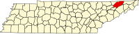
Hawkins County is a county located in the U.S. state of Tennessee. As of the 2020 census, the population was 56,721. Its county seat is Rogersville, Hawkins County is part of the Metropolitan Statistical Area, which is a component of the Johnson City-Kingsport-Bristol, TN-VA Combined Statistical Area, commonly known as the "Tri-Cities" region.

<span class="mw-page-title-main">Hancock County, Tennessee</span> County in Tennessee, United States

Hancock County is a county located in the northeastern part of the U.S. state of Tennessee. As of the 2020 census, the population was 6,662, making it the fourth-least populous county in Tennessee. Its county seat is Sneedville.

<span class="mw-page-title-main">Greene County, Tennessee</span> County in Tennessee, United States

Greene County is a county located on the eastern border of the U.S. state of Tennessee. As of the 2020 census, the population was 70,152. Its county seat is Greeneville. Greene County comprises the Greeneville, TN Micropolitan Statistical Area.

<span class="mw-page-title-main">Rogersville, Alabama</span> Town in Alabama, United States

Rogersville is a town in Lauderdale County, Alabama, United States. As of the 2018 census, the population of the town is 1,231, up from 1,199 in 2000.

<span class="mw-page-title-main">Grayville, Illinois</span> City in Illinois, United States

Grayville is a city in Edwards and White counties in the U.S. state of Illinois. As of the 2020 census, the city's population was 1,550, down from 1,666 at the 2010 census. Grayville is the birthplace of naval hero James Meredith Helm.

<span class="mw-page-title-main">Fairland, Maryland</span> Census-designated place in Maryland, United States

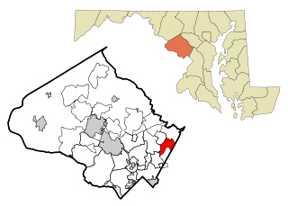
Fairland is a census-designated place and an unincorporated area in Montgomery County, Maryland, United States. It had a population of 25,396 per the 2020 census.

<span class="mw-page-title-main">Brant Township, Michigan</span> Civil township in Michigan, United States

Brant Township is a civil township of Saginaw County in the U.S. state of Michigan. As of the 2010 Census, the township population was 2,012.

<span class="mw-page-title-main">Hitterdal, Minnesota</span> City in Minnesota, United States

Hitterdal is a city in Clay County, Minnesota, United States. The population was 199 at the 2020 census.

<span class="mw-page-title-main">Newtown Grant, Pennsylvania</span> Census-designated place in Pennsylvania, United States

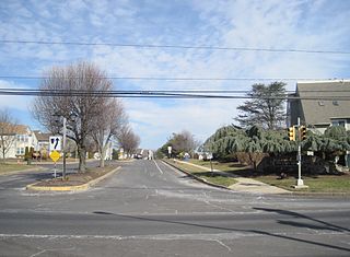
Newtown Grant is a census-designated place (CDP) in Bucks County, Pennsylvania, United States. The population was 3,620 at the 2010 census.

<span class="mw-page-title-main">Cumberland Gap, Tennessee</span> Town in Claiborne County, Tennessee, United States

Cumberland Gap is a town in Claiborne County, Tennessee, United States. Its population was 494 at the 2010 census, and estimated to be 490 in 2019. The town is located below the Cumberland Gap, a historic mountain pass for which is the town's namesake, and inside of the boundaries of Cumberland Gap National Historical Park.

<span class="mw-page-title-main">Baileyton, Tennessee</span> Town in Tennessee, United States

Baileyton is a town in northern Greene County, Tennessee, United States. The population was 431 at the 2010 census, down from 504 at the 2000 census. Baileyton is located 13 miles (21 km) north of Greeneville and 18 miles (29 km) southeast of Rogersville.

<span class="mw-page-title-main">Mosheim, Tennessee</span> Town in Tennessee, United States

Mosheim is a town in Greene County, Tennessee, United States. The population was 2,479 at the 2020 census.

<span class="mw-page-title-main">Church Hill, Tennessee</span> City in Tennessee, United States

Church Hill is a city in Hawkins County, Tennessee, United States. The population was 6,998 at the 2020 census and 6,737 at the 2010 census. It is part of the Kingsport-Bristol-Bristol, TN-VA Metropolitan Statistical Area, which is a component of the "Tri-Cities" region. It is the largest municipality located entirely within Hawkins County.

<span class="mw-page-title-main">Rogersville, Tennessee</span> Town in the United States

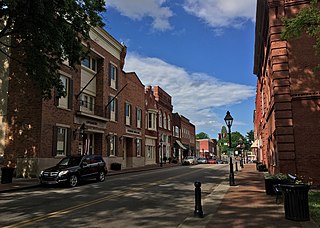
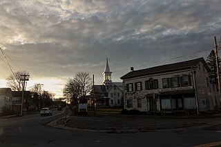
Rogersville is a town in, and the county seat of, Hawkins County, Tennessee, United States. It was settled in 1775 by the grandparents of Davy Crockett. It is named for its founder, Joseph Rogers. Tennessee's second oldest courthouse, the Hawkins County Courthouse, first newspaper The Knoxville Gazette, and first post office are all located in Rogersville. The Rogersville Historic District is listed on the National Register of Historic Places.

<span class="mw-page-title-main">Surgoinsville, Tennessee</span> Town in Tennessee, United States

Surgoinsville is a town in Hawkins County, Tennessee, United States. The 2020 census showed a population of 1,882, an increase over the figure of 1,801 tabulated in 2010. It is part of the Kingsport–Bristol (TN)–Bristol (VA) Metropolitan Statistical Area, which is a component of the Johnson City–Kingsport–Bristol, TN-VA Combined Statistical Area – commonly known as the "Tri-Cities" region.

<span class="mw-page-title-main">Pennington Gap, Virginia</span> Town in Virginia, United States

Pennington Gap is a town in Lee County, Virginia, United States. The population was 1,624 at the 2020 census.

<span class="mw-page-title-main">Belmont, West Virginia</span> Town in West Virginia, United States

Belmont is a town in Pleasants County, West Virginia, United States. It is part of the Parkersburg–Vienna metropolitan area. The population was 872 at the 2020 census. Belmont was incorporated on April 19, 1946 by the Circuit Court of Pleasants County. The city was named for the beautiful hills in the area.

<span class="mw-page-title-main">Scott Township, Allegheny County, Pennsylvania</span> CDP and Township in Pennsylvania, United States

Scott Township is a township in Allegheny County, Pennsylvania, United States. The population was 17,024 at the 2010 census.

<span class="mw-page-title-main">Esperance (village), New York</span> Village in New York, United States

Esperance is a village in Schoharie County, New York, United States. The population was 345 at the 2010 census. The village was given the French name for "hope."

<span class="mw-page-title-main">Tri-Cities, Tennessee</span> Region in East Tennessee

The Tri-Cities is the region comprising the cities of Kingsport, Johnson City, and Bristol and the surrounding smaller towns and communities in Northeast Tennessee and Southwest Virginia. All three cities are located in Northeast Tennessee, while Bristol has a twin city of the same name in Virginia.

References

  1. Bulls Gap official website Archived March 19, 2020, at the Wayback Machine . Retrieved: January 17, 2013.
  2. Tennessee Blue Book , 2005-2006, pp. 618-625.
  3. Larry Miller, Tennessee Place Names (Indiana University Press, 2001), p. 33.
  4. "ArcGIS REST Services Directory". United States Census Bureau. Retrieved October 15, 2022.
  5. 1 2 "Census Population API". United States Census Bureau. Retrieved October 15, 2022.
  6. 1 2 "U.S. Census website". United States Census Bureau . Retrieved January 31, 2008.
  7. "US Board on Geographic Names". United States Geological Survey. October 25, 2007. Retrieved January 31, 2008.
  8. Rogersville Chamber of Commerce. "Bulls Gap". Rogersville Chamber of Commerce. Rogersville Chamber of Commerce. Archived from the original on January 20, 2016. Retrieved January 12, 2016.
  9. "US Gazetteer files: 2010, 2000, and 1990". United States Census Bureau. February 12, 2011. Retrieved April 23, 2011.
  10. "Census of Population and Housing: Decennial Censuses". United States Census Bureau . Retrieved March 4, 2012.
  11. "Incorporated Places and Minor Civil Divisions Datasets: Subcounty Resident Population Estimates: April 1, 2010 to July 1, 2012". Population Estimates. U.S. Census Bureau. Archived from the original on June 11, 2013. Retrieved December 11, 2013.
  12. "Explore Census Data". data.census.gov. Retrieved December 27, 2021.
  13. Brosi, George (October 20, 2013). "Amy Greene: A Literary Phenomenon". Appalachian Heritage. 41 (4): 12–16. doi:10.1353/aph.2013.0118. ISSN   1940-5081.
  14. McCarthy, Cormac (August 11, 2010). Child of God. Knopf Doubleday Publishing Group. ISBN   9780307762481.
  15. "History « Volunteer Speedway". volunteerspeedway.com. Retrieved August 26, 2018.

36°15′33″N83°04′46″W / 36.259094°N 83.079507°W / 36.259094; -83.079507