Telford, Tennessee

Last updated

Telford
CDP
Telford-Tennessee-tn1.jpg
Buildings along Mill Street
USA Tennessee location map.svg
Red pog.svg
Telford
Coordinates: 36°14′56″N82°32′43″W / 36.24889°N 82.54528°W / 36.24889; -82.54528
Country United States
State Tennessee
County Washington
Area
[1]
  Total2.47 sq mi (6.39 km2)
  Land2.47 sq mi (6.39 km2)
  Water0.00 sq mi (0.00 km2)
Elevation
1,555 ft (474 m)
Population
 (2020) [2]
  Total909
  Density368.46/sq mi (142.25/km2)
Time zone UTC-5 (Eastern (EST))
  Summer (DST) UTC-4 (EDT)
ZIP code
37690 [3]
Area code 423
GNIS feature ID1304034 [4]

Telford is a census-designated place and unincorporated community in Washington County, Tennessee, located between Jonesborough and Limestone. As of the 2010 census, it had a population of 921. [5] The community is part of the Johnson City Metropolitan Statistical Area, which is a component of the Johnson City-Kingsport-Bristol, TN-VA Combined Statistical Area – commonly known as the "Tri-Cities" region. It has one school, Grandview Elementary.

Contents

Demographics

Historical population
CensusPop.Note
2020 909
U.S. Decennial Census [6]

History

The community was called Millwood in early times and continued so for many years. It was not until 1855, when Colonel George Whitfield Telford, a state senator who operated the Telford Manufacturing Company, donated about four acres of land to support local operations of the East Tennessee and Virginia Railroad, that the name Millwood was changed to Telford Depot. At a date sometime after 1876 the word "Depot" was discontinued and the single name Telford adopted. [7] [8]

During the Civil War, citizens of this part of Washington County voted to secede from the Confederacy, but they were unsuccessful in persuading others to do so. The independent nation called "Bricker's Republic" soon fell into relative obscurity. [9] A Civil War battle took place in Telford on September 8, 1863, when the 100th Ohio Infantry clashed with the Confederate-aligned Thomas' Legion just east of the depot. The Confederate force was supported by 4-Howitzer artillery unit commanded by General Alfred "Mudwall" Jackson.

Postal service

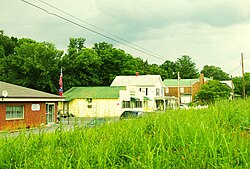
Telford has a post office and zip code. (37690) The post office is located at 1888 Old State Route 34, Telford, Tennessee 37690.

Notable people

Related Research Articles

<span class="mw-page-title-main">Washington County, Tennessee</span> County in Tennessee, United States

Washington County is a county located in the U.S. state of Tennessee. As of the 2020 census, the population was 133,001. Its county seat is Jonesborough. The county's largest city and a regional educational, medical and commercial center is Johnson City. Washington County is Tennessee's oldest county, having been established in 1777 when the state was still part of North Carolina. Washington County is part of the Johnson City, TN Metropolitan Statistical Area, which is a component of the Johnson City–Kingsport–Bristol, TN-VA Combined Statistical Area, commonly known as the "Tri-Cities" region.

<span class="mw-page-title-main">Carter County, Tennessee</span> County in Tennessee, United States

Carter County is a county located in the U.S. state of Tennessee. As of the 2020 census, the population was 56,356. Its county seat is Elizabethton. The county is named in honor of Landon Carter (1760-1800), an early settler active in the "Lost State of Franklin" 1784-1788 secession from the State of North Carolina. Carter County is part of the Johnson City, TN Metropolitan Statistical Area, which is a component of the Johnson City–Kingsport–Bristol, TN-VA Combined Statistical Area, located in northeastern Tennessee.

<span class="mw-page-title-main">Murray County, Georgia</span> County in Georgia, United States

Murray County is a county located in the northwestern part of the U.S. state of Georgia. As of the 2020 census, the population was 39,973. The county seat is Chatsworth.

<span class="mw-page-title-main">Greeneville, Tennessee</span> County seat of Greene County, Tennessee, United States

Greeneville is a town in and the county seat of Greene County, Tennessee, United States. The population as of the 2020 census was 15,479. The town was named in honor of Revolutionary War hero Nathanael Greene, and it is the second oldest town in Tennessee. It is the only town with this spelling in the United States, although there are numerous U.S. towns named Greenville. The town was the capital of the short-lived State of Franklin in the 18th-century history of East Tennessee.

<span class="mw-page-title-main">Bulls Gap, Tennessee</span> Town in Tennessee, United States

Bulls Gap is a town in Hawkins County, Tennessee, United States. The population was 756 at the 2020 census. It is part of the Metropolitan Statistical Area, which is a component of the Johnson City-Kingsport-Bristol, TN-VA Combined Statistical Area – commonly known as the "Tri-Cities" region.

<span class="mw-page-title-main">Blountville, Tennessee</span> CDP in Tennessee, United States

Blountville is a census-designated place (CDP) in and the county seat of Sullivan County, Tennessee. The population was 3,074 at the 2010 census and 3,120 at the 2020 census. It is the only Tennessee county seat not to be an incorporated city or town.

<span class="mw-page-title-main">Jonesborough, Tennessee</span> Oldest town in Tennessee, United States

Jonesborough is a town in, and the county seat of, Washington County, Tennessee, in the Southeastern United States. Its population was 5,860 as of 2020. It is "Tennessee's oldest town".

<span class="mw-page-title-main">Johnson City, Tennessee</span> City in Tennessee, United States

Johnson City is a city in Washington, Carter, and Sullivan counties in the U.S. state of Tennessee, mostly in Washington County. As of the 2020 United States census, the population was 71,046, making it the eighth largest city in Tennessee. Johnson City is the principal city of the Johnson City Metropolitan Statistical Area, which consists of Carter, Unicoi, and Washington counties and had a population of 207,285 as of 2020. The MSA is also a component of the Tri-Cities region. This CSA is the fifth-largest in Tennessee with a population of 514,899 as of 2020.

<span class="mw-page-title-main">Watauga, Tennessee</span> City in Tennessee, United States

Watauga is a city in Carter and Washington counties in the U.S. state of Tennessee. The population was 403 at the 2000 census, 458 at the 2010 census, 361 in the 2020 census. It is part of the Johnson City Metropolitan Statistical Area, which is a component of the Johnson City-Kingsport-Bristol, TN-VA Combined Statistical Area – commonly known as the "Tri-Cities" region.

<span class="mw-page-title-main">Fall Branch, Tennessee</span> CDP in Tennessee, United States

Fall Branch is a census-designated place (CDP) in Washington and Greene counties in the U.S. state of Tennessee. The population was 1,291 at the 2010 census. Some areas in Sullivan also use the Fall Branch ZIP code.

<span class="mw-page-title-main">Tri-Cities, Tennessee</span> Region in East Tennessee

The Tri-Cities is the region comprising the cities of Kingsport, Johnson City, and Bristol and the surrounding smaller towns and communities in Northeast Tennessee and Southwest Virginia. All three cities are located in Northeast Tennessee, while Bristol has a twin city of the same name in Virginia.

Tennessee's 1st congressional district is the congressional district of northeast Tennessee, including all of Carter, Cocke, Greene, Hamblen, Hancock, Hawkins, Johnson, Sullivan, Unicoi, Washington, and Sevier counties and parts of Jefferson County. It is largely coextensive with the Tennessee portion of the Tri-Cities region of northeast Tennessee and southwest Virginia. With a Cook Partisan Voting Index rating of R+30, it is the most Republican district in Tennessee.

<span class="mw-page-title-main">Jacks Creek, Tennessee</span> Unincorporated community in Tennessee, United States

Jacks Creek is an unincorporated community in Chester County, Tennessee, United States.

<span class="mw-page-title-main">Strawberry Plains, Tennessee</span> CDP in Tennessee, United States

Strawberry Plains is an unincorporated community and census-designated place (CDP) in Jefferson, Knox, and Sevier counties in the State of Tennessee, United States. Before 2010, it was treated by the United States Census Bureau as a census county division. It is included in both the Knoxville Metropolitan Statistical Area and the Morristown Metropolitan Statistical Area.

<span class="mw-page-title-main">Whiteside, Tennessee</span> Unincorporated community in Tennessee, United States

Whiteside is an unincorporated community in Marion County, Tennessee. It was originally settled as a Cherokee town in the late eighteenth century.

The Johnson City Metropolitan Statistical Area, as defined by the United States Census Bureau, is an area consisting of three counties in East Tennessee, anchored by the city of Johnson City. As of the 2020 census, the MSA had a population of 207,285.

<span class="mw-page-title-main">Flintville, Tennessee</span> Unincorporated community in Lincoln County, Tennessee

Flintville is an unincorporated community in Lincoln County, Tennessee, United States. As of the 2010 census, its population was 627. Flintville is located approximately 10.5 miles (16.9 km) southeast of Fayetteville along Tennessee State Route 275 highway.

<span class="mw-page-title-main">Pocahontas, Tennessee</span> Census-designated place in Tennessee, United States

Pocahontas is an unincorporated community and census-designated place (CDP) in Hardeman and McNairy counties, Tennessee, United States. It is eighty-three miles southeast of Memphis.

Frankewing is an unincorporated community in Giles County, Tennessee, United States. It is named for Frank Ewing who used his influence with state legislators to secure rail service to the area. A depot was built. It has a post office, with ZIP code is 38459. It is located 1 mile east of the interchange between Interstate 65 and U.S. Route 64. There is a Bank of Frankewing. Bradshaw Creek flows through the area.

Embreeville is an unincorporated community and census-designated place in southern Washington County, Tennessee. It is located along the Nolichucky River and on State Routes 81 and 107.

References

  1. "ArcGIS REST Services Directory". United States Census Bureau. Retrieved October 15, 2022.
  2. "Census Population API". United States Census Bureau. Retrieved October 15, 2022.
  3. United States Postal Service (2012). "USPS – Look Up a ZIP Code" . Retrieved February 15, 2012.
  4. "Telford". Geographic Names Information System . United States Geological Survey, United States Department of the Interior.
  5. "U.S. Census website". United States Census Bureau . Retrieved May 14, 2011.
  6. "Census of Population and Housing". Census.gov. Retrieved June 4, 2016.
  7. Watauga Association of Genealogists (1988). History of Washington County, Tennessee. p. 211.
  8. Miller, Larry (2001). Tennessee Place Names. Indiana University Press. p. 204. ISBN   0-253-33984-7.
  9. Paul Fink, Jonesborough (2002 printing), p. 87.