National Register of Historic Places listings in Giles County, Tennessee

Last updated

Location of Giles County in Tennessee Map of Tennessee highlighting Giles County.svg
Location of Giles County in Tennessee

This is a list of the National Register of Historic Places listings in Giles County, Tennessee.

Contents

This is intended to be a complete list of the properties and districts on the National Register of Historic Places in Giles County, Tennessee, United States. Latitude and longitude coordinates are provided for many National Register properties and districts; these locations may be seen together in a map. [1]

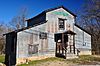
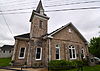
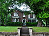
There are 33 properties and districts listed on the National Register in the county. Three previously listed sites have been delisted.

Map all coordinates using: OpenStreetMap  
Download coordinates as: KML
Contents: Counties in Tennessee
Anderson  Bedford  Benton  Bledsoe  Blount  Bradley  Campbell  Cannon  Carroll  Carter  Cheatham  Chester  Claiborne  Clay  Cocke  Coffee  Crockett  Cumberland  Davidson  Decatur  DeKalb  Dickson  Dyer  Fayette  Fentress  Franklin  Gibson  Giles  Grainger  Greene  Grundy  Hamblen  Hamilton  Hancock  Hardeman  Hardin  Hawkins  Haywood  Henderson  Henry  Hickman  Houston  Humphreys  Jackson  Jefferson  Johnson  Knox  Lake  Lauderdale  Lawrence  Lewis  Lincoln  Loudon  Macon  Madison  Marion  Marshall  Maury  McMinn  McNairy  Meigs  Monroe  Montgomery  Moore  Morgan  Obion  Overton  Perry  Pickett  Polk  Putnam  Rhea  Roane  Robertson  Rutherford  Scott  Sequatchie  Sevier  Shelby  Smith  Stewart  Sullivan  Sumner  Tipton  Trousdale  Unicoi  Union  Van Buren  Warren  Washington  Wayne  Weakley  White  Williamson  Wilson


    This National Park Service list is complete through NPS recent listings posted February 10, 2023. [2]

Current listings

[3] Name on the Register [4] ImageDate listed [5] Location City or townDescription
1 Abernathy Farm
Abernathy Farm Abernathy Farm-Pulaski, TN.jpg
Abernathy Farm
April 19, 2001
(#01000393)
9441 Elkton Pike
35°05′51″N86°57′32″W / 35.0975°N 86.9589°W / 35.0975; -86.9589 (Abernathy Farm)
Conway
2 Bass-Morrell House
Bass-Morrell House Bass-Morrell House-Ardmore, TN.jpg
Bass-Morrell House
November 10, 1988
(#88002615)
2898 TN-273/Bryson Rd.
35°05′19″N86°51′54″W / 35.088611°N 86.865°W / 35.088611; -86.865 (Bass-Morrell House)
Ardmore
4 Bodenham (Colored) School
Bodenham (Colored) School Bodenham School-side view.jpg
Bodenham (Colored) School
April 5, 2006
(#06000219)
830 Gimlet Creek Rd.
35°15′05″N87°10′24″W / 35.251389°N 87.173333°W / 35.251389; -87.173333 (Bodenham (Colored) School)
Bodeham
5 Bodenham Mill
Bodenham Mill Bodenham Mill.JPG
Bodenham Mill
March 27, 2013
(#13000122)
690 Bodenham Rd.
35°13′59″N87°09′19″W / 35.233189°N 87.155373°W / 35.233189; -87.155373 (Bodenham Mill)
Pulaski
6 Bridgeforth High School
Bridgeforth High School Bridgeforth High School.JPG
Bridgeforth High School
August 9, 2006
(#06000697)
1095 Bledsoe Rd.
35°12′45″N87°01′35″W / 35.2125°N 87.026389°W / 35.2125; -87.026389 (Bridgeforth High School)
Pulaski
7 Brown-Daly-Horne House
Brown-Daly-Horne House Brown-Daly-Horne House.JPG
Brown-Daly-Horne House
December 6, 1979
(#79002431)
307 W. Madison St.
35°11′58″N87°02′01″W / 35.199444°N 87.033611°W / 35.199444; -87.033611 (Brown-Daly-Horne House)
Pulaski
8 Campbell Chapel African Methodist Episcopal Church
Campbell Chapel African Methodist Episcopal Church Campbell Chapel African Methodist Episcopal Church (Pulaski, Tennessee).JPG
Campbell Chapel African Methodist Episcopal Church
June 22, 2000
(#00000725)
311 Mill St. [6]
35°13′30″N87°02′15″W / 35.225°N 87.0375°W / 35.225; -87.0375 (Campbell Chapel African Methodist Episcopal Church)
Pulaski
9 Church of the Messiah
Church of the Messiah Church of the Messiah.JPG
Church of the Messiah
July 28, 1983
(#83003031)
W. Madison and N. 3rd Sts.
35°12′00″N87°01′59″W / 35.2°N 87.033056°W / 35.2; -87.033056 (Church of the Messiah)
Pulaski
10 Clifton Place April 11, 1973
(#73001767)
Campbellsville Rd.
35°16′05″N87°04′24″W / 35.268056°N 87.073333°W / 35.268056; -87.073333 (Clifton Place)
Wales
11 Elk River Fortification September 29, 1998
(#98001212)
Address Restricted
Prospect
12 First Presbyterian Church of Pulaski
First Presbyterian Church of Pulaski First Presbyterian Church of Pulaski.JPG
First Presbyterian Church of Pulaski
July 28, 1983
(#83003032)
202 S. 2nd St.
35°11′53″N87°01′59″W / 35.198056°N 87.033056°W / 35.198056; -87.033056 (First Presbyterian Church of Pulaski)
Pulaski
13 Matt Gardner House
Matt Gardner House Matt Gardner House-Prospect, TN.jpg
Matt Gardner House
July 28, 1995
(#95000942)
110 Dixon Town Rd.
35°02′46″N86°53′11″W / 35.046111°N 86.886389°W / 35.046111; -86.886389 (Matt Gardner House)
Prospect
14 Hallehurst
Hallehurst Hallehurst-Pulaski, TN.jpg
Hallehurst
September 6, 2006
(#06000799)
106 Little Dry Creek Rd.
35°15′13″N87°05′22″W / 35.253611°N 87.089444°W / 35.253611; -87.089444 (Hallehurst)
Pulaski
15 Austin Hewitt Home
Austin Hewitt Home Austin Hewitt House.JPG
Austin Hewitt Home
December 13, 1984
(#84000611)
322 E. Washington St.
35°12′04″N87°01′38″W / 35.201111°N 87.027222°W / 35.201111; -87.027222 (Austin Hewitt Home)
Pulaski
16 Lairdland Farm House
Lairdland Farm House Lairdland Farm House and contributing buildings.jpg
Lairdland Farm House
September 7, 1995
(#95001088)
3238 Blackburn Hollow Rd.
35°16′33″N86°54′00″W / 35.275833°N 86.9°W / 35.275833; -86.9 (Lairdland Farm House)
Brick Church
17 Lynnville Historic District April 1, 1988
(#88000225)
Roughly bounded by Mill St., Main, and School Rd., and Long St., the former L&N railroad line, and Water and Buggs Sts.
35°22′36″N87°00′23″W / 35.376667°N 87.006389°W / 35.376667; -87.006389 (Lynnville Historic District)
Lynnville
18 Maplewood Cemetery
Maplewood Cemetery Maplewood Cemetery, Pulaski, Tennessee.JPG
Maplewood Cemetery
November 15, 2005
(#05000854)
South Sam Davis Ave.
35°11′38″N87°01′43″W / 35.193889°N 87.028611°W / 35.193889; -87.028611 (Maplewood Cemetery)
Pulaski
19 Milky Way Farm
Milky Way Farm Milky Way Farm Manor House.JPG
Milky Way Farm
September 27, 1984
(#84003537)
U.S. Route 31
35°18′37″N87°02′15″W / 35.310278°N 87.0375°W / 35.310278; -87.0375 (Milky Way Farm)
Pulaski
20 Olivet United Methodist Church, Parsonage and School
Olivet United Methodist Church, Parsonage and School Olivet United Methodist Church, Parsonage and School.JPG
Olivet United Methodist Church, Parsonage and School
July 19, 1984
(#84003538)
Columbia Pike
35°17′40″N87°01′34″W / 35.294444°N 87.026111°W / 35.294444; -87.026111 (Olivet United Methodist Church, Parsonage and School)
Riversburg
21 Original Church of God
Original Church of God Original Church of God (Pulaski, Tennessee).JPG
Original Church of God
August 9, 2006
(#06000698)
115 Gordon St.
35°12′34″N87°01′41″W / 35.209444°N 87.028056°W / 35.209444; -87.028056 (Original Church of God)
Pulaski
22 Pisgah United Methodist Church and Cemetery
Pisgah United Methodist Church and Cemetery Pisgah United Methodist Church.JPG
Pisgah United Methodist Church and Cemetery
November 23, 1984
(#84000330)
Pisgah Rd.
35°10′46″N86°54′43″W / 35.179444°N 86.911944°W / 35.179444; -86.911944 (Pisgah United Methodist Church and Cemetery)
Pisgah
23 Pulaski Courthouse Square Historic District
Pulaski Courthouse Square Historic District Giles County Tennessee Courthouse.jpg
Pulaski Courthouse Square Historic District
August 11, 1983
(#83003033)
1st, Jefferson, Madison, and 2nd Sts.; also 114 E. Jefferson St.
35°11′59″N87°01′52″W / 35.199722°N 87.031111°W / 35.199722; -87.031111 (Pulaski Courthouse Square Historic District)
Pulaski 114 Jefferson represents a boundary increase of July 3, 1997
24 Reveille
Reveille Reveille (Pulaski,TN).JPG
Reveille
October 28, 1994
(#94001273)
408 W. Madison
35°12′01″N87°02′04″W / 35.200278°N 87.034444°W / 35.200278; -87.034444 (Reveille)
Pulaski
25 Sam Davis Avenue Historic District March 2, 1989
(#89000148)
Sam Davis Ave. and E. Madison St.
35°11′51″N87°01′37″W / 35.1975°N 87.026944°W / 35.1975; -87.026944 (Sam Davis Avenue Historic District)
Pulaski
26 Dr. Benjamin Franklin Smith House
Dr. Benjamin Franklin Smith House Dr. Benjamin Franklin Smith House-Lynville, TN.jpg
Dr. Benjamin Franklin Smith House
August 23, 2006
(#06000728)
13494 Columbia Highway
35°22′42″N87°01′54″W / 35.378333°N 87.031667°W / 35.378333; -87.031667 (Dr. Benjamin Franklin Smith House)
Waco
27 South Pulaski Historic District July 10, 1986
(#86001556)
Roughly bounded by W. College, 1st, Cemetery, and S. 3rd Sts.
35°11′41″N87°02′02″W / 35.194722°N 87.033889°W / 35.194722; -87.033889 (South Pulaski Historic District)
Pulaski
28 George W. Tillery House
George W. Tillery House George W. Tillery House.JPG
George W. Tillery House
July 5, 1985
(#85001486)
U.S. Route 31
35°14′10″N87°02′35″W / 35.236111°N 87.043056°W / 35.236111; -87.043056 (George W. Tillery House)
Pulaski
29 Elisha White House
Elisha White House Elisha White house, Old Lynnville, Tenn. circaa 1811.jpg
Elisha White House
March 4, 1983
(#83003034)
West of Waco on Yokley Rd.
35°22′32″N87°02′09″W / 35.375556°N 87.035833°W / 35.375556; -87.035833 (Elisha White House)
Waco
30 Newton White House
Newton White House Newton White House-Pulaski, TN.jpg
Newton White House
October 22, 1987
(#87001884)
1961 Bledsoe Rd.
35°13′56″N87°01′09″W / 35.232222°N 87.019167°W / 35.232222; -87.019167 (Newton White House)
Pulaski
31 Copeland Whitfield House
Copeland Whitfield House Copeland Whitfield House.JPG
Copeland Whitfield House
July 7, 1988
(#88001021)
Bee Line Highway
35°10′21″N87°00′59″W / 35.1725°N 87.016389°W / 35.1725; -87.016389 (Copeland Whitfield House)
Pulaski
32 Wilkerson Place
Wilkerson Place Wilkerson Place-Pulaski, TN.jpg
Wilkerson Place
October 23, 1986
(#86002899)
300 Gunter Smith Rd.
35°17′56″N87°04′51″W / 35.298889°N 87.080833°W / 35.298889; -87.080833 (Wilkerson Place)
Wales
33 Wilkinson-Martin House
Wilkinson-Martin House Wilkinson-Martin House.JPG
Wilkinson-Martin House
March 17, 2010
(#10000085)
954 N. 1st St.
35°12′34″N87°01′38″W / 35.20952°N 87.02720°W / 35.20952; -87.02720 (Wilkinson-Martin House)
Pulaski
34 Wilson-Young House April 13, 1973
(#73001766)
Southwest of Dellrose off Interstate 65
35°05′45″N86°50′19″W / 35.095833°N 86.838611°W / 35.095833; -86.838611 (Wilson-Young House)
Dellrose

Former listings

Two other properties were once listed, but have since been removed:

[3] Name on the RegisterImageDate listedDate removedLocationCity or townDescription
1 Batte-Brown-Blackburn House
Batte-Brown-Blackburn House Grissom Colonial Hall.JPG
Batte-Brown-Blackburn House
June 7, 1996
(#96000659)
March 10, 2009318 W. Madison St.
35°11′59″N87°01′55″W / 35.1997°N 87.0319°W / 35.1997; -87.0319 (Batte-Brown-Blackburn House)
Pulaski Currently named Grissom Colonial Hall and owned by Martin Methodist College. Original building was damaged in a fire in 2000, and subsequently razed in 2001 [7]
2 Bethany Presbyterian Church Complex November 13, 1989
(#89001968)
March 27, 2020Elkton Rd.
35°05′51″N86°51′39″W / 35.0975°N 86.860833°W / 35.0975; -86.860833 (Bethany Presbyterian Church Complex)
Bryson
3 Noblit-Lytle House August 1, 2008
(#08000734)
July 25, 20181311 Sugar Creek Rd.
35°01′38″N87°13′00″W / 35.027344°N 87.216589°W / 35.027344; -87.216589 (Noblit-Lytle House)
Minor Hill Demolished in 2018.

See also

Related Research Articles

<span class="mw-page-title-main">National Register of Historic Places listings in Pulaski County, Virginia</span>

This is a list of the National Register of Historic Places listings in Pulaski County, Virginia.

<span class="mw-page-title-main">National Register of Historic Places listings in Pulaski County, Arkansas</span>

This is a list of the National Register of Historic Places listings in Pulaski County, Arkansas.

This is a list of the National Register of Historic Places listings in Obion County, Tennessee.

This is a list of the National Register of Historic Places listings in Bedford County, Tennessee.

This is a list of the National Register of Historic Places listings in Hamilton County, Tennessee.

This is a list of the National Register of Historic Places listings in Maury County, Tennessee.

This is a list of the National Register of Historic Places listings in Carter County, Tennessee.

This is a list of the National Register of Historic Places listings in Warren County, Tennessee.

This is a list of the National Register of Historic Places listings in Robertson County, Tennessee.

This is a list of the National Register of Historic Places listings in Hardeman County, Tennessee.

This is a list of the National Register of Historic Places listings in Haywood County, Tennessee.

<span class="mw-page-title-main">National Register of Historic Places listings in Cass County, Indiana</span>

This is a list of the National Register of Historic Places listings in Cass County, Indiana.

<span class="mw-page-title-main">National Register of Historic Places listings in White County, Indiana</span>

This is a list of the National Register of Historic Places listings in White County, Indiana.

<span class="mw-page-title-main">National Register of Historic Places listings in Fulton County, Indiana</span>

This is a list of the National Register of Historic Places listings in Fulton County, Indiana.

<span class="mw-page-title-main">National Register of Historic Places listings in Jasper County, Indiana</span>

This is a list of the National Register of Historic Places listings in Jasper County, Indiana.

<span class="mw-page-title-main">National Register of Historic Places listings in Marshall County, Indiana</span>

This is a list of the National Register of Historic Places listings in Marshall County, Indiana.

<span class="mw-page-title-main">National Register of Historic Places listings in Pulaski County, Indiana</span>

This is a list of the National Register of Historic Places listings in Pulaski County, Indiana.

<span class="mw-page-title-main">National Register of Historic Places listings in Starke County, Indiana</span>

This is a list of the National Register of Historic Places listings in Starke County, Indiana.

<span class="mw-page-title-main">National Register of Historic Places listings in Giles County, Virginia</span>

This is a list of the National Register of Historic Places listings in Giles County, Virginia.

<span class="mw-page-title-main">National Register of Historic Places listings in Pulaski County, Missouri</span>

This is a list of the National Register of Historic Places listings in Pulaski County, Missouri.

References

  1. The latitude and longitude information provided in this table was derived originally from the National Register Information System, which has been found to be fairly accurate for about 99% of listings. Some locations in this table may have been corrected to current GPS standards.
  2. National Park Service, United States Department of the Interior, "National Register of Historic Places: Weekly List Actions", retrieved February 10, 2023.
  3. 1 2 Numbers represent an alphabetical ordering by significant words. Various colorings, defined here, differentiate National Historic Landmarks and historic districts from other NRHP buildings, structures, sites or objects.
  4. "National Register Information System". National Register of Historic Places . National Park Service. April 24, 2008.
  5. The eight-digit number below each date is the number assigned to each location in the National Register Information System database, which can be viewed by clicking the number.
  6. Street address is derived from this AME directory page; the NRIS lists it simply as "in Pulaski"
  7. "Fire at Civil-war era home puzzles Pulaski officials". The Tennessean . May 3, 2000. p. 1. Retrieved April 16, 2022 via Newspapers.com.