The Statue of Liberty is a colossal neoclassical sculpture on Liberty Island in New York Harbor in New York, in the United States. The copper statue, a gift from the people of France to the people of the United States, was designed by French sculptor Frédéric Auguste Bartholdi and its metal framework was built by Gustave Eiffel. The statue was dedicated on October 28, 1886.

Libertas is the Roman goddess and embodiment of liberty.

Liberty County is a county in the U.S. state of Texas. As of the 2010 census, the population was 75,653. The county seat is Liberty. The county was created in 1831 as a municipality in Mexico and organized as a county in 1837. It is named for the popular American ideal of liberty.

Liberty County is a county located in the U.S. state of Montana. As of the 2010 United States Census, the population was 2,339. Its county seat is Chester. The decision to separate the future Liberty County area from the previous Hill and Chouteau counties was carried in a 1919 vote; the organization was authorized to commence in the following February.

Liberty Hill is a city in Williamson County, Texas, United States. The population is 1608 people as of March 2012 Census Bureau estimates, The population was 967 at the 2010 census. Liberty Hill is part of the Greater Austin metropolitan area.

Forest Lawn Memorial Park – Hollywood Hills is one of the six Forest Lawn cemeteries in Southern California. It is located at 6300 Forest Lawn Drive, Los Angeles, California 90068, in the Hollywood Hills neighborhood of Los Angeles. It is on the lower north slope at the east end of the Santa Monica Mountains range that overlooks North Hollywood, Universal City, and Burbank, and the overall San Fernando Valley area of north view Los Angeles.

Liberty is a loose term in English for the goddess or personification of the concept of liberty, and is represented by the Roman Goddess Libertas, by Marianne, the national symbol of France, and by many others.

Liberty University (LU) is a private evangelical Christian university in Lynchburg, Virginia.

A liberty pole is a tall wooden pole, often used as a type of flagstaff, planted in the ground, surmounted by a Phrygian cap. The symbol originated in the immediate aftermath of the assassination of Roman dictator Julius Caesar by a group of Rome's Senators in 44 BC. Immediately after Caesar was killed, the leaders of the assassination plot went to meet a crowd of Romans at the Roman Forum; a pileus was placed atop a pole to symbolize that the Roman people had been freed from the rule of Caesar, which the assassins claimed had become a tyranny because it overstepped the authority of the Senate and thus betrayed the Republic. In his "Apotheosis of Venice" (1585) Paolo Veronese has the ascendant Venice flanked by several symbolic persons, one of whom represents Liberty, dressed as a peasant hoisting a red Phrygian cap on a spear. During the French revolution, the Roman pileus was confused with the Phrygian cap, and this mis-identification then led to the use of the Phrygian cap as a symbol of liberal democratic republicanism.

Brookline is a neighborhood in Pittsburgh, Pennsylvania in the United States.

The Battle of Golden Hill was a clash between British soldiers and the Sons of Liberty in the American colonies that occurred on January 19, 1770, in New York City. Along with the Boston Massacre and the Gaspée Affair, the event was one of the early violent incidents in what would become the American Revolution.

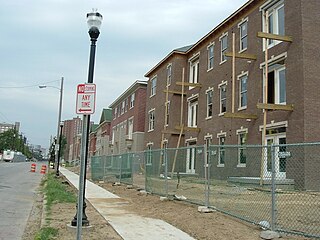
Phoenix Hill is a neighborhood of Louisville, Kentucky just east of Downtown. Its boundaries are Jefferson Street to the North, Preston Street to the West, Broadway to the South, and Baxter Avenue to the East. The Phoenix Hill neighborhood, settled before 1850 by German immigrants, is now a rich tapestry of people and a diverse mix of business, industry and residences.

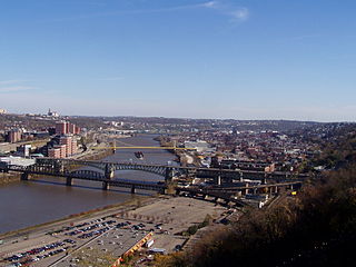
The Liberty Bridge, completed in 1928, connects downtown Pittsburgh, Pennsylvania, to the Liberty Tunnels and the South Hills neighborhoods beyond. It crosses the Monongahela River and intersects Interstate 579 at its northern terminus.

Michael Joseph Hill is an American professional golfer.

John Gardiner Richards Jr. was the 96th Governor of South Carolina from 1927 to 1931.

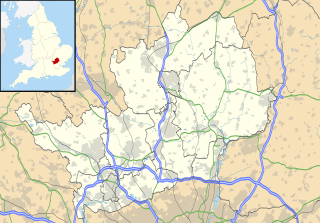
Brickendon is a village in the civil parish of Brickendon Liberty in the district of East Hertfordshire about 3 miles (4.8 km) south of the county town Hertford, and is served by Bayford railway station.

Liberty Hill is an unincorporated community in Albemarle County, Virginia.

Liberty Hills is an unincorporated community in Wood County, West Virginia.


