Frankewing, Tennessee | |
|---|---|
 Frankewing  Frankewing | |
| Coordinates: 35°11′33″N86°51′04″W / 35.19250°N 86.85111°W | |
| Country | United States |
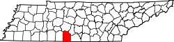
| State | Tennessee |
| County | Giles |
| Area | |
• Total | 0.94 sq mi (2.44 km2) |
| • Land | 0.94 sq mi (2.44 km2) |
| • Water | 0.00 sq mi (0.00 km2) |
| Elevation | 673 ft (205 m) |
| Population | |
• Total | 124 |
| • Density | 131.50/sq mi (50.78/km2) |
| Time zone | UTC-6 (Central (CST)) |
| • Summer (DST) | UTC-5 (CDT) |
| ZIP code | 38459 |
| Area code | 931 |
| GNIS feature ID | 1284814 [3] |
Frankewing is an unincorporated community in Giles County, Tennessee, United States. [3] It is named for Frank Ewing who used his influence with state legislators to secure rail service to the area. A depot was built. [4] It has a post office, with ZIP code is 38459. [5] It is located 1 mile east of the interchange between Interstate 65 (I-65, exit 14) and U.S. Route 64 (US 64). There is a Bank of Frankewing. Bradshaw Creek flows through the area.