Tennessee State Route 49

Last updated

Tennessee 49.svg Secondary Tennessee 49.svg

State Route 49

Tennessee State Route 49
SR 49; primary in red, secondary in blue
Route information
Maintained by TDOT
Length104.57 mi (168.29 km)
ExistedOctober 1, 1923 [1] –present
Major junctions
West endUS 79.svg US 79 in Dover
Major intersections
East endElongated circle 383.svg KY 383 at Kentucky state line near Orlinda
Location
Country United States
State Tennessee
Counties Stewart, Houston, Dickson, Cheatham, Robertson
Highway system
Tennessee 48.svg SR 48 Tennessee 50.svg SR 50

State Route 49 (SR 49) is a state highway in Tennessee. The route forms a broad southern arc that passes through the rural Middle Tennessee towns of Dover, Erin, Charlotte, Ashland City, Pleasant View, and Springfield. [2] [3] [4] [5] [6]

Contents

Route description

SR 49 begins in Stewart County in downtown Dover at a junction with US 79/SR 76 as a primary highway. It goes east, paralleling the Cumberland River before turning south and having an intersection with SR 233. It then goes through some farmland and hills before crossing into Houston County.

SR 49 then immediately enters Tennessee Ridge and comes to an intersection with SR 147, where SR 49 turns east again towards Erin. SR 49 then enters Erin shortly afterwards, going straight through downtown before having an intersection with SR 149. It then intersects with SR 13 not even a half a mile later. It then goes through some more hills and farmland, having an intersection and concurrency with SR 46 before crossing into Dickson County.

SR 49 then goes through some more hills before having an intersection and becoming concurrent with SR 235 and entering Vanleer. They then go through Vanleer, turning to the south temporarily then turning east again, before SR 235 breaks off and goes south, and SR 49 continues east. SR 49 then goes through more hills and farmland before entering Charlotte and having an intersection and short concurrency with SR 48, just north of its intersection with SR 47. SR 49 then goes through downtown and intersects Old State Hwy. 47, an old alignment of SR 47, before leaving Charlotte and becoming very curvy, going northeast.

It then enters Cheatham County and has a crossing of the Harpeth River before intersecting SR 250 and begins paralleling the Cumberland River again, becomes concurrent with SR 249, crosses the Cumberland River, and enters Ashland City. SR 49/SR 249 then intersect with SR 455 (Tennessee Waltz Parkway/Ashland City Bypass), a bypass for SR 12, before entering downtown and having an intersection and short concurrency with SR 12. SR 249 then separates and goes east and SR 49 turns north. SR 49 then enters Pleasant View and intersects US 41A/SR 112 before having an interchange with I-24 and crossing into Robertson County.

It then goes northeast to Coopertown where it intersects SR 257. SR 49 then goes through some farmland before entering Springfield. It then enters downtown and comes to an intersection with US 41/US 431/SR 11/SR 65/SR 76, with SR 76 becoming concurrent with SR 49. SR 76 then separates and turns east while SR 49 leaves Springfield and continues northeast. It then intersects and has a short concurrency with SR 25 before becoming a secondary highway and going through some more farmland. It then becomes curvy before entering Orlinda and intersecting SR 52 in the center of town. SR 49 then continues north to the Kentucky state line, where it continues as KY 383.

History

SR 49's route between Springfield and the Kentucky state line once formed an alternate route of the Dixie Highway system, bypassing the main route from Springfield to Russellville, Kentucky. The conditions of the road was described as poor. [7]

SR 49's course from Springfield to Orlinda, along with SR 52's eastward course from Orlinda to Portland was signed as SR 75 until the late-1920s. [8]

Until the 2000s, SR 49 extended north on The Trace Road to the Kentucky border. [9] Sometime in the 2000s, this portion was redesignated as SR 461. Google Maps and some recent road maps still displays SR 461 as SR 49. [10]

Major intersections

CountyLocationmikmDestinationsNotes
Stewart Dover 0.00.0US 79.svg US 79 (Fort Donelson Parkway/SR 76) Paris, Clarksville Western terminus; SR 49 begins as a primary highway; provides access to Land Between the Lakes National Recreation Area
Carlisle 9.715.6East plate.svg
Secondary Tennessee 233.svg
SR 233 east (Cumberland City Road) Cumberland City
Western terminus of SR 233
Houston Tennessee Ridge 17.127.5West plate.svg
Secondary Tennessee 147.svg
SR 147 west (N Main Street) Big Sandy, McKinnon
Eastern terminus of SR 147
Erin 21.935.2East plate.svg
Tennessee 149.svg
SR 149 east (Cumberland City Highway) Cumberland City, Clarksville
Western terminus of SR 149
22.135.6Tennessee 13.svgSecondary Tennessee 13.svg SR 13 (Waverly Highway/Clarksville Highway) Waverly, Clarksville
26.041.8North plate.svg
Secondary Tennessee 46.svg
SR 46 north Cumberland City
Western end of SR 46 concurrency
31.250.2South plate.svg
Secondary Tennessee 46.svg
SR 46 south Dickson
Eastern end of SR 46 concurrency
Dickson Vanleer 36.258.3North plate.svg
Secondary Tennessee 235.svg
SR 235 north (Slayden-Marion Road) Slayden, Cunningham
Western end of SR 235 concurrency
39.864.1South plate.svg
Secondary Tennessee 235.svg
SR 235 south (Sylvia Road) Dickson
Eastern end of SR 235 concurrency
Charlotte 46.374.5North plate.svg
Tennessee 48.svg
SR 48 north Clarksville
Western end of SR 48 concurrency
47.175.8South plate.svg
Tennessee 48.svg
SR 48 south Dickson
Eastern end of SR 48 concurrency
Cheatham Ashland City 64.2103.3South plate.svg
Secondary Tennessee 250.svg
SR 250 south (Petway Road) White Bluff
Northern terminus of SR 250; provides access to the Cheatham State Wildlife Management Area
66.6107.2West plate.svg
Secondary Tennessee 249.svg
SR 249 west (River Road) Pegram
Western end of SR 249 concurrency
67.3108.3Secondary Tennessee 455.svg SR 455 (Tennessee Waltz Parkway)Ashland City bypass for SR 12
67.6108.8North plate.svg
Tennessee 12.svg
SR 12 north (Main Street) Clarksville
Western end of SR 12 concurrency
67.7109.0South plate.svg
Tennessee 12.svg
SR 12 south (Main Street) Nashville
Eastern end of SR 12 concurrency
69.8112.3East plate.svg
Secondary Tennessee 249.svg
SR 249 east (Bearwallow Road)
Eastern end of SR 249 concurrency
Pleasant View 77.1124.1US 41A.svg US 41A (SR 112) Clarksville, Nashville
Robertson Pleasant View 77.3124.4I-24.svg I-24  Clarksville, Nashville I-24 exit 24
Coopertown 83.2133.9East plate.svg
Secondary Tennessee 257.svg
SR 257 east Ridgetop
Western terminus of SR 257
Springfield 88.7142.7US 41.svgUS 431.svgWest plate.svg
Secondary Tennessee 76.svg
US 41  / US 431  / SR 76 west (Memorial Boulevard/SR 11/SR 65)
Western end of SR 76 concurrency
89.8144.5East plate.svg
Secondary Tennessee 76.svg
SR 76 east White House
Eastern end of SR 76 concurrency
94.0151.3West plate.svg
Secondary Tennessee 25.svg
SR 25 west Barren Plains
Western end of SR 25 concurrency
95.0152.9East plate.svg
Tennessee 25.svg
SR 25 east Cross Plains
Eastern end of SR 25 concurrency; SR 49 turns secondary
Orlinda 101.0162.5East plate.svg
Secondary Tennessee 52.svg
To plate blue.svg
I-65.svg
SR 52 east to I-65  Portland
Western terminus of SR 52
104.6168.3North plate.svg
Elongated circle 383.svg
KY 383 north (Springfield Road) Franklin, KY
Eastern terminus; continuation into Kentucky; SR 49 ends as a secondary highway
1.000 mi = 1.609 km; 1.000 km = 0.621 mi

See also

Related Research Articles

<span class="mw-page-title-main">Tennessee State Route 56</span> Highway in Tennessee

State Route 56 is a 160.6-mile-long (258.5 km) state highway that runs south to north in Middle Tennessee, from the Alabama state line near Sherwood to the Kentucky state line near Red Boiling Springs.

<span class="mw-page-title-main">U.S. Route 31W</span> U.S. Highway in Kentucky and Tennessee

U.S. Route 31W is the westernmost of two parallel routes for U.S. Route 31 from Nashville, Tennessee to Louisville, Kentucky.

<span class="mw-page-title-main">U.S. Route 25W</span> Highway in Tennessee and Kentucky, United States

U.S. Route 25W (US 25W) is the western branch of US 25 from Newport, Tennessee, where US 25 splits into US 25E and US 25W, to North Corbin, Kentucky, where the two highways rejoin.

<span class="mw-page-title-main">Tennessee State Route 58</span> State highway in Tennessee, United States

State Route 58, also locally called "Highway 58", is a north–south state highway in the U.S. state of Tennessee that serves as a major route for many communities in Roane, Meigs, and Hamilton counties.

<span class="mw-page-title-main">Tennessee State Route 52</span> State highway in Tennessee, United States

State Route 52 is an east–west state highway that crosses eight counties in northern and northeastern Tennessee. The 141.4-mile-long (227.6 km) route originates in Orlinda along SR 49 and ends in Elgin along U.S. Route 27.

<span class="mw-page-title-main">Tennessee State Route 96</span> Highway in Tennessee

State Route 96 is an east–west and north–south highway in Middle Tennessee. The road begins in Dickson and ends in Granville. The current length is 126.7 mi (203.9 km). Along its path it goes through 10 counties. Locals mostly refer to it as Highway 96.

<span class="mw-page-title-main">Tennessee State Route 10</span> Highway in Tennessee

State Route 10 is a south–north route from the Alabama state line in Lincoln County to the Kentucky state line in Macon County.

<span class="mw-page-title-main">Tennessee State Route 76</span> Highway in Tennessee

State Route 76 (SR 76) is a state highway in Tennessee, traversing the state in a northeast-southwest axis from east of Memphis to north of Nashville. SR 76 is unique in that it actually changes its cardinal directions in Clarksville at the junction with US 41A and US 41A Bypass.

<span class="mw-page-title-main">Tennessee State Route 70</span> State highway in Tennessee, United States

State Route 70 is a state-maintained highway in East Tennessee, beginning at the border with North Carolina in the midst of the Cherokee National Forest and the Great Smoky Mountains and ending at the Virginia border in the extremely rural and mountainous terrain of Hancock County.

<span class="mw-page-title-main">U.S. Route 431 in Tennessee</span> United States Numbered Highway in Tennessee

U.S. Route 431 in Tennessee totals an estimated 116 miles (187 km) through Lincoln, Marshall, Maury, Williamson, Davidson, and Robertson counties in Middle Tennessee.

<span class="mw-page-title-main">U.S. Route 127 in Tennessee</span> Highway in Tennessee, United States

U.S. Route 127 in Tennessee is a 129.5-mile-long (208.4 km) United States Numbered Highway from Chattanooga to the Kentucky state line at Static. The highways connects through Dunlap, Pikeville, Crossville, and Jamestown. Throughout its length, US 127 straddles the line between East Tennessee and Middle Tennessee.

<span class="mw-page-title-main">Tennessee State Route 25</span> State highway in Tennessee, United States

State Route 25 is a 67.45-mile-long (108.55 km) east–west state highway in northern Middle Tennessee.

<span class="mw-page-title-main">Tennessee State Route 32</span> State unsigned highway in Tennessee

State Route 32 is a state highway in East Tennessee. For most of its route, it is an unsigned companion route concurrent with U.S. Route 25E. The highway stretches 89 miles from the North Carolina state line to the Tennessee-Kentucky state line near the town of Cumberland Gap.

<span class="mw-page-title-main">Tennessee State Route 72</span> State highway in Tennessee, United States

State Route 72 is a 43.3-mile-long (69.7 km) state highway in the eastern portion of U.S. state of Tennessee. It travels through the towns of Vonore and Loudon.

<span class="mw-page-title-main">Tennessee State Route 50</span> State highway in Tennessee, United States

State Route 50 (SR 50) is a west–to–east highway in Middle Tennessee. The road begins near Only and ends in Altamont. The current length is 161.3 miles (259.6 km).

<span class="mw-page-title-main">Tennessee State Route 53</span> Highway in Tennessee

State Route 53 (SR 53) is a north–south state highway that traverses six counties in Middle Tennessee. It is 113.5 miles (182.7 km) long.

<span class="mw-page-title-main">U.S. Route 231 in Tennessee</span>

U.S. Route 231 in Tennessee runs north–south for 121.15 miles (194.97 km), entirely in Middle Tennessee, that starts south of Fayetteville at the Alabama state line, and ends north of Westmoreland at the Kentucky state line. For the majority of its length, between the Alabama state line and Trousdale County, it is concurrent with unsigned State Route 10.

<span class="mw-page-title-main">Tennessee State Route 28</span> State highway in Tennessee, United States

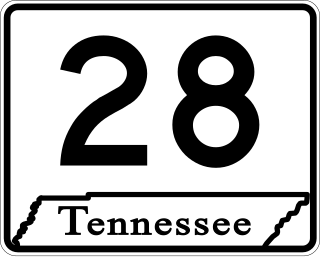
State Route 28 is a state highway in the state of Tennessee, traversing the state in a north–south axis from south of Jasper to the Kentucky state line at Static.

<span class="mw-page-title-main">U.S. Route 41 Alternate (Tennessee–Kentucky)</span> U.S. Highway in Tennessee and Kentucky

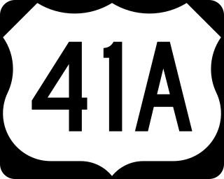
U.S. Route 41 Alternate, also signed U.S. Route 41A in Tennessee (US 41A), connects the town of Monteagle, Tennessee, with Hopkinsville, Kentucky, 10 miles (16 km) north of the Tennessee line. It serves the city of Clarksville, Tennessee, on its way to Nashville, where it briefly runs concurrently with US 41. It then separates again to serve Shelbyville, Winchester, and Tullahoma before rejoining the main route atop Monteagle Mountain. US 41A runs west of US 41 for its entire length, aside from one mile in downtown Nashville where they are concurrent. US 41A is also concurrent with U.S. Route 31A from Nashville to Triune, Tennessee, for a distance of approximately 25 miles (40 km).

<span class="mw-page-title-main">Tennessee State Route 235</span> State highway in Tennessee, United States

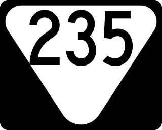
State Route 235 is a 27.3-mile-long (43.9 km) north–south state highway in Middle Tennessee. It connects Dickson to Cunningham via Sylvia, Vanleer, and Slayden.

References

  1. Highway Planning Survey Division (1925). Biennial Report of the Commissioner of the Department of Highways and Public Works State of Tennessee for the Years 1923 and 1924 (PDF) (Report). Nashville: Tennessee Department of Highways and Public Works. pp. 39–44. Retrieved May 19, 2023.
  2. Tennessee Department of Transportation (2012). Official Tennessee Transportation Map (PDF) (Map). Nashville: Tennessee Department of Transportation. Retrieved October 11, 2012.[ full citation needed ]
  3. Burmaster, Bill (October 9, 2009). "Tennessee State Route 49, Stewart County". Roads of the Mid-South and West. Retrieved October 12, 2012.[ self-published source ]
  4. Burmaster, Bill (October 9, 2009). "Tennessee State Route 49, Houston County". Roads of the Mid-South and West. Retrieved October 12, 2012.[ self-published source ]
  5. Burmaster, Bill (October 9, 2009). "Tennessee State Route 49, Robertson County". Roads of the Mid-South and West. Retrieved October 12, 2012.[ self-published source ]
  6. Burmaster, Bill (October 9, 2009). "Tennessee State Route 49, Cheatham County". Roads of the Mid-South and West. Retrieved October 12, 2012.[ self-published source ]
  7. https://2lanetraveler.com/home/dhmaps/
  8. Austin Peay Campaign Committee (1926). Highway Map of Tennessee Showing the Construction Progress During 8 Year Period 1918–1926, on Federal and State Aid Roads (Map). Scale not given. Nashville: Austin Peay Campaign Committee via Tennessee Virtual Archive.
  9. The Southeast (Map). Close-up: U.S.A. Washington D.C.: National Geographic Society. 1986.
  10. AAA (2021). "Kentucky" (Map). AAA Deluxe Road Atlas (2021 ed.). 1 in=20 mi. Kappa Map Group. p. 47. Kentucky Lakes Region inset. §§ R9-R11. ISBN   9781946494412.
Template:Attached KML/Tennessee State Route 49
KML is not from Wikidata