Tennessee State Route 101

Last updated

Secondary Tennessee 101.svg

State Route 101

Tennessee State Route 101
SR 101 highlighted in red
Route information
Maintained by TDOT
Length38.7 mi (62.3 km)
Major junctions
South endTennessee 30.svg SR 30 in Mount Crest
Major intersectionsUS 127.svg US 127 in Crossville

US 70.svgSecondary Tennessee 392.svg US 70  / SR 392 in Crossville

I-40.svg I-40 in Crossville
North endStonehenge Drive, Eagle Drive and Peavine Road in Fairfield Glade
Location
Country United States
State Tennessee
Counties Bledsoe, Cumberland
Highway system
Tennessee 100.svg SR 100 Secondary Tennessee 102.svg SR 102

State Route 101 (SR 101) is a state highway in Bledsoe and Cumberland counties in the eastern portion U.S. state of Tennessee.

Contents

Route description

SR 101 begins in the rolling farmlands of Bledsoe County at a Y-Intersection with SR 30 in the Mount Crest community. It then goes northwest as it enters a large wooded area before coming to an intersection with SR 285, where it turns northeast and crosses into Cumberland County. It then becomes curvy as it passes through the rolling hills and farmland of the Cumberland Plateau before passing just north of Lake Tansi Village and having an intersection with SR 282, northeast of Meadow Park Lake. It then has an intersection with SR 419, which provides access to Cumberland Mountain State Park. It then enters Crossville, at an intersection with SR 392 (a beltway around downtown). It then enters downtown and comes to an intersection and becomes concurrent with US 70/SR 1. They then intersect US 127/SR 28 a short distance later. They then leave downtown and come to another intersection with SR 392, where SR 101 separates from US 70/SR 1 and goes north to have an interchange with I-40 (Exit 322) before leaving Crossville and continuing northeast. It then enters the Fairfield Glade Resort, where it ends and continues as Peavine Road. [1]

Junction list

CountyLocationmikmDestinationsNotes
Bledsoe Mount Crest 0.000.00Tennessee 30.svg SR 30  Pikeville, Spencer Southern terminus
West plate.svg
Secondary Tennessee 285.svg
To plate.svg
Secondary Tennessee 301.svg
SR 285 west to SR 301  Spencer
Eastern terminus of SR 285
Cumberland South plate.svg
Secondary Tennessee 282.svg
SR 282 south (Dunbar Road) Lake Tansi Village
Northern terminus of SR 282
South plate.svg
Secondary Tennessee 419.svg
SR 419 south (Pigeon Ridge Road) Cumberland Mountain State Park
Northern terminus of SR 419
Crossville South plate.svg
Secondary Tennessee 392.svg
SR 392 south (Miller Avenue) Fairfield Glade
Southern end of SR 392 concurrency
North plate.svg
Secondary Tennessee 392.svg
SR 392 north (Miller Avenue)
Northern end of SR 392 concurrency
West plate.svg
US 70.svg
US 70 west (West Avenue/SR 1 west)
Southern end of US 70/SR 1 concurrency
US 127.svg US 127 (South Main Street/SR 28) Pikeville, Clarkrange
East plate.svg
US 70.svg
North plate.svg
Secondary Tennessee 392.svg
US 70 east (Highway 70/SR 1 east) / SR 392 north (Miller Avenue) Rockwood, Crossville
Northern end of US 70/SR 1 concurrency; Southern terminus of SR 392
I-40.svg I-40  Knoxville, Nashville I-40 exit 322
Fairfield Glade Stonehenge Drive, Eagle Lane and Peavine RoadNorthern terminus
1.000 mi = 1.609 km; 1.000 km = 0.621 mi

Related Research Articles

<span class="mw-page-title-main">Tennessee State Route 56</span> Highway in Tennessee

State Route 56 is a 160.6-mile-long (258.5 km) state highway that runs south to north in Middle Tennessee, from the Alabama state line near Sherwood to the Kentucky state line near Red Boiling Springs.

<span class="mw-page-title-main">Tennessee State Route 24</span> State highway in Tennessee, United States

State Route 24 is an unsigned west–east state highway in Tennessee, as it coincides with U.S. Route 70 and U.S. Route 70N for its entire duration from Nashville to Crossville. The road begins in western Nashville and ends in Crossville. It runs alongside Interstate 40 for its entire length.

<span class="mw-page-title-main">U.S. Route 70N</span> Numbered Highway in Tennessee, United States

U.S. Route 70N is a northern alternate to U.S. Route 70, passing through parts of Middle Tennessee and East Tennessee. It runs 86.0 miles (138.4 km) east–west from Lebanon to Crossville, connecting the cities of Carthage, Baxter, Cookeville, and Monterey.

<span class="mw-page-title-main">Tennessee State Route 22</span> State Highway in Tennessee

State Route 22 is a 172.8-mile long (278.1 km) south-to-north state highway in the western part of Tennessee, United States. It begins at the Mississippi state line in McNairy County, where the roadway continues as Mississippi Highway 2. It ends at the Kentucky state line in Lake County, when it crosses into the Kentucky Bend, a detached portion of Fulton County, Kentucky. The monument for the 1862 Battle of Island Number Ten in the American Civil War is located on SR 22, about 3 mi (4.8 km) north of Tiptonville.

<span class="mw-page-title-main">Tennessee State Route 66</span> State highway in Tennessee, United States

State Route 66 is a state-maintained highway in eastern Tennessee, including a six-lane divided highway known as Winfield Dunn Parkway in Sevier County, a four-lane expressway in Hamblen and Jefferson counties and a two-lane rural collector through mountainous terrain continuing to the northeast terminus in Hancock County.

<span class="mw-page-title-main">Tennessee State Route 96</span> Highway in Tennessee

State Route 96 is an east–west and north–south highway in Middle Tennessee. The road begins in Dickson and ends in Granville. The current length is 126.7 mi (203.9 km). Along its path it goes through 10 counties. Locals mostly refer to it as Highway 96.

<span class="mw-page-title-main">Tennessee State Route 10</span> Highway in Tennessee

State Route 10 is a south–north route from the Alabama state line in Lincoln County to the Kentucky state line in Macon County.

<span class="mw-page-title-main">Tennessee State Route 13</span> Highway in Tennessee

State Route 13, in the United States, is a south–north route from the Alabama border in Wayne County to the Kentucky border in Montgomery County. The entire route is located in western Middle Tennessee.

<span class="mw-page-title-main">Tennessee State Route 76</span> Highway in Tennessee

State Route 76 (SR 76) is a state highway in Tennessee, traversing the state in a northeast-southwest axis from east of Memphis to north of Nashville. SR 76 is unique in that it actually changes its cardinal directions in Clarksville at the junction with US 41A and US 41A Bypass.

<span class="mw-page-title-main">U.S. Route 412 in Tennessee</span> U.S. Highway in Tennessee

In Tennessee, U.S. Route 412 stretches for 181.93 miles (292.79 km) through the farmland of West Tennessee and the hills of Middle Tennessee, starting at the Missouri state line near Dyersburg and running to an interchange between I-65 and SR 99 in Columbia.

<span class="mw-page-title-main">U.S. Route 127 in Tennessee</span> Highway in Tennessee, United States

U.S. Route 127 in Tennessee is a 129.5-mile-long (208.4 km) United States Numbered Highway from Chattanooga to the Kentucky state line at Static. The highways connects through Dunlap, Pikeville, Crossville, and Jamestown. Throughout its length, US 127 straddles the line between East Tennessee and Middle Tennessee.

<span class="mw-page-title-main">Tennessee State Route 49</span> State highway in Tennessee, United States

State Route 49 is a state highway in Tennessee. The route forms a broad southern arc that passes through the rural Middle Tennessee towns of Dover, Erin, Charlotte, Ashland City, Pleasant View, and Springfield.

<span class="mw-page-title-main">Tennessee State Route 32</span> State unsigned highway in Tennessee

State Route 32 is a state highway in East Tennessee. For most of its route, it is an unsigned companion route concurrent with U.S. Route 25E. The highway stretches 89 miles from the North Carolina state line to the Tennessee-Kentucky state line near the town of Cumberland Gap.

<span class="mw-page-title-main">Tennessee State Route 392</span> State highway in Tennessee, United States

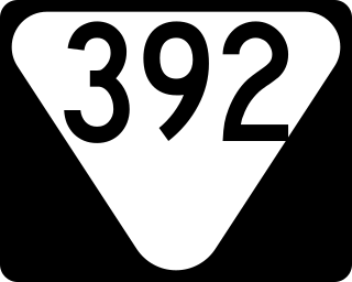
State Route 392 is a state highway and bypass around downtown Crossville in Cumberland County in the U.S. state of Tennessee.

<span class="mw-page-title-main">Tennessee State Route 50</span> State highway in Tennessee, United States

State Route 50 (SR 50) is a west–to–east highway in Middle Tennessee. The road begins near Only and ends in Altamont. The current length is 161.3 miles (259.6 km).

<span class="mw-page-title-main">Tennessee State Route 53</span> Highway in Tennessee

State Route 53 (SR 53) is a north–south state highway that traverses six counties in Middle Tennessee. It is 113.5 miles (182.7 km) long.

<span class="mw-page-title-main">U.S. Route 231 in Tennessee</span>

U.S. Route 231 in Tennessee runs north–south for 121.15 miles (194.97 km), entirely in Middle Tennessee, that starts south of Fayetteville at the Alabama state line, and ends north of Westmoreland at the Kentucky state line. For the majority of its length, between the Alabama state line and Trousdale County, it is concurrent with unsigned State Route 10.

<span class="mw-page-title-main">Tennessee State Route 28</span> State highway in Tennessee, United States

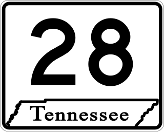
State Route 28 is a state highway in the state of Tennessee, traversing the state in a north–south axis from south of Jasper to the Kentucky state line at Static.

<span class="mw-page-title-main">Tennessee State Route 46</span> State highway in Tennessee, United States

State Route 46 is a north–south state highway located in Middle Tennessee. It mainly goes on a northwest to southeast course while passing through towns and cities such as Cumberland City, Dickson, Leipers Fork, along with mainly rural areas of Stewart, Houston, Dickson, Hickman and Williamson Counties.

<span class="mw-page-title-main">Tennessee State Route 298</span> State highway in Tennessee, United States

State Route 298, also known as Genesis Road, is a north–south state highway in the Cumberland Plateau region of East Tennessee.

References

  1. "TN-101 · Tennessee".