Finley, Tennessee | |
|---|---|
 Finley  Finley | |
| Coordinates: 36°02′09″N89°28′47″W / 36.03583°N 89.47972°W | |
| Country | United States |
| State | Tennessee |
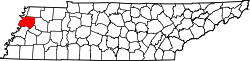
| County | Dyer |
| Settled | 1840 |
| Founded | 1881 |
| Named after | James Allen Finley |
| Area | |
• Total | 1.30 sq mi (3.38 km2) |
| • Land | 1.30 sq mi (3.38 km2) |
| • Water | 0.00 sq mi (0.00 km2) |
| Elevation | 282 ft (86 m) |
| Population | |
• Total | 774 |
| • Density | 593.56/sq mi (229.11/km2) |
| Time zone | UTC-6 (Central (CST)) |
| • Summer (DST) | UTC-5 (CDT) |
| ZIP code | 38030 |
| Area code | 731 |
| GNIS feature ID | 1284270 [2] |
Finley is an unincorporated community in Dyer County, Tennessee, United States. [2] It is located roughly 5.5 miles west of downtown Dyersburg along Tennessee State Route 104. Tennessee State Route 182 also passes through the community, which connects it with Interstate 155 and Lenox to the north.