Interstate 10 (I-10) is the southernmost transcontinental highway in the Interstate Highway System. I-10 is the fourth-longest Interstate in the United States at 2,460.34 miles (3,959.53 km), following I-90, I-80, and I-40. This freeway is part of the originally planned network that was laid out in 1956, and its last section was completed in 1990.

Interstate 19 (I-19) is a north–south Interstate Highway located entirely within the US state of Arizona. I-19 travels from Nogales, roughly 90 meters (300 ft) from the Mexican border, to Tucson, at I-10. The highway also travels through the cities of Rio Rico, Green Valley, and Sahuarita.

Interstate 24 (I-24) is an Interstate Highway in the Midwestern and Southeastern United States. It runs diagonally from I-57, 10 miles (16 km) south of Marion, Illinois, to Chattanooga, Tennessee, at I-75. It travels through Illinois, Kentucky, Tennessee, and Georgia. As an even-numbered Interstate, it is signed as an east–west route, though the route follows a more southeast–northwest routing, passing through Nashville, Tennessee. The numbering deviates from the standard Interstate Highway System grid, lying further north than its number would indicate west of Nashville. The short segment within Georgia bears the unsigned designation State Route 409 (SR 409).

U.S. Route 45 is a major north-south United States highway and a border-to-border route, from Lake Superior to the Gulf of Mexico. A sign at the highway's northern terminus notes the total distance as 1,297 miles (2,087 km).

Interstate 22 (I-22) is a 202.22-mile-long (325.44 km) Interstate Highway in the US states of Mississippi and Alabama, connecting I-269 near Byhalia, Mississippi, to I-65 near Birmingham, Alabama. I-22 is also Corridor X of the Appalachian Development Highway System (ADHS). Designated in 2012, I-22 follows the route of older U.S. Route 78 (US 78) and is concurrent with the route for all but its eastern most 11 miles (18 km). The freeway mainly spans rural areas and passes numerous small towns along its route, including Fulton, Tupelo, New Albany, and Holly Springs in Mississippi and Jasper, Winfield, and Hamilton in Alabama.

Interstate 640 (I-640) is an east–west auxiliary Interstate Highway in Knoxville, Tennessee. It serves as a bypass for I-40 around Downtown Knoxville and is also an alternative route for traffic passing between I-40 and I-75. All trucks carrying hazardous cargo through Knoxville are required to use I-640. It has a total length of 10.80 miles (17.38 km) and runs approximately three miles (4.8 km) north of downtown through the northern neighborhoods of Knoxville.

Interstate 565 (I-565) is a 22-mile-long (35 km) Interstate spur that connects I-65 in Decatur with U.S. Route 72 (US 72) in Huntsville in the US state of Alabama.

Interstate 155 (I-155) is an east–west auxiliary route of Interstate 55 (I-55) that runs through the Bootheel of Missouri and the northwestern corner of Tennessee. It begins south of Hayti, Missouri at I-55, passes eastward through Caruthersville, and crosses the Mississippi River on the Caruthersville Bridge into Tennessee. The route then proceeds to Dyersburg, Tennessee, where it terminates at U.S. Route 51 (US 51). I-155 is the only road that directly connects Missouri and Tennessee, and is concurrent with US 412 for its entire length.

U.S. Route 78 (US 78) is an east–west United States Numbered Highway that runs for 715 miles (1,151 km) from Memphis, Tennessee, to Charleston, South Carolina. From Byhalia, Mississippi to Birmingham, Alabama, US 78 runs concurrently with Interstate 22 (I-22). The highway's western terminus is at US 64/US 70/US 79 in Memphis, and its eastern terminus is on Line Street, in Charleston.

State Route 10 (SR 10) is a 172.3-mile-long (277.3 km) state highway in the U.S. state of Georgia. It travels from Downtown Atlanta to the South Carolina state line in Augusta. This highway, along with U.S. Route 78 (US 78), connect three of the biggest metro areas of the state together: Atlanta, Athens, and Augusta. It travels concurrently with US 78 in three sections: from Atlanta to Druid Hills; from near Stone Mountain to near Athens; and from Athens to its eastern terminus, for a total of 149.2 miles (240.1 km), or approximately 86.6 percent of its route.

U.S. Route 51 (US 51), mostly overlapped by the unsigned State Route 3 (SR 3), is a north–south state highway in the U.S. state of Tennessee, that is 135.9 miles (218.71 km) long, completely within West Tennessee. It begins in Shelby County and ends in Obion County. The SR 3 designation is seen largely on mileposts.

State Route 22 is a 172.8-mile long (278.1 km) south-to-north state highway in the western part of Tennessee, United States. It begins at the Mississippi state line in McNairy County, where the roadway continues as Mississippi Highway 2. It ends at the Kentucky state line in Lake County, when it crosses into the Kentucky Bend, a detached portion of Fulton County, Kentucky. The monument for the 1862 Battle of Island Number Ten in the American Civil War is located on SR 22, about 3 mi (4.8 km) north of Tiptonville.

State Route 191 is a 24.02 miles (38.66 km) north-south secondary state highway in Benton County, Tennessee.

State Route 211 (SR 211) is a 17.23-mile (27.73 km) secondary state route in Dyer County, Tennessee, United States, that previously extended north into Obion County. SR 211 is a two-lane highway throughout its length except for a short section in northern Dyersburg.

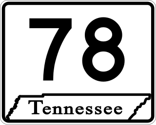
State Route 78 is a 36.93-mile (59.43 km) long primary state highway in northwestern Tennessee, USA. This highway carries a dual primary and secondary designation, however, the majority of this highway is signed as a Primary State Highway. The only portion of SR 78 designated as secondary is between its southern terminus at SR 104 to US 51 in Dyersburg.

State Route 19 or the Tina Turner Highway is a state highway in Haywood and Lauderdale counties in Tennessee, United States. State Route 19 is 42.81 mi (69 km) long.

State Route 57 is an east–west highway that runs from Memphis to the Mississippi state line near Pickwick Dam and Pickwick Landing State Park. Except for in Shelby County and western Fayette County, SR 57 is a two lane road generally with a 55 mph (89 km/h) speed limit. The majority of the road follows the path of the Memphis and Charleston Railroad.

In Tennessee, U.S. Route 412 stretches for 181.93 miles (292.79 km) through the farmland of West Tennessee and the hills of Middle Tennessee, starting at the Missouri state line near Dyersburg and running to an interchange between I-65 and SR 99 in Columbia.

State Route 386 (SR 386) is a major east–west state route, signed north-south, located in Davidson and Sumner counties in Tennessee. It is known as Vietnam Veterans Boulevard and serves as a bypass for U.S. Highway 31E and a connector to Hendersonville and Gallatin from Nashville. A majority of the route is a four-lane controlled-access highway.

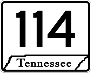
State Route 114 is a north–south state highway that traverses six counties in the western grand division of Tennessee. The 96.49-mile-long (155.29 km) route travels from Clifton Junction to an area south of Paris via Scotts Hill, Lexington, and the Natchez Trace State Park.


