Fowlkes, Tennessee

Last updated

Fowlkes, Tennessee
1888 c1882-NewportNew&MississippiValleyRailroad.jpg
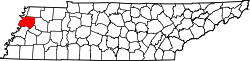
Map of Lauderdale County, showing Fowlkes in southern Dyer County
USA Tennessee location map.svg
Red pog.svg
Fowlkes
Usa edcp location map.svg
Red pog.svg
Fowlkes
Coordinates: 35°58′14″N89°23′10″W / 35.97056°N 89.38611°W / 35.97056; -89.38611
Country United States
State Tennessee
County Dyer
Founded1882
Area
[1]
  Total2.09 sq mi (5.42 km2)
  Land2.09 sq mi (5.42 km2)
  Water0.00 sq mi (0.00 km2)
Elevation
[2]
341 ft (104 m)
Population
 (2020) [3]
  Total882
  Density421.40/sq mi (162.73/km2)
Time zone UTC-6 (Central (CST))
  Summer (DST) UTC-5 (CDT)
ZIP code
38024 [4]
Area code 731
GNIS feature ID1284753 [2]

Fowlkes is an unincorporated community in Dyer County, Tennessee, United States. [2]

Contents

History

Originally founded as Fowlkes Station in 1882 by W.P. Fowlkes, the following year the Newport News & Mississippi Valley Railroad was completed in Dyer County. The line for this railroad passed through the community of Fowlkes. By 1887, the community supported a school, a Methodist church, and multiple grist mills and cotton gins. [5] [6]

Demographics

Historical population
CensusPop.Note
2020 882
U.S. Decennial Census [7]

Notes

  1. "ArcGIS REST Services Directory". United States Census Bureau. Retrieved October 15, 2022.
  2. 1 2 3 "Fowlkes, Tennessee". Geographic Names Information System . United States Geological Survey, United States Department of the Interior.
  3. "Census Population API". United States Census Bureau. Retrieved October 15, 2022.
  4. "Fowlkes TN ZIP Code". zipdatamaps.com. 2023. Retrieved February 17, 2023.
  5. Goodspeed's History of Tennessee. Nashville, TN: The Goodspeed Publishing Co. 1887. p. 850.
  6. "Goodspeed History - Dyer County". tn-roots.com. Retrieved July 1, 2024.
  7. "Census of Population and Housing". Census.gov. Retrieved June 4, 2016.


Related Research Articles

<span class="mw-page-title-main">Obion County, Tennessee</span> County in Tennessee, United States

Obion County is a county located in the northwest corner of the U.S. state of Tennessee. As of the 2020 census, the population was 30,787. The county seat is Union City. The county was formed in 1823 and organized in 1824. It was named after the Obion River.

<span class="mw-page-title-main">Morgan County, Tennessee</span> County in Tennessee, United States

Morgan County is a county located in the U.S. state of Tennessee. As of the 2020 census, the population was 21,035. Its county seat is Wartburg. Morgan County is part of the Knoxville, TN Combined Statistical Area.

<span class="mw-page-title-main">Dyer County, Tennessee</span> County in Tennessee, United States

Dyer County is a county located in the westernmost part of the U.S. state of Tennessee. As of the 2020 census, the population was 36,801. The county seat is Dyersburg. Dyer County comprises the Dyersburg, TN Micropolitan Statistical Area.

<span class="mw-page-title-main">Shelbyville, Tennessee</span> City in Tennessee, United States

Shelbyville is a city in and the county seat of Bedford County, Tennessee. The town was laid out in 1810 and incorporated in 1819. Shelbyville had a population of 20,335 residents at the 2010 census. The town is a hub of the Tennessee Walking Horse industry and has been nicknamed "The Walking Horse Capital of the World".

<span class="mw-page-title-main">Ashland City, Tennessee</span> Town in Tennessee, United States

Ashland City is a town and the county seat of Cheatham County, Tennessee. Located in Middle Tennessee, it is part of the Nashville-Davidson–Murfreesboro–Franklin, TN Metropolitan Statistical Area. As of the 2020 census, the town's population was 5,193.

<span class="mw-page-title-main">Tazewell, Tennessee</span> Town in Tennessee, United States

Tazewell is a town in and the county seat of Claiborne County, Tennessee, United States. The population was 2,165 at the 2000 census, 2,218 at the 2010 census, and 2,348 at the 2020 census. The town is named for Tazewell, Virginia, which itself was named for Henry Tazewell (1753–1799), a U.S. senator from Virginia.

<span class="mw-page-title-main">Halls, Tennessee</span> Town in Tennessee, United States

Halls is a town in Lauderdale County, Tennessee, United States. The population was 2,255 at the 2010 census.

<span class="mw-page-title-main">Niota, Tennessee</span> City in Tennessee, United States

Niota is a city in McMinn County, Tennessee, United States. The population was estimated at 772 in 2020 by the U.S. Census Bureau.

<span class="mw-page-title-main">Bartlett, Tennessee</span> City in Tennessee, United States

Bartlett is a city in Shelby County, Tennessee, United States. The population was 57,786 at the 2020 U.S. Census.

Bluff City is a city in Sullivan County, Tennessee. The population was 1,733 at the 2010 census. It is part of the Kingsport-Bristol-Bristol, TN-VA Metropolitan Statistical Area, which is a component of the Johnson City-Kingsport-Bristol, TN-VA Combined Statistical Area, commonly known as the "Tri-Cities" region.

<span class="mw-page-title-main">Atoka, Tennessee</span> Town

Atoka is a local government area with a town charter in Tipton County, Tennessee, United States. In 1888, Atoka was a stop on the Newport News & Mississippi Valley Railroad. Today the City of New Orleans Amtrak passenger train makes its daily route between New Orleans and Chicago, through Atoka. The population was 10,008 at the 2020 census, making the Town of Atoka the largest municipality in Tipton County.

<span class="mw-page-title-main">Maynardville, Tennessee</span> City and county seat of Union County, Tennessee, United States

Maynardville is a city in and the county seat of Union County, Tennessee, United States. The city was named to honor Horace Maynard, who successfully defended the creation of Union County from a challenge from Knox County. Its population was 2,413 at the 2010 census, up from 1,782 at the 2000 census. It is included in the Knoxville metropolitan statistical area.

<span class="mw-page-title-main">McKenzie, Tennessee</span> City in Tennessee, United States

McKenzie is a city at the tripoint of Carroll, Henry, and Weakley counties in Tennessee, United States. The population was 5,310 at the 2010 census.

<span class="mw-page-title-main">Gladeville, Tennessee</span> Unincorporated community in Tennessee, United States

Gladeville is an unincorporated community in Wilson County, Tennessee. The community is named for the surrounding cedar glades— a unique type of ecosystem that thrives in the thin or barren soil of south Wilson County. Gladeville is located just off Interstate 840 along Stewarts Ferry Pike, approximately 10 miles (16 km) southeast of Mt. Juliet.

<span class="mw-page-title-main">Statesville, Tennessee</span> Unincorporated community in Tennessee, United States

Statesville is an unincorporated community in Wilson County, Tennessee. It is located along Tennessee State Route 267 near Watertown.

Counce is an unincorporated community in Hardin County, Tennessee. Counce is located on Tennessee State Route 57 near the Mississippi border. The community is adjacent to the Tennessee River near the Pickwick Landing Dam. Counce is the terminus of a Kansas City Southern line which was originally the Corinth and Counce Railroad and later became part of the MidSouth Rail Corporation before Kansas City Southern took over MidSouth. Counce was named after the Counce families, who were the first families to inhabit the community.

<span class="mw-page-title-main">Newcomb, Tennessee</span> Unincorporated community in Tennessee, US

Newcomb is an unincorporated community in Campbell County, Tennessee, United States. It is situated in the Elk Fork Creek Valley in the Cumberland Mountains, southwest of Jellico. Tennessee State Route 297 passes through the community. The ZIP Code for Newcomb is 37819.

Finley is an unincorporated community in Dyer County, Tennessee, United States. It is located roughly 5.5 miles west of downtown Dyersburg along Tennessee State Route 104. Tennessee State Route 182 also passes through the community, which connects it with Interstate 155 and Lenox to the north.

Lenox is an unincorporated community in Dyer County, Tennessee, United States. Its ZIP code is 38047.

<span class="mw-page-title-main">McDonald, Tennessee</span> Census-designated place in Tennessee, United States

McDonald is an unincorporated community and census-designated place (CDP) in Bradley County, Tennessee, United States. McDonald is located along U.S. Route 11 and U.S. Route 64 6.8 miles (10.9 km) west-southwest of Cleveland. McDonald has a post office with ZIP code 37353.