Guam Highway 1

Last updated
Guam Route 1.svg
Guam Highway 1
Marine Corps Drive
Guam Highway 1.png
GH-1 highlighted in red
Route information
Maintained by Guam DPW
Length21.04 mi [1]  (33.86 km)
Existedc.1941 [2] –present
Major junctions
West endGuam Route 2A.svg GH-2A  / Entrance Gate to Naval Base Guam in Santa Rita
Major intersectionsGuam Route 18.svg GH-18 in Piti

Guam Route 6.svg GH-6 in Asan
Guam Route 4.svg GH-4 in Hagåtña
Guam Route 8.svg GH-8 in Hagåtña
Guam Route 16.svg GH-16 in Tamuning

Contents

Guam Route 3.svg GH-3 in Dededo
East endGuam Route 9.svg GH-9  / Entrance Gate to Andersen AFB in Yigo
Location
Country United States
Territory Guam
Highway system
Guam Route 34.svg GH-34 Guam Route 2.svg GH-2

Guam Highway 1 (GH-1), also known as Marine Corps Drive, is one of the primary automobile routes in the United States territory of Guam. It runs in a southwest-to-northeast direction, from the main gate of Naval Base Guam in the southwestern village of Santa Rita in a northeasterly direction to the main gate of Andersen Air Force Base in the village of Yigo. It passes through Guam's capital, Hagåtña, as well as intersecting other territorial highways. The highway runs through tropical forest, urbanized commercial areas, and residential neighborhoods. The US military upgraded and extended the road starting in 1941. Construction ceased with the Japanese invasion in December 1941 and resumed after the Second Battle of Guam in 1944. The highway was formally dedicated to the U.S. Marine Corps by the governor in 2004.

Route description

The southern end of GH-1 begins near the entrance gate to Naval Base Guam, at a junction with GH-2A. Known as Marine Corps Drive, the route then travels to the northeast through tropical forests along Apra Harbor to the town of Piti. After passing through Piti, the drive runs along Tepungon Beach before passing Asan Point. It runs parallel to the coast along War in the Pacific National Historical Park's Asan Invasion Beach through the community of Asan. At Ricardo J. Bordallo Governor's Complex in Adelup, it passes northward through the western edge of Hagåtña. In this area, GH-1 runs through commercial areas parallel to the West Agaña Beach Front area. The drive passes the Paseo de Susana and Skinner Plaza before following Trinchera Beach northeasterly through town. [3] [4]

Marine Corps Drive on Guam Marine Drive Guam.jpg
Marine Corps Drive on Guam

After passing through the Hagåtña and an area of Mongmong-Toto-Maite below the cliffline, the road turns towards the northeast and reaches typically its most congested section in Tamuning at the intersection with Guam Highway 14. Curving northwest past the intersection with Guam Highway 10A that leads to Antonio B. Won Pat International Airport, Marine Drive passes John F. Kennedy High School and the area of Upper Tumon. It curves northeasterly around the Micronesia Mall and inland areas of upper, losing sight of the ocean, before turning inland and southeasterly through residential areas as it cuts across the southern edges of Dededo. It runs to the south of the Guam International Country Club and north of the forested military property known as Andersen South. Marine Corps Drive passes the War Dead Cemetery and turns northeasterly with residential areas on both sides of the roadway through Yigo before reaching its terminus at Salisbury Junction, the main entrance to the Air Force Base, where the road continues to the northwest as GH-9. [3] [4]

Like most major highways on Guam, a 35 mph (56 km/h) speed limit is posted throughout most of its length. In the past, GH-1 was one of the few roads to post a 45 mph (72 km/h) limit on lengths of less-developed roadway. However, as more of the area became developed, certain sections of the roads were posted with lower limits. Travelers heading north away from the developed areas are allowed a 45 mph (72 km/h) speed limit. However, the southbound lanes on the same sections remain posted at 35 mph (56 km/h) due to development on the western side of the road. [5]

History

The United States military began to develop and construct roads on the island in 1941. Some roads had existed prior to this, but improvements were beginning to take shape. Only one road, which encircled most of the island, had been graded. It was the primary route linking Agana (the name of the capital at the time) to Piti and Asan. This was the foundation for Marine Corps Drive. After the Japanese invasion, little infrastructure improvements were made by the occupiers. Road construction resumed by the US military after the island was invaded in 1944. In 60 days, a 12-mile (19 km), four-lane super-highway with nine bridges was built after the invasion. The remainder of the roadway was built and numbered under the local administration after Guam was given civil government in 1950. [2]

The road was known as simply Marine Drive until it was rededicated by Governor Felix Perez Camacho in 2004. [6] In 2012, the DPW has started to install LED streetlights along Marine Corps Drive. [7] At the same time, construction has started to replace the Agana Bridge along GH-1. [8]

Major intersections

Locationmi [1] kmDestinationsNotes
Santa Rita 0.000.00Entrance to Naval Base Guam Western terminus
0.050.080South plate.svg
Guam Route 2A.svg
GH-2A south Agat
Northern terminus of GH-2A
Piti 2.724.38West plate.svg
Guam Route 18.svg
GH-18 west Port Authority Beach
Eastern terminus of GH-18
2.824.54East plate.svg
Guam Route 6.svg
GH-6 east Nimitz Hill
Western terminus of GH-6
3.104.99West plate.svg
Guam Route 11.svg
GH-11 west Commercial Port
Eastern terminus of GH-11
Asan 6.009.66West plate.svg
Guam Route 6.svg
GH-6 west Nimitz Hill
Eastern terminus of GH-6
Hagåtña 7.6612.33West plate.svg
Guam Route 4.svg
GH-4 west Sinajana
Eastern terminus of GH-4
7.8412.62East plate.svg
Guam Route 8.svg
GH-8 east (Purple Heart Highway) Mongmong
Western terminus of GH-8
Tamuning 10.3416.64North plate.svg
Guam Route 14B.svg
GH-14B north (Ypao Road) Tumon
Southern terminus of GH-14B
10.7017.22East plate.svg
Guam Route 10A.svg
GH-10A east Airport
Western terminus of GH-10A
Tumon 11.3018.19North plate.svg
Guam Route 14A.svg
GH-14A north Tumon
Southern terminus of GH-14A
13.1921.23East plate.svg
Guam Route 16.svg
GH-16 east Barrigada
Western terminus of GH-16
13.2921.39West plate.svg
Guam Route 34.svg
GH-34 west
Southern terminus of GH-34
13.7922.19North plate.svg
Guam Route 3.svg
GH-3 north
Southern terminus of GH-3
Dededo 13.9922.51West plate.svg
Guam Route 27A.svg
GH-27A west
Eastern terminus of GH-27A
14.7023.66West plate.svg
Guam Route 27.svg
GH-27 west
Eastern terminus of GH-27
15.1124.32South plate.svg
Guam Route 26.svg
GH-26 south Mangilao
Northern terminus of GH-26
15.3024.62North plate.svg
Guam Route 28.svg
GH-28 north
Southern terminus of GH-28
Yigo 18.9230.45East plate.svg
Guam Route 29.svg
To plate.svg
Guam Route 15.svg
GH-29 east to GH-15
Western terminus of GH-29
21.0433.86Guam Route 9.svg GH-9  Andersen AFB Eastern terminus; entrance to Andersen Air Force Base
1.000 mi = 1.609 km; 1.000 km = 0.621 mi

See also

Related Research Articles

<span class="mw-page-title-main">Hagåtña, Guam</span> Capital city of Guam

Hagåtña, formerly Agana or Agaña, is a coastal village and the capital of the United States territory of Guam. From the 18th through mid-20th century, it was Guam's population center, but today, it is the second smallest of the island's 19 villages in both area and population. However, it remains one of the island's major commercial districts in addition to being the seat of government.

<span class="mw-page-title-main">Roman Catholic Archdiocese of Agaña</span> Roman Catholic archdiocese in Guam

The Metropolitan Archdiocese of Agaña is a Latin Church ecclesiastical territory or diocese. It comprises the United States dependency of Guam. The prelate is an archbishop whose cathedral is the Dulce Nombre de Maria Cathedral-Basilica.

<span class="mw-page-title-main">Piti, Guam</span> Village in Guam, United States

Piti is a village located on the central west coast of the United States territory of Guam. It contains northern and eastern coastlines of Apra Harbor, including Cabras Island, which has the commercial Port of Guam and the island's largest power plants. Piti was a pre-Spanish CHamoru village and, after Spanish colonization, became the primary port town on Guam. The town was largely destroyed during the 1944 liberation of Guam and the population relocated during the wartime construction of Apra Harbor.

<span class="mw-page-title-main">War in the Pacific National Historical Park</span> National Historical Park of the US

The War in the Pacific National Historical Park is a multi-unit protected area in the United States territory of Guam, which was established in 1978 in honor of those who participated in the Pacific Theater of World War II. Uniquely among the National Park System, it honors the bravery and sacrifices of all those who participated in the Pacific Theater.

<span class="mw-page-title-main">Agana Heights, Guam</span> Village in Guam, United States

Agana Heights is one of the nineteen villages in the United States territory of Guam. It is located in the hills south of Hagåtña, in the central part of the island. United States Naval Hospital Guam is located in this largely residential village.

The area code 671 is the local telephone area code of the United States territory of Guam. It was created with the beginning of permissive dialing on July 1, 1997, replacing Guam's previous International Telecommunication Union country code 671 at the end of permissive dialing on July 1, 1998.

<span class="mw-page-title-main">Nimitz Hill Annex, Guam</span> Census-designated place in Guam, United States

Nimitz Hill Annex is a community and census-designated place (CDP) in Asan-Maina, Guam. It contains the geographic feature of Nimitz Hill, and is located immediately northeast of the Nimitz Hill CDP in Piti. In normal conversation, the Nimitz Hill CDP and Nimitz Hill Annex CDP are often collectively referred to as "Nimitz Hill."

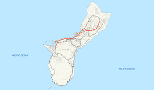
Guam Highway 4 (GH-4) is one of the primary automobile highways in the United States territory of Guam.

Guam Highway 6 (GH-6) is one of the primary automobile highways in the United States territory of Guam. It is known as Spruance Drive within Piti and Halsey Drive within Asan-Maina: both named for noteworthy US Navy Admirals that served in the Pacific Ocean theater of World War II: Raymond A. Spruance and William Halsey Jr., respectively.

Guam Highway 7 (GH-7) is one of the primary automobile highways in the United States territory of Guam.

Guam Highway 8 (GH-8) is one of the primary automobile highways in the United States territory of Guam.

The Guam Department of Parks and Recreation operates public parks in Guam. The agency has its headquarters in Agana Heights.

<span class="mw-page-title-main">Joint Region Marianas</span> One of eleven naval regions of the U.S. Navy

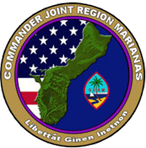
Joint Region Marianas' mission is to provide installation management support to all Department of Defense components and tenants through assigned regional installations on Guam and the Northern Mariana Islands in support of training in the Marianas; to act as the interface between the Department of Defense and the civilian community; to ensure compliance with all environmental laws and regulations, safety procedures, and equal opportunity policy; and perform other functions and tasks as may be assigned.

<span class="mw-page-title-main">Adelup Point</span> Cape in Guam

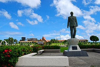
Adelup Point is limestone promontory in Hagåtña, Guam that extends into the Philippine Sea and separates Asan Bay from Hagåtña Bay. It has been the site of the Ricardo J. Bordallo Governor's Complex since 1990. Adelup is therefore a metonym for the Office of the Governor of Guam.

<span class="mw-page-title-main">Liberation Day (Guam)</span> Public holiday in Guam

Liberation Day on the U.S. territory of Guam is an annual commemoration of the invasion by U.S. military forces on July 21, 1944, which ended the Japanese occupation that had begun in 1941. Begun in 1945, it is Guam's largest celebration. Festivities include a queen contest, summer carnival, fireworks display, and mile-long parade on Marine Corps Drive in Hagåtña from Adelup to Paseo de Susana, as well as solemn memorials and visits to massacre sites. It is organized by the Guam Island Fair Committee.

<span class="mw-page-title-main">Piti Bomb Holes Marine Preserve</span> Marine protected area in Guam

Piti Bomb Holes Marine Preserve is a marine protected area comprising all of Piti Bay on the western coast of Guam, located off of the village of Piti in the Philippine Sea. The defining "bomb hole" features, named because they look like bomb craters in the reef flat, are actually natural percolation pits where fresh water filters into the shallow lagoon at a depth of 25 to 30 feet. The largest pit houses the commercial Fish Eye Marine Park tourist attraction, which includes a wooden pier to a underwater observatory and a Seawalker tour of the lagoon bottom. It is visited by more than 200,000 people annually. The Piti preserve is the most ecologically diverse of Guam's five marine preserves. The pit around Fish Eye is a popular snorkeling and recreational diving site.

<span class="mw-page-title-main">Asan, Guam</span> Census-designated place in Guam, United States

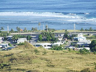
Asan is a community and census-designated place (CDP) along the western coast of the U.S. territory of Guam. Asan, along with Maina and Nimitz Hill Annex, are the three communities in the village of Asan-Maina. It is known for being the location of the northern invasion beach used by the United States during the retaking of Guam in 1944.

References

  1. 1 2 U.S. Census Bureau (January 1, 2006). "2006 Second Edition TIGER/Line File". U.S. Census Bureau. Retrieved February 19, 2008.
  2. 1 2 National Park Service (May 3, 2004). "Part 2a: History". Cultural Landscapes Inventory: Asan and Agat Invasion Beaches, War in the Pacific National Historical Park. National Park Service. Retrieved February 19, 2008.
  3. 1 2 Unpingco, Bert; Nielsen, Frank M. (January 2007). Franko's Guide Map of Guam (Map). Scale not given. Corona, CA: Franko's Maps. §§ D2–C4, K7–J8. ISBN   1-60190-090-2.
  4. 1 2 "Overview Map of Guam Highway 1" (Map). Google Maps . Retrieved April 19, 2012.
  5. Davis, John (January 3, 2008). "One Road, Two Speed Limits? Better Believe It". Hagåtña, GU: KUAM-TV. Archived from the original on February 23, 2012. Retrieved February 23, 2008.
  6. Eusebio, Marissa (April 13, 2004). "Governor Signs Order to Rename Marine Drive to 'Marine Corps Drive'". Hagåtña, GU: KUAM-TV. Retrieved October 31, 2006.
  7. Temkar, Arvin (April 19, 2012). "Conference Kicks off on Sustainability". Pacific Daily News. Retrieved April 19, 2012.[ permanent dead link ]
  8. Kelman, Brett (April 5, 2012). "Agana Bridge Groundbreaking April 16". Pacific Daily News. Retrieved April 19, 2012.[ permanent dead link ]
Template:Attached KML/Guam Highway 1
KML is from Wikidata