
Hagåtña, formerly Agana or Agaña, is a coastal village and the capital of the United States territory of Guam. From the 18th through mid-20th century, it was Guam's population center, but today, it is the second smallest of the island's 19 villages in both area and population. However, it remains one of the island's major commercial districts in addition to being the seat of government.

Apra Harbor, also called Port Apra, is a deep-water port on the western side of the United States territory of Guam. It is considered one of the best natural ports in the Pacific Ocean. The harbor is bounded by Cabras Island and the Glass Breakwater to the north and the Orote Peninsula in the south. Naval Base Guam and the Port of Guam are the two major users of the harbor. It is also a popular recreation area for boaters, surfers, scuba divers, and other recreationalists.

Asan-Maina is a village located on the western shore of the United States territory of Guam. The municipality combines the names of the coastal community of Asan with Maina, a community along the slopes of the Fonte River valley to the east. Asan was the northern landing site for United States Marines during Guam's liberation from the Japanese during World War II. Asan Beach Park is part of the War in the Pacific National Historic Park. The third community comprising Asan-Maina is Nimitz Hill Annex in the hills above Asan and Maina, which is the location of the Joint Region Marianas headquarters. Asan-Maina is located in the Luchan (Western) District.

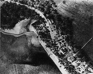
Piti is a village located on the central west coast of the United States territory of Guam. It contains northern and eastern coastlines of Apra Harbor, including Cabras Island, which has the commercial Port of Guam and the island's largest power plants. Piti was a pre-Spanish CHamoru village and, after Spanish colonization, became the primary port town on Guam. The town was largely destroyed during the 1944 liberation of Guam and the population relocated during the wartime construction of Apra Harbor.

Yona is a village in the United States territory of Guam.

The War in the Pacific National Historical Park is a multi-unit protected area in the United States territory of Guam, which was established in 1978 in honor of those who participated in the Pacific Theater of World War II. Uniquely among the National Park System, it honors the bravery and sacrifices of all those who participated in the Pacific Theater.

Guam Highway 1 (GH-1), also known as Marine Corps Drive, is one of the primary automobile routes in the United States territory of Guam. It runs in a southwest-to-northeast direction, from the main gate of Naval Base Guam in the southwestern village of Santa Rita in a northeasterly direction to the main gate of Andersen Air Force Base in the village of Yigo. It passes through Guam's capital, Hagåtña, as well as intersecting other territorial highways. The highway runs through tropical forest, urbanized commercial areas, and residential neighborhoods. The US military upgraded and extended the road starting in 1941. Construction ceased with the Japanese invasion in December 1941 and resumed after the Second Battle of Guam in 1944. The highway was formally dedicated to the U.S. Marine Corps by the governor in 2004.

Nimitz Hill Annex is a community and census-designated place (CDP) in Asan-Maina, Guam. It contains the geographic feature of Nimitz Hill, and is located immediately northeast of the Nimitz Hill CDP in Piti. In normal conversation, the Nimitz Hill CDP and Nimitz Hill Annex CDP are often collectively referred to as "Nimitz Hill."

The Orote Peninsula is a four kilometer-long peninsula jutting from the west coast of the United States territory of Guam. A major geologic feature of the island, it forms the southern coast of Apra Harbor and the northern coast of Agat Bay. Its tip, Point Udall, is Guam's westernmost point and also the United States' westernmost point by travel, not longitude. The peninsula historically was the site of the important Chamorro village of Sumay, as well as Fort Santiago of the Spanish colonial period. In modern times, the peninsula is politically in the village of Santa Rita, but it is controlled in its entirety by Naval Base Guam.
The Asan River is a river in the United States territory of Guam that lies entirely within the village of Asan-Maina. It originates in the highlands of Nimitz Hill Annex and flows through the Asan Inland Unit of War in the Pacific National Historical Park (WAPA) and enters the community of Asan. It then briefly re-enters WAPA at its Asan Inland Unit, with the mouth at the eastern end of Asan Memorial Park into Asan Bay. The river was thus a significant geographical feature of the Asan Invasion Beach for U.S. forces during the initial landings on Guam in July 1944.
Guam Highway 6 (GH-6) is one of the primary automobile highways in the United States territory of Guam. It is known as Spruance Drive within Piti and Halsey Drive within Asan-Maina: both named for noteworthy US Navy Admirals that served in the Pacific Ocean theater of World War II: Raymond A. Spruance and William Halsey Jr., respectively.
Joint Region Marianas' mission is to provide installation management support to all Department of Defense components and tenants through assigned regional installations on Guam and the Northern Mariana Islands in support of training in the Marianas; to act as the interface between the Department of Defense and the civilian community; to ensure compliance with all environmental laws and regulations, safety procedures, and equal opportunity policy; and perform other functions and tasks as may be assigned.

United States Naval Hospital Guam is a U.S. Navy medical facility on the U.S. territory of Guam. It provides a broad range of medical services to active-duty U.S. military personnel under Joint Region Marianas. Besides the main hospital, the hospital runs a medical clinic and a dental clinic on Naval Base Guam.
Nimitz Hill may refer to:
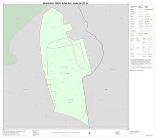
Nimitz Hill is a community and census-designated place (CDP) in Piti, Guam. is located immediately west of the Nimitz Hill Annex CDP in Asan-Maina, which contains the geographic feature of Nimitz Hill. In normal conversation, the Nimitz Hill CDP and Nimitz Hill Annex CDP are often collectively referred to as "Nimitz Hill."
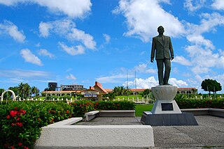
Adelup Point is limestone promontory in Hagåtña, Guam that extends into the Philippine Sea and separates Asan Bay from Hagåtña Bay. It has been the site of the Ricardo J. Bordallo Governor's Complex since 1990. Adelup is therefore a metonym for the Office of the Governor of Guam.

Liberation Day on the U.S. territory of Guam is an annual commemoration of the invasion by U.S. military forces on July 21, 1944, which ended the Japanese occupation that had begun in 1941. Begun in 1945, it is Guam's largest celebration. Festivities include a queen contest, summer carnival, fireworks display, and mile-long parade on Marine Corps Drive in Hagåtña from Adelup to Paseo de Susana, as well as solemn memorials and visits to massacre sites. It is organized by the Guam Island Fair Committee.
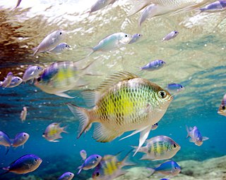
Piti Bomb Holes Marine Preserve is a marine protected area comprising all of Piti Bay on the western coast of Guam, located off of the village of Piti in the Philippine Sea. The defining "bomb hole" features, named because they look like bomb craters in the reef flat, are actually natural percolation pits where fresh water filters into the shallow lagoon at a depth of 25 to 30 feet. The largest pit houses the commercial Fish Eye Marine Park tourist attraction, which includes a wooden pier to a underwater observatory and a Seawalker tour of the lagoon bottom. It is visited by more than 200,000 people annually. The Piti preserve is the most ecologically diverse of Guam's five marine preserves. The pit around Fish Eye is a popular snorkeling and recreational diving site.

Nimitz Hill is a hill in Asan-Maina, Guam. It lies within the Nimitz Hill Annex CDP. The US Navy headquarters for Guam lie near the crest of the hill. The hill is named after American admiral Chester W. Nimitz who was Commander in Chief of the Pacific Ocean Areas during World War II with his headquarters in Guam.


