Guam Highway 15

Last updated

Guam route marker 15.svg

Guam Highway 15
Route information
Maintained by Guam Department of Public Works
Major junctions
West endGuam route marker 4.svg GH-4 in Chalan Pago-Ordot
 

Guam route marker 10.svg GH-10 in Mangilao
Guam route marker 26.svg GH-26 in Mangilao

Guam route marker 29.svg GH-29 in Yigo
East end Rear Gate to Andersen AFB
Highway system

Guam Highways

Guam route marker 14.svg GH-14 GH-16 Guam route marker 16.svg

Guam Highway 15 (GH-15) is one of the primary automobile highways in the United States territory of Guam.

United States Federal republic in North America

The United States of America (USA), commonly known as the United States or America, is a country composed of 50 states, a federal district, five major self-governing territories, and various possessions. At 3.8 million square miles, the United States is the world's third or fourth largest country by total area and is slightly smaller than the entire continent of Europe's 3.9 million square miles. With a population of over 327 million people, the U.S. is the third most populous country. The capital is Washington, D.C., and the largest city by population is New York City. Forty-eight states and the capital's federal district are contiguous in North America between Canada and Mexico. The State of Alaska is in the northwest corner of North America, bordered by Canada to the east and across the Bering Strait from Russia to the west. The State of Hawaii is an archipelago in the mid-Pacific Ocean. The U.S. territories are scattered about the Pacific Ocean and the Caribbean Sea, stretching across nine official time zones. The extremely diverse geography, climate, and wildlife of the United States make it one of the world's 17 megadiverse countries.

Guam Island territory of the United States of America

Guam is an unincorporated and organized territory of the United States in Micronesia in the western Pacific Ocean. It is the easternmost point and territory of the United States, along with the Northern Mariana Islands. The capital city of Guam is Hagåtña and the most populous city is Dededo. The inhabitants of Guam are called Guamanians, and they are American citizens by birth. Indigenous Guamanians are the Chamorros, who are related to other Austronesian natives of Eastern Indonesia and Philippines and Taiwan. Guam has been a member of the Pacific Community since 1983.
Contents

Route description

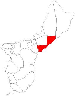
GH-15's route covers mainly the northeast coast of Guam. Beginning off of GH-4 in Chalan Pago-Ordot, GH-15 proceeds eastward into Mangilao, where it intersects GH-10. GH-15 continues east until it approaches the east coast. From there, GH-15 generally follows the coastline. Towards the northern edge of Mangilao, GH-15 meets the southern end of GH-26, heading north towards Dededo. GH-15 eventually crosses into Yigo and starts moving gradually inland. Shortly after passing GH-15's most notable attraction, the Guam International Raceway, GH-15 makes its final major junction, with GH-29, a connector to GH-1 and the main gate to Andersen Air Force Base. GH-15 finally continues north until it ends at Andersen AFB's rear gate. [1]

Guam Highway 4 (GH-4) is one of the primary automobile highways in the United States territory of Guam.

Mangilao, Guam Village in Guam, United States

Mangilao is a village on the eastern shore of the United States territory of Guam. The village's population has increased slightly following the island's 2000 census.

Guam Highway 10 (GH-10) is one of the primary automobile highways in the United States territory of Guam.

Major intersections

LocationmikmDestinationsNotes
Chalan Pago-Ordot Guam route marker 4.svg GH-4  Yona, Hagåtña Western terminus
Mangilao Guam route marker 10.svgGuam route marker 4.svg GH-10 to GH-4  Barrigada
Guam route marker 26.svg GH-26 north Dededo
Yigo Guam route marker 29.svgGuam route marker 1.svg GH-29 west to GH-1
Andersen AFB Rear GateEastern terminus
1.000 mi = 1.609 km; 1.000 km = 0.621 mi

Related Research Articles

U.S. Route 101 (US 101) is a United States Numbered Highway that runs along the Pacific Coast from Los Angeles, California to Tumwater, Washington. Within the state of Washington, US 101 connects cities on the coast of the Pacific Ocean and encircles the Olympic Peninsula around the Olympic Mountains and Olympic National Park.

Guam Highway 2 is one of the primary automobile routes in the United States territory of Guam.

Guam Highway 3 (GH-3) is one of the primary automobile highways in the United States territory of Guam.

Guam Highway 5 (GH-5) is one of the primary automobile highways in the United States territory of Guam.

Guam Highway 6 (GH-6) is one of the primary automobile highways in the United States territory of Guam. It is known alternately as Spruance Drive and Halsey Drive: both named for noteworthy US Navy Admirals that served in the Pacific Ocean theater of World War II: Raymond A. Spruance and William Halsey Jr., respectively.

Guam Highway 7 (GH-7) is one of the primary automobile highways in the United States territory of Guam.

Guam Highway 8 (GH-8) is one of the primary automobile highways in the United States territory of Guam.

Guam Highway 11 (GH-11) is one of the primary automobile highways in the United States territory of Guam.

Guam Highway 9 (GH-9) is one of the primary automobile highways in the United States territory of Guam.

Guam Highway 16 (GH-16), also named Army Drive, is one of the primary automobile highways in the United States territory of Guam.

Guam Highway 10A (GH-10A) is one of the primary automobile highways in the United States territory of Guam.

Guam Highway 17 (GH-17) is one of the primary automobile highways in the United States territory of Guam.

Guam Highway 18 (GH-18) is one of the primary automobile highways in the United States territory of Guam.

Guam Highway 12 (GH-12) is one of the primary automobile highways in the United States territory of Guam.

Guam Highway 14 (GH-14) is one of the primary automobile highways in the United States territory of Guam.

Guam Highway 27 (GH-27), also known as Hamburger Highway or Harmon Loop Road, is a short highway in the United States territory of Guam. The highway runs in an east–west direction from a junction with GH-16 to a junction with GH-1, and is located almost entirely in the southern region of the city of Dededo. The highway gets its name from the fact that it provides access to a large McDonald's restaurant located at the intersection with GH-16.

Highway 1 (Tasmania) road route in Tasmania

In Tasmania, Highway 1 is a 336-kilometre (209 mi) long route that connects Hobart to the state's north coast, and to Launceston via a 3.8-kilometre (2.4 mi) long spur. Highway 1 also exists on the mainland of Australia, linking the state capitals via a circular route around the coastline. All roads within the Highway 1 system are allocated a road route numbered 1, M1, A1, or B1, depending on the state route numbering system. In Tasmania the highway is designated as National Highway 1, though all other routes in the state are alphanumeric.

References

  1. Map of Guam U.S.A. (Map). Franko's Maps, Ltd., Guam Visitors Bureau. 2007.

Route map: Google

KML file (edithelp)
KML is from Wikidata