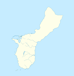
Tamuning, also known as Tamuning-Tumon-Harmon is a village located on the western shore of the United States territory of Guam. The village of Tamuning is the economic center of Guam, containing tourist center Tumon, Harmon Industrial Park, and other commercial districts. Its central location along Marine Corps Drive, the island's main thoroughfare, has aided in its development.
King's Highway 26, commonly referred to as Highway 26, is a provincially maintained highway in the Canadian province of Ontario, connecting the cities of Owen Sound and Barrie. Between these two cities, the highway serves the southern shoreline of Georgian Bay, passing through Meaford, Collingwood and Stayner, as well as passing the Blue Mountain Resort. In addition, the highway serves as the main route to Wasaga Beach, a popular recreational destination during the summer months.

Tumon is a district located on Tumon Bay along the northwest coast of the United States unincorporated territory of Guam. Located in the municipality of Tamuning, it is the center of Guam's tourist industry.
The Guam Department of Education (GDOE), formerly the Guam Public School System, is a school district that serves the United States territory of Guam. The school district can be thought of as analogous to the school districts of other cities and communities in the United States, but in some manners, it can also be thought of as analogous to the state education agencies of other states and territories.

Tumon Bay is a bay in the United States territory of Guam, opening to the Philippine Sea. It is bounded to the north by Two Lovers Point and to the south by Ypao Point. The entirety of the bay falls within the Tumon Bay Marine Preserve, also known as the Tumon Bay Marine Preserve Area (MPA) and Tumon Preserve, one of five marine preserves on Guam. The Preserve measures 4.54 square kilometers and is roughly two miles long. The platform of the fringing reef that separates the open ocean from the lagoon is up to 1,450 feet (440 m) wide. and up to one mile from the shore. The bay is located off of the Tumon area, the tourist center of the island, in the village of Tamuning. The bay is extensively utilized for recreation and fishing.

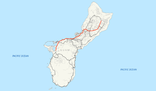
Guam Highway 1 (GH-1), also known as Marine Corps Drive, is one of the primary automobile routes in the United States territory of Guam. It runs in a southwest-to-northeast direction, from the main gate of Naval Base Guam in the southwestern village of Santa Rita in a northeasterly direction to the main gate of Andersen Air Force Base in the village of Yigo. It passes through Guam's capital, Hagåtña, as well as intersecting other territorial highways. The highway runs through tropical forest, urbanized commercial areas, and residential neighborhoods. The US military upgraded and extended the road starting in 1941. Construction ceased with the Japanese invasion in December 1941 and resumed after the Second Battle of Guam in 1944. The highway was formally dedicated to the U.S. Marine Corps by the governor in 2004.
Guam Highway 2 is one of the primary automobile routes in the United States territory of Guam.
Guam Highway 4 (GH-4) is one of the primary automobile highways in the United States territory of Guam.

Guam Premier Outlets or GPO (Japanese:グアムプレミアアウトレット), located along GH-14, is an enclosed outlet mall located in Tamuning, Guam. GPO is the only outlet mall in the United States territory of Guam with Ross Dress for Less being the only anchor of the mall.
Guam Highway 3 (GH-3) is one of the primary automobile highways in the United States territory of Guam.
Guam Highway 5 (GH-5) is one of the primary automobile highways in the United States territory of Guam.
Guam Highway 6 (GH-6) is one of the primary automobile highways in the United States territory of Guam. It is known alternately as Spruance Drive and Halsey Drive: both named for noteworthy US Navy Admirals that served in the Pacific Ocean theater of World War II: Raymond A. Spruance and William Halsey Jr., respectively.
Guam Highway 7 (GH-7) is one of the primary automobile highways in the United States territory of Guam.
Guam Highway 8 (GH-8) is one of the primary automobile highways in the United States territory of Guam.
Guam Highway 10 (GH-10) is one of the primary automobile highways in the United States territory of Guam.
Guam Highway 16 (GH-16), also named Army Drive, is one of the primary automobile highways in the United States territory of Guam.
Guam Highway 10A (GH-10A) is one of the primary automobile highways in the United States territory of Guam.
Guam Highway 15 (GH-15) is one of the primary automobile highways in the United States territory of Guam.
Guam Highway 27 (GH-27), also known as Hamburger Highway or Harmon Loop Road, is a short highway in the United States territory of Guam. The highway runs in an east–west direction from a junction with GH-16 to a junction with GH-1, and is located almost entirely in the southern region of the city of Dededo. The highway gets its name from the fact that it provides access to a large McDonald's restaurant located at the intersection with GH-16.
San Vitores may refer to:


