Guam Highway 1 (GH-1), also known as Marine Corps Drive, is one of the primary automobile routes in the United States territory of Guam. It runs in a southwest-to-northeast direction, from the main gate of Naval Base Guam in the southwestern village of Santa Rita in a northeasterly direction to the main gate of Andersen Air Force Base in the village of Yigo. It passes through Guam's capital, Hagåtña, as well as intersecting other territorial highways. The highway runs through tropical forest, urbanized commercial areas, and residential neighborhoods. The US military upgraded and extended the road starting in 1941. Construction ceased with the Japanese invasion in December 1941 and resumed after the Second Battle of Guam in 1944. The highway was formally dedicated to the U.S. Marine Corps by the governor in 2004.
Guam Highway 2 is one of the primary automobile routes in the United States territory of Guam.
Guam Highway 4 (GH-4) is one of the primary automobile highways in the United States territory of Guam.
Guam Highway 5 (GH-5) is one of the primary automobile highways in the United States territory of Guam.
Guam Highway 7 (GH-7) is one of the primary automobile highways in the United States territory of Guam.
Guam Highway 8 (GH-8) is one of the primary automobile highways in the United States territory of Guam.
Guam Highway 11 (GH-11) is one of the primary automobile highways in the United States territory of Guam.
Guam Highway 9 (GH-9) is one of the primary automobile highways in the United States territory of Guam.
Guam Highway 10 (GH-10) is one of the primary automobile highways in the United States territory of Guam.
Guam Highway 16 (GH-16), also named Army Drive, is one of the primary automobile highways in the United States territory of Guam.
Guam Highway 10A (GH-10A) is one of the primary automobile highways in the United States territory of Guam.
Guam Highway 17 (GH-17) is one of the primary automobile highways in the United States territory of Guam.
Guam Highway 12 (GH-12) is one of the primary automobile highways in the United States territory of Guam.
Guam Highway 15 (GH-15) is one of the primary automobile highways in the United States territory of Guam.
Guam Highway 14 (GH-14) is one of the primary automobile highways in the United States territory of Guam.
Joint Region Marianas' mission is to provide installation management support to all Department of Defense components and tenants through assigned regional installations on Guam and the Northern Mariana Islands in support of training in the Marianas; to act as the interface between the Department of Defense and the civilian community; to ensure compliance with all environmental laws and regulations, safety procedures, and equal opportunity policy; and perform other functions and tasks as may be assigned.

Dededo is the most populated village in the United States territory of Guam. According to the U.S. Census Bureau, Dededo's population was just under 45,000 in 2020. The village is located on the coral plateau of Northern Guam. The greater Dededo-Machanao-Apotgan Urban Cluster had a population of 139,825 as of the 2010 census, making up 87.7% of Guam's population and 29.8% of its area.
Guam Highway 27 (GH-27), also known as Hamburger Highway or Harmon Loop Road, is a short highway in the United States territory of Guam. The highway runs in an east–west direction from a junction with GH-16 to a junction with GH-1, and is located almost entirely in the southern region of the city of Dededo. The highway gets its name from the fact that it provides access to a large McDonald's restaurant located at the intersection with GH-16.
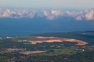
Marine Corps Base (MCB) Camp Blaz is a U.S. Marine Corps facility located in the village of Dededo in northwest Guam.

Naval Computer and Telecommunications Station Guam is a United States Navy communications facility on the U.S. territory of Guam. It is located on the Naval Base Guam North Finegayan Telecommunications Site along Guam Highway 3 in Dededo, on the northwest coast of the island.