Leach Highway is a 23-kilometre (14 mi) east-west arterial highway in the southern suburbs of Perth, Western Australia, primarily linking Kewdale and Perth Airport with the city of Fremantle.

Yamato Road is a 9.38-mile (15.10 km) east–west arterial boulevard in incorporated and unincorporated Boca Raton, Florida. A portion of the road in incorporated Boca Raton is designated State Road 794, while most of the road to the west is designated, but not signed, as County Road 794. Yamato is located on North 51st Street in the Boca Raton street numbering grid.

New York State Route 204 (NY 204) is an east–west state highway located just southwest of Rochester in Monroe County, New York, in the United States. The western terminus of the route is at exit 6 on Interstate 490 (I-490) in Gates. Its eastern terminus is at I-390 exit 18. The western portion of NY 204 is a limited-access highway known as the Airport Expressway that indirectly connects I-490 to the Greater Rochester International Airport. The remaining part of the connection is made by an at-grade portion of NY 204 on Chili and Brooks Avenues. NY 204 was assigned c. 1965 from I-490 to the Rochester city line in Gates, however the section between I-390 and the city line was removed by January 2017.

State Route 118 is a state highway in the U.S. state of Virginia. Known as Airport Road, the state highway runs 1.84 miles (2.96 km) from U.S. Route 11 in Roanoke north to SR 117 in Hollins. SR 118 provides supplemental access to Roanoke Regional Airport, whose primary access road is Aviation Drive, which is more directly connected with SR 101, Interstate 581, and US 220.

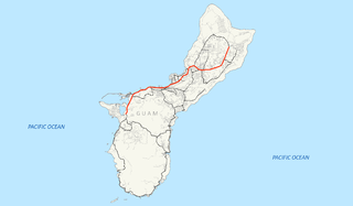
Guam Highway 1 (GH-1), also known as Marine Corps Drive, is one of the primary automobile routes in the United States territory of Guam. It runs in a southwest-to-northeast direction, from the main gate of Naval Base Guam in the southwestern village of Santa Rita in a northeasterly direction to the main gate of Andersen Air Force Base in the village of Yigo. It passes through Guam's capital, Hagåtña, as well as intersecting other territorial highways. The highway runs through tropical forest, urbanized commercial areas, and residential neighborhoods. The US military upgraded and extended the road starting in 1941. Construction ceased with the Japanese invasion in December 1941 and resumed after the Second Battle of Guam in 1944. The highway was formally dedicated to the U.S. Marine Corps by the governor in 2004.

State Road 289, known locally as North 9th Avenue, is a north–south major thoroughfare in Pensacola, Florida.
Guam Highway 4 (GH-4) is one of the primary automobile highways in the United States territory of Guam.
Guam Highway 5 (GH-5) is one of the primary automobile highways in the United States territory of Guam.
Guam Highway 7 (GH-7) is one of the primary automobile highways in the United States territory of Guam.
Guam Highway 8 (GH-8) is one of the primary automobile highways in the United States territory of Guam.
Guam Highway 11 (GH-11) is one of the primary automobile highways in the United States territory of Guam.
Guam Highway 10 (GH-10) is one of the primary automobile highways in the United States territory of Guam.
Guam Highway 16 (GH-16), also named Army Drive, is one of the primary automobile highways in the United States territory of Guam.
Guam Highway 17 (GH-17) is one of the primary automobile highways in the United States territory of Guam.
Guam Highway 12 (GH-12) is one of the primary automobile highways in the United States territory of Guam.
Guam Highway 15 (GH-15) is one of the primary automobile highways in the United States territory of Guam.
Guam Highway 14 (GH-14) is one of the primary automobile highways in the United States territory of Guam.

Barrigada is a village in the United States territory of Guam. A largely residential municipality, its main village is located south of the Antonio B. Won Pat International Airport near the intersections of Routes 8, 10, and 16. The community east of the airport known as Barrigada Heights is considered an affluent neighborhood on the island, where homes have excellent views overlooking much of Guam including the island's airport and hotels along Tumon Bay. Another significant location is Mount Barrigada, nearly 200 meters above sea level. Its location in the center of the island means it houses most of the island's radio masts and towers; the position and height make it easier for radio signals to reach the entire island.
Guam Highway 27 (GH-27), also known as Hamburger Highway or Harmon Loop Road, is a short highway in the United States territory of Guam. The highway runs in an east–west direction from a junction with GH-16 to a junction with GH-1, and is located almost entirely in the southern region of the city of Dededo. The highway gets its name from the fact that it provides access to a large McDonald's restaurant located at the intersection with GH-16.


