
This is intended to be a complete list of properties and districts listed on the National Register of Historic Places in Galveston County, Texas. There are 10 districts, 70 individual properties, and four former properties listed on the National Register in the county. Two districts and one individually listed property are National Historic Landmarks. One district and six individually listed properties are State Antiquities Landmarks. Seventy-two properties are Recorded Texas Historic Landmarks including one property that contains two while four districts contain many more.

This is a list of the National Register of Historic Places listings in Lamar County, Texas.
Arundel Cove Archaeological Site is an archaeological site near Baltimore in Anne Arundel County, Maryland. It is situated on the south shore of Arundel Cove, a tributary of Curtis Creek which drains into the Patapsco River. The site was discovered during routine shovel test pitting of the U.S. Coast Guard Yard at Curtis Bay in 1981. The test pits revealed that the site is small in size, extending only 20 feet north–south by 15 feet east–west. It represents the remains of a prehistoric summer camp which apparently was not repeatedly occupied. It contains a prehistoric period storage pits, with evidence of the use of galium and wild black cherry.
The Dead Indian Campsite is an archeological site in the Sunlight Basin of the Absaroka Mountains in Park County, Wyoming, United States. The site was found during the construction of the Sunlight Basin Road in 1967. The location was used as a butchering site, and excavations by the University of Wyoming in 1969 uncovered numerous stone tools, as well as the bones of elk, deer, mountain sheep, porcupine and wolf. A stone cairn was found to contain antler sets. The site was used in different eras for 4500 years.
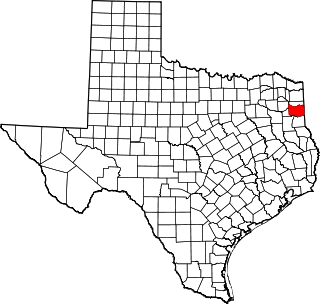
This is a list of the National Register of Historic Places listings in Harrison County, Texas.

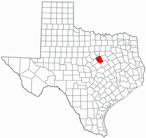
This is a list of the National Register of Historic Places listings in McLennan County, Texas.
This is a list of the National Register of Historic Places listings in Bosque County, Texas.
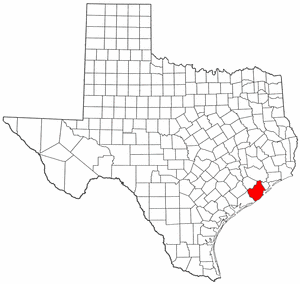
This is a list of the National Register of Historic Places listings in Brazoria County, Texas.

This is a list of the National Register of Historic Places listings in Webb County, Texas.

This is a list of the National Register of Historic Places listings in Montague County, Texas.

Cape Alitak is a finger of land on the south side of Kodiak Island, the major island of the Kodiak Archipelago of southern Alaska. The cape is an extension of Tanner Head, from which it is separated by Rodman Reach, a saltwater lagoon. The cape is bounded on the east by Alitak Bay, on the west by the southern end of Shelikof Strait, and on the south by Sitkinak Strait, which separates Kodiak Island from the Trinity Islands. The cape has long been known its remarkable collection of prehistoric petroglyphs, which include a wide variety of shapes, some of animals and humans, and others of apparently abstract geometric figures. The cape was surveyed in detail in 2011 by archaeologists from the Alutiiq Museum in Kodiak, at which time thirteen different petroglyph locations were identified, along with evidence of prehistoric habitation of the area. The petroglyph site were listed on the National Register of Historic Places in 2013.
The Talagi Pictograph Cave is a rock art site on the island of Guam. It is located on property owned by the government of Guam within the bounds of Andersen Air Force Base on the northern part of the island near Tarague Beach. The cave contains thirteen pictographs representing human figures, and a places where limestone mortar was used that is of prehistoric origin. Based on the characteristics of the figures, it is believed that they were probably the work of a single individual. It is one of a small number known rock art sites on the island.
The Fafai Beach Site is a prehistoric archaeological site near the village of Tamuning on the island of Guam. The site is stratified, containing layers representative of both the Latte and Pre-Latte periods of prehistory. The site includes several latte stone house sites, stone mortar sites, and rock overhang areas with cultural deposits. Stone, shell, and charcoal artifacts have been found here, as have several human burials.
The Mahlac Pictograph Cave is a rock art site on the island of Guam. It is located high in the southern mountains of the island, and contains more than 40 images, rendered in paints that are white, red, brown, and black. The art was carefully analyzed in 2011, and a radiocarbon date of c. 600 CE was obtained from a paint sample. The meaning of the art is a subject of debate.

The Haputo Beach Site is a prehistoric village site in northwestern Guam. The site, located on Naval Computer and Telecommunications Station Guam land near a sheltered cove, includes standing latte stones, as well as rock shelters and caves with evidence of human occupation. In addition to needing military permission for access to the site, the main trail leads through the Navy's Haputo Ecological Preserve.
Big Sioux Prehistoric Prairie Procurement System Archaeological District is a discontiguous historic district of 30 sites located along 15 miles (24 km) of river terraces and blufftops in Lyon County, Iowa. The sites are both large and small in size and they "contain a representative sample of the best preserved elements of a hunting and gathering system" of the native peoples who inhabited the northwest Iowa plains from 10,000 to 200 years ago. They include late base camps, deeply-buried early Archaic camps, and procurement sites from all time periods in the Pre-Columbian era. The district was listed on the National Register of Historic Places in 1989.
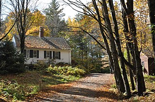
Green Pastures is a historic private summer estate near Squam Lake in Sandwich, New Hampshire. The 38-acre (15 ha) property includes a main house, several 19th-century barns, a former district schoolhouse, and a small sap house converted to a writing cabin. The property belonged to the locally prominent Coolidge family until 1934, when they sold it to Rev. T. Guthrie Speers Sr., the first minister to preach at the Chocorua Island Chapel, for his use as a summer residence.
The Four Mounds Site is a historic site located in Dubuque, Iowa, United States. It is made up of a row of four conical burial mounds on a blufftop that overlooks the Mississippi River. They are prehistoric in their origin. The site was individually listed on the National Register of Historic Places in 2000. It was included as a contributing property in the Four Mounds Estate Historic District in 2002.
The Rosenstock Village Site is a historic site located in Frederick County, Maryland, United States, near the city of Frederick. It contains the remains of a Late Woodland Village situated on a bluff overlooking the Monocacy River. The village was occupied between A.D. 1335 and A.D. 1400, based on artifact analysis and radiocarbon dating. It is similar to the Montgomery Complex, which is a cultural complex made up of Late Woodland sites located on the Potomac River. The site was excavated in 1979 and from 1990 to 1992, and estimates suggest that 93% of the site remains undisturbed. They uncovered a large oval area surrounded by pits, a large sheet midden area, and what are believed to be two sweatlodges. The excavations have yielded a trove of artifacts and animal remains. The site was listed on the National Register of Historic Places in 2018.
The Benson Archeological Site, designated 13WD50 in the state archaeological inventory, is a historic site located near Smithland, Iowa, United States. Pottery fragments found at the site include Black Sand and Crawford ware from the early Woodland period and Valley ware from the Middle Woodland period. The site was listed on the National Register of Historic Places in 1984.
