10th Independent Mixed Regiment was a regiment of the Imperial Japanese Army that has association with a number of U.S. National Register of Historic Places-listed places in Guam.
The Ilik River Fortification I near Yona, Guam was built by Japanese forces during World War II. It was listed on the U.S. National Register of Historic Places in 1991.

Blagaj Fortress or Old Town of Blagaj, locally known as Stjepan-grad (Стјепан-град), or Stipan-grad, in classical times Bona (Бона), is a town-fortress complex near the town of Blagaj, Bosnia and Herzegovina. The old Blagaj Fort was built on a high, inaccessible karst hill, at an elevation of 310 metres (1,020 ft) above sea level and 266 metres (873 ft) above the source of the river Buna. Blagaj Fort is 275 metres (902 ft) above sea level. Fortress is National monument of Bosnia and Herzegovina, declared by KONS on 6 December 2003.

The As Sombreru Pillbox I, As Sombreru Pillbox II, and As Sombreru Pillbox III are three historic defensive fortifications on Guam, near Tumon, that were listed on the U.S. National Register of Historic Places in 1991. They are pillboxes, a type of defensive fortification, built by the 48th Independent Mixed Brigade; 29th Division of the Imperial Japanese Army during 1941-1944, between Japan capturing Guam on December 8, 1941 from the United States and the U.S. recapturing Guam in 1944.

The Spanish Dikes, located northeast of Agana Springs, Hagåtña, Guam, are historic 19th-century water control structures that were listed on the National Register of Historic Places in 1974.

The Torre Water Catchment, also known as the Hatsuho Water Catchment, is located on what is now Hatsuho Golf Course in Yigo (Piga), Guam. It is a historic site that was listed on the U.S. National Register of Historic Places in 1994. The catchment has an octagonal-shaped exterior made of concrete around limestone gravel and cobbles and has a plastered cylindrical interior. It is 5.19 metres (17.0 ft) in diameter and its walls vary from .27 to .46 meters thick. It was built in approximately 1916 by a farmer, Juan dela Torre, to provide water when needed, in a northern area of Guam that is far from regular water supplies.

The Mataguac Hill Command Post, near Yigo, Guam, has significance from 1944 during the Battle of Guam. It was the location of "the last organized resistance by the Japanese to the American liberation of Guam during World War II and therefore is considered a highlight of the invasion of Guam."

The Agana Historic District in Hagåtña, Guam is a 2-acre (0.81 ha) historic district that was listed on the U.S. National Register of Historic Places in 1985. It includes five contributing buildings: the Calvo-Torres, Rosario, Martinez-Notley, Lujan and Leon Guerrero houses. The area is roughly bounded by 2nd S., 3rd S., and 9th W., Santa Cruz and Legaspi Sts. in Agana.

Fort Santa Agueda, on Guam Highway 7 in Hagåtña, Guam, dates from about 1800, during the 1784-1802 administration of Spanish governor Manuel Moro. It was an uncovered fort with a manposteria parapet, rising about 10 feet (3.0 m) above a sloping hillside. It is listed on the U.S. National Register of Historic Places, as the only remaining fortification of the Spanish Era in Hagåtña.
The Baza Outdoor Oven is a 20th-century version of a traditional hotnu, or outside oven, on the island of Guam. This oven is located at the end of Beatrice Baza Drive in the village of Yona. It was built in 1952 out of brick and concrete, but is based on traditional forms that have been in use on Guam since they were introduced by the Spanish in the 17th century. It is a barrel-shaped structure about 2 metres (6.6 ft) long, 1.5 metres (4.9 ft) wide, and 1.67 metres (5.5 ft) high. The base of the structure is poured concrete about 0.6 metres (2.0 ft) high, with the vaulted portion about 1 metre (3.3 ft) high. The interior of the vault is made out of heat-resistant bricks, while the exterior is finished in cement. The oven was used by heating it until the bricks were white, after which the burning materials were removed, the food to be cooked was added, and the main door was closed. This oven is large enough to roast four pigs.

The Gongna Beach defenses are a collection of World War II structures built on or near Gongna Beach in Tamuning on the island of Guam, now a United States territory. These defenses were erected by the Imperial Japanese Army during its occupation of the island 1941–44. The three surviving elements were listed on the National Register of Historic Places in 1991. They are located well north of the main Allied landing areas of the 1944 Battle of Guam.
The Inarajan Pillbox is a World War II-era defensive fortification near the mouth of Inarajan Bay in the United States territory of Guam. Set on a limestone outcrop on the south side of the bay, the fortification occupies a natural niche in the formation, with a wall of piled coral rocks and cement covering part of the opening. This wall is about 1.8 metres (5.9 ft) long, 2.0 metres (6.6 ft) high, and 1.0 metre (3.3 ft) thick. A cement gunport is set in the wall, about 0.75 metres (2.5 ft) above ground level. This fortification was built by Japanese soldiers occupying Guam between 1941 and 1944. The structure was listed on the National Register of Historic Places in 1991, as "Inalahan Pillbox".
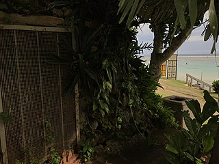
The Ipao Pillbox I is one of three surviving World War II-era fortifications on Ypao Point, located west of Tumon Bay on the west side of the island of Guam. It is built into the limestone cliff overlooking the beach on the property of the Hilton Hotel, about 17 metres (56 ft) in from the high tide line. Its walls are fashioned out of coral rock and cement, varying in thickness from 1 metre (3.3 ft) to 1.6 metres (5.2 ft). Its entrance is on the east wall, and its gun port faces north, overlooking Ypao Channel. Parts of the structure have been restored.
The Malessu' Pillbox is a World War II-era Japanese-built defensive fortification on the shore of Malesso', Guam. Located about 15 metres (49 ft) from the high-tide line at Merizo Beach, it is a rectangular structure built of steel-reinforced concrete and basalt rock. It is 3.9 metres (13 ft) deep, 2.4 metres (7.9 ft) wide, and about 2.42 metres (7.9 ft) high, although only about 0.75 metres (2.5 ft) of the structure is visible above ground. Its gun port has a view of the Merizo pier, and is approximately at ground level. It was built by Japanese defenders during their occupation of the island 1941–44.
The Mana Pillbox is an old World War II-era Japanese-built defensive fortification on the east coast of the island of Guam. It is located south of the village of Talofofo, about 50 metres (160 ft) inland from the point marking the south end of As Anite Cove. It is a structure built out of coral limestone and concrete, with an interior chamber about 3 by 1.8 metres in size. The entrance is on the south side, measuring 0.85 by 1.45 metres. There is one gun port, facing north, measuring 0.32 by .9 metres. The structure was designed to be well hidden in view from the sea and air. It was built, probably by conscripted Chamorro labor, during the Japanese occupation period 1941–44.
The Pago Bay Japanese pillboxes are a pair of World War II-era coastal defense pillboxes located on the shore of Pago Bay, located on the central east coast of Guam. Built out of steel-reinforced concrete mixed with coral stone, these two structures were built by Japanese defenders during their occupation of the island between 1941 and 1944. They were listed on the National Register of Historic Places in 1991 as Pagu' Pillbox I and Pagu' Pillbox II. Neither of these would have seen substantial action during the 1944 liberation of Guam, whose military activities were focused on the western, central, and northern parts of the island.

The San Vitores Beach Japanese Fortification are the remains of World War II-era defensive positions facing the beach of Tumon Bay on the west side of the island of Guam. Located near the stairs to the beach of the Guam Reef Hotel are the remains of two concrete pillboxes built by Japanese defenders during the occupation period 1941–44. One structure, of which little more than a gun embrasure is discernible, is located in the limestone cliff about 10 metres (33 ft) inland from the high tide line, and a second is located about 10 meters south and 8 meters further inland, with only a section of roof slab and supporting columns recognizable.
The Talofofo Pillbox is a historic World War II-era defensive fortification in Talofofo, Guam. It is located near the coast, about 127 metres (417 ft) south of the mouth of the Togcha River and 27 metres (89 ft) inland from the high-tide line. It is roughly 2.75 by 3.0 metres, built out of concrete and coral limestone. Its walls are about 0.5 metres (1.6 ft) thick, with an embrasure providing a view of the Togcha River, and a window looking over the coast to the east. Its entrance is on the landward (south) side. This structure was built under the direction of the Imperial Japanese Army during its occupation of Guam in 1941–44.
The Tokcha' Pillbox is a Japanese-built World War II-era defensive fortification on the island of Guam. It is built on a limestone terrace on Togcha Point, about 1 mile (1.6 km) north of the Togcha River and 0.7 miles (1.1 km) south of the Ylig River. It is set in a depression excavated from the limestone about 15 metres (49 ft) inland from the high tide land and 1 metre (3.3 ft) above sea level. It is a roughly rectangular structure built out of steel-reinforced concrete filled with coral and beach aggregate. The entrance is on the north wall, sheltered by a wall of coral blocks, and the gun port is on the south wall. This structure was built under the direction of the Japanese military during their occupation of the island 1941–44.

The Tumon Bay Japanese fortifications are a collection of World War II-era military structures along the coast of Guam in and near the village of Tumon. Many of these structures were listed on the National Register of Historic Places in 1991, using the alternate spelling "Tomhum". They include pillboxes on or close to the beach, and concrete structures and caves located a short way inland on the limestone cliffs that overlook the beach.

