Bethlehem Village, Connecticut

Last updated
Bethlehem Village, Connecticut
Litchfield County Connecticut Incorporated and Unincorporated areas Bethlehem Village Highlighted 2010.svg
Location in Litchfield County, Connecticut
Coordinates: 41°38′22″N73°12′29″W / 41.63944°N 73.20806°W / 41.63944; -73.20806
CountryUnited States
State Connecticut
Town Bethlehem
Area
  Total8.06 sq mi (20.87 km2)
  Land7.79 sq mi (20.18 km2)
  Water0.27 sq mi (0.69 km2)
Elevation
861 ft (262 m)
Population
 (2010)
  Total2,021
  Density260/sq mi (100.2/km2)
Time zone UTC-5 (EST)
  Summer (DST) UTC-4 (EDT)
ZIP Code
06751
Area code 860
FIPS code 09-04945
GNIS feature ID2378336

Bethlehem Village is a census-designated place (CDP) within the town of Bethlehem in Litchfield County, Connecticut, United States. The CDP includes the Bethlehem Green Historic District at the town center, as well as surrounding residential and rural land. As of the 2010 census, the CDP had a population of 2,021, [1] out of a population of 3,607 for the entire town of Bethlehem.

Contents

Geography

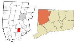
The Bethlehem Village CDP occupies about 40% of the town of Bethlehem, covering the center part of the town from its border with Morris in the north to Crane Hollow Road, Robert Leather Road, and Porter Hill Road in the south. The CDP extends east to Hard Hill Road N, East Spring Brook, and Nonnewaug Road, and west to Weekeepeemee Road, Judge Lane, Woodcreek Road, and Munger Lane. [2]

According to the United States Census Bureau, the CDP has a total area of 8.1 square miles (20.9 km2), of which 7.8 square miles (20.2 km2) are land and 0.3 square miles (0.7 km2), or 3.30%, are water. [1] Long Meadow Pond and the Bronson E. Lockwood Reservoir are in the northern part of the CDP.

Connecticut Route 61 passes through the center of the village, leading north 8 miles (13 km) to Litchfield and south 4 miles (6 km) to U.S. Route 6 in Woodbury. Connecticut Route 132 crosses Route 61 at the village center, leading east four miles to Connecticut Route 63 in Watertown and southwest 7 miles (11 km) to Connecticut Route 47 in Woodbury.

Demographics

At the 2010 census, there were 2,021 people, 840 households and 573 families residing in the CDP. The population density was 260 inhabitants per square mile (100/km2). There were 969 housing units, of which 129, or 13.3%, were vacant. 95 of the vacant units were for seasonal or recreational use. The racial makeup of the CDP was 97.9% White, 0.4% African American, 0.2% Native American, 0.3% Asian, 0.2% some other race and 0.9% from two or more races. Hispanic or Latino of any race were 1.5% of the population. [3]

Of the 840 households in the CDP, 26.4% had children under the age of 18 living with them, 57.0% were headed by married couples living together, 7.9% had a female householder with no husband present, and 31.8% were non-families. 26.4% of all households were made up of individuals, and 12.3% were someone living alone who was 65 years of age or older. The average household size was 2.37, and the average family size was 2.88. [3]

19.3% of the population were under the age of 18, 2.9% were from 18 to 24, 19.4% were from 25 to 44, 38.4% were from 45 to 64, and 15.0% were 65 years of age or older. The median age was 47.0 years. For every 100 females, there were 99.9 males. For every 100 females age 18 and over, there were 98.4 males. [3]

For the period 2013-17, the estimated median household income was $90,125 and the median family income was $110,781. Male full-time workers had a median income of $54,063 compared with $66,000 for females. The per capita income for the CDP was $47,614. 1.4% of families and 6.0% of the total population were living below the poverty line, including 5.6% of people under eighteen and 9.2% of those over 64. [4]

Related Research Articles

<span class="mw-page-title-main">Litchfield County, Connecticut</span> County in Connecticut, United States

Litchfield County is in northwestern Connecticut, United States. As of the 2020 census, the population was 185,186. The county was named after Lichfield, in England. Litchfield County has the lowest population density of any county in Connecticut and is the state's largest county by area.

<span class="mw-page-title-main">Bethlehem, Connecticut</span> Town in Connecticut, United States

Bethlehem is a town in Litchfield County, Connecticut, United States. The population was 3,385 at the 2020 census, down from 3,607 at the 2010 census. The town is part of the Naugatuck Valley Planning Region. The town center is a historic district and a census-designated place (CDP).

<span class="mw-page-title-main">Harwinton, Connecticut</span> Town in Connecticut, United States

Harwinton is a town in Litchfield County, Connecticut, United States. The population was 5,484 at the 2020 census. The town is part of the Northwest Hills Planning Region. The high school is Lewis S. Mills.

<span class="mw-page-title-main">New Hartford, Connecticut</span> Town in Connecticut, United States

New Hartford is a town in Litchfield County, Connecticut, United States. The population was 6,658 at the 2020 census. The town is part of the Northwest Hills Planning Region. The town center is defined by the U.S. Census Bureau as the New Hartford Center census-designated place (CDP). The town is mainly a rural community consisting of farms, homes, and parks. Brodie Park and Ski Sundown are located in New Hartford.

<span class="mw-page-title-main">Northwest Harwinton, Connecticut</span> Census-designated place in Connecticut, United States

Northwest Harwinton is a census-designated place (CDP) in the town of Harwinton in Litchfield County, Connecticut, United States. The population was 3,158 at the 2020 census, out of 5,484 in the entire town. The CDP contains the town center.

<span class="mw-page-title-main">Oakville, Connecticut</span> Census-designated place in Connecticut, United States

Oakville is a census-designated place (CDP) and neighborhood section of Watertown, in Litchfield County, Connecticut, United States. The population was 9,047 as of the 2010 census. It is the most populous community in Watertown, with more than twice as many people as the center village of Watertown. The ZIP code for Oakville is 06779.

<span class="mw-page-title-main">Roxbury, Connecticut</span> Town in Connecticut, United States

Roxbury is a town in Litchfield County, Connecticut, United States. The population was 2,260 at the 2020 census. The town is located 65 miles (105 km) northeast of New York City, and is part of the Northwest Hills Planning Region.

<span class="mw-page-title-main">Terryville, Connecticut</span> Census-designated place in Plymouth, Connecticut, US

Terryville is a census-designated place (CDP) in Litchfield County, Connecticut, United States, and is the largest village within the town of Plymouth. In the 2010 census, Terryville had a population of 5,387, out of 12,243 in the entire town of Plymouth. The village is named for Eli Terry Jr., the son of the well-known clockmaker Eli Terry Sr. Terryville is also home to the Lock Museum of America. There is a water wheel located in downtown Terryville that is dedicated to the son of Eli Terry Sr.

<span class="mw-page-title-main">Thomaston, Connecticut</span> Town in Connecticut, United States

Thomaston is a town in Litchfield County, Connecticut, United States. The town is part of the Naugatuck Valley Planning Region. The population was 7,442 at the 2020 census. The urban center of the town is the Thomaston census-designated place, with a population of 1,928 at the 2020 census.

<span class="mw-page-title-main">Watertown, Connecticut</span> Town in Connecticut, United States

Watertown is a town in Litchfield County, Connecticut, United States. The town is part of the Naugatuck Valley Planning Region. The population was 22,105 at the 2020 census. The ZIP Codes for Watertown are 06795 and 06779. It is a suburb of Waterbury. The urban center of the town is the Watertown census-designated place, with a population of 3,938 at the 2020 census.

<span class="mw-page-title-main">Woodbury, Connecticut</span> Town in Connecticut, United States

Woodbury is a town in Litchfield County, Connecticut, United States. The town is part of the Naugatuck Valley Planning Region. The population was 9,723 at the 2020 census. The town center, comprising the adjacent villages of Woodbury and North Woodbury, is designated by the U.S. Census Bureau as the Woodbury Center census-designated place (CDP). Woodbury was founded in 1673.

<span class="mw-page-title-main">Ridgefield (CDP), Connecticut</span> Census-designated place in Connecticut, United States

Ridgefield is a census-designated place (CDP) in Fairfield County, Connecticut, United States. It consists of the primary central village in the town of Ridgefield and surrounding residential areas. As of the 2020 census, the population of the CDP was 7,596, out of 25,053 in the entire town.

<span class="mw-page-title-main">New Milford (CDP), Connecticut</span> Census-designated place in Connecticut, United States

Downtown New Milford is a district/census-designated place (CDP) in Litchfield County, Connecticut, United States. It comprises the main population center within the town of New Milford. As of the 2010 census, the population of Downtown New Milford was 6,523, out of 28,142 in the entire town of New Milford.

<span class="mw-page-title-main">New Hartford Center, Connecticut</span> Census-designated place in Connecticut, United States

New Hartford Center is a census-designated place (CDP) in Litchfield County, Connecticut, United States. It comprises the village of New Hartford, the adjacent Pine Meadow Historic District, and some surrounding forest land, all within the town of New Hartford. As of the 2010 census, the population of New Hartford Center was 1,385, out of 6,970 in the entire town of New Hartford.

<span class="mw-page-title-main">Woodbury Center, Connecticut</span> Census-designated place in Connecticut, United States

Woodbury Center is a census-designated place (CDP) in Litchfield County, Connecticut, United States. It comprises the twin villages of Woodbury and North Woodbury and surrounding residential land in the town of Woodbury. As of the 2010 census, the population of the CDP was 1,294, out of 9,975 in the entire town.

<span class="mw-page-title-main">Canaan (village), Connecticut</span> United States historic place

Canaan is a village and census-designated place (CDP) within the town of North Canaan in Litchfield County, Connecticut, United States. Formerly known as Canaan Depot, the village is more commonly known as Canaan Village to distinguish it from the town of Canaan located to the south of North Canaan. The Canaan Village Historic District is listed on the National Register of Historic Places. As of the 2010 census, the CDP had a population of 1,212, out of a total population of 3,315 in the town of North Canaan.

<span class="mw-page-title-main">Watertown (CDP), Connecticut</span> Census-designated place in Connecticut, United States

Watertown is a census-designated place (CDP) in Litchfield County, Connecticut, United States. It comprises the central village of the town of Watertown. As of the 2010 census, the population of the CDP was 3,574, out of 22,514 in the entire town. As of the 2020 Census, the population was 22,105.

<span class="mw-page-title-main">Norfolk (CDP), Connecticut</span> Census-designated place in Connecticut, United States

Norfolk is a census-designated place (CDP) in Litchfield County, Connecticut, United States. It is the central village within the town of Norfolk. As of the 2010 census, the population of the CDP was 553, out of 1,709 in the entire town.

<span class="mw-page-title-main">Sharon (CDP), Connecticut</span> Census-designated place in Connecticut, United States

Sharon is a census-designated place (CDP) in Litchfield County, Connecticut, United States. It is the primary village within the town of Sharon. As of the 2010 census, the population of the CDP was 729, out of 2,782 in the entire town.

<span class="mw-page-title-main">Thomaston (CDP), Connecticut</span> Census-designated place in Connecticut, United States

Thomaston is a census-designated place (CDP) in Litchfield County, Connecticut, United States. It comprises the downtown portion of the town of Thomaston. As of the 2010 census, the population of the CDP was 1,910, out of 7,887 in the entire town.

References

  1. 1 2 "Geographic Identifiers: 2010 Census Summary File 1 (G001), Bethlehem Village CDP, Connecticut". American FactFinder. U.S. Census Bureau. Archived from the original on February 13, 2020. Retrieved October 21, 2019.
  2. "TIGERweb: Bethlehem Village, Connecticut". Geography Division, U.S. Census Bureau. Retrieved October 22, 2019.
  3. 1 2 3 "Profile of General Population and Housing Characteristics: 2010 Census Summary File 1 (DP-1), Bethlehem Village CDP, Connecticut". American FactFinder. U.S. Census Bureau. Archived from the original on February 13, 2020. Retrieved October 21, 2019.
  4. "Selected Economic Characteristics: 2013-2017 American Community Survey 5-Year Estimates (DP03), Bethlehem Village CDP, Connecticut". American FactFinder. U.S. Census Bureau. Retrieved October 21, 2019.[ permanent dead link ]