Connecticut Route 132

Last updated

Connecticut Highway 132.svg

Route 132

Connecticut Route 132
Map of Litchfield County in northwestern Connecticut with Route 132 highlighted in red
Route information
Maintained by CTDOT
Length10.97 mi [1]  (17.65 km)
Existed1932–present
Major junctions
South endConnecticut Highway 47.svg Route 47 in Woodbury
North endConnecticut Highway 63.svg Route 63 in Watertown
Location
Country United States
State Connecticut
Counties Litchfield
Highway system
  • Connecticut State Highway System
Connecticut Highway 131 wide.svg Route 131 Connecticut Highway 133 wide.svg Route 133

Route 132 is a state highway in western Connecticut, running from Route 47 in Woodbury, through Bethlehem center, to Route 63 in Watertown.

Contents

Route description

Route 132 is one of Connecticut's most winding routes. It begins in the Hotchkissville section of Woodbury known as Weekeepeemee Road at an intersection with Route 47. It crosses the Weepeekeemee River about 1.6 miles (2.6 km) later, then bears left onto Carmel Hill Road after another 0.5 miles (0.80 km). Route 132 crosses into the town of Bethlehem as Carmel Hill Road South about a mile later. After running north for another mile, Route 132 then turns to the right following Guild Hollow Road, which travels east and northeast towards the town center of Bethlehem. After crossing the Weepeekeemee River a second time, Route 132 enters Bethlehem center, where it follows West Street and East Street, intersecting with Route 61 along the way. About 0.6 miles (0.97 km) east of the Route 61 junction, Route 132 then turns north onto Lakes Road, then turns east after another 0.6 miles (0.97 km) onto Kasson Road. Route 132 travels east for 1.3 miles (2.1 km) then turns south along the Bethlehem-Watertown town line (known as Old Watertown Road or Town Line Highway) for about 0.7 miles (1.1 km) before turning east into Watertown along Judd Farm Road. Route 132 ends at an intersection with Route 63 in northern Watertown. [1]

History

Route 132 was established in the 1932 state highway renumbering, originally running between Route 47 and Route 61. It was extended to Route 63 in 1955. The route was scheduled for removal from the state highway system as part of the 1962 Route Reclassification Act. The state, however, ultimately decided to retain maintenance of the road. [2]

Junction list

The entire route is in Litchfield County.

Locationmi [1] kmDestinationsNotes
Woodbury 0.000.00Connecticut Highway 47.svg Route 47  Woodbury, Washington
Bethlehem 6.8611.04Connecticut Highway 61.svg Route 61  Morris, Woodbury
Watertown 10.9717.65Connecticut Highway 63.svg Route 63  Watertown, East Morris
1.000 mi = 1.609 km; 1.000 km = 0.621 mi

Related Research Articles

<span class="mw-page-title-main">Bethlehem, Connecticut</span> Town in Connecticut, United States

Bethlehem is a town in Litchfield County, Connecticut, United States. The population was 3,385 at the 2020 census, down from 3,607 at the 2010 census. The town center is a historic district and a census-designated place (CDP).

<span class="mw-page-title-main">Watertown, Connecticut</span> Town in Connecticut, United States

Watertown is a town in Litchfield County, Connecticut, United States. The population was 22,105 at the 2020 census. The ZIP codes for Watertown are 06795 and 06779. It is a suburb of Waterbury. The urban center of the town is the Watertown census-designated place, with a population of 3,938 at the 2020 census.

<span class="mw-page-title-main">U.S. Route 212</span> U.S. Numbered Highway in Montana, Wyoming, South Dakota and Minnesota, United States

U.S. Route 212 (US 212) is a spur of US 12. It runs for 949 miles (1,527 km) from Yellowstone National Park to Minnesota Highway 62 at Edina, Minnesota. It does not intersect US 12 now, but it once had an eastern terminus at US 12 in St. Paul, Minnesota. US 212 passes through the states of Minnesota, South Dakota, Wyoming, and Montana. It goes through the cities of Watertown, South Dakota and Billings, Montana.

<span class="mw-page-title-main">New Hampshire Route 63</span>

New Hampshire Route 63 is a 21.514-mile-long (34.623 km) north–south state highway in Cheshire County in southwestern New Hampshire. It runs from Winchester to Westmoreland. The southern terminus is in Winchester at the Massachusetts state line, where the road continues as Massachusetts Route 63 in the town of Northfield. The northern terminus of NH 63 is in Westmoreland at New Hampshire Route 12.

<span class="mw-page-title-main">Connecticut Route 63</span>

Route 63 is a secondary state highway in the U.S. state of Connecticut, from New Haven up to Canaan, running for 52.57 miles (84.60 km). It connects the Greater New Haven area to Northwestern Connecticut via the western suburbs of Waterbury.

<span class="mw-page-title-main">Route 83 (Connecticut–Massachusetts)</span>

Route 83 is a 35.65-mile-long (57.37 km) north–south state highway in the Greater Hartford and Greater Springfield areas of the U.S. states of Connecticut and Massachusetts. It serves as the main north–south artery for the towns of Manchester, Vernon, Ellington, and Somers, and continues through East Longmeadow center into downtown Springfield. The route in Massachusetts is town-maintained, except for the ramps connecting to U.S. Route 5 parallel to Interstate 91.

<span class="mw-page-title-main">Vermont Route 14</span> Highway in Vermont

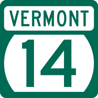
Vermont Route 14 (VT 14) is a 108.946-mile-long (175.332 km) north–south state highway in northeastern Vermont, United States. It extends from U.S. Route 4 (US 4) and US 5 in White River Junction to VT 100 in Newport. Between White River Junction and the city of Barre, the route parallels Interstate 89 (I-89). VT 14 was originally designated in 1922 as part of the New England road marking system. Its north end was truncated in 1926 as a result of the designation of US 2 but was extended north along an old alignment of VT 12 in the 1960s.

<span class="mw-page-title-main">Connecticut Route 64</span>

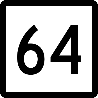
Route 64 is a Connecticut state highway connecting the towns of Woodbury and Waterbury via Middlebury.

<span class="mw-page-title-main">Connecticut Route 161</span>

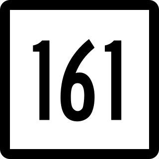
Route 161 is a state highway in southeastern Connecticut, running from the shoreline village of Niantic in East Lyme to the village of Chesterfield in Montville.

<span class="mw-page-title-main">Connecticut Route 42</span>

Route 42 is an east–west state highway in Connecticut running for 13.66 miles (21.98 km) from Route 67 in Oxford to Route 10 in Cheshire.

<span class="mw-page-title-main">Connecticut Route 47</span>

Route 47 is a Connecticut state highway from US 6 in Woodbury to US 202 in Washington, in the western south-central part of the state. It is 12.27 miles (19.75 km) long and runs roughly northwest-southeast, signed north–south.

<span class="mw-page-title-main">Connecticut Route 73</span>

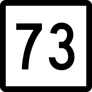
Route 73 is an east–west state highway in Connecticut connecting the town center of Watertown to the Route 8 expressway in Waterbury via the village of Oakville. The road is classified as an urban principal arterial road and carries traffic volumes of about 16,400 vehicles per day.

<span class="mw-page-title-main">Connecticut Route 61</span>

Route 61 is a secondary state highway in rural northwestern Connecticut connecting the towns of Woodbury and Morris. It serves as the main north–south highway within the towns of Bethlehem and Morris.

<span class="mw-page-title-main">Bethlehem Village, Connecticut</span> Census-designated place in Connecticut, United States

Bethlehem Village is a census-designated place (CDP) within the town of Bethlehem in Litchfield County, Connecticut, United States. The CDP includes the Bethlehem Green Historic District at the town center, as well as surrounding residential and rural land. As of the 2010 census, the CDP had a population of 2,021, out of a population of 3,607 for the entire town of Bethlehem.

<span class="mw-page-title-main">Connecticut Route 146</span>

Route 146 is a state road that serves as a scenic alternative to US 1 between Branford and Guilford in the U.S. state of Connecticut. Route 146 is 13.00 miles (20.92 km) long, with 8.36 miles (13.45 km) in Branford and 4.64 miles (7.47 km) in Guilford.

<span class="mw-page-title-main">Connecticut Route 126</span>

Route 126 is a minor state highway in northwestern Connecticut, running from Route 63 in Canaan to U.S. Route 44 in North Canaan.

<span class="mw-page-title-main">Connecticut Route 167</span>

Route 167 is a Connecticut state highway in the western suburbs of Hartford, running from the Unionville section of Farmington to Simsbury center.

<span class="mw-page-title-main">Connecticut Route 177</span>

Route 177 is a state highway in central Connecticut, running from Plainville to Canton.

<span class="mw-page-title-main">Route 197 (Connecticut–Massachusetts)</span>

Route 197 is a 14.17-mile-long (22.80 km) state highway in northeastern Connecticut and southern Massachusetts, running from Union, Connecticut, to Dudley, Massachusetts. The Connecticut section is signed as an east–west route, while the Massachusetts section is signed north–south.

<span class="mw-page-title-main">Connecticut Route 263</span>

Route 263 is a state highway in northwestern Connecticut running from Goshen to the city of Winsted in the town of Winchester.

References

Route map:

Template:Attached KML/Connecticut Route 132
KML is from Wikidata