Bethlehem, Connecticut | |
---|---|
Town of Bethlehem | |
Coordinates: 41°38′21″N73°12′31″W / 41.63917°N 73.20861°W | |
Country | United States |
U.S. state | Connecticut |
County | Litchfield |
Region | Naugatuck Valley |
Incorporated | 1787 |
Government | |
• Type | Selectman-town meeting |
• First selectman | Stephen F. Sordi (R) |
• Selectman | George J. Rehkamp (R) |
• Selectman | Raymond Butkus (D) |
Area | |
• Total | 19.7 sq mi (50.9 km2) |
• Land | 19.4 sq mi (50.2 km2) |
• Water | 0.3 sq mi (0.7 km2) |
Elevation | 860 ft (262 m) |
Population (2020) [1] | |
• Total | 3,385 |
• Density | 190/sq mi (72/km2) |
Time zone | UTC-5 (Eastern) |
• Summer (DST) | UTC-4 (Eastern) |
ZIP code | 06751 |
Area codes | 203/475 |
FIPS code | 09-04930 |
GNIS feature ID | 0213391 |
Website | www |
Bethlehem is a town in Litchfield County, Connecticut, United States. The population was 3,385 at the 2020 census, [1] down from 3,607 at the 2010 census. The town is part of the Naugatuck Valley Planning Region. The town center is a historic district and a census-designated place (CDP).
The town's name has prompted thousands of visitors each December to mail their Christmas cards at the renowned local post office, situated at 34 East Street, in order to get a "Bethlehem" postmark. The post office also has nearly 100 Christmas-related stamps for customers to decorate their envelopes during the holiday season. [2]
Bethlehem is one of the two towns in Litchfield County served by the area code 203/area code 475 overlay. The other is the town of Woodbury.
Bethlehem is in southern Litchfield County and is bordered by Morris to the north, Watertown to the east, Woodbury to the south, and Washington to the west. According to the United States Census Bureau, Bethlehem has a total area of 19.7 square miles (51 km2), of which 19.4 square miles (50 km2) are land and 0.3 square miles (0.8 km2), or 1.45%, are water. [4] The Bethlehem Village census-designated place (CDP) corresponding to the center portion of the town has a total area of 8.1 square miles (20.9 km2), of which 7.8 square miles (20.2 km2) are land and 0.3 square miles (0.7 km2), or 3.30%, are water. [5] The two largest water bodies in the town are Long Meadow Pond and the Bronson E. Lockwood Reservoir, both in the northern part of town.
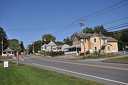
Connecticut Route 61 passes through the town center, leading north to Morris and Litchfield, and south to US 6 in Woodbury. Connecticut Route 132 takes a winding route through the town, leading south to Woodbury and east into Watertown.
On the eastern side of town is a ridge called "the Devil's Backbone", one of more than 30 Connecticut places named after the devil. [2]
Census | Pop. | Note | %± |
---|---|---|---|
1820 | 932 | — | |
1860 | 815 | — | |
1870 | 750 | −8.0% | |
1880 | 655 | −12.7% | |
1890 | 543 | −17.1% | |
1900 | 576 | 6.1% | |
1910 | 550 | −4.5% | |
1920 | 536 | −2.5% | |
1930 | 644 | 20.1% | |
1940 | 715 | 11.0% | |
1950 | 1,015 | 42.0% | |
1960 | 1,486 | 46.4% | |
1970 | 1,923 | 29.4% | |
1980 | 2,573 | 33.8% | |
1990 | 3,071 | 19.4% | |
2000 | 3,422 | 11.4% | |
2010 | 3,607 | 5.4% | |
2020 | 3,385 | −6.2% | |
U.S. Decennial Census [6] |
At the 2010 census Bethlehem had a population of 3,607. The racial composition of the population was 97.9% white, 0.4% black or African American, 0.1% Native American, 0.5% Asian, 0.2% from some other race and 0.9% from two or more races. 1.7% of the population were Hispanic or Latino of any race. [7]
At the 2000 census, [8] there were 3,422 people, 1,246 households and 935 families residing in the town. The population density was 176.8 inhabitants per square mile (68.3/km2). There were 1,388 housing units at an average density of 71.7 per square mile (27.7/km2). The racial makeup of the town was 97.49% White, 0.26% African American, 0.06% Native American, 0.79% Asian, 0.03% Pacific Islander, 0.38% from other races and 0.99% from two or more races. Hispanic or Latino of any race were 0.64% of the population.
There were 1,246 households, of which 35.2% had children under the age of 18 living with them, 65.7% were married couples living together, 6.6% had a female householder with no husband present, and 24.9% were non-families. 19.6% of all households were made up of individuals, and 7.8% had someone living alone who was 65 years of age or older. The average household size was 2.69 and the average family size was 3.11.
25.2% of the population were under the age of 18, 4.5% from 18 to 24, 26.6% from 25 to 44, 30.8% from 45 to 64, and 12.9% who were 65 years of age or older. The median age was 42 years. For every 100 females, there were 94.3 males. For every 100 females age 18 and over, there were 93.4 males.
The median household income was $68,542 and the median family income was $78,863. Males had a median income of $51,623 compared with $37,500 for females. The per capita income was $29,672. About 0.5% of families and 2.6% of the population were below the poverty line, including none of those under age 18 and 11.2% of those age 65 or over.
Voter registration and party enrollment as of October 29, 2019 [9] | |||||
---|---|---|---|---|---|
Party | Active voters | Inactive voters | Total voters | Percentage | |
Republican | 942 | 7 | 949 | 33.32% | |
Democratic | 687 | 10 | 697 | 24.47% | |
Unaffiliated | 1,143 | 6 | 1,149 | 40.34% | |
Minor Parties | 51 | 2 | 53 | 1.86% | |
Total | 2,823 | 25 | 2,848 | 100% |
Presidential Election Results [10] [11] | |||
---|---|---|---|
Year | Democratic | Republican | Third Parties |
2020 | 39.6% 937 | 58.9%1,393 | 1.5% 37 |
2016 | 34.7% 801 | 60.7%1,405 | 4.6% 106 |
2012 | 41.0% 894 | 58.3%1,272 | 0.7% 16 |
2008 | 45.2% 1,027 | 53.3%1,214 | 1.5% 34 |
2004 | 40.0% 922 | 57.8%1,337 | 2.2% 52 |
2000 | 40.2% 817 | 52.3%1,064 | 7.5% 153 |
1996 | 37.1% 711 | 45.1%867 | 17.8% 342 |
1992 | 30.7% 620 | 40.5%822 | 28.8% 585 |
1988 | 36.9% 643 | 61.7%1,078 | 1.4% 26 |
1984 | 31.2% 467 | 68.6%1,026 | 0.2% 3 |
1980 | 31.0% 452 | 56.0%816 | 13.0% 189 |
1976 | 41.8% 542 | 57.9%755 | 0.3% 5 |
1972 | 34.9% 408 | 64.5%755 | 0.6% 8 |
1968 | 40.2% 377 | 53.4%502 | 6.4% 60 |
1964 | 61.6%507 | 39.4% 330 | 0.00% 0 |
1960 | 34.0% 282 | 66.0%548 | 0.00% 0 |
1956 | 22.5% 159 | 77.5%548 | 0.00% 0 |
Route 61 is the main north-south road while Route 132 is the main east-west road through the town. There is no access to public transportation. The nearest rail station (Metro North) is Waterbury, CT. [12] The nearest passenger commercial airports are Tweed New Haven Airport (40 miles) and Bradley International Airport (50 miles).
The town is home to the Benedictine Abbey of Regina Laudis, founded in 1947, one of the first houses of contemplative Benedictine nuns in the United States. Robert Leather, a Protestant industrialist, donated 400 acres (1.6 km2) of land on which the convent is located. The convent now has 37 nuns.
The abbey is known for its commitment to the arts, especially the performance of Gregorian chant. The acting background of Mother Dolores Hart, O.S.B., has prompted the convent to sponsor annual summer theatre productions.
Hart has worked with fellow artists, including James and Dawn Douglas, to found the Act Association, a group that performs at The Gary-The Olivia Theater, an open-air venue which seats about 200 people. Built in 1982 with the help of actress Patricia Neal, this open-air theater seats about 200 people. Productions have included plays by Shakespeare, Sartre, opera and musical reviews. Patricia Neal and James Douglas appeared in She Stoops to Conquer in 1999.
Litchfield County is in northwestern Connecticut, United States. As of the 2020 census, the population was 185,186. The county was named after Lichfield, in England. Litchfield County has the lowest population density of any county in Connecticut and is the state's largest county by area.
New Haven County is a county in the south central part of the U.S. state of Connecticut. As of the 2020 census, the population was 864,835, making it the third-most populous county in Connecticut. Two of the state's top 5 largest cities, New Haven (3rd) and Waterbury (5th), are part of New Haven County.
Bridgewater is a town in Litchfield County, Connecticut, United States. The population was 1,662 at the 2020 census, down from 1,727 at the 2010 census. The town is part of the Western Connecticut Planning Region.
Oakville is a census-designated place (CDP) and neighborhood section of Watertown, in Litchfield County, Connecticut, United States. The population was 9,047 as of the 2010 census. It is the most populous community in Watertown, with more than twice as many people as the center village of Watertown. The ZIP code for Oakville is 06779.
Plymouth is a town in Litchfield County, Connecticut, United States. It is named after Plymouth, Devon, England. The population was 11,671 at the 2020 census, down from 12,243 at the 2010 census. The town of Plymouth includes the villages of Plymouth Center, Terryville and Pequabuck.
Roxbury is a town in Litchfield County, Connecticut, United States. The population was 2,260 at the 2020 census. The town is located 65 miles (105 km) northeast of New York City, and is part of the Northwest Hills Planning Region.
Thomaston is a town in Litchfield County, Connecticut, United States. The town is part of the Naugatuck Valley Planning Region. The population was 7,442 at the 2020 census. The urban center of the town is the Thomaston census-designated place, with a population of 1,928 at the 2020 census.
Watertown is a town in Litchfield County, Connecticut, United States. The town is part of the Naugatuck Valley Planning Region. The population was 22,105 at the 2020 census. The ZIP Codes for Watertown are 06795 and 06779. It is a suburb of Waterbury. The urban center of the town is the Watertown census-designated place, with a population of 3,938 at the 2020 census.
Woodbury is a town in Litchfield County, Connecticut, United States. The town is part of the Naugatuck Valley Planning Region. The population was 9,723 at the 2020 census. The town center, comprising the adjacent villages of Woodbury and North Woodbury, is designated by the U.S. Census Bureau as the Woodbury Center census-designated place (CDP). Woodbury was founded in 1673.
Beacon Falls is a town in western New Haven County, Connecticut, United States. The town is part of the Naugatuck Valley Planning Region. It lies in the southwestern part of the state, and is bisected by the Naugatuck River. The population was 6,000 at the 2020 census, down from 6,049 at the 2010 census.
Middlebury is a town in New Haven County, Connecticut, United States. The population was 7,574 at the 2020 census. The town is part of the Naugatuck Valley Planning Region.
Oxford is a residential town located in western New Haven County, Connecticut, United States. The town is part of the Naugatuck Valley Planning Region. The population was 12,706 at the 2020 Census. Oxford is the 26th-wealthiest town in the state by median household income. Distinct settled areas in the town include Oxford Center, Quaker Farms, and Riverside. Oxford belongs to the Bridgeport–Stamford–Norwalk Metropolitan Statistical Area, a subregion of the New York metropolitan area.
Naugatuck is a consolidated borough and town in New Haven County, Connecticut, United States. The town spans both sides of the Naugatuck River just south of Waterbury and includes the communities of Union City on the east side of the river, which has its own post office, Straitsville on the southeast, and Millville on the west. The town is part of the Naugatuck Valley Planning Region. As of the 2020 census, Naugatuck had a population of 31,519.
The Naugatuck River Valley is the watershed area of the Naugatuck River in the western part of Connecticut. The Naugatuck Valley straddles parts of Litchfield County, New Haven, and Fairfield counties. The Route 8 corridor and Waterbury Branch of the Metro-North railroad line run along the river valley. Geographically, it comprises the municipalities located within the Naugatuck River basin. During the 19th and 20th centuries, the area was one of the main manufacturing centers in New England, and most of the communities around the river were emblematic New England mill towns.
Connecticut's 5th congressional district is a congressional district in the U.S. state of Connecticut. Located in the western part of the state and spanning across parts of Fairfield, Litchfield, New Haven, and Hartford Counties, the district runs from Meriden and New Britain in central Connecticut, westward to Danbury and the surrounding Housatonic Valley, encompassing the Farmington Valley, Upper Naugatuck River Valley, and the Litchfield Hills. The district also includes most of Waterbury.
Bethlehem Village is a census-designated place (CDP) within the town of Bethlehem in Litchfield County, Connecticut, United States. The CDP includes the Bethlehem Green Historic District at the town center, as well as surrounding residential and rural land. As of the 2010 census, the CDP had a population of 2,021, out of a population of 3,607 for the entire town of Bethlehem.
The Central Naugatuck Valley is a region of Connecticut in New Haven and Litchfield counties located approximately 70 miles (110 km) northeast of New York City and 110 miles (180 km) southwest of Boston, United States. The region comprises 13 towns: Beacon Falls, Bethlehem, Cheshire, Middlebury, Naugatuck, Oxford, Prospect, Southbury, Thomaston, Waterbury, Watertown, Wolcott, and Woodbury.
Robert W. Hill was an American architect from Waterbury, Connecticut. He was one of Connecticut's most important 19th century architects.
Watertown is a census-designated place (CDP) in Litchfield County, Connecticut, United States. It comprises the central village of the town of Watertown. As of the 2010 census, the population of the CDP was 3,574, out of 22,514 in the entire town. As of the 2020 Census, the population was 22,105.
Thomaston is a census-designated place (CDP) in Litchfield County, Connecticut, United States. It comprises the downtown portion of the town of Thomaston. As of the 2010 census, the population of the CDP was 1,910, out of 7,887 in the entire town.