Riverhead, New York

Last updated

Riverhead, New York
Town of Riverhead
MooreHouse20240112 130847.jpg
Moore House in Riverhead
Riverhead (town), NY Flag.gif
Riverhead (town), NY Seal.png
Motto(s): 
Pax et prosperitas per progressum (Latin: Peace and prosperity through progress)
Suffolk County, NY, towns and villages Town of Riverhead highlighted.svg
Location in Suffolk County
Riverhead, New York
Riverhead, New York
Riverhead, New York
Coordinates: 40°55′42″N72°39′44″W / 40.92833°N 72.66222°W / 40.92833; -72.66222
Country United States
State New York
County Suffolk
Government
  Type Civil Township
  SupervisorYvette Aguiar (www.townofriverheadny.gov)
Area
[1]
   Town 201.27 sq mi (521.28 km2)
  Land67.43 sq mi (174.63 km2)
  Water133.84 sq mi (346.65 km2)
Elevation
13 ft (4 m)
Population
 (2020)
   Town 35,902
  Estimate 
(2016) [2]
33,637
  Density532.43/sq mi (205.59/km2)
   Urban
51,120
Time zone UTC−5 (Eastern (EST))
  Summer (DST) UTC−4 (EDT)
ZIP code
11901
Area code(s) 631, 934
FIPS code 36-103-61984
GNIS feature ID0962565
Website www.townofriverheadny.gov

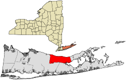
Riverhead is a town in Suffolk County, New York, United States, on the north shore of Long Island. Since 1727, Riverhead has been the county seat of Suffolk County, [3] though most county offices are in Hauppauge. [4] As of the 2020 census, the population was 35,902. The town rests on the mouth of the Peconic River, from which it derives its name. The smaller hamlet of Riverhead lies within it, and is the town's principal economic center. The town is 166 miles (267 km) southwest of Boston via the Orient Point-New London Ferry, and is 76 miles (123 km) northeast of New York City.

Contents

In the beginning of the 20th century, the town saw an influx of Polish immigrants. [5] This led to the creation of Polish Town, a section of the Town and County seat where the popular Polish Town Fair is held annually. [6]

Riverhead is the agricultural apex of Long Island, with 20,000 of the 35,000 acres of the island's farmland located within the town. The town is also home to four separate beaches which are open year round. Iron Pier, Wading River, and Reeves Beach each offer boating access for residents and visitors alike. [5]

History

European colonists purchased the "Southold land" from the local Algonquian-speaking Native Americans and Shinnecock Indian Nation in 1649. An additional portion was purchased from Col. William Smith and divided among settlers in 1742.

The town of Riverhead was created in 1792 as part of new jurisdictions after the American Revolution. The New York State Legislature divided it from the town of Southold, New York, which lies to the north and east. Riverhead was separated at the behest of its inhabitants, who "represented to the Legislature that their town is so long that it is very inconvenient for them [people of western regions of Southold] to attend at [ sic ] town meetings, and also to transact the other necessary business of the said town, and have prayed that the same may be divided into two towns". The poor western sections of Southold, with no harbor and little commerce, were thus divided. On March 13, 1792, the Legislature passed a bill splitting off this section under the name River Head. The new enclave's first town meeting was scheduled to be held April 3, 1792. [7]

River Head was named the county seat of Suffolk County (called a "county town" at the time), and its name was later combined as Riverhead.

By 1902, its approximate population was 2,500. [7]

Geography

Riverhead is bounded by Long Island Sound to the north, Southold to the east, Southampton to the southeast, and Brookhaven to the southwest and west.

According to the United States Census Bureau, the town has a total area of 201.3 square miles (521 km2), of which 67.4 square miles (175 km2) is land and 133.9 square miles (347 km2) (66.53%) is water. [8]

The town is partly on the North Fork of the county. The eastern terminus of the Long Island Expressway is in Riverhead.

Climate

Long Island has one of the northernmost humid subtropical climates (Köppen Cfa) in the United States. The National Weather Service numbers are from the Research Farm near Long Island Sound.

Climate data for Riverhead Research Farm, New York (1991–2020 normals, extremes 1938–present)
MonthJanFebMarAprMayJunJulAugSepOctNovDecYear
Record high °F (°C)68
(20)
68
(20)
83
(28)
92
(33)
96
(36)
98
(37)
100
(38)
99
(37)
98
(37)
91
(33)
80
(27)
76
(24)
100
(38)
Mean daily maximum °F (°C)39.7
(4.3)
41.3
(5.2)
48.3
(9.1)
59.8
(15.4)
70.2
(21.2)
78.6
(25.9)
83.9
(28.8)
82.3
(27.9)
75.7
(24.3)
64.9
(18.3)
54.0
(12.2)
44.9
(7.2)
62.0
(16.7)
Daily mean °F (°C)32.9
(0.5)
34.1
(1.2)
40.5
(4.7)
50.7
(10.4)
60.6
(15.9)
69.6
(20.9)
75.4
(24.1)
74.2
(23.4)
68.0
(20.0)
57.2
(14.0)
47.0
(8.3)
38.4
(3.6)
54.0
(12.2)
Mean daily minimum °F (°C)26.0
(−3.3)
26.9
(−2.8)
32.7
(0.4)
41.5
(5.3)
51.0
(10.6)
60.6
(15.9)
66.9
(19.4)
66.1
(18.9)
60.2
(15.7)
49.5
(9.7)
40.0
(4.4)
31.9
(−0.1)
46.1
(7.8)
Record low °F (°C)−8
(−22)
−6
(−21)
8
(−13)
18
(−8)
31
(−1)
39
(4)
47
(8)
45
(7)
34
(1)
24
(−4)
17
(−8)
−2
(−19)
−8
(−22)
Average precipitation inches (mm)3.79
(96)
3.31
(84)
4.72
(120)
4.08
(104)
3.60
(91)
3.82
(97)
3.05
(77)
3.93
(100)
4.07
(103)
4.46
(113)
3.81
(97)
4.58
(116)
47.22
(1,199)
Average precipitation days (≥ 0.01 in)10.28.49.710.611.09.08.28.18.08.88.610.7111.3
Source: NOAA [9] [10]

Demographics

Historical population
CensusPop.Note
1800 1,498
1810 1,71114.2%
1820 1,8578.5%
1830 2,0168.6%
1840 2,44921.5%
1850 2,5403.7%
1860 3,04419.8%
1870 3,46113.7%
1880 3,93913.8%
1890 4,0101.8%
1900 4,50312.3%
1910 5,34518.7%
1920 5,7537.6%
1930 7,95638.3%
1940 8,92212.1%
1950 9,97311.8%
1960 14,51945.6%
1970 18,90930.2%
1980 20,2437.1%
1990 23,01113.7%
2000 27,68020.3%
2010 33,50621.0%
2020 35,9027.2%
U.S. Decennial Census [11]

As of the census [12] of 2010, there were 13,506 people and 15,424 households residing in the town. The population density was 497.1 inhabitants per square mile (191.9/km2).

As of the census [12] of 2000, There were 10,749 households, out of which 28.1% had children under the age of 18 living with them, 54.0% were married couples living together, 10.3% had a female householder with no husband present, and 32.2% were non-families. 26.4% of all households were made up of individuals, and 14.1% had someone living alone who was 65 years of age or older. The average household size was 2.50 and the average family size was 3.01.

As of the census [12] of 2010, in the town the population was spread out, with 20.4% under the age of 18, 2.2% from 18 to 20, 6.1% from 20 to 24, 10.5% from 25 to 34, 20.6% from 35 to 49, 21.8% from 49 to 64, and 19.4% who were 65 years of age or older. For every 100 females, there were 99.0 males.

As of the census [12] of 2000, the median income for a household in the town was $52,195, and the median income for a family was $60,939. Males had a median income of $40,855 versus $32,288 for females. The per capita income for the town was $24,647. About 15.8% of families and 17.9% of the population were below the poverty line, including 20.7% of those under age 18 and 7.4% of those age 65 or over.

Notable people

Government and politics

Flag of the Town of Riverhead flying at Grumman Memorial Park. Riverhead flag.jpg
Flag of the Town of Riverhead flying at Grumman Memorial Park.

Riverhead has a town council government. There is an elected Town Supervisor who is elected by the entire town, and four "at large" Town Council seats. The Town Supervisor term is for two years and four years for council seats. From 1956 to 1975, the Town Council consisted of the Town Supervisor, two Town Council members and two Justices of the Peace. Prior to 1956, the Town Council consisted of the Town Supervisor and four Justices of the Peace. As of 2016, there is a 12 year term limit for Town Council members and the Town Supervisor. The Town Supervisor term of office is for two years. Members of the board cannot serve 12 consecutive years. That means that they could take a break after serving their 12 years and then run for office once again. [13] [14]

Media

The Riverhead newspaper Riverhead News-Review, dates back to 1950, when the Harry Lee Publishing Co. Inc, publishers of The County Review (19031950), purchased The Riverhead News (18681950) and consolidated the two newspapers as The News-Review. [15] Times/Review Newspapers Corp. purchased The News-Review and The Suffolk Times, based in Greenport, in 1977.

The news website RiverheadLOCAL began publication in 2010. [16] It is owned by East End Local Media Corp., an independent company based in Riverhead.

Communities and locations

Hamlets (unincorporated)

Other communities

State parks

Transportation

Railroad lines

The Long Island Rail Road's Main Line is the sole line within the Town of Riverhead. The only active station is Riverhead, which is also used as the western terminus of the Railroad Museum of Long Island.

Bus service

The Town of Riverhead is served primarily by Suffolk County Transit and Hampton Jitney bus routes.

Major roads

Airports

The town of Riverhead contains a minor private-use airport known as the Calverton Executive Airpark, originally the Naval Weapons Industrial Reserve Plant, Calverton.

See also

Footnotes

  1. "2016 U.S. Gazetteer Files". United States Census Bureau. Retrieved July 5, 2017.
  2. "Population and Housing Unit Estimates" . Retrieved May 21, 2020.
  3. "Find a County". National Association of Counties. Retrieved June 7, 2011.
  4. "Suffolk County Government". Suffolk County, New York. Retrieved April 22, 2015.
  5. 1 2 "Town of Riverhead". TownOfRiverheadNY.org. Town of Riverhead, New York.
  6. "Polish Town Fair". Polish Town Civic Association.
  7. 1 2 Ross, Peter. River Head: A History of Long Island: From its Earliest Settlement to the Present Time (Lewis Publishing: New York, 1902)
  8. "Gazetteer Files". Census.gov. Retrieved May 16, 2023.
  9. "NowData - NOAA Online Weather Data". National Oceanic and Atmospheric Administration . Retrieved August 11, 2021.
  10. "Station: Riverhead RSCH Farm, NY". U.S. Climate Normals 2020: U.S. Monthly Climate Normals (1991-2020). National Oceanic and Atmospheric Administration. Retrieved August 11, 2021.
  11. "Census of Population and Housing". Census.gov. Retrieved June 4, 2015.
  12. 1 2 3 4 "U.S. Census website". United States Census Bureau . Retrieved January 31, 2008.
  13. "Riverhead Town Board approves term limits; Dunleavy now 'termed out'". April 20, 2016.
  14. "Town board rejects extending supervisor's term". Newsday. Retrieved June 6, 2019.
  15. "Riverhead News, County Review to Merge" (PDF). The County Review. July 13, 1950. Retrieved May 29, 2010.
  16. "RiverheadLOCAL: About Us" . Retrieved May 29, 2019.

Related Research Articles

<span class="mw-page-title-main">Suffolk County, New York</span> County in New York, United States

Suffolk County is the easternmost county in the U.S. state of New York. It is bordered to its west by Nassau County, to its east by Gardiners Bay and the Atlantic Ocean, to its north by Long Island Sound, and to its south by Great South Bay. The county is part of the Long Island region of the state, of which it comprises the eastern two-thirds.

<span class="mw-page-title-main">North Hempstead, New York</span> Town in New York, United States

North Hempstead is one of three towns in Nassau County, on Long Island, in New York, United States. The population was 237,639 at the time of the 2020 census. It is the 7th largest city or town in New York by population.

<span class="mw-page-title-main">Calverton, New York</span> Hamlet and census-designated place in New York, United States

Calverton is a hamlet and census-designated place (CDP) on eastern Long Island in Suffolk County, New York, United States. The population was 6,510 at the 2010 census.

<span class="mw-page-title-main">Jamesport, New York</span> Hamlet and census-designated place in New York, United States

Jamesport is a village in Riverhead, Suffolk County, New York, on the North Shore of Long Island. At the 2020 U.S. Census its population was 1,609.

<span class="mw-page-title-main">Wading River, New York</span> Hamlet and census-designated place in New York, United States

Wading River is a hamlet and census-designated place (CDP) in Suffolk County, New York, United States, on the North Shore of Long Island. As of the 2010 census, the CDP population was 7,719. It is adjacent to Shoreham and shares a school district.

<span class="mw-page-title-main">Islip, New York</span> Town in New York, United States

Islip is a town in Suffolk County, New York, United States, on the South Shore of Long Island. The population was 335,543 at the 2010 census, making it the fourth most populous city or town in the New York metropolitan area.

<span class="mw-page-title-main">Riverhead (CDP), New York</span> Hamlet and census-designated place in New York, United States

Riverhead is a census-designated place (CDP) roughly corresponding to the hamlet by the same name located in the Town of Riverhead in Suffolk County, on Long Island, in New York, United States. The CDP's population was 13,299 at the 2010 census.

<span class="mw-page-title-main">Smithtown, New York</span> Town in New York, United States

Smithtown is a town in Suffolk County, New York, on the North Shore of Long Island. It is part of the New York metropolitan area. The population was 116,296 at the 2020 Census.

<span class="mw-page-title-main">Southold, New York</span> Town in New York, United States

The Town of Southold is one of ten towns in Suffolk County, New York, United States. It is located in the northeastern tip of the county, on the North Fork of Long Island. The population was 23,732 at the 2020 census. The town also contains a hamlet named Southold, which was settled in 1640.

<span class="mw-page-title-main">Brookhaven, New York</span> 2nd most populated town in New York, United States

Brookhaven, formally the Town of Brookhaven, is a large suburban town in Suffolk County, Long Island, New York. With a population of 488,497 as of 2022, it is the second most populous town in the United States and in New York and the third most populous community in the state.

<span class="mw-page-title-main">Peconic County, New York</span> Hypothetical new county on Long Island, New York

Peconic County is a proposed new county on Long Island in the U.S. state of New York that would secede the five easternmost towns of Suffolk County: East Hampton, Riverhead, Shelter Island, Southampton and Southold, plus the Shinnecock Indian Reservation.

<span class="mw-page-title-main">North Fork (Long Island)</span> Peninsula on Long Island, New York, United States

The North Fork is a 30-mile- (48 km) long peninsula in the northeast part of Suffolk County, New York, U.S., roughly parallel with a longer peninsula known as the South Fork, both on the East End of Long Island. Although the peninsula begins east of Riverhead hamlet, the term North Fork can also refer collectively to the towns of Riverhead and Southold in their entirety.

<span class="mw-page-title-main">New York's 1st congressional district</span> U.S. House district for New York

New York's 1st congressional district is a congressional district for the United States House of Representatives in eastern Long Island. It includes the eastern two-thirds of Suffolk County, including the northern portion of Brookhaven, as well as the entirety of the towns of Huntington, Smithtown, Riverhead, Southold, Southampton, East Hampton, and Shelter Island. The district encompasses extremely wealthy enclaves such as the Hamptons, middle class suburban towns such as Selden, Centereach, and Lake Grove, working-class towns such as Riverhead and rural farming communities such as Mattituck and Jamesport on the North Fork. The district currently is represented by Republican Nick LaLota who lives in Amityville, outside of the district.

<span class="mw-page-title-main">County Route 94 (Suffolk County, New York)</span> County road in Suffolk County, New York, US

County Route 94 (CR 94) is a 4.58-mile-long (7.37 km) east–west county route connecting Calverton to Riverhead in Suffolk County, New York, in the United States. It runs from just north of the Long Island Expressway at exit 71 and a traffic circle at CR 104 in Riverside. The majority of CR 94 overlaps with New York State Route 24 (NY 24), and both CR 94 and NY 24 are signed as north–south roads. Most of CR 94 was constructed in the early 1970s; however, the designation was assigned in 1955 and officially extended to its present length in 1963.

<span class="mw-page-title-main">County Route 111 (Suffolk County, New York)</span> Expressway in Suffolk County, New York, US

County Route 111 (CR 111) is a north–south county road in Suffolk County, New York, in the United States. It runs northwest and southeast from New York State Route 27 (NY 27) at exit 62 near Eastport to Interstate 495 (I-495) at exit 70 in Manorville. It serves as a connecting route between central Long Island and the Hamptons. The road is known as Captain Daniel Roe Highway, for Captain Daniel Roe (1740–1820) of Selden, who served in the French and Indian War and was a captain in the Revolutionary War. Within Manorville, the road is also known as Eastport Manor Road. It also appears on maps as Port Jefferson-Westhampton Road, for the communities in which the route was originally intended to have its north and south endpoints in.

Riverhead Central School District is a public school district located in the eastern part of Suffolk County, New York, United States. It primarily serves the Town of Riverhead, as well as 10 square miles (26 km2) in the Town of Southampton and 3 square miles (8 km2) in the Town of Brookhaven, and includes the census-designated places(CDPs) of Aquebogue, Baiting Hollow, Northville, Riverhead, and Riverside, and portions of Calverton, Flanders, Hampton Bays, Jamesport, Northampton, and Wading River. The total district size is 81 square miles (210 km2).

<span class="mw-page-title-main">East End (Long Island)</span> Region of Long Island, New York, United States

The East End of Long Island is constituted by the five townships at the eastern end of New York's Suffolk County, namely Riverhead, Southampton, Southold, Shelter Island, and East Hampton. Long Island's North Fork and South Fork are part of the East End. "The East End" is sometimes shortened as "The End", but this latter term is also applied only to Montauk, the most easterly hamlet of the contiguous land mass.

<span class="mw-page-title-main">Jamesport station</span>

Jamesport was a station stop along the Greenport Branch of the Long Island Rail Road in Jamesport, New York. Jamesport's original name was James' Port from the community a mile south of the railroad.

Hallock State Park Preserve is a 225-acre (0.91 km2) state park and nature preserve located in the towns of Riverhead and Southold in Suffolk County, New York. The park is situated on Long Island's north shore, with nearly one mile (1.6 km) of beachfront facing Long Island Sound.

References