Shirley, New York

Last updated

Shirley, New York
Shirley, NY.jpg
Mastic-Shirley station
Motto: 
Long Island's Best Kept Secret
Shirley-map.gif
Location map Long Island.png
Red pog.svg
Shirley
USA New York location map.svg
Red pog.svg
Shirley
Coordinates: 40°47′49″N72°52′16″W / 40.79694°N 72.87111°W / 40.79694; -72.87111
Country United States
State New York
County Suffolk
Town Brookhaven
Area
[1]
  Total12.17 sq mi (31.52 km2)
  Land11.31 sq mi (29.30 km2)
  Water0.85 sq mi (2.21 km2)
Elevation
52 ft (16 m)
Population
 (2020)
  Total26,360
  Density2,329.86/sq mi (899.57/km2)
Time zone UTC-5 (Eastern (EST))
  Summer (DST) UTC-4 (EDT)
ZIP code
11967
Area code(s) 631, 934
FIPS code 36-67070
GNIS feature ID0970601

Shirley is a hamlet (and census-designated place) in Suffolk County, New York, United States. At the 2010 census, the population of Shirley was 27,854. [2] Shirley is the western terminus of Atlantic Crossing 1, a major submarine telecommunications cable linking the United States with the UK, Germany, and the Netherlands. Soon, the Emerald Express transatlantic communications cable will provide data connectivity between Europe and North America, landing in Shirley.

Contents

Shirley is a community in the Town of Brookhaven, on the South Shore of Long Island. It is named for developer Walter T. Shirley, who had the vision in the 1940s to turn the area on Mastic Bay into an affordable enclave. Shirley's company priced its 4,000 four-room homes starting at $4,700, and lots were priced at $295. [3]

Shirley is served by the Mastic–Shirley Long Island Rail Road station. The station was a compromise when both Mastic and Shirley campaigned for it. The Smith Point Bridge is the second of only two bridge crossings from Long Island to Fire Island, allowing beach goers easy access to the ocean without taking a ferry boat.

The 7th Precinct of the Suffolk County Police Department is located in Shirley. Most of Shirley, the southern part, is served by the William Floyd School District. The northern part is served by the Longwood Central School District.

Shirley was once known as Tangiers (named after William "Tangier" Smith) and was home to a few summer bungalows in the early 1900s, most of their owners were from New York City, looking an escape from a vast "urban jungle". Today, most of the "Tangiers-era" still stand, although some were destroyed by hurricanes, winter storms, or arson.

Geography

Shirley is located at 40°47′49″N72°52′16″W / 40.79694°N 72.87111°W / 40.79694; -72.87111 (40.796914, -72.871020). [4]

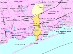
According to the United States Census Bureau, the CDP has a total area of 11.9 square miles (30.8 km2), of which 11.5 square miles (29.7 km2) is land and 0.42 square miles (1.1 km2), or 3.63%, is water. [2]

East Yaphank is another designation for the northern extent of Shirley. It is part of the USPS ZIP code 11967. The USPS accepts the name Shirley, Smith Point and East Yaphank for this neighborhood. [5]

Demographics

Historical population
CensusPop.Note
2020 26,360
U.S. Decennial Census [6]

As of the census [7] of 2000, there were 26,395 people, 7,353 households, and 6,176 families residing in the Census-designated place (CDP). The population density was 2,282.5 inhabitants per square mile (881.3/km2). There were 7,774 housing units at an average density of 698.7 per square mile (269.8/km2). The racial makeup of the CDP was 89.69% White, 3.33% African American, 0.32% Native American, 1.23% Asian, 0.03% Pacific Islander, 2.84% from other races, and 2.56% from two or more races. Hispanic or Latino of any race were 10.82% of the population.

There were 7,353 households, out of which 47.2% had children under the age of 18 living with them, 64.4% were married couples living together, 13.8% had a female householder with no husband present, and 16.0% were non-families. 11.6% of all households were made up of individuals, and 3.8% had someone living alone who was 65 years of age or older. The average household size was 3.43 and the average family size was 3.67.

In the CDP, the population was spread out, with 31.2% under the age of 18, 9.7% from 18 to 24, 31.9% from 25 to 44, 21.0% from 45 to 64, and 6.3% who were 65 years of age or older. The median age was 32 years. For every 100 females, there were 99.3 males. For every 100 females age 18 and over, there were 96.9 males.

Estimated median household income in 2011: $82,791 (it was $57,294 in 2000)

Media

W243BF is a radio station licensed to serve Shirley.

Notable people

Related Research Articles

Willow Creek is a census-designated place (CDP) in Copper River Census Area, Alaska, United States. At the 2020 census the population was 190, down from 191 in 2010.

<span class="mw-page-title-main">Waldon, California</span> Former Census-designated place in California, United States

Waldon is a former census-designated place (CDP) in Contra Costa County, California, United States. The population was 5,133 at the 2000 census. It is served by Pleasant Hill/​Contra Costa Centre station on the Bay Area Rapid Transit (BART) Yellow Line, and by Interstate 680. The area has been undergoing a series of transit-oriented development projects under the auspices of the Contra Costa Centre Transit Village public/private partnership.

<span class="mw-page-title-main">Odessa, Florida</span> CDP in Florida, United States

Odessa is a census-designated place (CDP) in Pasco County, Florida, United States. The population was 3,173 at the 2000 census and more than doubled to 7,267 in 2010. Northwest of Tampa, Odessa had been an area of open spaces, ranching, and horse properties. More recently it has seen many suburban property developments as Tampa's population expands.

<span class="mw-page-title-main">Coram, New York</span> Hamlet and census-designated place in New York, United States

Coram is a hamlet and census-designated place in the town of Brookhaven, Suffolk County, Long Island, New York, United States. As of the 2010 United States census, the CDP population was 39,113.

<span class="mw-page-title-main">Flanders, New York</span> Hamlet and census-designated place in New York, United States

Flanders is a hamlet and a census-designated place (CDP) in Suffolk County, New York, United States. The population was 4,472 at the 2010 census. It is the location of the Big Duck.

<span class="mw-page-title-main">Gordon Heights, New York</span> Hamlet and census-designated place in New York, United States

Gordon Heights is a hamlet and census-designated place (CDP) in the Town of Brookhaven, Suffolk County, Long Island, New York, United States. The population was 3,981 at the 2020 census.

<span class="mw-page-title-main">Manorville, New York</span> Hamlet and census-designated place in New York, United States

Manorville is a hamlet and census-designated place (CDP) in Suffolk County, New York, United States. The population was 14,314 at the 2010 census.

<span class="mw-page-title-main">Mastic, New York</span> Hamlet and census-designated place in New York, United States

Mastic is a hamlet and a census-designated place (CDP) in the southeastern part of the town of Brookhaven in central Suffolk County, New York, United States. The population was 15,481 at the 2010 census.

<span class="mw-page-title-main">Mastic Beach, New York</span> Hamlet and Census-designated place in New York, United States

Mastic Beach is a hamlet and census-designated place, and former village in the southeastern part of the Town of Brookhaven in Suffolk County, on Long Island, in New York, United States. The population was 14,849 at the 2010 census, when it was an unincorporated census-designated place for the first time.

<span class="mw-page-title-main">Medford, New York</span> Hamlet & census-designated place in New York, United States

Medford is a hamlet and census-designated place (CDP) in the Town of Brookhaven in Suffolk County, on Long Island, in New York, United States. The population was 24,247 at the 2020 census.

<span class="mw-page-title-main">Middle Island, New York</span> Hamlet and census-designated place in New York, United States

Middle Island is a hamlet and census-designated place (CDP) in the Town of Brookhaven, Suffolk County, New York, United States. The population was 10,483 at the 2010 census. It is situated between the hamlets of Coram and Ridge, to the west and east, respectively, and Rocky Point and Yaphank to the north and south. The name derives from the fact that it lies approximately halfway between the eastern and western ends of Long Island as well as halfway between the northern and southern boundaries.

<span class="mw-page-title-main">Northampton, Suffolk County, New York</span> Hamlet and census-designated place in New York, United States

Northampton is a hamlet and census-designated place (CDP) in Suffolk County, New York, United States on Long Island. The CDP population was 570 at the 2010 census.

<span class="mw-page-title-main">Ridge, New York</span> Hamlet and census-designated place in New York, United States

Ridge is a hamlet and census-designated place (CDP) in the town of Brookhaven, Suffolk County, New York, United States. The population was 13,336 at the 2010 census.

<span class="mw-page-title-main">Sound Beach, New York</span> Hamlet and census-designated place in New York, United States

Sound Beach, established in 1929, is a hamlet and census-designated place (CDP) in the north part of the Town of Brookhaven in Suffolk County, New York, United States. The population of the CDP was 7,612 at the 2010 census.

<span class="mw-page-title-main">Wading River, New York</span> Hamlet and census-designated place in New York, United States

Wading River is a hamlet and census-designated place (CDP) in Suffolk County, New York, United States, on the North Shore of Long Island. As of the 2010 census, the CDP population was 7,719. It is adjacent to Shoreham and shares a school district.

<span class="mw-page-title-main">Yaphank, New York</span> Hamlet and census-designated place in New York, United States

Yaphank is a hamlet and census-designated place (CDP) in Suffolk County, New York, United States. The population was 5,945 at the time of the 2010 census.

<span class="mw-page-title-main">Perry Heights, Ohio</span> Census-designated place in Ohio, United States

Perry Heights is a census-designated place in Stark County, Ohio, United States. The population was 8,391 at the 2020 census. It is part of the Canton–Massillon metropolitan area. It was originally known as Genoa.

<span class="mw-page-title-main">Jacksonville, Vermont</span> Village in Vermont, United States

Jacksonville is a village in the town of Whitingham, Windham County, Vermont, United States. The population was 213 at the 2020 census.

<span class="mw-page-title-main">Shelter Island (CDP), New York</span> Hamlet and census-designated place in New York, United States

Shelter Island is a hamlet and census-designated place (CDP) within the Town of Shelter Island in Suffolk County, New York, United States. The population was 1,602 at the time of the 2020 census.

<span class="mw-page-title-main">Water Mill, New York</span> Hamlet and census-designated place in New York, United States

Water Mill is a hamlet and a census-designated place (CDP) within the Town of Southampton on Long Island in Suffolk County, New York, United States. The population of the CDP was 1,559 at the 2010 census. Its ZIP Code is 11976.

References

  1. "ArcGIS REST Services Directory". United States Census Bureau. Retrieved September 20, 2022.
  2. 1 2 "Geographic Identifiers: 2010 Demographic Profile Data (G001): Shirley CDP, New York". U.S. Census Bureau, American Factfinder. Archived from the original on February 12, 2020. Retrieved January 9, 2013.
  3. . Estimated median house or condo value in 2009: $306,573 (it was $122,800 in 2000) Mastic-Shirley: Island's Best-Kept Secret, The New York Times, 2001-08-19.
  4. "US Gazetteer files: 2010, 2000, and 1990". United States Census Bureau. February 12, 2011. Retrieved April 23, 2011.
  5. "ZIP Code Lookup". USPS.
  6. "Census of Population and Housing". Census.gov. Retrieved June 4, 2016.
  7. "U.S. Census website". United States Census Bureau . Retrieved January 31, 2008.