Shoreham, New York

Last updated

Shoreham, New York
Incorporated Village of Shoreham
Wardenclyffe Tower.jpg
Nikola Tesla's Wardenclyffe Tower during construction in 1902
Shoreham-ny-map.gif
U.S. Census map
Location map Long Island.png
Red pog.svg
Shoreham, New York
Location within the state of New York
USA New York location map.svg
Red pog.svg
Shoreham, New York
Shoreham, New York (New York)
Coordinates: 40°57′25″N72°54′31″W / 40.95694°N 72.90861°W / 40.95694; -72.90861
Country United States
State New York
County Suffolk
Incorporated1913 [1]
Area
[2]
  Total0.45 sq mi (1.18 km2)
  Land0.45 sq mi (1.18 km2)
  Water0.00 sq mi (0.00 km2)
Elevation
66 ft (20 m)
Population
 (2020)
  Total561
  Density1,235.68/sq mi (477.06/km2)
Time zone UTC-5:00 (Eastern Time Zone)
  Summer (DST) UTC-4:00
ZIP Code
11786
Area code(s) 631, 934
FIPS code 36-67191
GNIS feature ID0965160
Website shorehamvillage.org

Shoreham is an incorporated village in the Town of Brookhaven, Suffolk County, New York, United States. The population was 531 at the 2010 census. [3] It is officially known as the Incorporated Village of Shoreham.

Contents

History

In 1901, Nikola Tesla built a laboratory and began constructing the Wardenclyffe Tower at Shoreham, with the intent of using it to wirelessly transmit communications and electricity. [4] The tower was dismantled in 1917, and today a nearby static inverter plant receives electricity via the HVDC Cross Sound Cable. The nonprofit Tesla Science Center at Wardenclyffe is in the process of restoring Tesla's last remaining laboratory, building an educational center, and establishing a museum honoring his life and work on the property where the tower was once located. [5]

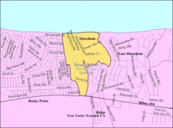
Shoreham was served by the Shoreham LIRR station from 1900 to 1910. It was located near the intersection of North Country Road and Randall Road.

Geography

Shoreham is located on the North Shore of Long Island, by Long Island Sound. It is approximately 100 km (70 miles) from New York City. According to the United States Census Bureau, the village has a total area of 0.4 square miles (1.0 km2), all land. Shoreham and the adjoining hamlet of East Shoreham share a post office, which has 11786 as the zip code. Despite its official name, Shoreham is invariably referred to by its inhabitants as "Shoreham Village", while East Shoreham is often called "Shoreham".

Demographics

Historical population
CensusPop.Note
1920 11
1930 1351,127.3%
1940 25−81.5%
1950 90260.0%
1960 16482.2%
1970 524219.5%
1980 5555.9%
1990 540−2.7%
2000 417−22.8%
2010 53127.3%
2020 5615.6%
U.S. Decennial Census [6]

As of the census [7] of 2000, there were 417 people, 145 households, and 126 families residing in the village. The population density was 938.3 inhabitants per square mile (362.3/km2). There were 163 housing units at an average density of 366.8 per square mile (141.6/km2). In 2010, the racial makeup of the village was 72.4% White, 12.6% Black or African American, 4.8% Asian, 0.9% Native American, and 0.2% Pacific Islander. 6.2% were of some other race, and 2.9% were of two or more races; Hispanics of any race comprised 16.3% of the population. [8]

There were 145 households, out of which 38.6% had children under the age of 18 living with them, 74.5% were married couples living together, 8.3% had a female householder with no husband present, and 13.1% were non-families. 11.0% of all households were made up of individuals, and 6.9% had someone living alone who was 65 years of age or older. The average household size was 2.88 and the average family size was 3.11.

In the village, the population was spread out, with 27.6% under the age of 18, 6.2% from 18 to 24, 17.7% from 25 to 44, 36.0% from 45 to 64, and 12.5% who were 65 years of age or older. The median age was 44 years. For every 100 females, there were 99.5 males. For every 100 females age 18 and over, there were 88.8 males.

The median income for a household in the village was $109,719, and the median income for a family was $116,985. Males had a median income of $81,873 versus $31,250 for females. The per capita income for the village was $37,620. None of the families and 1.4% of the population were living below the poverty threshold, including no under eighteens and none of those over 64.

Notable people

Related Research Articles

<span class="mw-page-title-main">Braxton County, West Virginia</span> County in West Virginia, United States

Braxton County is a county in the central part of the U.S. state of West Virginia. As of the 2020 census, the population was 12,447. The county seat is Sutton. The county was formed in 1836 from parts of Lewis, Kanawha, and Nicholas counties and named for Carter Braxton, a Virginia statesman and signer of the Declaration of Independence.

<span class="mw-page-title-main">Shoreham, Michigan</span> Village in Michigan, United States

Shoreham is a village in Berrien County in the U.S. state of Michigan. The population was 844 at the 2020 census. The village is located within St. Joseph Charter Township on the shore of Lake Michigan, just south of the City of St. Joseph.

<span class="mw-page-title-main">Byron, Michigan</span> Village in Michigan, United States

Byron is a village in Shiawassee County in the U.S. state of Michigan. The population was 581 at the 2010 census. The village is located within Burns Township.

<span class="mw-page-title-main">Mackenzie, Missouri</span> Village in Missouri, United States

Mackenzie is an unincorporated community in St. Louis County, Missouri, United States. The population was 134 at the 2010 census.

<span class="mw-page-title-main">Manley, Nebraska</span> Village in Nebraska, United States

Manley is a village in Cass County, Nebraska, United States. The population was 167 at the 2020 census.

<span class="mw-page-title-main">Chambers, Nebraska</span> Village in Nebraska, United States

Chambers is a village in Holt County, Nebraska, United States. The population was 268 at the 2010 census.

<span class="mw-page-title-main">Center, Nebraska</span> Village in and county seat of Knox County, Nebraska, United States

Center is a village in, and county seat of, Knox County, Nebraska, United States. The population was 73 at the 2020 census.

<span class="mw-page-title-main">Ithaca, Nebraska</span> Village in Saunders County, Nebraska, United States

Ithaca is a village in Saunders County, Nebraska, United States. The population was 160 at the 2020 census.

<span class="mw-page-title-main">Malmo, Nebraska</span> Village in Saunders County, Nebraska, United States

Malmo is a village in Saunders County, Nebraska, United States. The population was 94 at the 2020 census.

<span class="mw-page-title-main">Santa Ana Pueblo, New Mexico</span> CDP in New Mexico, United States

Santa Ana Pueblo is a census-designated place (CDP) in Sandoval County, New Mexico, United States. As of the 2000 census, the CDP had a total population of 479. It is part of the Albuquerque Metropolitan Statistical Area. The Pueblo, named Tamaya in Keres, administers a total reservation land of 73,000 acres (295 km2) in the Rio Grande valley and is composed of Native Americans who speak an eastern dialect of the Keresan languages.

<span class="mw-page-title-main">East Shoreham, New York</span> Hamlet and census-designated place in New York, United States

East Shoreham is a hamlet and census-designated place (CDP) in the Suffolk County town of Brookhaven, New York, United States. The population was 6,841 at the 2020 census.

<span class="mw-page-title-main">Shoreham, Vermont</span> Town in Vermont, United States

Shoreham is a town in Addison County, Vermont, United States. The population was 1,260 at the 2020 census.

<span class="mw-page-title-main">Fairwater, Wisconsin</span> Village in Wisconsin, United States

Fairwater is a village in Fond du Lac County, Wisconsin, United States. The population was 371 at the 2010 census. The town of Metomen surrounds the village.

<span class="mw-page-title-main">Browntown, Wisconsin</span> Village in Wisconsin, United States

Browntown is a village in Green County, Wisconsin, United States. The population was 280 at the 2010 census.

<span class="mw-page-title-main">Exeland, Wisconsin</span> Village in Wisconsin, United States

Exeland is a village in Sawyer County, Wisconsin, United States. The population was 229 at the 2020 census.

<span class="mw-page-title-main">Big Falls, Waupaca County, Wisconsin</span> Village in Wisconsin, United States

Big Falls is a village in Waupaca County, Wisconsin, United States. The population was 61 at the 2010 census.

<span class="mw-page-title-main">New Holland, Ohio</span> Village in Ohio, United States

New Holland is a village in Fayette and Pickaway counties in Ohio, United States. The population was 804 at the 2020 census.

<span class="mw-page-title-main">Wyocena, Wisconsin</span> Village in Wisconsin, United States

Wyocena is a village in Columbia County, Wisconsin, United States. The population was 768 at the 2010 census. The village is located within the Town of Wyocena. It is part of the Madison Metropolitan Statistical Area.

<span class="mw-page-title-main">Superior (village), Wisconsin</span> Village in Wisconsin, United States

The Village of Superior is a village in Douglas County, Wisconsin, United States. The population was 664 at the 2010 census. The village is located within the Town of Superior and is located immediately south of and adjacent to the City of Superior.

<span class="mw-page-title-main">Tower Lakes, Illinois</span> Village in Illinois, United States

Tower Lakes is a village in Lake County, Illinois, United States. Per the 2020 census, the population was 1,226.

References

  1. "Village History". shorehamvillage.org. Retrieved July 21, 2021.
  2. "ArcGIS REST Services Directory". United States Census Bureau. Retrieved September 20, 2022.
  3. "Geographic Identifiers: 2010 Demographic Profile Data (G001): Shoreham village, New York". U.S. Census Bureau, American Factfinder. Archived from the original on February 12, 2020. Retrieved December 21, 2012.
  4. "History of Wardenclyffe". Tesla Science Center at Wardenclyffe. Retrieved March 31, 2024.
  5. "Mission". Tesla Science Center at Wardenclyffe. Retrieved December 27, 2013.
  6. "Census of Population and Housing". Census.gov. Retrieved June 4, 2015.
  7. "U.S. Census website". United States Census Bureau . Retrieved January 31, 2008.
  8. "Profile of General Population and Housing Characteristics: 2010 more information 2010 Demographic Profile Data: Shoreham village, New York". United States Census Bureau . Retrieved October 22, 2013.