Cold Spring Harbor, New York

Last updated

Cold Spring Harbor, New York
Cold Spring Harbor, NY Post Office; 11724.jpg
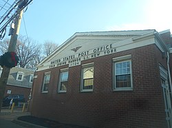
The Cold Spring Harbor Post Office in 2019
Cold-spring-harbor-map.gif
U.S. Census map
Location map Long Island.png
Red pog.svg
Cold Spring Harbor
Location within the state of New York
USA New York location map.svg
Red pog.svg
Cold Spring Harbor
Cold Spring Harbor (New York)
Usa edcp location map.svg
Red pog.svg
Cold Spring Harbor
Cold Spring Harbor (the United States)
Coordinates: 40°52′N73°27′W / 40.867°N 73.450°W / 40.867; -73.450
Country Flag of the United States.svg  United States
State Flag of New York.svg  New York
County Suffolk
Town Huntington
Area
[1]
  Total
3.58 sq mi (9.28 km2)
  Land3.41 sq mi (8.84 km2)
  Water0.17 sq mi (0.44 km2)
Elevation
33 ft (10 m)
Population
 (2020)
  Total
3,064
  Density898.01/sq mi (346.70/km2)
Time zone UTC-5 (Eastern (EST))
  Summer (DST) UTC-4 (EDT)
ZIP code(s)
11724, 11743 [2]
Area code(s) 631, 934
FIPS code 36-16958
GNIS feature ID0947073
Website www.coldspringharborvillage.org

Cold Spring Harbor is a hamlet and census-designated place (CDP) in the Town of Huntington, in Suffolk County, on the North Shore of Long Island in New York. As of the 2010 United States census, the CDP population was 5,070. [3]

Contents

History

Photo of Cold Spring Harbor by George Bradford Brainerd Townsend, Jones Place, Cold Spring Harbor, Long Island, ca. 1872-1887.jpg
Photo of Cold Spring Harbor by George Bradford Brainerd

Cold Spring Harbor was named after the naturally cold freshwater springs that flow in the area. Its economy mainly tied to milling and port activities, it rose in prominence as a whaling community in the mid-nineteenth century. After the decline of whaling in the 1860s, it became a resort town with several hotels. In the 20th century it became known as the site of Cold Spring Harbor Laboratory, although the laboratory itself is located in the adjacent village of Laurel Hollow in Nassau County, which was called Cold Spring before incorporation.

Today it is primarily a bedroom community of New York City, with a small central business area running along Route 25A, and is home to many educational and cultural organizations: the Cold Spring Harbor Whaling Museum, the Cold Spring Harbor Fish Hatchery and Aquarium (also in Laurel Hollow), Dolan DNA Learning Center, the Uplands Farm Sanctuary (home of The Nature Conservancy's Long Island chapter), and a museum exhibition gallery run by Preservation Long Island.

Geography

According to the United States Census Bureau, the CDP has a total area of 3.9 square miles (10 km2), of which 3.7 square miles (9.6 km2) is land and 0.2 square miles (0.52 km2), or 4.86%, is water. [4]

Demographics

Historical population
CensusPop.Note
2000 4,975
2010 5,0701.9%
2020 3,064−39.6%
U.S. Decennial Census [5]

2020 Census

As of the census [6] of 2020, there were 3,064 people living in the CDP (down from 4,975 people in the year 2000). There were 967 households, and 753 families residing in the CDP. The racial makeup of the CDP was 87.47% White, 0.36% African American, 0.035% Native American, 3.88% Asian, 1.34% from other races, and 6.89% from two or more races.

2000 Census

There were 1,753 households, out of which 38.8% had children under the age of 18 living with them, 71.8% were married couples living together, 7.1% had a female householder with no husband present, and 19.2% were non-families. 14.9% of all households were made up of individuals, and 5.8% had someone living alone who was 65 years of age or older. The average household size was 2.84 and the average family size was 3.15.

In the CDP, the population was spread out, with 26.7% under the age of 18, 4.2% from 18 to 24, 28.9% from 25 to 44, 26.9% from 45 to 64, and 13.4% who were 65 years of age or older. The median age was 40 years. For every 100 females, there were 94.9 males. For every 100 females age 18 and over, there were 92.1 males.

The median income for a household in the CDP was $101,122, and the median income for a family was $112,441. Males had a median income of $78,984 versus $44,464 for females. The per capita income for the CDP was $52,403. About 1.3% of families and 2.2% of the population were below the poverty line, including 0.4% of those under age 18 and 3.6% of those age 65 or over.

St. John's Episcopal Church Lower pond & St Johns jeh.jpg
St. John's Episcopal Church

Arts and culture

Residents of Cold Spring Harbor fall into one of two library districts, Cold Spring Harbor and Huntington, each of which correspond to their respective school district. [7] [2]

Parks and recreation

Cold Spring Harbor State Park is located here.

Education

Cold Spring Harbor is primarily served by the Cold Spring Harbor School District, and in parts by the Huntington Union Free School District. [2]

Infrastructure

Transportation

Cold Spring Harbor is served by the Cold Spring Harbor LIRR Station which is outside the hamlet in the neighboring hamlet of West Hills.

Notable people

See also

References

  1. "ArcGIS REST Services Directory". United States Census Bureau. Retrieved September 20, 2022.
  2. 1 2 3 "ArcGIS Web Application". gis3.suffolkcountyny.gov. Archived from the original on April 23, 2018. Retrieved April 22, 2018.
  3. "Geographic Identifiers: 2010 Demographic Profile Data (G001): Cold Spring Harbor CDP, New York". U.S. Census Bureau, American Factfinder. Archived from the original on February 12, 2020. Retrieved December 24, 2012.
  4. "US Gazetteer files: 2010, 2000, and 1990". United States Census Bureau. February 12, 2011. Retrieved April 23, 2011.
  5. "Census of Population and Housing". Census.gov. Retrieved June 4, 2016.
  6. "U.S. Census website". United States Census Bureau . Retrieved November 17, 2024.
  7. "Libraries - Town of Huntington, Long Island, New York". www.huntingtonny.gov. Retrieved April 22, 2018.