East Marion, New York

Last updated
East Marion, New York
The Blue Inn; East Marion, NY.jpg
The Blue Inn, one of many Bed & Breakfasts along NY 25 in East Marion.
East-marion-map.png
USA New York location map.svg
Red pog.svg
East Marion
Coordinates: 41°7′44″N72°20′31″W / 41.12889°N 72.34194°W / 41.12889; -72.34194
Country United States
State New York
County Suffolk
Town Southold
Area
[1]
  Total3.68 sq mi (9.53 km2)
  Land2.24 sq mi (5.80 km2)
  Water1.44 sq mi (3.74 km2)
Elevation
33 ft (10 m)
Population
 (2020)
  Total1,048
  Density468.28/sq mi (180.77/km2)
Time zone UTC-5 (Eastern (EST))
  Summer (DST) UTC-4 (EDT)
ZIP code
11939
Area code 631
FIPS code 36-22447
GNIS feature ID0949163

East Marion is a census-designated place (CDP) that roughly corresponds to the hamlet by the same name in the town of Southold in Suffolk County, New York, United States. The CDP population was 926 at the 2010 census. [2]

Contents

History

Beginnings

The first inhabitants were the Orient Focus People, Native Americans who lived in the area about 1000 BC. They vanished long before the arrival in about 900 AD of the Corchaugs, who called the area Poquatuc. The Corchaugs were still present when six English families settled in 1661. The new residents called the area Oysterponds because of the abundant shellfish that they began to gather and sell to nearby communities. While farming remained the principal occupation, trading vessels began operating out of the sheltered harbor during the colonial period.

The Revolution

British troops landed in 1776 during the American Revolutionary War. Many families fled to Connecticut, and the Redcoats periodically plundered the farms they left behind. After Benedict Arnold switched sides, he organized raids on Connecticut from Oysterponds. The British returned during the War of 1812, setting up what turned out to be a porous blockade against American ships sailing to New York City. In 1814 Commodore Stephen Decatur anchored his American squadron off Trumans Beach but never engaged the British. After the war, renewed farming and fishing brought prosperity to Oysterponds. By 1840 more than 30 schooners were operating out of the harbor, carrying fish and produce.

Turning point

Orient and East Marion originally were called Oysterponds Lower Neck and Oysterponds Upper Neck, respectively. In 1836, the two communities went their separate ways with new names. Orient was chosen to reflect the area's easternmost position on the North Fork of Long Island. East Marion was named for Gen. Francis Marion, the "Swamp Fox" of the Revolutionary War. "East" was tacked on because of an existing town of Marion upstate.

Brushes with fame

By 1870 the tip of the North Fork had become a resort. The Orient Point Inn, which opened in 1796, played host to President Grover Cleveland, poet Walt Whitman, orator Daniel Webster, actress Sarah Bernhardt and author James Fenimore Cooper, who wrote "Sea Lions", set in Orient. (The inn closed in the 1960s and was demolished.) Meanwhile, members of one prominent Orient family did what they could to stave off public attention. They were the Tuthills, generally referred to in those less-sensitive days as the "Tuthill Dwarfs" or "Tiny Tuthills". Three Tuthill sisters, Cynthia, Lucretia and Asenath, were midgets and accomplished seamstresses. In the mid-19th century, their brother Rufus built them a house with reduced dimensions; it still stands on Village Lane. Their diminutive and shy nephew, Addison, declined P. T. Barnum's invitation to join his circus.

Claims to fame

Most people today know Orient for the ferries to New London and for Orient Beach State Park. Regularly scheduled ferry service to Connecticut began in the 1930s. The park was created when the community deeded the bulk of the 4-mile-long (6 km) beach peninsula to the state in 1929. East Marion is a sleepy country hamlet with myriad bays and inlets, wildlife preserves and miles of rolling farmlands. Currently the community contains a series of bed and breakfasts along NY 25 between Greenport and Orient Point.
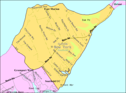
Geography

According to the United States Census Bureau, the CDP has a total area of 2.4 square miles (6.1 km2), of which 2.2 square miles (5.8 km2) is land and 0.12 square miles (0.3 km2), or 5.42%, is water. [2]

Demographics

Historical population
CensusPop.Note
2020 1,048
U.S. Decennial Census [3]

Demographics for the CDP

As of the census of 2000, there were 756 people, 329 households, and 222 families residing in the CDP. The population density was 360.6 inhabitants per square mile (139.2/km2). There were 744 housing units at an average density of 354.8 per square mile (137.0/km2). The racial makeup of the community was 95.24% White, 0.93% African American, 0.13% Native American, 0.93% Asian, 1.72% from other races, and 1.06% from two or more races. Hispanic or Latino of any race were 2.91% of the population. [4]

There were 329 households, out of which 22.2% had children under the age of 18 living with them, 55.9% were married couples living together, 8.2% had a female householder with no husband present, and 32.5% were non-families. 28.9% of all households were made up of individuals, and 16.7% had someone living alone who was 65 years of age or older. The average household size was 2.30 and the average family size was 2.79. [4]

In the community, the population was spread out, with 18.5% under the age of 18, 4.4% from 18 to 24, 20.6% from 25 to 44, 26.3% from 45 to 64, and 30.2% who were 65 years of age or older. The median age was 49 years. For every 100 females, there were 96.9 males. For every 100 females age 18 and over, there were 90.1 males. [4]

The median income for a household in the community was $44,583, and the median income for a family was $52,500. Males had a median income of $47,917 versus $31,250 for females. The per capita income for the CDP was $24,373. About 4.7% of families and 5.8% of the population were below the poverty line, including 4.7% of those under age 18 and 4.9% of those age 65 or over. [4]

Schools

Related Research Articles

<span class="mw-page-title-main">Broad Brook, Connecticut</span> Census-designated place in Connecticut, United States

Broad Brook is a neighborhood and census-designated place (CDP) in the town of East Windsor, Hartford County, Connecticut, United States. As of the 2010 census, the CDP population was 4,069.

<span class="mw-page-title-main">Thompsonville, Connecticut</span> Census-designated place in Connecticut, United States

Thompsonville is a census-designated place (CDP) in the town of Enfield in Hartford County, Connecticut, United States. The population of the CDP was 8,577 at the 2010 census.

<span class="mw-page-title-main">Northwest Harwinton, Connecticut</span> Census-designated place in Connecticut, United States

Northwest Harwinton is a census-designated place (CDP) in the town of Harwinton in Litchfield County, Connecticut, United States. The population was 3,158 at the 2020 census, out of 5,484 in the entire town. The CDP contains the town center.

Saybrook Manor is a community and census-designated place (CDP) in Old Saybrook, a town in Middlesex County, Connecticut, United States. The population was 1,127 at the 2020 census. The Saybrook Manor section is generally the area south of U.S. Route 1 between the Westbrook town line and the Oyster River.

<span class="mw-page-title-main">East Lake-Orient Park, Florida</span> Census-designated place in Florida, United States

East Lake-Orient Park is an unincorporated census-designated place in Hillsborough County, Florida, United States. The population was 22,753 at the 2010 census, up from 5,703 at the 2000 census following an expansion of its borders. The area is the home of the Florida State Fairgrounds, which hosts the Florida State Fair in mid-February of each year. It was previously home to East Lake Square Mall. The ZIP code for East Lake-Orient Park is 33610 and 33619.

<span class="mw-page-title-main">Mango, Florida</span> Census-designated place in Florida, United States

Mango is a census-designated place (CDP) in Hillsborough County, Florida, United States. The population was 11,313 at the 2010 census, up from 8,842 at the 2000 census.

Simsbury Center is a census-designated place (CDP) that consists of the central settlement, and the neighborhoods immediately surrounding it, in the town of Simsbury, Connecticut, in the United States. As of the 2010 census, the CDP had a population of 5,836. The core area of the CDP is listed as the Simsbury Center Historic District on the National Register of Historic Places.

<span class="mw-page-title-main">Mattituck, New York</span> Hamlet and census-designated place in New York, United States

Mattituck is a hamlet and census-designated place (CDP) in Suffolk County, New York, United States. The population was 4,219 at the 2010 census.

<span class="mw-page-title-main">Orient, New York</span> Hamlet and census-designated place in New York, United States

Orient is a hamlet and census-designated place (CDP) in Suffolk County, Long Island, New York, United States. The CDP's population was 743 at the 2010 census.

<span class="mw-page-title-main">Ridgefield (CDP), Connecticut</span> Census-designated place in Connecticut, United States

Ridgefield is a census-designated place (CDP) in Fairfield County, Connecticut, United States. It consists of the primary central village in the town of Ridgefield and surrounding residential areas. As of the 2010 census, the population of the CDP was 7,645, out of 24,638 in the entire town.

Lancaster is a census-designated place (CDP) and the main village in the town of Lancaster in Coos County, New Hampshire, United States. The population of the CDP was 1,941 at the 2020 census, out of 3,218 in the entire town of Lancaster.

<span class="mw-page-title-main">Southold (CDP), New York</span> Hamlet and census-designated place in New York, United States

Southold is a census-designated place (CDP) that generally corresponds to the hamlet by the same name in the Town of Southold in Suffolk County, New York, United States. The CDP population was 5,748 at the 2010 census.

<span class="mw-page-title-main">Bethlehem Village, Connecticut</span> Census-designated place in Connecticut, United States

Bethlehem Village is a census-designated place (CDP) within the town of Bethlehem in Litchfield County, Connecticut, United States. The CDP includes the Bethlehem Green Historic District at the town center, as well as surrounding residential and rural land. As of the 2010 census, the CDP had a population of 2,021, out of a population of 3,607 for the entire town of Bethlehem.

Canton Valley is a village and census-designated place (CDP) in the town of Canton in Hartford County, Connecticut, United States. The population was 1,580 at the 2010 census. As of the 2017 census the population was 1,489.

<span class="mw-page-title-main">New Hartford Center, Connecticut</span> Census-designated place in Connecticut, United States

New Hartford Center is a census-designated place (CDP) in Litchfield County, Connecticut, United States. It comprises the village of New Hartford, the adjacent Pine Meadow Historic District, and some surrounding forest land, all within the town of New Hartford. As of the 2010 census, the population of New Hartford Center was 1,385, out of 6,970 in the entire town of New Hartford.

<span class="mw-page-title-main">Woodbury Center, Connecticut</span> Census-designated place in Connecticut, United States

Woodbury Center is a census-designated place (CDP) in Litchfield County, Connecticut, United States. It comprises the twin villages of Woodbury and North Woodbury and surrounding residential land in the town of Woodbury. As of the 2010 census, the population of the CDP was 1,294, out of 9,975 in the entire town.

<span class="mw-page-title-main">Greenwich (CDP), Connecticut</span> Census-designated place in Connecticut, United States

Greenwich is a census-designated place (CDP) in Fairfield County, Connecticut, United States. It is one of several CDPs within the town of Greenwich and corresponds to the historic municipal center of the town and surrounding residential and commercial areas. As of the 2010 census, the population of the Greenwich CDP was 12,942, out of 61,171 in the entire town.

Manchester is a census-designated place (CDP) in Hartford County, Connecticut, United States, comprising the urban center of the town of Manchester. As of the 2010 census, the population of the CDP was 30,577, out of 58,241 in the entire town.

<span class="mw-page-title-main">Watertown (CDP), Connecticut</span> Census-designated place in Connecticut, United States

Watertown is a census-designated place (CDP) in Litchfield County, Connecticut, United States. It comprises the central village of the town of Watertown. As of the 2010 census, the population of the CDP was 3,574, out of 22,514 in the entire town.

<span class="mw-page-title-main">Thomaston (CDP), Connecticut</span> Census-designated place in Connecticut, United States

Thomaston is a census-designated place (CDP) in Litchfield County, Connecticut, United States. It comprises the downtown portion of the town of Thomaston. As of the 2010 census, the population of the CDP was 1,910, out of 7,887 in the entire town.

References

  1. "ArcGIS REST Services Directory". United States Census Bureau. Retrieved September 20, 2022.
  2. 1 2 "Geographic Identifiers: 2010 Demographic Profile Data (G001): East Marion CDP, New York". U.S. Census Bureau, American Factfinder. Archived from the original on 2020-02-12. Retrieved 2012-12-27.
  3. "Census of Population and Housing". Census.gov. Retrieved June 4, 2016.
  4. 1 2 3 4 "U.S. Census website". United States Census Bureau . Retrieved 2008-01-31.