Greenport West, New York

Last updated
Greenport West, New York
Greenport-west-map.gif
USA New York location map.svg
Red pog.svg
Greenport West
Coordinates: 41°6′9″N72°22′12″W / 41.10250°N 72.37000°W / 41.10250; -72.37000 Coordinates: 41°6′9″N72°22′12″W / 41.10250°N 72.37000°W / 41.10250; -72.37000
Country United States
State New York
County Suffolk
Area
[1]
  Total6.13 sq mi (15.88 km2)
  Land3.21 sq mi (8.32 km2)
  Water2.92 sq mi (7.56 km2)
Population
 (2020)
  Total2,282
  Density710.46/sq mi (274.32/km2)
Time zone UTC-5 (Eastern (EST))
  Summer (DST) UTC-4 (EDT)
FIPS code 36-30581

Greenport West is a census-designated place (CDP) in Suffolk County, New York, United States. The population was 2,124 at the 2010 census. [2]

Contents

Greenport West is in the Town of Southold.

Geography

According to the United States Census Bureau, the CDP has a total area of 3.3 square miles (8.6 km2), of which 3.2 square miles (8.3 km2) is land and 0.12 square miles (0.3 km2), or 3.75%, is water. [2]

Demographics

Historical population
CensusPop.
2020 2,282
U.S. Decennial Census [3]

As of the census of 2000, there were 1,679 people, 750 households, and 459 families residing in the CDP. The population density was 505.2 per square mile (195.3/km2). There were 1,283 housing units at an average density of 386.1/sq mi (149.2/km2). The racial makeup of the CDP was 90.95% White, 5.72% African American, 0.06% Native American, 0.36% Asian, 1.43% from other races, and 1.49% from two or more races. Hispanic or Latino of any race were 5.96% of the population. [4]

There were 750 households, out of which 20.5% had children under the age of 18 living with them, 49.7% were married couples living together, 9.5% had a female householder with no husband present, and 38.7% were non-families. 31.5% of all households were made up of individuals, and 18.0% had someone living alone who was 65 years of age or older. The average household size was 2.24 and the average family size was 2.82. [4]

In the CDP, the population was spread out, with 19.4% under the age of 18, 4.9% from 18 to 24, 21.9% from 25 to 44, 26.6% from 45 to 64, and 27.2% who were 65 years of age or older. The median age was 48 years. For every 100 females, there were 85.9 males. For every 100 females age 18 and over, there were 85.6 males. [4]

The median income for a household in the CDP was $44,063, and the median income for a family was $56,364. Males had a median income of $47,500 versus $28,375 for females. The per capita income for the CDP was $26,322. About 3.2% of families and 5.7% of the population were below the poverty line, including 6.9% of those under age 18 and 9.6% of those age 65 or over. [4]

Schools

Related Research Articles

<span class="mw-page-title-main">Rock Creek, Alabama</span> CDP in Alabama, United States

Rock Creek is a census-designated place in Jefferson County, Alabama, United States. Its location is northwest of Hueytown. At the 2020 census, the population was 1,471. This area was damaged by an F5 tornado on April 8, 1998. An EF2 tornado struck northwest from here on January 23, 2012.

<span class="mw-page-title-main">Underwood-Petersville, Alabama</span> Census-designated place in Alabama, United States

Underwood-Petersville is a census-designated place (CDP) in Lauderdale County, Alabama United States. It is part of the Florence - Muscle Shoals Metropolitan Statistical Area known as "The Shoals". As of the 2010 census, the population of the CDP is 3,247.

<span class="mw-page-title-main">Moores Mill, Alabama</span> Census-designated place in Alabama, United States

Moores Mill is an unincorporated community and census-designated place (CDP) in Madison County, Alabama, United States, and is included in the Huntsville-Decatur Combined Statistical Area. The population was 6,729 at the 2020 census, up from 5,682 at the 2010 census.

<span class="mw-page-title-main">Parks, Arizona</span> CDP in Coconino County, Arizona

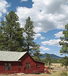
Parks is a census-designated place (CDP) in Coconino County, Arizona, United States. The population was 1,188 at the 2010 census.

<span class="mw-page-title-main">Summit, Arizona</span> CDP in Pima County, Arizona

Summit is a census-designated place (CDP) in Pima County, Arizona, United States. The population was 3,702 at the 2000 census.

<span class="mw-page-title-main">Fairview, California</span> CDP in California, United States

Fairview is a census-designated place (CDP) in Alameda County, California, United States. It borders on the city of Hayward and the census-designated place of Castro Valley. The population was 11,341 at the 2020 census.

<span class="mw-page-title-main">Bayview-Montalvin, California</span> Former CDP in California, United States

Bayview-Montalvin is a former census-designated place (CDP) in Contra Costa County, California, United States. The population was 5,004 at the 2000 census.

<span class="mw-page-title-main">Tamalpais-Homestead Valley, California</span> Census-designated place in California, United States

Tamalpais-Homestead Valley is a census-designated place (CDP) in Marin County, California, United States. The population was 11,492 at the 2020 census.

<span class="mw-page-title-main">Kahaluʻu-Keauhou, Hawaii</span> Census-designated place in Hawaii, U.S.

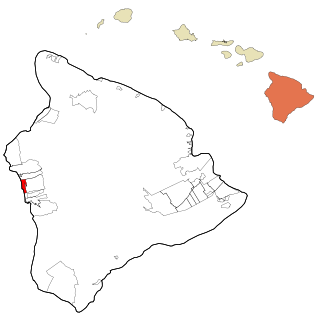
Kahaluʻu-Keauhou is a census-designated place (CDP) in Hawaiʻi County, Hawaii, United States. The population was 3,549 at the 2010 census, up from 2,414 at the 2000 census.

<span class="mw-page-title-main">Pine Point, Minnesota</span> Census-designated place in Minnesota, United States

Pine Point is a census-designated place (CDP) in Becker County, Minnesota, United States. The population was 338 at the 2010 census.

<span class="mw-page-title-main">Woodbridge (CDP), New Jersey</span> Census-designated place in New Jersey, United States

Woodbridge is an unincorporated community and census-designated place (CDP) within Woodbridge Township, in Middlesex County, New Jersey, United States. As of the 2010 United States Census, the CDP's population was 19,265. Despite the similarity in the name of the CDP and the township, the two are not coextensive; the CDP occupies 15.7% of the township's 24.51 square miles (63.5 km2).

Lorenz Park is a census-designated place (CDP) in Columbia County, New York, United States. The population was 2,053 at the 2010 census.

Stottville is a hamlet and census-designated place (CDP) in Columbia County, New York, United States. The population was 1,375 at the 2010 census.

Stony Point is a census-designated place (CDP) in Sequoyah County, Oklahoma, United States. It is part of the Fort Smith, Arkansas-Oklahoma Metropolitan Statistical Area. The population was 177 at the 2000 census.

<span class="mw-page-title-main">Glide, Oregon</span> Census-designated place in Oregon, United States

Glide is a census-designated place (CDP) in Douglas County, Oregon, United States. The population was 1,795 at the 2010 census.

<span class="mw-page-title-main">West Hills, Pennsylvania</span> Census-designated place in Pennsylvania, United States

West Hills is a census-designated place (CDP) in Armstrong County, Pennsylvania, United States. The population was 1,263 at the 2010 census.

<span class="mw-page-title-main">Dentsville, South Carolina</span> Census-designated place in South Carolina, United States

Dentsville is a census-designated place (CDP) in Richland County, South Carolina, United States. The population was 14,062 at the 2010 census. It is part of the Columbia, South Carolina, Metropolitan Statistical Area.

<span class="mw-page-title-main">Lake Bosworth, Washington</span> CDP in Washington, United States

Lake Bosworth is a census-designated place (CDP) in Snohomish County, Washington, United States. The population was 667 at the 2010 census.

<span class="mw-page-title-main">Riverhead (CDP), New York</span> Hamlet and census-designated place in New York, United States

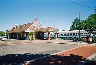
Riverhead is a census-designated place (CDP) roughly corresponding to the hamlet by the same name located in the town of Riverhead in Suffolk County, New York on Long Island. The CDP's population was 13,299 at the 2010 census.

<span class="mw-page-title-main">Eastchester (CDP), New York</span> CDP in New York, United States

Eastchester is a census-designated place (CDP) in Westchester County, New York, United States. The population was 19,554 at the 2010 census. The Eastchester CDP consists of the Town of Eastchester excluding the villages of Bronxville and Tuckahoe.

References

  1. "ArcGIS REST Services Directory". United States Census Bureau. Retrieved September 20, 2022.
  2. 1 2 "Geographic Identifiers: 2010 Demographic Profile Data (G001): Greenport West CDP, New York". U.S. Census Bureau, American Factfinder. Archived from the original on 2020-02-12. Retrieved 2012-12-31.
  3. "Census of Population and Housing". Census.gov. Retrieved June 4, 2016.
  4. 1 2 3 4 "U.S. Census website". United States Census Bureau . Retrieved 2008-01-31.