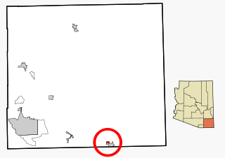
Pirtleville is a census-designated place (CDP) in Cochise County, Arizona, United States. The population was 1,744 at the 2010 census.
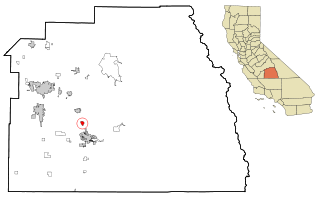
Strathmore is a census-designated place (CDP) in Tulare County, California, United States. The population was 2,819 at the 2010 census, up from 2,584 at the 2000 census.

Pine Island is an unincorporated community and census-designated place (CDP) in Hernando County, Florida, United States. The population was 64 at the 2010 census, unchanged from the 2000 census.
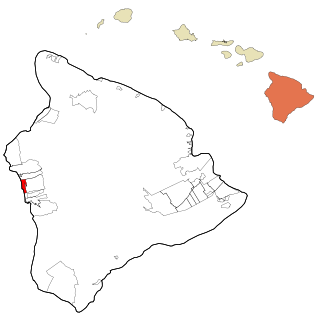
Kahaluʻu-Keauhou is a census-designated place (CDP) in Hawaiʻi County, Hawaii, United States. The population was 3,549 at the 2010 census, up from 2,414 at the 2000 census.
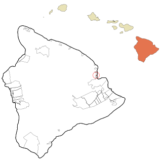
Paukaʻa is a census-designated place (CDP) in Hawaii County, Hawaii, United States. The population was 425 at the 2010 census, down from 495 at the 2000 census. The ZIP code is 96720.

Kalāheo is an unincorporated community and census-designated place (CDP) in Kauaʻi County, island of Kauaʻi, Hawaiʻi, United States. The population was 4,996 at the 2020 census, up from 3,913 at the 2000 census.

Lāwaʻi is a census-designated place (CDP) in Kauaʻi County in the U.S. state of Hawaiʻi. The population was 2,578 at the 2020 census, up from 1,984 at the 2000 census.

Kualapuʻu is a census-designated place (CDP) on the island of Molokai in Maui County, Hawaiʻi, United States. The population was 2,110 at the 2020 census. Kualapuʻu can be literally translated as "hill overturned", but is thought to be a corruption of Puʻuʻuala: "sweet potato hill". The present settlement is a former pineapple cannery village once associated with Del Monte Foods.
Coyne Center is a census-designated place (CDP) in Rock Island County, Illinois, United States. The population was 827 at the 2010 census.
Rock Island Arsenal is a census-designated place (CDP) in Rock Island County, Illinois, United States. The population was 149 at the 2010 census. The island contains the Rock Island National Cemetery.

Popponesset Island is an island and census-designated place (CDP) in the town of Mashpee in Barnstable County, Massachusetts, United States. The population was 220 at the 2010 census.

Aquebogue is a census-designated place (CDP) roughly corresponding to the hamlet by the same name in the Town of Riverhead in Suffolk County, on Long Island, in New York, United States. The CDP's population was 2,438 at the 2010 census.
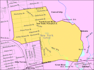
North Great River is a hamlet and census-designated place (CDP) in the Town of Islip, in Suffolk County, on Long Island, in New York, United States. The CDP population was 4,001 at the 2010 census. The hamlet is served by the Islip Terrace Post Office (11752).

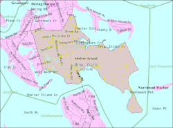
Shelter Island Heights is a hamlet and census-designated place (CDP) located in the Town of Shelter Island, in Suffolk County, New York, United States. It is located on the north side of Shelter Island, surrounding the village of Dering Harbor. The population was 1,601 at the time of the 2020 census.

Terrebonne is an unincorporated community and census-designated place (CDP) in Deschutes County, Oregon, United States. It is part of the Bend, Oregon Metropolitan Statistical Area. The population was 1,257 at the 2010 census.

East Uniontown is a census-designated place (CDP) in Fayette County, Pennsylvania, United States. The population was 2,419 at the 2010 census, down from 2,760 at the 2000 census.

Cumberland Hill is a census-designated place (CDP) in the town of Cumberland, in Providence County, Rhode Island, United States. The population was 7,934 at the 2010 census.

Piney View is a census-designated place (CDP) in Raleigh County, West Virginia, United States. The population was 989 at the 2010 census.

Blennerhassett is a census-designated place (CDP) in Wood County, West Virginia, United States. It is part of the Parkersburg-Marietta-Vienna, WV-OH Metropolitan Statistical Area. The population was 3,089 at the 2010 census.

Tiverton is a census-designated place (CDP) in Newport County, Rhode Island, United States. The CDP encompasses the town center of Tiverton and the adjacent village of North Tiverton. The population of the CDP was 7,557 at the 2010 census.
