Saltaire, New York

Last updated

Saltaire
Village of Saltaire
Saltaire, Fire Island dock.jpg
Dock at Saltaire
USA New York location map.svg
Red pog.svg
Saltaire
Location within the state of New York
Fire-island-map.jpg
Red pog.svg
Saltaire
Location on Fire Island
Coordinates: 40°38′15″N73°11′48″W / 40.63750°N 73.19667°W / 40.63750; -73.19667
Country United States
State New York
County Suffolk
Town Islip
Area
[1]
  Total0.28 sq mi (0.74 km2)
  Land0.23 sq mi (0.60 km2)
  Water0.05 sq mi (0.13 km2)
Elevation
3 ft (1 m)
Population
 (2020)
  Total113
  Density484.98/sq mi (187.43/km2)
Time zone UTC-5 (Eastern (EST))
  Summer (DST) UTC-4 (EDT)
ZIP code
11706
Area code 631
FIPS code 36-64881
GNIS feature ID0964335
Website www.saltaire.org

Saltaire is a village on Fire Island in Islip, Suffolk County, New York, United States. The year-round population was 37 at the 2010 census, [2] which, as a summer beach community, increases many times over in the summer.

Contents

History

Saltaire was founded in 1910 and incorporated in 1917.[ citation needed ]

The village was heavily damaged and six residents killed in the Hurricane of 1938. [3]

In early 2009, the village underwent a beach restoration project. [4]

The village was damaged by Hurricane Sandy in 2012.

Geography

Saltaire Beach Beach @ Saltaire, Fire Island.jpg
Saltaire Beach

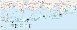
Saltaire can be reached by the Fire Island Ferries, by private boat, by walking, or by car. Fire Island Ferry service to Saltaire leaves from the Fire Island ferry terminal in Bay Shore, New York.[ citation needed ]

The village is on the western part of Fire Island between the Great South Bay and the Atlantic Ocean and between the hamlets of Kismet (to the west) and Fair Harbor (to the east).

According to the United States Census Bureau, the village has an area of 0.27 square miles (0.7 km2), of which 0.23 square miles (0.6 km2) is land and 0.04 square miles (0.1 km2), or 18.04%, is water. [2] Among other things, Saltaire is known for its great softball league in the summer. The village encompasses the widest portion of Fire Island, at approximately 0.5 miles (0.80 km).

There are 459 housing units in the community, [2] as well as a Village Hall and Court, general market, fire house, two churches, and a members yacht club.

Saltaire is the second-largest Fire Island community, and is on the widest part of the island.

Demographics

Historical population
CensusPop.Note
1920 12
1930 64433.3%
1940 22−65.6%
1950 21−4.5%
1960 2833.3%
1970 3732.1%
1980 35−5.4%
1990 388.6%
2000 4313.2%
2010 37−14.0%
2020 113205.4%
U.S. Decennial Census [5]

The following demographics represent year-round Saltaire households (not representative of total ownership, or summer population):

As of the census [6] of 2000, there were 43 people, 14 households, and 9 families residing in the village. The population density was 155.0 inhabitants per square mile (59.8/km2). There were 401 housing units at an average density of 1,445.2 per square mile (558.0/km2). The racial makeup of the village was 79.07% White, 9.30% Asian, and 11.63% from two or more races. Hispanic or Latino of any race were 2.33% of the population.

There were 14 households, out of which 35.7% had children under the age of 18 living with them, 57.1% were married couples living together, and 28.6% were non-families. 14.3% of all households were made up of individuals, and 14.3% had someone living alone who was 65 years of age or older. The average household size was 3.07 and the average family size was 3.50.

In the village, the population was spread out, with 37.2% under the age of 18, 25.6% from 25 to 44, 16.3% from 45 to 64, and 20.9% who were 65 years of age or older. The median age was 36 years. For every 100 females, there were 152.9 males. For every 100 females age 18 and over, there were 107.7 males.

The median income for a household in the village was $75,252, and the median income for a family was $49,500. Males had a median income of $51,250 versus $41,250 for females. The per capita income for the village was $17,125. None of the population and none of the families were below the poverty line.

Parks and recreation

The Saltaire Yacht Club was founded in 1911. All property owners and renters in the village are eligible to join.[ citation needed ]

Government

Village Hall Saltaire Village Hall 7.jpg
Village Hall

The Village is governed by a Mayor and Board of Trustees.[ citation needed ]

Education

Children of year-round residents are zoned to Fire Island School District. [7] They attend the sole school of the district, Woodhull School in Ocean Beach until grade 6, at which point they are bussed to Long Island for grades 7-12, with a choice of either the Bay Shore School District (which operates Bay Shore Middle School and Bay Shore High School) or to the Islip School District (which operates Islip High School). [8] They may also be bussed to one of the many private and parochial schools on the mainland.[ citation needed ]

Infrastructure

Saltaire Volunteer Fire Company Saltaire Volunteer Fire Company 5.jpg
Saltaire Volunteer Fire Company

The Saltaire Volunteer Fire Company was established in 1969 to provide fire suppression services to the village. In 1986, the fire company became the first Fire Island fire department to provide Emergency Medical Services to the village and surrounding communities.[ citation needed ]

Related Research Articles

<span class="mw-page-title-main">Suffolk County, New York</span> County in New York, United States

Suffolk County is the easternmost county in the U.S. state of New York. It comprises the eastern two-thirds of Long Island, bordered to its west by Nassau County, to its east by Gardiners Bay and the Atlantic Ocean, to its north by Long Island Sound, and to its south by Great South Bay.

<span class="mw-page-title-main">Dauphin Island, Alabama</span> Town in Alabama, United States

Dauphin Island is an island town in Mobile County, Alabama, United States, on a barrier island of the same name, in the Gulf of Mexico. It incorporated in 1988. The population was 1,778 at the 2020 census, up from 1,238 at the 2010 census. The town is part of the Mobile metropolitan area. The island was renamed for Louis XIV of France's great-grandson and heir, the dauphin, the future Louis XV of France. The name of the island is often mistaken as Dolphin Island; the word dauphin is French for dolphin, but historically, the term was used as the title of the heir apparent to the French monarch.

<span class="mw-page-title-main">Bay Park, New York</span> Hamlet and census-designated place in New York, United States

Bay Park is a hamlet and census-designated place (CDP) in the Town of Hempstead in Nassau County, on the South Shore of Long Island, in New York, United States. The population was 2,212 at the 2010 census.

<span class="mw-page-title-main">Hewlett Bay Park, New York</span> Village in New York, United States

Hewlett Bay Park is a village in the Town of Hempstead in Nassau County, on the South Shore of Long Island, in New York. The population was 404 at the 2010 census.

<span class="mw-page-title-main">Massapequa Park, New York</span> Village in New York, United States

Massapequa Park is an incorporated village located within the southern portion of the Town of Oyster Bay in Nassau County, on the South Shore of Long Island, in New York. The population was 17,008 at the 2010 census.

<span class="mw-page-title-main">Bay Shore, New York</span> Hamlet and census-designated place in New York, United States

Bay Shore is a hamlet and census-designated place (CDP) in the Town of Islip, New York, United States. It is situated on the South Shore of Long Island, adjoining the Great South Bay. The population of the CDP was 29,244 at the time of the 2020 census.

<span class="mw-page-title-main">Brightwaters, New York</span> Village in New York, United States

Brightwaters is an incorporated village in the southwestern part of the Town of Islip in Suffolk County, on Long Island, in New York, United States. The population was 3,103 at the time of the 2010 census.

<span class="mw-page-title-main">East Islip, New York</span> Hamlet and census-designated place in New York, United States

East Islip is a hamlet and CDP in the Town of Islip, Suffolk County, New York, United States. At the time of the 2010 census, the CDP had a population of 14,475.

<span class="mw-page-title-main">East Patchogue, New York</span> Census-designated place in New York, United States

East Patchogue is a census-designated place (CDP) in the Town of Brookhaven in Suffolk County, on the South Shore of Long Island, in New York, United States. The population was 22,469 at the 2010 census. The CDP is a proximate representation of the East Patchogue hamlet used for statistical purposes of the Census Bureau.

<span class="mw-page-title-main">Hampton Bays, New York</span> Hamlet and census-designated place in New York, United States

Hampton Bays is a hamlet and census-designated place (CDP) in the Town of Southampton in Suffolk County, on Long Island, in New York. It is considered as part of the region of Long Island known as The Hamptons. The population was 13,603 at the 2010 census.

<span class="mw-page-title-main">Mastic Beach, New York</span> Hamlet and Census-designated place in New York, United States

Mastic Beach is a hamlet and census-designated place, and former village in the southeastern part of the Town of Brookhaven in Suffolk County, on Long Island, in New York, United States. The population was 14,849 at the 2010 census, when it was an unincorporated census-designated place for the first time.

<span class="mw-page-title-main">North Bay Shore, New York</span> Hamlet and census-designated place in New York, United States

North Bay Shore is a hamlet and census-designated place on Long Island in the Town of Islip in Suffolk County, New York, United States. The population was 18,944 as of the 2010 census. The hamlet is a suburb of New York City.

<span class="mw-page-title-main">Ocean Beach, New York</span> Village in New York, United States

Ocean Beach is a village in the southern part of the Town of Islip, on Fire Island, within Suffolk County, New York, United States. As of the 2010 census, the population was 79. Known for its strict local ordinances, the village is nicknamed "The Land of No".

<span class="mw-page-title-main">West Hampton Dunes, New York</span> Village in New York, United States

West Hampton Dunes is an incorporated village in the Town of Southampton on Westhampton Island, in Suffolk County, in New York, United States, off the South Shore of Long Island. The population was 55 at the 2010 census.

<span class="mw-page-title-main">West Islip, New York</span> Hamlet and census-designated place in New York, United States

West Islip is a hamlet and CDP founded in 1683, located in the Town of Islip, in Suffolk County, New York, United States. Situated on the South Shore of Long Island, the population of the CDP was 27,048 at the time of the 2020 census.

<span class="mw-page-title-main">Westhampton Beach, New York</span> Village in New York, United States

Westhampton Beach is an incorporated village in the Town of Southampton, in Suffolk County, on the South Shore of Long Island, in New York, United States. As of the 2010 census, the population was 1,721.

<span class="mw-page-title-main">Babylon, New York</span> Town in New York, United States

The Town of Babylon is one of ten towns in Suffolk County, New York, United States. Its population was 218,223 as of the 2020 census. Parts of Jones Beach Island, Captree Island and Fire Island are in the southernmost part of the town. It borders Nassau County to the west and the Atlantic Ocean to the south. At its westernmost point, it is about 20 miles (32 km) from New York City at the Queens border, and about 30 miles (48 km) from Manhattan. The village of Babylon is also within the town.

<span class="mw-page-title-main">Islip, New York</span> Town in New York, United States

Islip is a town in Suffolk County, New York, United States, on the south shore of Long Island. The population was 335,543 at the 2010 census, making it the fourth most populous city or town in the state.

<span class="mw-page-title-main">Islip (hamlet), New York</span> Hamlet and census-designated place in New York, United States

Islip is a hamlet and census-designated place (CDP) that lies within the town of the same name in Suffolk County, New York. Located on the south shore of Long Island, the CDP had a population of 18,869 at the time of the 2010 census, a decline of 8% from the 2000 census.

<span class="mw-page-title-main">Fire Island</span> Island in New York

Fire Island is the large center island of the outer barrier islands parallel to the South Shore of Long Island, in the U.S. state of New York.

References

  1. "ArcGIS REST Services Directory". United States Census Bureau. Retrieved September 20, 2022.
  2. 1 2 3 "Geographic Identifiers: 2010 Demographic Profile Data (G001): Saltaire village, New York". U.S. Census Bureau, American Factfinder. Archived from the original on February 12, 2020. Retrieved December 21, 2012.
  3. The Great Hurricane of 1938 photos and essay, by the Saltaire Village Historian
  4. Beach restoration pictures
  5. "Census of Population and Housing". Census.gov. Retrieved June 4, 2015.
  6. "U.S. Census website". United States Census Bureau . Retrieved January 31, 2008.
  7. "2020 CENSUS - SCHOOL DISTRICT REFERENCE MAP: Suffolk County, NY" (PDF). U.S. Census Bureau. p. 5. Retrieved May 2, 2021.
  8. "History". Fire Island School District . Retrieved May 3, 2021.
Preceded by Beaches of Fire Island Succeeded by