Kismet | |
---|---|
![]() The town of Kismet on Fire Island is seen from the Fire Island Ferry on bay side of the island in the early evening during the summer. | |
Coordinates: 40°38′03″N73°12′12″W / 40.63417°N 73.20333°W Coordinates: 40°38′03″N73°12′12″W / 40.63417°N 73.20333°W | |
Country | United States |
State | New York |
County | Suffolk |
Township | Islip |
Elevation | 3 ft (0.9 m) |
Time zone | UTC-5 (EST) |
• Summer (DST) | UTC-4 (EDT) |
ZIP code | 11706 |
Area code(s) | 631 |
GNIS feature ID | 954725 |
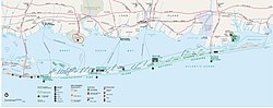
Kismet is a hamlet in the town of Islip, Suffolk County, New York, United States. It is the westernmost beach community on Fire Island, immediately west of Saltaire and east of the Fire Island Light. Kismet is accessible by road or on foot via Robert Moses State Park to the west, or by ferry (Fire Island Ferries) from Bay Shore on Long Island. [1] [2]
Suffolk County is a predominantly suburban county on Long Island and the easternmost county in the U.S. state of New York. As of the 2010 census, the county's population was 1,493,350, estimated to have decreased slightly to 1,492,953 in 2017, making it the fourth-most populous county in New York. Its county seat is Riverhead, though most county offices are in Hauppauge. The county was named after the county of Suffolk in England, from where its earliest European settlers came.
New York is a state located in the Northeastern United States. New York was one of the original thirteen colonies that formed the United States. With an estimated 19.54 million residents in 2018, it is the fourth most populous state. In order to distinguish the state from its city with the same name, it is sometimes referred to as New York State (NYS).
The United States of America (USA), commonly known as the United States or simply America, is a country comprising 50 states, a federal district, five major self-governing territories, and various possessions. At 3.8 million square miles, it is the world's third or fourth largest country by total area and is slightly smaller than the entire continent of Europe. Most of the country is located in central North America between Canada and Mexico. With an estimated population of over 327 million people, the U.S. is the third most populous country. The capital is Washington, D.C., and the most populous city is New York City.
Facilities in Kismet include a marina, a few stores (the Kismet Market, Beach & Vine Wines & Spirits and the Red Wagon Emporium), Margarita Villas LLC Vacation Rentals, and three restaurants, Fire Island Tap (located at Margarita Villas), the Kismet Inn and the Surf's Out. [3] [4]
Brooklyn is a borough of New York City, coterminous with Kings County, located in the U.S. state of New York, the most populous county in the state, and the second-most densely populated county in the United States. It is New York City's most populous borough, with an estimated 2,504,700 residents in 2010. Named after the Dutch village of Breukelen, it borders the borough of Queens at the western end of Long Island. Brooklyn has several bridge and tunnel connections to the borough of Manhattan across the East River, and the Verrazzano-Narrows Bridge connects it with Staten Island.
Branford is a shoreline town located on Long Island Sound in New Haven County, Connecticut, 8 miles (13 km) east of New Haven. The population was 28,026 at the 2010 census.
Oak Bluffs is a town located on the island of Martha's Vineyard in Dukes County, Massachusetts, United States. The population was 4,527 at the 2010 United States Census. It is one of the island's principal points of arrival for summer tourists, and is noted for its "gingerbread cottages" and other well-preserved mid- to late-nineteenth-century buildings. The town has been an historically important center of African American culture since the eighteenth century.
Cherry Grove is a hamlet in the Town of Brookhaven, Suffolk County, New York, United States. It is located on Fire Island, a barrier island separated from the southern side of Long Island by the Great South Bay. The hamlet has approximately 300 houses on 41 acres (170,000 m2), a summer seasonal population of 2,000 and a year-round population of 15.
Ocean Beach is a village in the southern part of the town of Islip, on Fire Island, within Suffolk County, New York, United States.
Saltaire is a village on Fire Island in the southern part of the Town of Islip in Suffolk County, New York, United States. The year-round population was 37 at the 2010 census, which, as a summer beach community, increases many times over in the summer.
Coney Island is a residential and commercial neighborhood and entertainment area in the southwestern part of the borough of Brooklyn in New York City. The neighborhood is bounded by Sea Gate to its west, Brighton Beach and Manhattan Beach to its east, Lower New York Bay to the south, and Gravesend to the north. Coney Island was formerly the westernmost of the Outer Barrier islands on the southern shore of Long Island, but in the early 20th century it became a peninsula, connected to the rest of Long Island by land fill.
Islip is one of ten towns in Suffolk County, New York (USA). Located on the South Shore of Long Island, the town population was 335,543 at the 2010 census. Within the Town of Islip is a smaller, unincorporated hamlet and census-designated place also named Islip.
The Jersey Shore is the coastal region of the U.S. state of New Jersey. Geographically, the term encompasses about 141 miles (227 km) of oceanfront bordering the Atlantic Ocean, from Perth Amboy in the north to Cape May Point in the south. The region includes Middlesex, Monmouth, Ocean, Atlantic, and Cape May counties. Many New Jersey residents refer to it simply as The Shore. Most of the shore region is located in Central and South New Jersey.
Robert Moses State Park - Long Island is a 875-acre (3.54 km2) state park in southern Suffolk County, New York. The park lies on the western end of Fire Island, one of the central barrier islands off the southern coast of Long Island, and is known for its five-mile (8.0 km) stretch of beaches on the Atlantic Ocean. The park is accessible from Long Island by the Robert Moses Causeway across Great South Bay.
Fire Island is the large center island of the outer barrier islands parallel to the south shore of the mainland of Long Island. The island is approximately 31 miles (50 km) long and varies between 520 and 1,310 feet wide. Its land area is 24.9 square kilometres. Fire Island is part of Suffolk County, New York. It lies within the towns of Babylon, Islip, and Brookhaven, containing two villages and a number of hamlets. All parts of the island not within village limits are part of the Fire Island census-designated place (CDP), which had a permanent population of 292 at the 2010 United States Census, though that expands to thousands of residents and tourists during the summer months. Since the late 1930s, the island has been a popular destination for the LGBT community. Every year on the fourth of July hundreds of drag queens board the ferry from Cherry Grove to The Pines in a reenactment of the 1976 act of solidarity now known as the "Invasion of the Pines".
The Rockaway Peninsula, commonly referred to as The Rockaways or Rockaway, is the name of a peninsula within the New York City borough of Queens on Long Island, New York. Relatively isolated from Manhattan and other more urban parts of the city, Rockaway became a popular summer retreat in the 1830s. It has since become a mixture of lower, middle, and upper-class neighborhoods. In the 2010s, it became one of the city's most quickly gentrifying areas.
Fire Island Pines is a hamlet in the Town of Brookhaven, Suffolk County, New York, United States. It is located on Fire Island, a barrier island on the southern side of Long Island.
The Outer Barrier, also known as the Long Island and New York City barrier islands, refers to the string of barrier islands that divide the lagoons south of Long Island, New York from the Atlantic Ocean. These islands include Coney Island, Long Beach Barrier Island, Island Park, Jones Beach Island, Fire Island and Westhampton Island. The outer barrier extends 75 miles (121 km) along the South Shore of Long Island, from the Rockaway Peninsula in New York City to the east end of Shinnecock Bay in Suffolk County.
Davis Park is a hamlet on Fire Island in the Town of Brookhaven in Suffolk County, in the U.S. state of New York, off the South Shore village of Patchogue, Long Island. It lies within the Fire Island National Seashore. Davis Park is commonly used to refer to the business and public part of the community on both sides of Trustees' Walk, in contrast to the sections known as Leja Beach and Ocean Ridge. However, Davis Park is also used to refer to all three areas together, which are contiguous, share services and social life, and are separated from other communities on the island.
Ocean Bay Park is a hamlet in the Town of Brookhaven in Suffolk County, New York, on Fire Island.
Water Island is a hamlet in Suffolk County, New York, on Fire Island.
Fair Harbor is a small community hamlet located near the western end of Fire Island. It is a part of the Town of Islip on Long Island, New York. With approximately 350 homes within its 13-block town limits, the town features a few stores, a restaurant and a pizza shop, giving it old-style charm with the security of a state-of-the-art Fire Department and EMS. Moreover, the beach is wide, and the bay front is active.
Lighthouse Beach is a small section of the Fire Island National Seashore that is adjacent to Robert Moses State Park on New York's Long Island. It was notable for having sections that were officially designated as clothing optional prior to 2013.
Preceded by Saltaire | Beaches of Fire Island | Succeeded by Robert Moses State Park |
![]() | This article about a location in Suffolk County, New York is a stub. You can help Wikipedia by expanding it. |