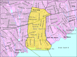
This article needs additional citations for verification .(July 2018) |
West Islip, New York | |
---|---|
![]() U.S. Census map | |
Coordinates: 40°42′54″N73°17′52″W / 40.71500°N 73.29778°W | |
Country | United States |
State | New York |
County | Suffolk |
Area | |
• Total | 7.81 sq mi (20.22 km2) |
• Land | 6.09 sq mi (15.78 km2) |
• Water | 1.71 sq mi (4.44 km2) |
Elevation | 20 ft (6 m) |
Population (2020) | |
• Total | 27,048 |
• Density | 4,438.46/sq mi (1,713.80/km2) |
Time zone | UTC-5 (Eastern (EST)) |
• Summer (DST) | UTC-4 (EDT) |
ZIP code | 11795 |
Area code | 516/631 |
FIPS code | 36-80302 [2] |
GNIS feature ID | 0969276 [3] |
West Islip is a hamlet and CDP founded in 1683, located in the Town of Islip, in Suffolk County, New York, United States. Situated on the South Shore of Long Island, the population of the CDP was 27,048 at the time of the 2020 census. [4]
West Islip is located at 40°42′54″N73°17′52″W / 40.71500°N 73.29778°W (40.715008, -73.297746). [5]
According to the United States Census Bureau, the CDP has a total area of 6.8 square miles (17.5 km2), of which 6.3 square miles (16.4 km2) is land and 0.42 square miles (1.1 km2), or 6.46%, is water. [4]
Great South Bay, Jones Beach Island and Fire Island lie to the south. Babylon and North Babylon form the western border. Bay Shore lies to the east, and in the north West Islip borders on Deer Park and Brentwood. West Islip is 45 miles (72 km) east of Manhattan and 45 miles (72 km) west of Southampton, New York. West Islip's western boundary is a natural one formed by Sampawams Creek, Hawley's Lake, and the Guggenheim Lakes.
Census | Pop. | Note | %± |
---|---|---|---|
2020 | 27,048 | — | |
U.S. Decennial Census [6] |
The first people to settle in the area were the Secatogue Native Americans. The unearthing of a Native American burial ground north of West Islip beach enabled historians to reconstruct a village of these Native Americans who lived along the edges of the Great South Bay, Sampawams Creek, Trues Creek and Willetts Creek. [Citation needed.]
Farming and fishing were the main occupations. In the mid-19th century, the completion of the Long Island Rail Road brought travelers to West Islip.
Today West Islip has its own fire department, post office, public library and Good Samaritan Hospital. A short drive affords access to good fishing and swimming.
As of the census of 2020, there were 27,048 [7] people in 9,040 households in the CDP. The racial makeup of the CDP was 95.9% White, 1.7% Asian, 0.6% Black, 0.1% Native American, and 0.6% from other races, and 1.1% being multiracial.
There were 7,459 families, out of which 39.4% had children under the age of 18 living with them, 68.2% were married couples living together, 10.3% had a female householder with no husband present, and 17.5% were non-families. Nearly 11.4% of all households were made up of individuals, and 6.9% had someone living alone who was 65 years of age or older. The average household size was 3.09, and the average family size was 3.43.
In the CDP, the population was spread out, with 25.6% under the age of 18, 4.0% from 18 to 24, 31.8% from 25 to 44, 21.9% from 45 to 64, and 12.2% who were 65 years of age or older. The median age was 37 years.
The median income for a household in the CDP was $103,789, [7] and the median income for a family was $117,451. [7] Males had a median income of $75,868 versus $54,389 for females. The per capita income for the CDP was $38,933. About 2.9% of families and 3.4% of the population were below the poverty line, including 4.9% of those under age 18 and 4.3% of those age 65 or over.
West Islip is located approximately 1 mi (1.6 km) east of Babylon station on the Long Island Rail Road.
![]() |
Public school districts:
Private schools:
Public libraries:
Queen Valley is a census-designated place (CDP) in north central Pinal County, Arizona, United States. The population was 820 at the 2000 census.
Manor Creek is a home rule-class city in Jefferson County, Kentucky, United States. The population was 140 at the 2010 census, down from 221 at the 2000 census.
Leeds is a hamlet and census-designated place (CDP) in Greene County, New York, United States. The population was 377 at the 2010 census.
Baywood is a hamlet and census-designated place (CDP) in the Town of Islip in Suffolk County, on Long Island, in New York, United States. The population was 7,350 at the 2010 census.
Central Islip is a hamlet and census-designated place (CDP) within the Town of Islip in Suffolk County, New York, United States. The population was 34,450 at the 2010 census.
Copiague is a hamlet on Long Island in Suffolk County, New York, United States. The population was 23,429 at the 2020 census. Copiague is an unincorporated place within Babylon.
Deer Park is a hamlet and census-designated place (CDP) in the Town of Babylon, in Suffolk County, on Long Island, in New York, United States. The population was 27,745 at the 2010 census.
East Islip is a hamlet and CDP in the Town of Islip, Suffolk County, New York, United States. At the time of the 2010 census, the CDP had a population of 14,475.
Gilgo-Oak Beach-Captree, frequently just called Oak Beach, was a census-designated place (CDP) in Suffolk County, New York within the Town of Babylon. The population was 333 at the 2000 census.
Hauppauge is a hamlet and census-designated place (CDP) in the towns of Islip and Smithtown in Suffolk County, New York on Long Island. The population was 20,882 at the time of the 2010 census.
Holbrook is a hamlet and census-designated place (CDP) in Suffolk County, New York, United States. The population was 27,195 at the 2010 census. The community borders the eastern side of Long Island MacArthur Airport.
Islip Terrace is a hamlet and census-designated place (CDP) in the Town of Islip in Suffolk County, on the South Shore of Long Island, in New York, United States. The population was 5,389 at the 2010 census.
North Great River is a hamlet and census-designated place (CDP) in the Town of Islip, in Suffolk County, on Long Island, in New York, United States. The CDP population was 4,001 at the 2010 census. The hamlet is served by the Islip Terrace Post Office (11752).
West Babylon is a census-designated place (CDP) in the Town of Babylon in Suffolk County, New York, United States. The population was 43,213 at the 2010 census.
West Bay Shore is a hamlet and census-designated place (CDP) in the Town of Islip, Suffolk County, New York, United States. Its population was 4,648 at the 2010 census.
Pine Plains is a hamlet and census-designated place (CDP) in Dutchess County, New York, United States. The population was 1,142 at the 2020 census. It is part of the Poughkeepsie–Newburgh–Middletown, NY Metropolitan Statistical Area as well as the larger New York–Newark–Bridgeport, NY-NJ-CT-PA Combined Statistical Area.
The Town of Babylon is one of ten towns in Suffolk County, New York, United States. Its population was 218,223 as of the 2020 census. Parts of Jones Beach Island, Captree Island and Fire Island are in the southernmost part of the town. It borders Nassau County to the west and the Atlantic Ocean to the south. At its westernmost point, it is about 20 miles (32 km) from New York City at the Queens border, and about 30 miles (48 km) from Manhattan. The village of Babylon is also within the town.
Islip is a town in Suffolk County, New York, United States, on the south shore of Long Island. The population was 335,543 at the 2010 census, making it the fourth most populous city or town in the state.
Islip is a hamlet and census-designated place (CDP) that lies within the town of the same name in Suffolk County, New York. Located on the south shore of Long Island, the CDP had a population of 18,869 at the time of the 2010 census, a decline of 8% from the 2000 census.
Gilgo is a hamlet and census-designated place (CDP) in the Town of Babylon in Suffolk County, New York, United States. The population was 131 at the 2010 census.