Hewlett Neck, New York

Last updated

Hewlett Neck, New York
Incorporated Village of Hewlett Neck
Hewlett Neck Welcome Sign, Hewlett Neck, NY August 8, 2022 A.jpg
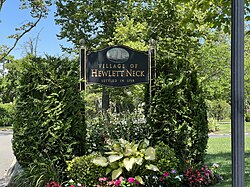
A Hewlett Neck village welcome sign in 2022
Nassau County New York incorporated and unincorporated areas Hewlett Neck highlighted.svg
Location in Nassau County and the state of New York
Location map Long Island.png
Red pog.svg
Hewlett Neck, New York
Location on Long Island
USA New York location map.svg
Red pog.svg
Hewlett Neck, New York
Location within the state of New York
Coordinates: 40°37′23″N73°41′49″W / 40.62306°N 73.69694°W / 40.62306; -73.69694
Country Flag of the United States.svg United States
State Flag of New York.svg New York
County Nassau
Town Hempstead
Incorporated April 14, 1927
Area
[1]
  Total
0.21 sq mi (0.55 km2)
  Land0.20 sq mi (0.51 km2)
  Water0.02 sq mi (0.05 km2)
Elevation
7 ft (2 m)
Population
 (2020)
  Total
569
  Density2,917.95/sq mi (1,123.97/km2)
Time zone UTC-5 (Eastern (EST))
  Summer (DST) UTC-4 (EDT)
ZIP code
11598
Area codes 516, 363
FIPS code 36-34319
GNIS feature ID0952663
Website hewlettneck.org

Hewlett Neck is a village located within the Town of Hempstead in Nassau County, on the South Shore of Long Island, in New York, United States. The population was 569 at the time of the 2020 census.

Contents

The Incorporated Village of Hewlett Neck is included in the Five Towns, which is usually said to comprise the villages of Lawrence and Cedarhurst, as well as the hamlets of Woodmere, Inwood, and "The Hewletts," which consist of the villages of Hewlett Bay Park, Hewlett Harbor, Hewlett Neck, and Woodsburgh, and the unincorporated hamlet of Hewlett. [2]

History

Hewlett Neck was incorporated as a village on April 14, 1927. [3]

Hewlett Neck consists of many large homes, mansions, villas and former plantations with very large property – a few dating back to the time of the American Revolution. [4] The area, much like Back/Old Lawrence, is unique because its rural affluence is similar in character to the more well known Gold Coast of the North Shore instead of being more urbanized like the rest of the South Shore of Nassau County. [2] [4]

Geography

U.S. Census map of Hewlett Neck Hewlett-neck-ny-map.gif
U.S. Census map of Hewlett Neck

According to the United States Census Bureau, the village has a total area of 0.2 square miles (0.52 km2), of which 0.2 square miles (0.52 km2) is land and 4.35% is water. [5]

Demographics

Historical population
CensusPop.Note
1930 253
1940 252−0.4%
1950 36946.4%
1960 50737.4%
1970 5294.3%
1980 472−10.8%
1990 54715.9%
2000 504−7.9%
2010 445−11.7%
2020 56927.9%
U.S. Decennial Census [6]

As of the census [7] of 2000, there were 504 people, 155 households, and 139 families residing in the village. The population density was 2,369.1 inhabitants per square mile (914.7/km2). There were 163 housing units at an average density of 766.2 per square mile (295.8/km2). The racial makeup of the village was 98.81% White, 0.79% African American, 0.20% Asian, 0.20% from other races. Hispanic or Latino of any race were 0.99% of the population.

There were 155 households, out of which 51.0% had children under the age of 18 living with them, 85.2% were married couples living together, 1.9% had a female householder with no husband present, and 10.3% were non-families. 8.4% of all households were made up of individuals, and 6.5% had someone living alone who was 65 years of age or older. The average household size was 3.25 and the average family size was 3.39.

In the village, the population was spread out, with 33.1% under the age of 18, 5.8% from 18 to 24, 21.8% from 25 to 44, 26.0% from 45 to 64, and 13.3% who were 65 years of age or older. The median age was 39 years. For every 100 females, there were 100.0 males. For every 100 females age 18 and over, there were 95.9 males.

The median income for a household in the village was $171,612, and the median income for a family was $181,530. Males had a median income of $100,000 versus $48,333 for females. The per capita income for the village was $88,049. None of the families and 1.2% of the population were living below the poverty line, including no under eighteens and 5.4% of those over 64.

Government

As of September 2025, the Mayor of Hewlett Neck is Moshe Blinder, the Deputy Mayor is Isaac Showman, and the Village Trustees are Ariella Gasner, Isaac Showman, Edward Vilinsky, Russel Weinrib. [8]

Politics

In the 2024 United States presidential election, the majority of Hewlett Neck voters voted for Donald J. Trump (R). [9] [10]

Education

School district

The Village of Hewlett Neck is located entirely within the boundaries of (and is thus served by) the Hewlett–Woodmere Union Free School District. Accordingly, all children who reside within the village and attend public schools go to Hewlett–Woodmere's schools. [11] [12]

Library district

The Village of Hewlett Neck is located entirely within the boundaries of (and is thus served by) the Hewlett–Woodmere Library District, which is served by the Hewlett–Woodmere Public Library in the hamlet of Hewlett. [11]

Infrastructure

Transportation

Road

Major roads either partially or wholly within the village include Browers Point Branch (CR C25) and Woodmere Boulevard (CR E68). [11] [13] [14]

Rail

No rail service passes through Hewlett Neck. [11] The nearest Long Island Rail Road stations to the village are Hewlett and Woodmere on the Far Rockaway Branch. [11]

Bus

No bus routes pass through the village. [11] [15]

Utilities

Natural gas

National Grid USA provides natural gas to homes and businesses that are hooked up to natural gas lines in Hewlett Neck. [16] [17] [18]

Power

PSEG Long Island provides power to all homes and businesses within Hewlett Neck, on behalf of the Long Island Power Authority. [17] [19] [20]

Sewage

Hewlett Neck, in its entirety, is served by the Nassau County Sewage District's sanitary sewer network. [11]

Trash collection

Trash collection services in Hewlett Neck are provided by the Town of Hempstead's Sanitation District 1. [11]

Water

The water supply in Hewlett Neck is provided by New York American Water. [11]

See also

References

  1. "ArcGIS REST Services Directory". United States Census Bureau. Retrieved September 20, 2022.
  2. 1 2 Barron, James (July 10, 1983). "IF YOU'RE THINKING OF LIVING IN: FIVE TOWNS (Published 1983)". The New York Times. ISSN   0362-4331 . Retrieved February 2, 2021.
  3. "Village of Hewlett Neck – About". hewlettneck.org. Retrieved August 9, 2022.
  4. 1 2 Winsche, Richard (October 1, 1999). The History of Nassau County Community Place-Names. Interlaken, New York: Empire State Books. ISBN   978-1557871541.
  5. "US Gazetteer files: 2010, 2000, and 1990". United States Census Bureau. February 12, 2011. Retrieved April 23, 2011.
  6. "Census of Population and Housing". Census.gov. Retrieved June 4, 2015.
  7. "U.S. Census website". United States Census Bureau . Retrieved January 31, 2008.
  8. "Village of Hewlett Neck – Village Officials". hewlettneck.org. Retrieved September 8, 2025.
  9. LaRocco, Paul (November 12, 2024). "Map: How Long Island voted for president in Harris-Trump race". Newsday. Retrieved November 12, 2024.
  10. "Donald Trump Voting Results: Nassau County Win Shows Democrats' US Struggles". Bloomberg. November 15, 2024. Retrieved August 14, 2025.
  11. 1 2 3 4 5 6 7 8 9 "Long Island Zoning Atlas". www.longislandindexmaps.org. Retrieved April 6, 2022.
  12. "Composite School District Boundaries Shapefiles". NCES. Retrieved October 23, 2020.
  13. "New York State Roadway Inventory System Viewer". gis.dot.ny.gov. Retrieved July 27, 2025.
  14. "New York State Department of Transportation Functional Class Viewer". gis.dot.ny.gov. Retrieved July 28, 2025.
  15. "Nassau Inter-County Express - Maps and Schedules". nicebus.com. Retrieved August 10, 2020.
  16. "Village of Hewlett Harbor – Important Links". www.hewlettharbor.org. Retrieved August 9, 2022.
  17. 1 2 "Long Island Utility Information - LIPA, Nat Grid, & Local Water Authorities". LongIsland.com. Retrieved October 24, 2020.
  18. "Natural Gas & Electricity | National Grid". www.nationalgridus.com. Retrieved July 21, 2021.
  19. "Home Page - PSEG Long Island". www.psegliny.com. Retrieved July 21, 2021.
  20. "NYS Electric Utility Service Territories Map | State of New York". data.ny.gov. Retrieved July 29, 2025.